B&G Zeus2 16 Glass Helm Pack w/ Insight Maps

This item is brand new
$7,399.00
Backorder, ships in 3 - 4 weeks
|sw


Nss Evo2 Zeus2 Chart Card Door


General Purpose Camera, REVERS White

Varifocal Dome Camera, Surface Mount

Mini Camera, Fixed, Color w/ IR

Mini Bullet Camera, 800TVL, White

Mini HD Dome Camera, 1000TVL, White

3G Broadband Radar Kit

4G Broadband Radar Kit for Zeus
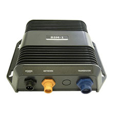
BSM-1 Broadband Sounder Module

BSM-2 Broadband CHIRP Sounder Module

NAIS-400 System, Class B-AIS w GPS Ant

WM-3 Sirius Sat Weather, Radio Module
Suggested Maps and Software:
 | Navionics Marine Charts |
 | C-Map Charts |
 | Cmor maps |
Contents of the package
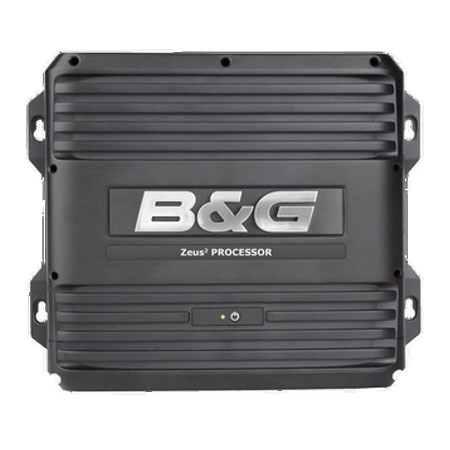
Zeus2 Glass Helm CPU with power and touch monitor serial cable
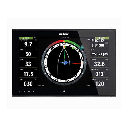
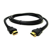
ZM16-T Monitor with power and 3m HDMI cables
ZC1 Remote Keypad Controller with cable
ZG100 GPS Antenna with built-in rate-stabilized heading sensor
Dash mounted chart card reader with cable
RJ45 adapter cable
NMEA 2000 backbone cable with power cable, T connector and terminators
Features
Zeus2 16" Glass Helm PackageEverything you need to start navigating!
Zeus2 Glass Helm is a super-fast, smart dual-screen multifunction navigation system for large cruising and performance sailboats. Realize unprecedented sailing navigation with B&G's composite SailSteer sailing information screen, WindPlot and Sailing Time calculations. Zeus2 Glass Helm features independent output, quad core high-power processing and intuitive multi-touch control and delivers lightning fast charting, radar and sonar. Plus smart Autorouting and Easy Routing capabilities with extensive network compatibility.
Choice of Cartography
Sailing-specific features
SailSteer
Laylines with sailing time
WindPlot
Integrated pilot control
Dual video independent output
Quad core Zeus2 processors
NMEA 2000, NMEA 0183, and Ethernet compatibility
Package includes:
Glass Helm processor with Insight Cartography
ZM16-T high bright, 15.6" widescreen, multi-touch monitor
ZC1 Remote Keypad Controller
ZG100 GPS Antenna with built-in rate-stabilized heading sensor
Dash mounted chart card reader
Specifications
Display 15.6" Diag. Widescreen, 1000 nitsResolution 1366 x 768 pixels
Antenna External antenna with built-in heading sensor
Mapping HD Insight Basemap preloaded, ability to add Navionics, C-Map Max, Platinum+ via SD
card.
Waypoints/Routes 10,000 points total combined waypoints / route points
Sounder Network sounder sold separately
Radar All B&G Broadband Radar units. Also compatible with Simrad Pulse radars
Interface NMEA 0183 out; NMEA 2000; Ethernet; Video in/out
Other Functions Special software designed for racing and performance sailing. AIS (receiver required);
Sirius weather (receiver and subscription required); engine monitoring (sensors required)
Dimensions Display: 15.7"W x 10.2"H x 2.9"D; Processor: 11.0"W x 9.1"H x 2.6"D
Warranty Two Year
Item number: 000-12235-001
UPC: 9420024137918
Package weight: 35 lb