C-MAP MAX NA-M023 - U.S. Gulf Coast, Inland Rivers - SD Card
Item: NA-M023SDCARD
This item is brand new
$279.00
Backorder, ships in 3 - 4 weeks
cw|cw


This item is brand new
$279.00
Backorder, ships in 3 - 4 weeks
cw|cw
Contents of the package
Features
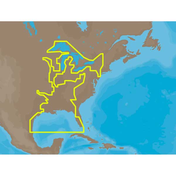
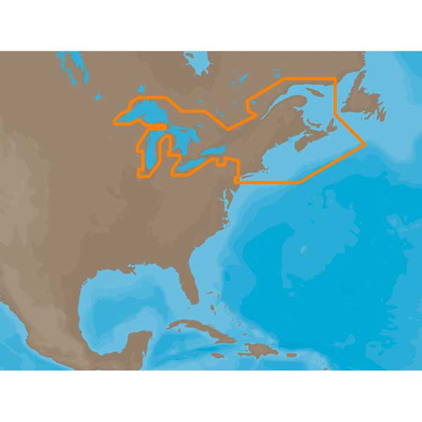
NA-M023 SD CARD FORMAT US GULF COAST , INLAND RIVERSNA-M023 => Gulf of Mexico, Great Lakes and Rivers
Coverage of the Gulf states, starting from Boca Raton, FL, down to Key West, FL, then back up and around the Gulf to Brownsville, TX. Also includes coverage of all the Great Lakes: Erie, Superior, Ontario, Huron and Michigan. Coverage of the Great Lakes also includes Fox River and Lake Winnebago, Lake St. Clair and the Trent-Severn Waterway. River coverage includes the Mississippi River, Ohio River, Illinois River, Arkansas River, Red River, Ouachita River, Tennessee River, Cumberland River, Tenn-Tom Waterway and the Black Warrior River. Other smaller rivers are also included: Green River, KY, Kanawha River, WV, Allegheny and Monongahela Rivers, PA and Kankakee River, IL. Additional coverage of the Hudson River, including Lake Champlain, down to New York City, the Erie Barge Canal and partial coverage of the St. Lawrence River up to Montreal.
Specifications
Item number: NA-M023SDCARD
UPC: 686074002722
Package weight: 0.1 lb
Other Products in the Series:


List of Compatible Units:
Note: Displayed are products sold in gps4us store.
There might be more GPS units compatible with chosen accessory.