FURUNO Bahamas, Caribbean and Bermuda - Vector Chart, 3D Data and Standard Resolution Satellite Photos - Unlock Code
This item is brand new
$241.95
Backorder, ships in 3 - 4 weeks
|cw


Features
Bahamas, Caribbean & Bermuda - Vector Chart, 3D Data & Standard Resolution Satellite Photos - Unlock Code
**SYSTEM ID REQUIRED TO RECEIVE UNLOCK CODE**
Vector Charts, 3D Data and Standard Resolution Satellite Photos - Bahamas, Caribbean & Bermuda
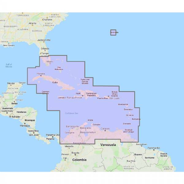
The Bahamas/Caribbean/Bermuda Chart Pack includes vector charts, 3D data and standard resolution satellite photography for the southern tip of Florida, Caribbean & Bermuda, Bahamas, Cuba, Haiti, Jamaica, Dominican Republic, Grenada, North Columbia, Guyana, Bahamas, South Florida, From Fort Pierce to Fort Myers in Florida including the Cayman Islands, Puerto Rico, Lesser Antilles, Windward Islands, Boca Grande, Trinidad, Golfo de Uraba, Aruba and Curacao. The vector charts datacore is by Navionics and then converted to the TimeZero format.
To purchase this chart pack for NavNet 3D, TZT or TZT2, you will need to provide your NavNet system ID to your local authorized Furuno dealer. The system ID can be located under the “My NavNet” menu.
NOTE: While this chart pack includes "Standard Resolution" satellite photos, it no longer includes "High Resolution" satellite photos. The "High Resolution" satellite photos can now be found at MM3-908-SAT.
 WARNING: This product can expose you to chemicals which are known to the State of California to cause cancer, birth defects or other reproductive harm. For more information go to P65Warnings.ca.gov.
Specifications
Item number: MM3-V90-8G0UPC: -
Package weight: 6.16 lb
List of Compatible Units:
| FURUNO NavNet TZtouch3 9 inch Hybrid Control MFD w/Single Channel CHIRP Sonar |
Note: Displayed are products sold in gps4us store.
There might be more GPS units compatible with chosen accessory.