FURUNO U.S. East Mid-Atlantic and Canyons Chart Pack - Vector Chart, 3D Data, Satellite Photos - Unlock Code
Item: MM3-V90-5P0
This item is brand new
$241.95
Backorder, ships in 3 - 4 weeks
|cw


This item is brand new
$241.95
Backorder, ships in 3 - 4 weeks
|cw
Features
U.S. East Mid-Atlantic & Canyons Chart Pack - Vector Chart, 3D Data, Satellite Photos - Unlock Code
**SYSTEM ID REQUIRED TO RECEIVE UNLOCK CODE**
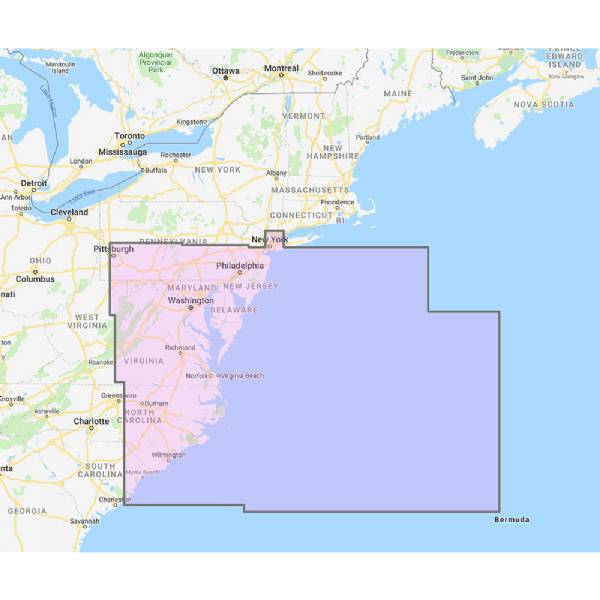
Navionics Vector Charts, 3D Data and Satellite Photos - US Mid Atlantic and Canyons
This Navionics vector chart pack includes vector charts, 3D data and satellite photography for US Mid Atlantic and Canyons.
To purchase this chart pack for NavNet 3D, TZT or TZT2, you will need to provide your NavNet system ID to your local authorized Furuno dealer. The system ID can be located under the “My NavNet” menu.
Specifications
Item number: MM3-V90-5P0UPC: -
Package weight: 6.16 lb
List of Compatible Units:
| FURUNO NavNet TZtouch3 9inch Hybrid Control MFD w/Single Channel CHIRP Sonar |
Note: Displayed are products sold in gps4us store.
There might be more GPS units compatible with chosen accessory.