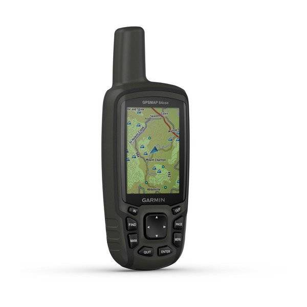
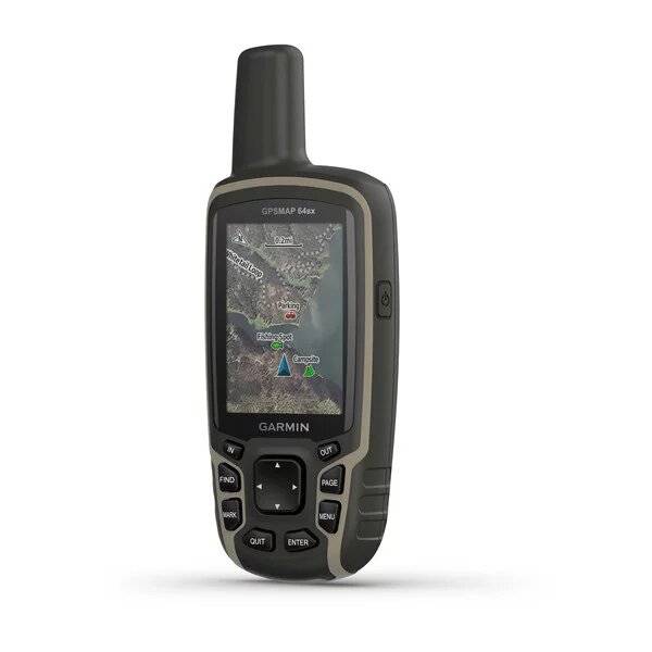
GARMIN GPSMAP 64sx


AC Charger


GA 27C low-profile remote automobile antenna

GA 25MCX low profile remote GPS antenna


Speed/Cadence bike sensor (GSC 10)
Heart rate monitor

Premium Heart rate monitor Soft Strap


HRM-Pro Heart Rate Monitor with Bluetooth and Running Dynamics

HRM-Pro Plus Heart Rate Monitor


Cup Holder Universal Mount RAM-A-CAN II with 6 in Flex Arm


Lanyard 17 inch


Carabiner clip

Lanyard Carabiner

Chirp Wireless geocaching beacon

BirdsEye Satellite Imagery Retail Card
Virb X
Virb Xe
NOH Virb XE
VIRB XE Cycling Bundle
VIRB XE Auto Racing Bundle
VIRB XE Aviation Bundle
VIRB Ultra 30
VIRB Camera
VIRB Elite Camera Dark
VIRB Elite Camera
BirdsEye Satellite Imagery US and Canada
Suggested Maps and Software:
 | Inland Lakes |
 | BlueChart g2, g3 on micro SD card with adapter |
 | Garmin Street Maps and City Navigation |
 | Garmin Topographic Maps |
 | LakeVu HD |
Contents of the package
- GPSMAP 64sx
- USB cable
- Documentation
Features
Explore the World with Reliable Navigation in HandRugged and water-resistant design with button operation and a 2.6 sunlight-readable color display
Preloaded with TopoActive maps (U.S. and Australia only) featuring routable roads and trails for cycling and hiking
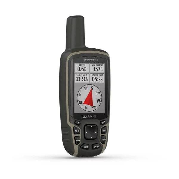
Know where youre at with a high-sensitivity receiver with quad helix antenna and multi-GNSS support (GPS, GLONASS and Galileo) and 3-axis compass with barometric altimeter
Wireless connectivity via BLUETOOTH® technology and ANT+® technology available on GPSMAP 64sx and GPSMAP 64csx models
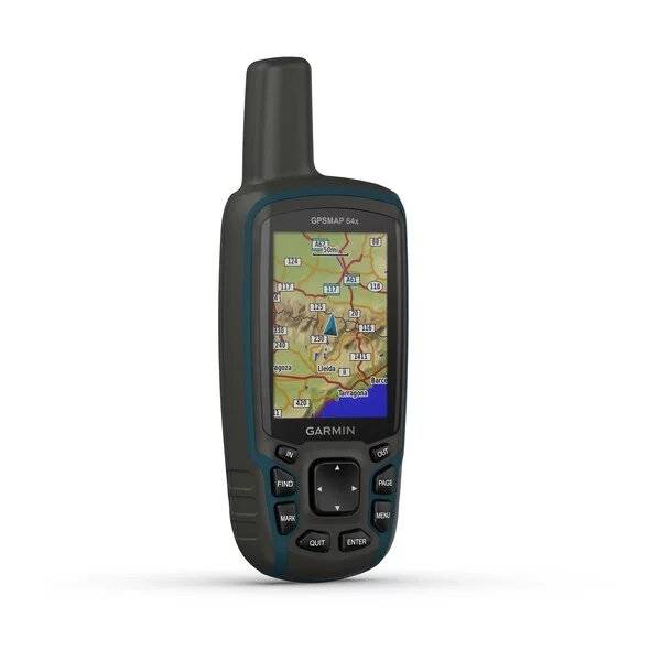
Navigate your next adventure with the GPSMAP 64x handheld navigator series. Whether youre hiking, cycling, geocaching or climbing, you are free to explore more with proven Garmin handheld navigation in the palm of your hand. And the series now has multi-GNSS support and TopoActive mapping.
Explore the Terrain
The GPSMAP 64x handheld series comes preloaded with TopoActive maps featuring routable streets and trails so you can take the journey off the grid. Now you can know your surroundings such as waterways and natural features as well as buildings, international boundaries and more. You can also find thousands of points of interests, including shops, restaurants, universities, parks and accommodations.
Keep Your Fix
With its quad helix antenna and high-sensitivity receiver and multiple global navigation system support (GPS, GLONASS and Galileo), the GPSMAP 64x series locates your position quickly and precisely and maintains its location in more challenging environments than GPS alone.
Add Maps
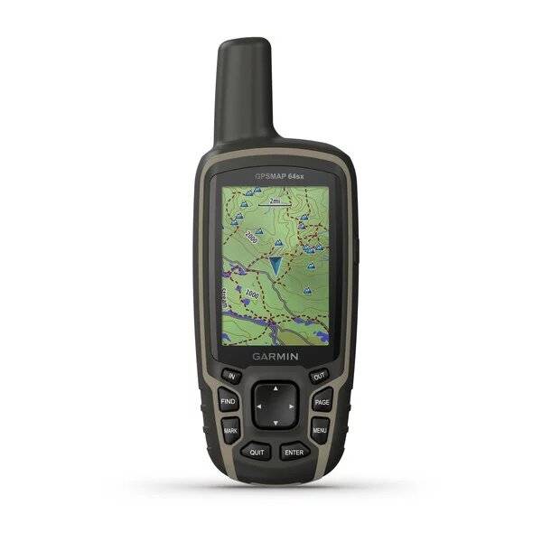
With 8 GB of onboard memory and a microSD card slot for expandable storage, you can conveniently download even more maps.
Satellite Imagery
The GPSMAP 64x series also supports BirdsEye Satellite Imagery (subscription required) that lets you load satellite images and integrate them with your maps.
Share Wirelessly
GPSMAP 64sx and 64csx handhelds let you share your waypoints, tracks, routes and geocaches wirelessly with other compatible devices. Your friends can enjoy your favorite hike or cache without waiting for you to plug in to your computer; simply press send to transfer your information to another Garmin handheld.
Stay Connected
With smart notifications, you can wirelessly receive emails, texts and alerts from your paired compatible device. Stay connected without having to dig into your backpack for your smartphone.
Find Fun
The GPSMAP 64x series features paperless geocaching. Upload GPX files straight to your device, and view key information such as location, terrain and hints from Geocaching.com.
Specifications
Maps & Memory |
|
| Preloaded maps | TopoActive (routable) |
|---|---|
| Ability to add maps | |
| Basemap | |
| Storage and Power Capacity | microSD card (not included) |
| Waypoints/favorites/locations | 5000 |
| Routes | 200 |
| Track log | 10,000 points, 200 saved tracks |
Sensors |
|
| Barometric altimeter | |
|---|---|
| Compass | Yes (tilt-compensated 3-axis) |
Outdoor Recreation Features |
|
| Area calculation | |
|---|---|
| Automatic routing (turn by turn routing on roads) | Yes (with optional mapping for detailed roads) |
| Geocaching-friendly | Yes (Paperless) |
| Custom maps compatible | |
| Hunt/fish calendar | |
| Sun and moon information | |
| Picture viewer | |
Garmin Connect |
|
| Garmin Connect compatible (online community where you analyze, categorize and share data) | |
|---|---|
Additional |
|
| Additional |
|
|---|---|
General |
|
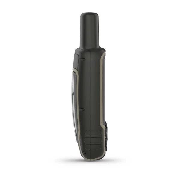
| Physical dimensions | 2.4" x 6.3" x 1.4" (6.1 x 16.0 x 3.6 cm) |
|---|---|
| Display size | 1.43" x 2.15" (3.6 x 5.5 cm); 2.6" diag (6.6 cm) |
| Display resolution | 160 x 240 pixels |
| Display type | transflective, 65K color TFT |
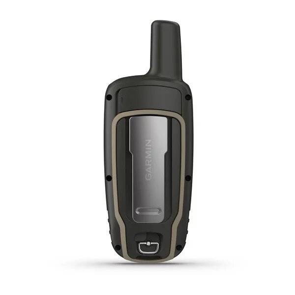
| Weight | 8.1 oz (230 g) with batteries |
| Battery | 2 AA batteries (not included); NiMH or Lithium recommended |
| Battery life | 16 hours |
| Water rating | IPX7 |
| Memory/History | 8 GB |
| High-sensitivity receiver | |
| Interface | high-speed USB and NMEA 0183 compatible |
Item number: 010-02258-10
UPC: 753759229481
Package weight: 0.9 lb
Following reviews were written by actual customers.
Every GPS4US customer has a chance to live a feedback after receiving a product.
 by Mory K, , 4/27/2023
5
Other Products in the Series: