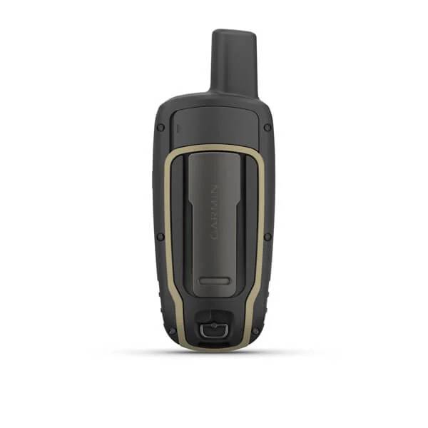
GARMIN GPSMAP 65


Item: 010-02451-00
This item is brand new
$335.95
This item ships within 1 day
pe|pe


This item is brand new
$335.95
This item ships within 1 day
pe|pe
Adapters Chargers


010-10723-00US
AC Charger
AC Charger
No Longer Available


Antennas

010-10052-05
GA 27C low-profile remote automobile antenna
GA 27C low-profile remote automobile antenna
No Longer Available

010-10702-00
GA 25MCX low profile remote GPS antenna
GA 25MCX low profile remote GPS antenna
No Longer Available
Cables


Cases and Covers


Fitness
010-10644-00
Speed/Cadence bike sensor (GSC 10)
Speed/Cadence bike sensor (GSC 10)
No Longer Available
010-10997-00
Heart rate monitor
Heart rate monitor
No Longer Available

010-10997-02
Premium Heart rate monitor Soft Strap
Premium Heart rate monitor Soft Strap
Out of stock


010-12955-00
HRM-Pro Heart Rate Monitor with Bluetooth and Running Dynamics
HRM-Pro Heart Rate Monitor with Bluetooth and Running Dynamics
No Longer Available

010-13118-00
HRM-Pro Plus Heart Rate Monitor
HRM-Pro Plus Heart Rate Monitor
No Longer Available
Kits

Memory


Mounts


RAM Mounts


RAM Mounts Build your own


RAP-299-2U
Cup Holder Universal Mount RAM-A-CAN II with 6 in Flex Arm
Cup Holder Universal Mount RAM-A-CAN II with 6 in Flex Arm
No Longer Available


Straps, Holsters, Clips


013-00052-00
Lanyard 17 inch
Lanyard 17 inch
No Longer Available


010-12897-01
Carabiner clip
Carabiner clip
Out of stock

010-12668-02
Lanyard Carabiner
Lanyard Carabiner
Out of stock
Other

010-11092-20
Chirp Wireless geocaching beacon
Chirp Wireless geocaching beacon
Out of stock

010-11543-00
BirdsEye Satellite Imagery Retail Card
BirdsEye Satellite Imagery Retail Card
No Longer Available
010-01363-01
Virb X
Virb X
Out of stock
010-01363-11
Virb Xe
Virb Xe
No Longer Available
010-01363-11
NOH Virb XE
NOH Virb XE
Out of stock
010-01363-20
VIRB XE Cycling Bundle
VIRB XE Cycling Bundle
No Longer Available
010-01363-40
VIRB XE Auto Racing Bundle
VIRB XE Auto Racing Bundle
No Longer Available
010-01363-30
VIRB XE Aviation Bundle
VIRB XE Aviation Bundle
No Longer Available
010-01529-03
VIRB Ultra 30
VIRB Ultra 30
No Longer Available
010-01088-00
VIRB Camera
VIRB Camera
No Longer Available
010-01088-15
VIRB Elite Camera Dark
VIRB Elite Camera Dark
No Longer Available
010-01088-10
VIRB Elite Camera
VIRB Elite Camera
No Longer Available
010-11753-00
BirdsEye Satellite Imagery US and Canada
BirdsEye Satellite Imagery US and Canada
No Longer Available
Compatible maps
Also available

Suggested Maps and Software:
 | Garmin Street Maps and City Navigation |
 | Garmin Marine Maps and Charts |
 | Garmin Topographic Maps |
Contents of the package
GPSMAP 65
USB cable
Carabiner clip
Documentation
USB cable
Carabiner clip
Documentation
Features
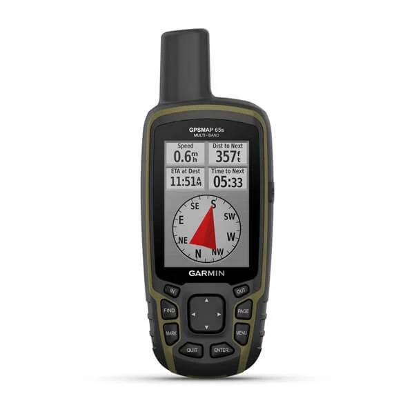
FIND YOUR WAY IN THIS BIG, WIDE WORLDExplore more with this rugged handheld that offers multiple frequencies for our most accurate position to date, a 2.6 color display and preloaded maps.
Dont miss a detail with this large, sunlight-readable color display.
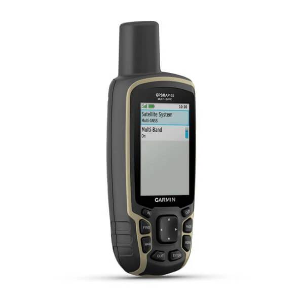
Lead the way in challenging locations with multi-band technology and expanded GNSS satellite support.
Cross the countryside with routable TopoActive maps for the U.S. and Canada.
Venture confidently. This rugged handheld is built for tough environments.
Organize your adventure from anywhere with the Garmin Explore website and app1.
Travel with up to 16 hours of battery life in GPS mode.
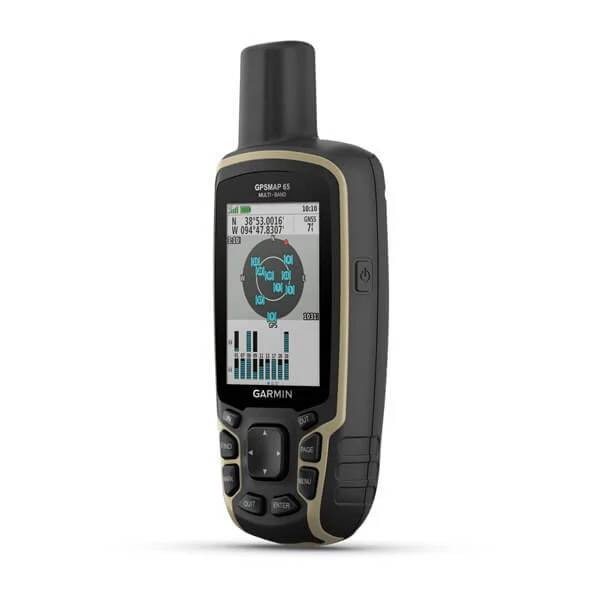
EXPANDED GNSS SUPPORT
Multi-band technology and expanded GNSS support (GPS, GLONASS, Galileo, QZSS and IRNSS) provide optimal accuracy in steep country, urban canyons and forests with dense trees.
PRELOADED TOPO MAPS
Preloaded TopoActive U.S. and Canada maps show you terrain contours, topographic elevations, summits, parks, coastlines, rivers, lakes and geographical points.
PUBLIC LAND BOUNDARIES
An optional display of federal public land boundaries on topographical maps helps you know that youre venturing where youre supposed to be.
SMART NOTIFICATIONS
Receive emails, texts and alerts right on your handheld when paired with your compatible device.
GARMIN EXPLORE APP
Plan, review and sync waypoints, routes and tracks by using the Garmin Explore app1 and website. You can even review completed activities while still in the field.
MICROSD SLOT
Using your compatible device and microSD memory card, conveniently download TOPO 24K maps and hit the trail, or access HuntView Plus maps to see public land types and boundaries as well as private landowner names and boundaries.
GEOCACHING
Get paperless geocaches by uploading GPX files straight to your device. View key information such as location, terrain and hints from Geocaching.com.
Specifications
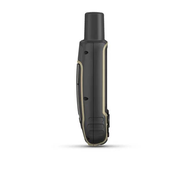
GeneralPHYSICAL DIMENSIONS: 2.4" x 6.3" x 1.4" (6.1 x 16.0 x 3.6 cm)
DISPLAY SIZE: 1.43" x 2.15" (3.6 x 5.5 cm); 2.6" diag (6.6 cm)
DISPLAY RESOLUTION: 160 x 240 pixels
DISPLAY TYPE: transflective, 65K color TFT
WEIGHT: 7.7 oz (217 g) with batteries
BATTERY TYPE: 2 AA batteries (not included); NiMH or Lithium recommended
BATTERY LIFE: 16 hours
WATER RATING: IPX7
HIGH-SENSITIVITY RECEIVER: Yes
INTERFACE: high speed mini USB and NMEA 0183 compatible
MEMORY/HISTORY: 16 GB (user space varies based on included mapping)
Maps & Memory
PRELOADED MAPS: yes (TopoActive; routable)
ABILITY TO ADD MAPS: Yes
BASEMAP: Yes
AUTOMATIC ROUTING (TURN BY TURN ROUTING ON ROADS): Yes
MAP SEGMENTS: 3000
BIRDSEYE: 250 BirdsEye Imagery files
INCLUDES DETAILED HYDROGRAPHIC FEATURES (COASTLINES, LAKE/RIVER SHORELINES, WETLANDS AND PERENNIAL AND SEASONAL STREAMS): Yes
INCLUDES SEARCHABLE POINTS OF INTERESTS (PARKS, CAMPGROUNDS, SCENIC LOOKOUTS AND PICNIC SITES): Yes
DISPLAYS NATIONAL, STATE AND LOCAL PARKS, FORESTS, AND WILDERNESS AREAS: Yes
EXTERNAL MEMORY STORAGE: yes (32 GB max microSD card)
WAYPOINTS/FAVORITES/LOCATIONS: 5000
TRACKS: 200
TRACK LOG: 10000 points, 200 saved tracks
ROUTES: 200, 250 points per route; 50 points auto routing
Sensors
GPS: Yes
GLONASS: Yes
GALILEO: Yes
GPS COMPASS (WHILE MOVING): Yes
Daily Smart Features
VIRB REMOTE: Yes
PAIRS WITH GARMIN CONNECT MOBILE: Yes
SMART NOTIFICATIONS ON HANDHELD: Yes
Outdoor Recreation
POINT-TO-POINT NAVIGATION: Yes
COMPATIBLE WITH BASECAMP: Yes
AREA CALCULATION: Yes
HUNT/FISH CALENDAR: Yes
SUN AND MOON INFORMATION: Yes
GEOCACHING-FRIENDLY: Yes (Paperless)
CUSTOM MAPS COMPATIBLE: yes (500 custom map tiles)
PICTURE VIEWER: Yes
Outdoor Applications
COMPATIBLE WITH GARMIN EXPLORE APP: Yes
GARMIN EXPLORE WEBSITE COMPATIBLE: Yes
Connections
WIRELESS CONNECTIVITY: yes (BLUETOOTH®, ANT+®)
Item number: 010-02451-00
UPC: 753759257828
Package weight: 0.9 lb