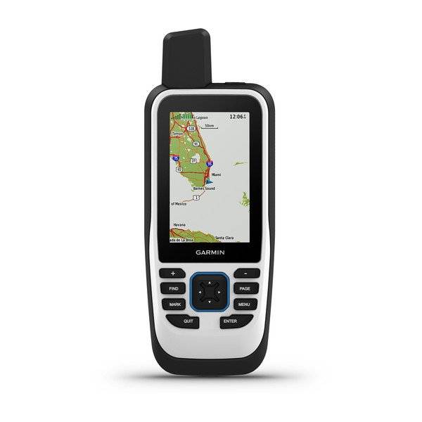
GARMIN GPSMAP 86i with inReach Capabilities


Item: 010-02236-00
This item is brand new
$516.95
Request price match
Backorder, ships in 3 - 4 weeks
wi|cw|sw|wi|ln


This item is brand new
$516.95
Request price match
Backorder, ships in 3 - 4 weeks
wi|cw|sw|wi|ln
Adapters Chargers


010-10723-00US
AC Charger
AC Charger
No Longer Available


Cables


Cases and Covers

Kits

Mounts


RAM Mounts Build your own


RAP-299-2U
Cup Holder Universal Mount RAM-A-CAN II with 6 in Flex Arm
Cup Holder Universal Mount RAM-A-CAN II with 6 in Flex Arm
No Longer Available


Straps, Holsters, Clips


013-00052-00
Lanyard 17 inch
Lanyard 17 inch
No Longer Available


010-12897-01
Carabiner clip
Carabiner clip
Out of stock

010-12668-02
Lanyard Carabiner
Lanyard Carabiner
Out of stock
Compatible maps
Also available

Suggested Maps and Software:
 | Garmin Street Maps and City Navigation |
 | Garmin Marine Maps and Charts |
 | Garmin Topographic Maps |
Contents of the package
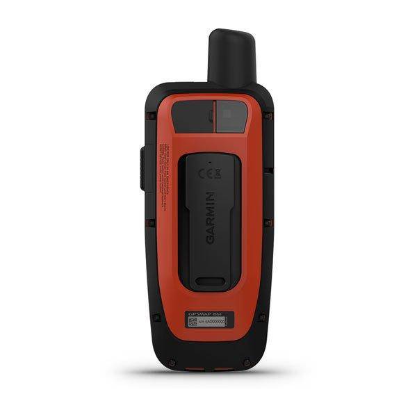
- GPSMAP 86i handheld with worldwide basemap
- Powered mount
- Lanyard
- USB to Micro USB cable
- USB to 2 pin cable
- Mounting hardware
- Documentation
Features
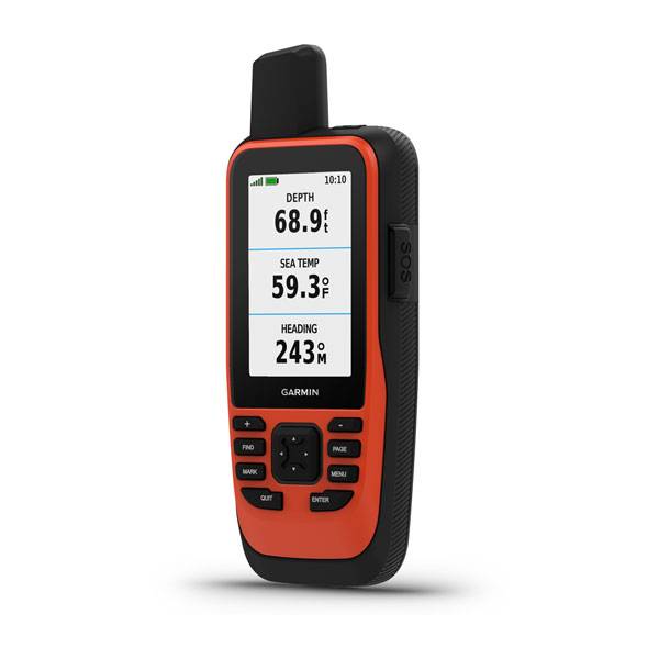
Marine Handheld GPS with inReach® Satellite Communication CapabilitiesWater-resistant, floating design, sunlight-readable 3 display and button operation provide ease of use on the water
Stream boat data from compatible chartplotters and instruments to consolidate your marine system information
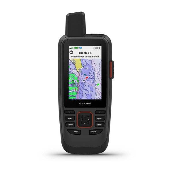
Stay in touch with inReach satellite communication and two-way text messaging via the 100% global Iridium® satellite network (satellite subscription required)
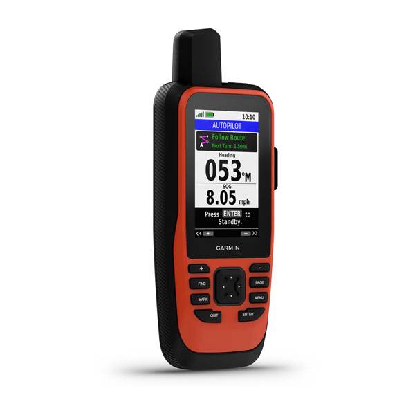
Functions as a remote control for convenient operation of your Garmin autopilot and select FUSION® marine products
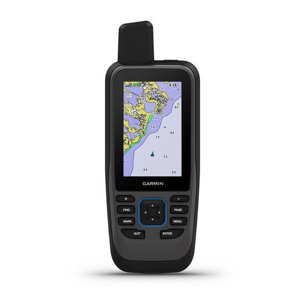
Supports optional BlueChart® g3 charts
Adjustable GPS filter smooths speed and heading indications over swells
Cast off confidently with the GPSMAP 86i handheld. Whether youre out for a day of fishing, sailing or cruising, youll gain peace of mind that comes from having a backup navigator with satellite communication and interactive SOS. This premium handheld floats and has a sunlight-readable 3 color display. Plus, wireless connectivity makes it a virtual extension of your onboard marine system, giving you added awareness and convenience.
Connect with Your Boat
Sync GPSMAP 86i with compatible Garmin chartplotters and instruments, and youll see real-time boat data displayed right on your handheld. Plus, it can serve as a remote control for convenient operation of your Garmin autopilot and select FUSION marine products. And when youre underway, an adjustable GPS filter smooths speed and heading indications over swells for more accurate tracking.
Satellite Communication
With built-in inReach satellite technology and additional service options¹, GPSMAP 86i helps you stay in touch globally. Send and receive two-way text messages, track and share your journey, and, if necessary, trigger an interactive SOS to get emergency help from a 24/7 global monitoring center via the 100% global Iridium satellite network. You can also receive marine weather forecasts directly on your device, so you can make educated decisions based on local conditions or the destination ahead.
Optional BlueChart g3 Charts
GPSMAP 86i comes preloaded with a worldwide basemap. It also allows you to add BlueChart g3 coastal charts, giving you industry-leading coverage, clarity and detail with integrated Garmin and Navionics® data. Detailed contours allow you to see 1 contours that provide a more accurate depiction of bottom structure for improved fishing charts and enhanced detail in swamps, canals and port plans.
Stay in Touch
Get smart notifications right on your GPSMAP 86i handheld when you pair it with your compatible smartphone. You can also sync GPSMAP 86i with the Garmin Explore website for cloud management of your favorite waypoints, tracks and routes. GPSMAP 86i offers Wi-Fi® connectivity, ANT+® technology and BLUETOOTH® wireless technology for easy wireless updates and connections. And for longer voyages, its internal, rechargeable lithium battery provides up to 35 hours of operation in 10-minute tracking mode and up to 200 hours in expedition mode².
¹Satellite subscription required
²Battery life may vary depending on usage; battery is user-replaceable
Specifications
Maps & Memory |
|
| Ability to add maps | |
|---|---|
| Basemap | |
| Storage and Power Capacity | microSD card (not included) |
| Waypoints/favorites/locations | 10000 |
| Routes | 250 |
| Track log | 20,000 points, 250 saved gpx tracks, 300 saved fit activities |
Sensors |
|
| Barometric altimeter | |
|---|---|
| Compass | Yes (tilt-compensated 3-axis) |
Outdoor Recreation Features |
|
| Area calculation | |
|---|---|
| Automatic routing (turn by turn routing on roads) | Yes (with optional mapping for detailed roads) |
| Geocaching-friendly | Yes (Paperless) |
| Custom maps compatible | |
| Hunt/fish calendar | |
| Sun and moon information | |
| Picture viewer | |
Garmin Connect |
|
| Garmin Connect compatible (online community where you analyze, categorize and share data) | |
|---|---|
General |
|
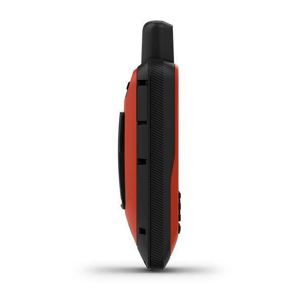
| Physical dimensions | WxHxD: 2.75" x 7" x 1.7" (7 x 17.8 x 4.4 cm) |
|---|---|
| Display size | 1.5"W x 2.5"H (3.8 x 6.3 cm); 3" diag (7.6 cm) |
| Display resolution | 240 x 400 pixels |
| Display type | transflective, 65K color TFT |
| Weight | 9.59 oz (272 g) |
| Battery | rechargeable internal lithium ion |
| Battery life | Up to 35 hours in 10-minute tracking mode; up to 200 hours (expedition mode) |
| Water rating | IPX7 |
| Memory/History | 16 GB |
| High-sensitivity receiver | |
| Interface | high-speed USB and NMEA 0183 compatible |
Item number: 010-02236-00
UPC: 753759228859
Package weight: 1.40 lb