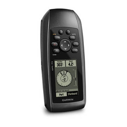
GARMIN Gps 72

This item is brand new
$119.19
This item ships within 1 day


AC adapter, USA, 4 Pin


USB to RS232 converter cable


PC interface cable (RS232 serial port connector)


Power/data cable (bare wires)


Cup Holder Universal Mount RAM-A-CAN II with 6 in Flex Arm


Lanyard 17 inch

Lanyard Carabiner

Contents of the package
Features
GPS 72 is WAAS-enabled for accuracy to within 3 meters and features a large screen and easy-to-use buttons. GPS 72 floats in water, and it's IPX7 waterproof. Whether on water or land, the GPS 72 can save up to 500 of your favorite places in memory and point you to your destination (no street or terrain maps). The GPS 72 is preloaded with worldwide cities as well as marine navigation aids, including lights, buoys, sound signals and day beacons. If you're into boating, hunting or fishing, you can use the 72's built-in celestial data, which includes tide information, sunrise/sunset times and a hunting and fishing calendar.

Specifications
Physical & Performance:
Unit dimensions, WxHxD: 2.7" x 6.2" x 1.2" (6.9 x 15.7 x 3.0 cm)
Display size, WxH: 1.6" x 2.2" (4.1 x 5.6 cm)
Display resolution, WxH: 120 x 160 pixels
Display type: 4 level gray LCD
Weight: 7.7 oz (218 g) with batteries
Battery: 2 AA batteries (not included)
Battery life: 16 hours
Waterproof: yes (IPX7)
Floats: yes
High-sensitivity receiver: no
Interface: serial
RoHS version available: yes
Maps & Memory:
Basemap: no
Preloaded maps: no
Ability to add maps: no
Built-in memory: no
Accepts data cards: no
Waypoints/favorites/locations: 500
Routes: 50
Track log: 2,048 points, 10 saved tracks
Features:
Automatic routing (turn by turn routing on roads): no
Electronic compass: no
Touchscreen: no
Barometric altimeter: no
Geocaching-friendly: no
Outdoor GPS games: no
Hunt/fish calendar: yes
Sun and moon information: yes
Tide tables: yes
Area calculation: yes
Custom POIs (ability to add additional points of interest): no
Unit-to-unit transfer (shares data wirelessly with similar units): no
Picture viewer: no
Item number: 010-00309-00
UPC: 753759041540
Package weight: 2 lb
Other Products in the Series:
| GARMIN Gps 60 | Add to comparison |
| GARMIN Gps 72H | Add to comparison |
 | GARMIN Gps 72H NOH | |
| GARMIN GPS 72H Marine Bundle | Add to comparison |
 | GARMIN GPS 73 | Add to comparison |
| GARMIN Gps 76 | Add to comparison |