GARMIN Trailhead Series-Appalachian Trail


Item: 010-C1058-00
1 reviews - 5.0
This item is brand new
$67.95
Backorder, ships in 3 - 4 weeks
cw|cw|sw|wi


1 reviews - 5.0
This item is brand new
$67.95
Backorder, ships in 3 - 4 weeks
cw|cw|sw|wi
Contents of the package
Features
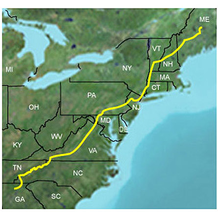
Prepare for your next hiking or camping adventure with highly detailed 24K topographic maps for the Appalachian Trail. These maps feature terrain contours, topo elevations, summits, parks, coastlines, rivers, lakes, geographic points as well as a fully routable trail.Includes coverage for the Appalachian Trail, plus 10 mi (16 km) of extended coverage on each side of the trail.
- Provides highly detailed digital topographic maps for the Appalachian Trail, comparable to 1:24,000 scale USGS maps.
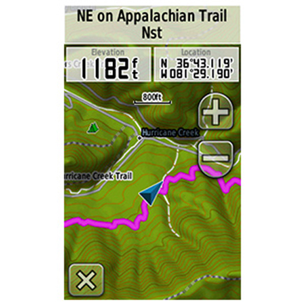
- Contains a fully routable trail from beginning to end, plus basic road coverage available as a reference.
- Includes national, state and local parks, forests, recreational and wildlife area boundaries.
- Contains detailed hydrographic features, including coastlines, lake and river shorelines, wetlands and perennial and seasonal streams.
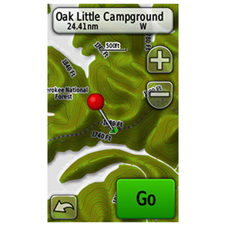
- Includes searchable points of interest, such as geographic place names, campgrounds, scenic lookouts and picnic sites, businesses and more.
- Displays 3-D terrain shading and digital elevation model (DEM) shaded relief on compatible devices to help estimate terrain difficulty.
- Features Bureau of Land Management township, range and section information and USGS quad locations.
Specifications
Item number: 010-C1058-00
UPC: 753759976941
Package weight: 0.1 lb
Product Reviews
Following reviews were written by actual customers.
Every GPS4US customer has a chance to live a feedback after receiving a product.
 by Joshua W, , 11/6/2017
Was so thankful my son bought this for me, it gave me much needed peace of mind while hiking this trail! Had good info related to trail life, some difficulty with cloudy days where it would show I wasnt on the trail despite being right next to a white blaze.
Following reviews were written by actual customers.
Every GPS4US customer has a chance to live a feedback after receiving a product.
by Joshua W, , 11/6/2017Was so thankful my son bought this for me, it gave me much needed peace of mind while hiking this trail! Had good info related to trail life, some difficulty with cloudy days where it would show I wasnt on the trail despite being right next to a white blaze.
List of Compatible Units:
Note: Displayed are products sold in gps4us store.
There might be more GPS units compatible with chosen accessory.