GARMIN Aera 500


This item is brand new
$599.95
This item ships within 1 day


AC Charger


Lithium-ion battery (replacement)


Cup Holder Universal Mount RAM-A-CAN II with 6 in Flex Arm


GTM 20 with lifetime traffic
Suggested Maps and Software:
 | Inland Lakes |
 | BlueChart g2, g3 on micro SD card with adapter |
 | Garmin Street Maps and City Navigation |
 | Garmin Topographic Maps |
 | Garmin Extras |
Contents of the package
- aera 500
- Free single database update
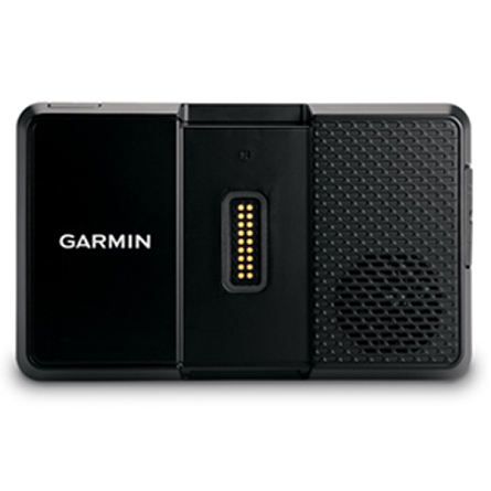
- Yoke mount with power cable
- Battery pack
- Portable friction mount
- USB cable
- Vehicle power cable
- Pilot's guide and owner's manual
Features
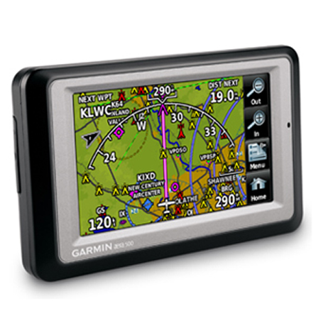
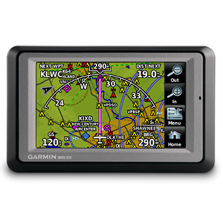
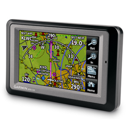
Go from Runways to Roadways4.3" touchscreen display
Fast 5 Hz GPS refresh rate
Map display with terrain and obstacle warnings
Street navigation with preloaded maps
Dual-duty GPS Portable
The most affordable model in the series, aera 500 combines the best in moving-map display features with intuitive, menu-driven touchscreen control. Featuring a crisp 4.3" QVGA wide-format touchscreen and preloaded graphical mapping, this versatile, feature-rich navigator comes ready for takeoff, right out of the box.
Fly aera Anywhere
In aviation mode, aera 500s detailed chart-style shaded mapping and extensive terrain and aviation databases help you visualize your flight path in relation to nearby navaids, terrain, SUAs and obstructions. To keep you aware of special airspace activity, more than 683 parachute drop zones are detailed in the Americas navigation database. Plus, the addition of private airports and heliports to the database affords even more navigation and emergency nearest options.
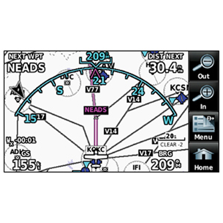
A database-driven terrain advisory feature offers TAWS-like color coding and pop-up alerts when possible obstructions or ground proximity conflicts loom. And with terrain/obstacle data shown at standard 30 arc-second resolution, youll enjoy a surprising level of detail on the display. Its graphical Terrain page offers both overhead and vertical profile views of the topography youre flying over. IFR map mode lets you display and navigate on high or low enroute airways. You can also pull up MEAs (Minimum Enroute Altitudes) and distances between intersections by touching the airway on the map.
The internal GPS updates at a rate of 5 times per second (5 Hz), which allows your moving map and flight data to display smoothly and continuously. And for added safety, an optional power/data cable (sold separately) makes it easy to interface aera 500 with the GTX 330 Mode S transponder in your aircraft, so you can access and display TIS traffic alerts in busy terminal airspace. You can also use the aera to load communications frequencies into your SL 40 Comm or SL 30 Nav/Comm transceiver.
Built to Fly
On the ground, aera navigation continues with full automotive GPS capability and preloaded City Navigator® NT street maps. Just like our nüvi® line of touchscreen automotive navigators, aera 500 offers voice-guided turn-by-turn directions with text-to-speech audio technology that calls out streets by name. Theres built-in Bluetooth® support for wireless hands-free calling with your compatible mobile phone. And built-in points of interest include millions of motels, restaurants, gas stations and ATMs. To speed your transition from aircraft to automotive mode, a unique smart mount offers instant clip-and-go car navigation.
*GPS receiver has a nominal operating velocity range of 0 800 kts (411 m/s).
Specifications
Physical & Performance | |
| Physical dimensions | 5.3"W x 3.3"H x .9"D (13.5 x 8.4 x 2.3 cm) |
| Display size, WxH | 3.81"W x 2.25"H (9.7 x 5.7 cm); 4.3" diag (10.9 cm) |
| Display resolution, WxH | 480 x 272 pixels |
| Display type | touchscreen WQVGA color TFT with white backlight |
| Weight | 9.5 ounces (270 g) |
| Battery | removable, rechargeable lithium-ion |
| Battery life | up to 5 hours (less with full backlight and options) |
| Water rating | IPX7 |
| SBAS/WAAS receiver | high-sensitivity with WAAS position accuracy |
| Voltage range | 11-35 |
| IFR or VFR | VFR |
| Traffic Information Services (TIS) alerts compatible | |
Maps & Memory | |
| Basemap | |
| Preloaded street maps | |
| Ability to add maps | |
| Built-in memory | internal solid state |
| Accepts data cards | yes (microSD cards) |
| Custom POIs (ability to add additional points of interest) | Yes (Auto mode) |
| Waypoints/favorites/locations | 3,000 (aviation mode); 1,000 (automotive mode) |
| Routes | 50 |
Databases | |
| Navigation database (includes Jeppesen® data) | |
| Navigation database coverage areas | Americas or Atlantic or Pacific |
| Types of Jeppesen data | full and ARTCC, FSS frequencies and final approach waypoints |
| Preloaded Terrain database | |
| Preloaded Obstacle database | Yes (U.S. and Europe only) |
| Preloaded SafeTaxi airport diagrams | Not available |
| Preloaded AOPA Airport Directory | Not available |
| Preloaded low & high altitude enroute airways | |
| Preloaded private airports | Yes (U.S. only) |
Navigation Features | |
| Speaks street names (e.g. "Turn right ON ELM STREET in 500 ft.") | Yes (Auto mode) |
| Bluetooth® wireless technology | yes (auto mode) |
Aviation Portable Features | |
| Moving map | |
| Patented panel page | |
| HSI (GPS-based) | |
| IFR map mode | |
| Audible terrain alerts | |
| Terrain resolution | standard |
| Smart Airspace Feature (generates and displays altitude-sensitive alerts) | |
| Automatic logbook | |
| Separate serial and USB interfaces | |
| 3-D map view | Yes (Auto mode) |
Additional | |
| Additional | GPS receiver has a nominal operating velocity range of 0 800 kts (411 m/s) |
Item number: 010-00836-00
UPC: 753759097448
Package weight: 4 lb