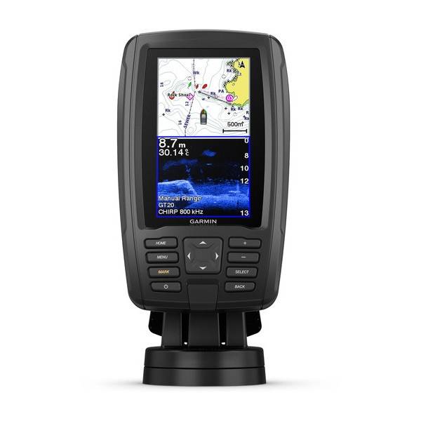
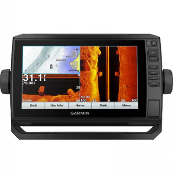
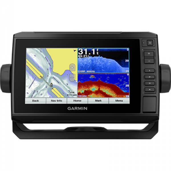
GARMIN echoMAP Plus 75CV Canada Lakes g2 DownVu
This item is brand new
$600.95
Backorder, ships in 3 - 4 weeks
|sw


MotorGuide Adapter Cable 8-pin


Panoptix PS31 Forward Transducer

Panoptix PS60 Thru-hull Down Transducer
Panoptix PS21 LiveVu Forward Transducer
Panoptix PS21-TM Forward Transom Mount Transducer


NMEA 2000 Transducer Adapter Kit

GNT 10 NMEA 2000 - ANT Transceiver


M260-8G 1kW 200/50kHz In-Hull Plastic Transducer


M265LH DO 42 210 kHz 1kW CHIRP In-hull/Pocket Plastic Transducer


R599LH 2-3kW CHIRP Transducer


B175L no connector 1kW 12 tilt CHIRP Bronze Transducer
B175H no connector 1kW 20 tilt CHIRP Bronze Transducer

P72-8G 500W 77/200 kHz Transducer


B175M 8pin1kW 12 tilt CHIRP Transducer

B175M 8pin 1kW 20 tilt CHIRP Transducer


B75H 0 deg tilt CHIRP Transducer


B75L 12 deg tilt CHIRP Transducer


B164 1kW 0 tilt 200/50kHz Bronze Transducer 8-pin


Wide beam bare wires 0 Tilt 150-250 kHz 1kW CHIRP Bronze Transducer
Wide beam bare wires 12 Tilt 150-250 kHz 1kW CHIRP Bronze Transducer
Wide beam bare wires 20 Tilt 150-250 kHz 1kW CHIRP Bronze Transducer
B175H no connector 1kW 0 tilt CHIRP Bronze Transducer
B175H no connector 1kW 12 tilt CHIRP Bronze Transducer
B175L 8pin 1kW 0 tilt CHIRP Bronze Transducer
B175L no connector 1kW 20 tilt CHIRP Bronze Transducer
B175M no connector 1kW 0 tilt CHIRP Bronze Transducer
B175M no connector 1kW 12 tilt CHIRP Bronze Transducer
B175M no connector 1kW 20 tilt CHIRP Bronze Transducer

B265LH CHIRP Transducer
B45-DT-8G Thru-Hull 50/200 kHz Bronz Narrow Stem 8pin Transducer

CM599 LH 2-3kW CHIRP Transducer

CM599 LM 2-3kW CHIRP Pocket Mount Transducer

PM265LM DT 42-135 kHz 1kW CHIRP Poket Bronze Transducer

R109LH 38-210 kHz 2kW CHIRP Urethane Thru-Hull Transducer

R509LH DT 28-210 kHz 2-3kW CHIRP Epoxy Thru-Hull Transducer

R509LM DT 28-130 kHz 2-3kW CHIRP Epoxy Thru-Hull Transducer

SS164 0 deg tilt 1kW Transducer 8pin

SS164 12 deg tilt 1kW Transducer 8 pin

SS164 20 deg tilt 1kW Transducer 8 pin


P32-8G DST 77/200 Khz 45/15 beam Transom Mount 8pin Triducer

TM150M 95-155 kHz Trunsom mount Plastic CHIRP 8pinTransducer
GT21-TM - Transom Mount DownVu 500W CHIRP 260/455 kHz Traditional 600W 50/200 kHz Transducer w/Temp


TM265LH DT 42-210 Khz 1kW CHIRP Urth Transom Transducer

For Garmin TM258-8G DT Cone 3-21 1kW 200/50kHz Transom 8pin Transducer
Suggested Maps and Software:
 | Inland Lakes |
 | BlueChart g2, g3 Vision |
 | BlueChart g2, g3 on micro SD card with adapter |
 | Garmin Extras |
 | LakeVu HD Ultra |
 | LakeVu HD |
Contents of the package
- ECHOMAP Plus 75cv with Canada LakeVü HD
- CV22HW-TM transducer
- Power/data cable
- Tilt/swivel mount with quick release cradle
- Flush mount
- Protective cover
- Hardware
- Documentation
Features
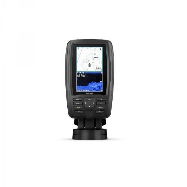
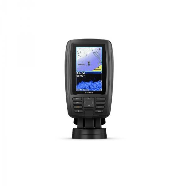
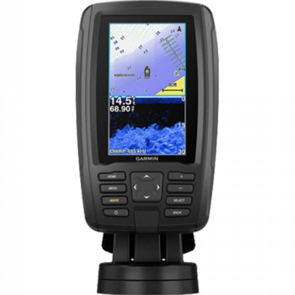
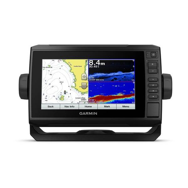
The Combo with ConnectionsBright, sunlight-readable 7 keyed-assist touchscreen combo
Includes transducer for Garmin CHIRP traditional sonar plus CHIRP ClearVü scanning sonar and compatible with Panoptix all-seeing sonar (sold separately)
Preloaded Canada LakeVü HD maps cover more than 13,500 lakes, of which more than 4,800 are HD lakes with 1 contours
Built-in Garmin Quickdraw Contours mapping software instantly creates personalized fishing maps on-screen with 1 contours as you fish
Use built-in Wi-Fi® to pair with the free ActiveCaptain app for access to OneChart, smart notifications¹, Garmin Quickdraw Community data and more
At a Glance
Bright, sunlight-readable 7 combo offers the convenience of a keyed-assist touchscreen. It comes with one transducer that features both Garmin CHIRP traditional sonar and CHIRP ClearVü scanning sonar, and its also compatible with Panoptix all-seeing sonar. Preloaded with Canada LakeVü HD maps cover more than 13,500 lakes, of which more than 4,800 are HD lakes with 1 contours. Plus, Quickdraw Contours mapping software to instantly create personalized fishing maps on-screen with 1 contours as you fish. It also has built-in Wi-Fi® to pair with the free ActiveCaptain app for access to OneChart, which allows you to purchase and download new charts. ActiveCaptain also gives you access to smart notifications1, the ActiveCaptain community for marina and other points of interest details, Quickdraw Community data and more. Features quick-release bail mount to make it easy to remove and take with you. Transom and trolling motor mounts included.
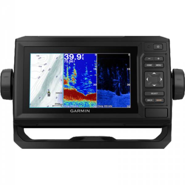
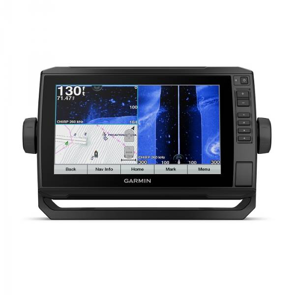
The Garmin CHIRP Difference
The built-in sonar capabilities of ECHOMAP Plus 75cv include our CHIRP traditional sonar, one of the most sophisticated sonar technologies available for the fishing and boating public. CHIRP traditional sonar provides amazingly clear target separation and definition, because it puts even more energy onto the target than traditional sonar. It also provides traditional sonar support for Minn Kota® and MotorGuide® trolling motors with integrated transducers.
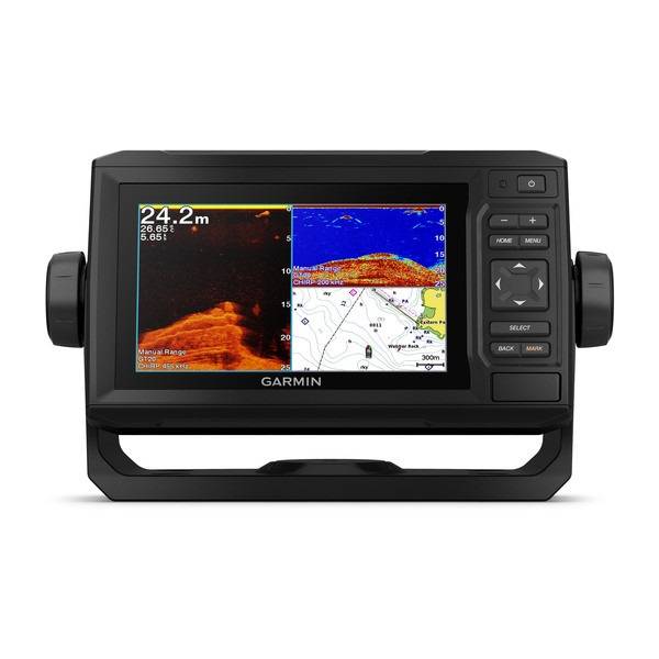
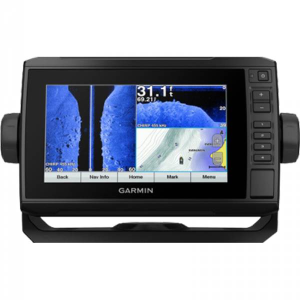
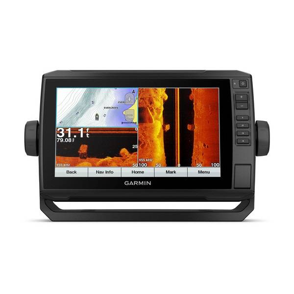
Clear Scanning Sonar Images
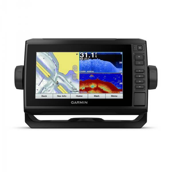
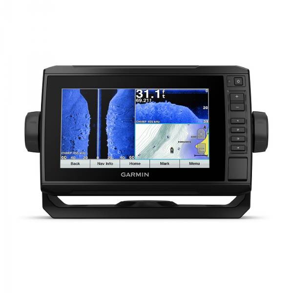
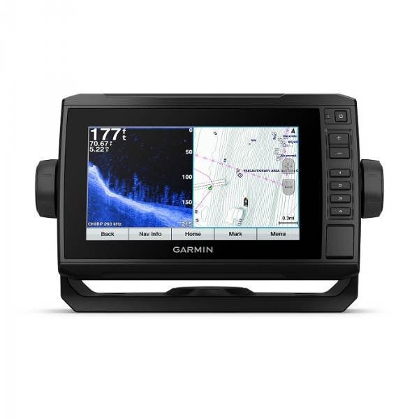
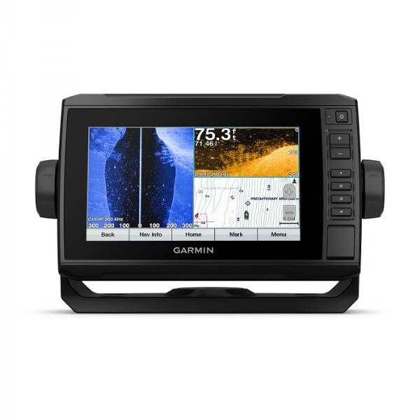
Garmin CHIRP ClearVü scanning sonar gives you a nearly photographic image of whats below your boat. You clearly see structure, submerged objects and fish. Garmin CHIRP traditional sonar and CHIRP ClearVü scanning sonar are combined into 1 transducer.
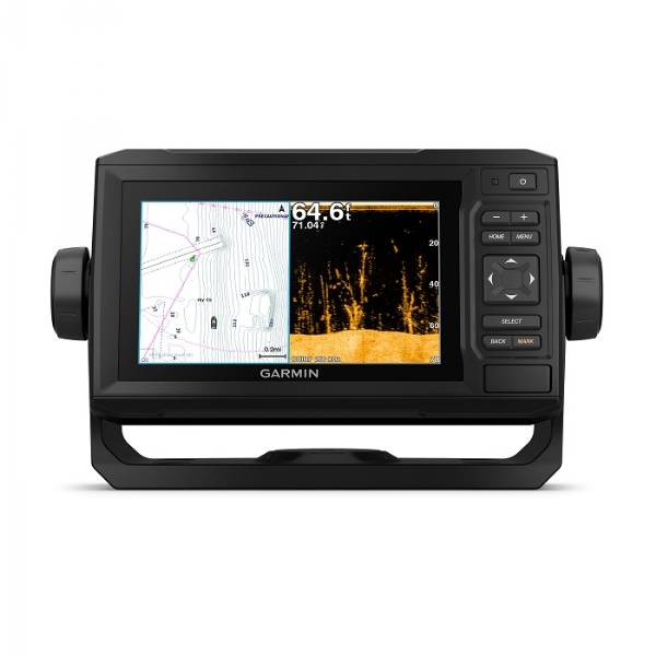
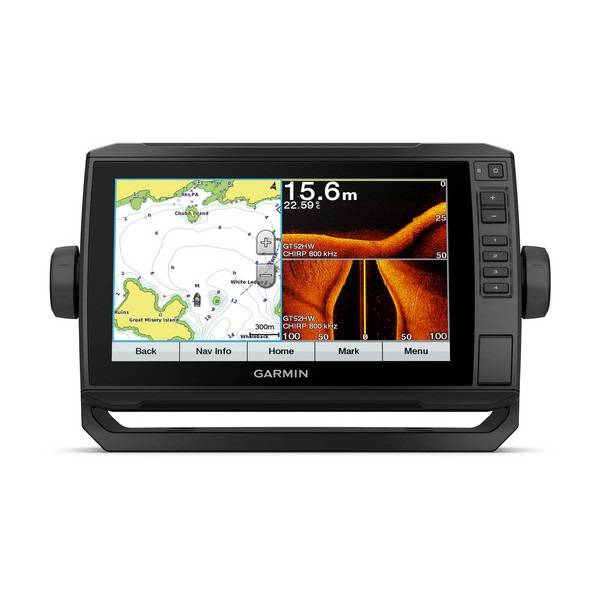
Preloaded Canada LakeVü HD Maps
These highly detailed freshwater maps include 13,500 Canada lakes, rivers and reservoirs, including coverage for the Great Lakes and Trent Severn Waterway. That number also includes more than 4,800 HD lakes with 1 contours in Alberta, British Columbia, Nova Scotia, Ontario, Quebec, Saskatchewan and Yukon provinces. Canada LakeVü HD gives you excellent detail of underwater features, plus Shallow Water Shading allows you to designate a minimum depth. It also shows interstates, general roads and bridges, designated fishing areas, boat ramps, marinas and campgrounds.
Quickdraw Contours to Create Your Own Maps
Instantly create personalized fishing maps on-screen with 1 contours while you fish. Tailor them to fit your needs. These are your maps you own them. Keep the data to yourself, or share it with the Quickdraw Community on Garmin Connect.
Get Connected with ActiveCaptain App
Our free all-in-one ActiveCaptain app allows you to manage your marine experience from nearly anywhere. It creates a simple yet powerful connection between your compatible mobile device and your chartplotter, charts, maps and the community. Use the combos built-in Wi-Fi® to pair with the free ActiveCaptain app for access to OneChart, which allows you to update or purchase and download new charts. ActiveCaptain also gives you access to smart notifications1, the ActiveCaptain community for marina and other points of interest details, Quickdraw Community data and more.
SailAssist Features
SailAssist features include laylines, enhanced wind rose and heading and course-over-ground lines. See true and apparent wind angle and speed as well as set and drift and a glance. To help you gain a wind-maximizing competitive edge, a pre-race guidance page that shows your virtual starting line along with data fields showing laylines, time to burn before the start and a race timer.
Upgrade to Our Best Maps on the Water
Step up to Canada LakeVü HD Ultra with Max Def Lakes, BlueChart g2 HD and BlueChart g2 Vision HD, which adds Auto Guidance² and other great features. A single microSD card slot provides expandable memory for accessory map purchases.
See Fish Swimming in Real Time
Add optional Panoptix all-seeing sonar and see all around your boat and below it in real time, even while your boat is stationary. See your lure as it sinks, relative to structure in the water. Watch the movement of fish and their reactions to your bait up to 100 away or below the boat.
NMEA 2000® Network Support
Provides NMEA 2000 support for engine data, sensors, FUSION-LINK audio system, autopilots and more.
Take Your ECHOMAP Plus with You
When youre off the water, its easy to keep your ECHOMAP Plus combo safe and secure. You dont have to mess with plugging and unplugging wires from the unit because the cords plug directly into the mount. This allows you to quickly install and remove your ECHOMAP Plus from power and the mount.
¹When paired with a compatible mobile device.
²Auto Guidance is for planning purposes only and does not replace safe navigation operations.
Specifications
General | |
| Physical dimensions | 9.8" x 5.5" x 2.0" (25 x 13.9 x 5.1 cm) |
|---|---|
| Weight | 1.7 lbs.(0.77kg) |
| Water rating | IPX7 |
| Display type | WVGA display |
| Display size | 6.1" x 3.4"; 7.0" diagonal (15.5 x 8.6 cm; 17.8 cm diagonal) |
| Display resolution | 400 x 800 pixels |
| Power consumption | 15W |
| Antenna | Internal_or_external_over_NMEA_2000 |
| Mounting options | Bail or flush |
| Receiver | 5 Hz |
| Garmin Marine Network ports | 1 Panoptix port |
Maps & Memory | |
| Accepts data cards | 1 microSD card; 32 GB maximum card size |
|---|---|
| Waypoints | 5,000 |
| Routes | 100 |
| Track log | 50,000 points; 50 saved tracks |
| Preloaded maps | LakeVü HD (inland maps) |
Outdoor Recreation Features | |
| Tide tables | |
|---|---|
Chartplotter Features | |
| Garmin Sonar compatible | |
|---|---|
| Supports AIS (tracks target ships position) | |
| Supports DSC (displays position data from DSC-capable VHF radio) | |
| Supports FUSION-Link compatible radios | |
Sonar Features & Specifications | |
| Dual-frequency (50/200 kHz) sonar capable | |
|---|---|
| Dual-beam (77/200 kHz) sonar capable | |
| Frequencies supported | CHIRP (low, mid, high) Traditional: 50/77/83/200 kHz ClearVü: 260/455/800 kHz |
| Transmit power | 500 W (RMS) / 4,000 W (peak to peak) |
| CHIRP sonar technology | Yes (Built-in) |
| ClearVü | Yes with CHIRP (built-in) |
| SideVü | No |
| Maximum depth | 2,300 ft @ 77 kHz, freshwater 1,100 ft @ 77 kHz, saltwater (depth capacity is dependent on water bottom type and other water conditions) |
| Bottom lock (shows return from the bottom up) | |
| Water temperature log and graph | |
| Sonar recording | |
| Sonar history rewind | |
Connections | |
| NMEA 2000® compatible | |
|---|---|
| Transducer pin numbers | 8 |
| NMEA 0183 input ports | 1 |
| NMEA 0183 output ports | 1 |
| Video input ports | None |
| Video output ports | None |
| Wireless connectivity | Yes |
Item number: 010-01895-00
UPC: 753759185534
Package weight: 6.50 lb
Other Products in the Series: