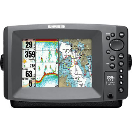
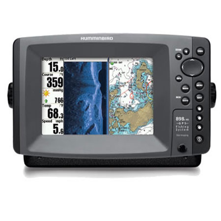
HUMMINBIRD 898c HD SI Combo with Side Imaging
Item: 408890-1
This item is brand new
$1,499.95
This item ships within 8 days


This item is brand new
$1,499.95
This item ships within 8 days
Cables


RAM Mounts

Marine Networking

408390-1
AS ETH NMEA2K, HUM-408390-1, Inteface
AS ETH NMEA2K, HUM-408390-1, Inteface
No Longer Available

Sensors and Boards

730021-1
SW Speed Sensor, MFG 730021-1, Transom mount, with 20 ft cable
SW Speed Sensor, MFG 730021-1, Transom mount, with 20 ft cable
No Longer Available

730000-1
TS-W Temp/Speed Sensor
TS-W Temp/Speed Sensor
No Longer Available
Transducers Humminbird


710210-1
XPTH 9 HDSI 180 T Down Side Imaging depth transducer w temp
XPTH 9 HDSI 180 T Down Side Imaging depth transducer w temp
No Longer Available

710205-1
XTM-9-HDSI-180-T Side Imaging Trolling Motor Transducer
XTM-9-HDSI-180-T Side Imaging Trolling Motor Transducer
No Longer Available


p66-DTHB
P66-DTHB Plastic Transom Mount Transducer with Temp, 600w 9 connector
P66-DTHB Plastic Transom Mount Transducer with Temp, 600w 9 connector
No Longer Available


TM270W-HB
TM270W Wide Beam 25 Cone 1kW 200/50kHz Transom 9 connector Transducer
TM270W Wide Beam 25 Cone 1kW 200/50kHz Transom 9 connector Transducer
No Longer Available
Compatible maps
Suggested Maps and Software:
 | Navionics Marine Charts |
Contents of the package
In the box:
- 898c HD SI Display
- GPS Antenna/receiver
- Transom mount transducer
- Mounting bracket
- Installation hardware
- Owner's manual
Features
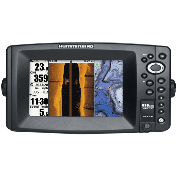
Model 898c HD SI Fishfinder/Chartplotter with Side ImagingSuperior Sonar and Navigation with Advanced Network Capabilities
The 898c HD SI Combo features a brilliant color, ultra-high resolution 480V x 800H 7" display, Side Imaging and DualBeam PLUS sonar with 500 Watts RMS power output, GPS Chartplotting with built-in ContourXD mapping, and advanced Fishing System capabilities. In addition, it includes dual card slots for maps and saving waypoints, as well as 3 programmable preset buttons to save your favorite views. Maximize your angling experience with the Humminbird 898c SI Combo fishfinder GPS system.
Humminbird Contour XD Charts
The built-in Contour XD chart covers the contiguous U.S.A. coastline and inland lakes and rivers. On the coast, this clearly shows features as small as canals, and many coastal navigation lights. Inland, the Contour XD features virtually all recreational lakes and rivers, plus hundreds of thousands of small lakes that dont appear on other charts. In other words, your lake is likely to be there!
Available Advanced Fishfinding System Modules:
- WeatherSense Barometer for weather prediction
- Wireless Sonar Link for remote sensing
- CannonLink for control of downriggers
- InterLink for networking with other units
Advanced Sonar Features:
- Freeze Frame with ability to Mark Structure on Sonar
- Instant Image Update
- Real Time Sonar RTS Window
- Selective Fish ID
- Sonar Echo Enhancement
- Sonar Recording
- Sonar Snapshot
- Split Screen Zoom
- TrueArch Technology
- Wide Narrow Cone Split Screen
- Custom Digital Readout Selection
- Custom View Selections
- Large Digits View
- Quick Disconnect Mounting System
- Temperature Alarm
- Triplog
- X Press Menu System
Specifications
Display7" diag. widescreen color LCD
Resolution
480 x 800 Pixels
Dimensions
11"W x 6"H x 4"D
Mapping
Built-in ContourXD maps, optional Navionics
Waypoints/Routes
2,750 waypoints, 45 routes, 20,000 trackpoionts, 50 saved tracks
Antenna
External GPS antenna included
Sounder
1,000 Watt, 83/200KHz Dual Beam sonar, 455/800KHz Down/Side Imaging sonar, transducer included
Radar
Available radar antennas include 2KW, 12" and 4KW, 21" radomes
Other Functions
AIS (third party), Cannon Link, Ethernet hub, WeatherSense
Interface
Ethernet; NMEA 2000; NMEA 0183
Warranty
One Year
Item number: 408890-1
UPC: 082324038402
Package weight: 9 lb
Other Products in the Series: