LOWRANCE Elite-7 Ti Touch C-Map Pro with Med/High/LSS-HD

This item is brand new
$729.95
This item ships within 1 day
|cw|sw|wi


Suggested Maps and Software:
 | Navionics Marine Charts |
 | Lowrance Maps |
 | C-Map Charts |
 | Cmor maps |
Contents of the package
Quick release bracket
Suncover
Power cable
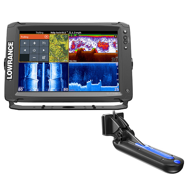
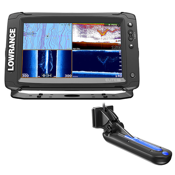
HST - WSBL 83/200 kHz transom-mount skimmer depth/temp
StructureScan HD Skimmer Transom Mount Transducer
Documentation
Features
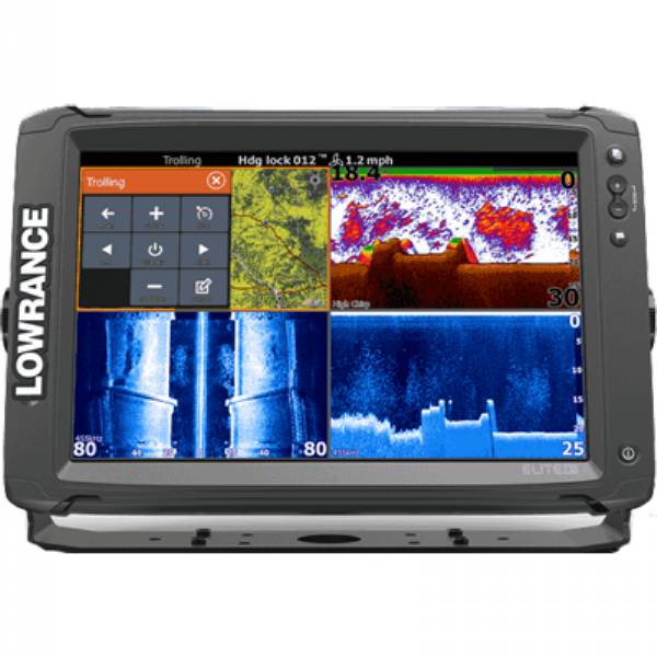
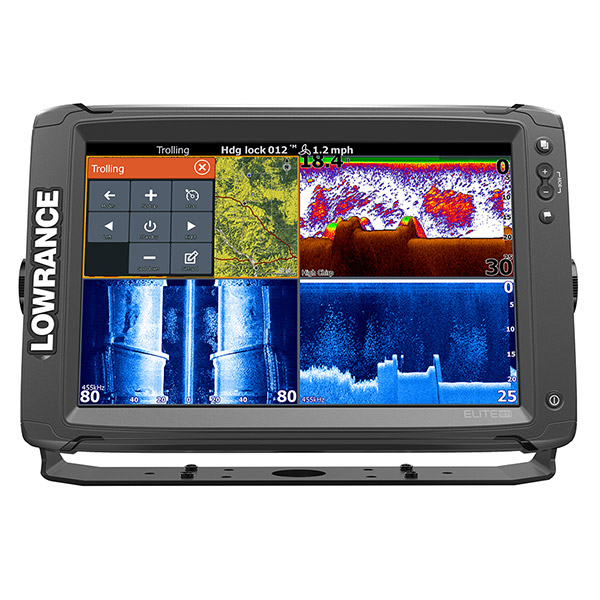
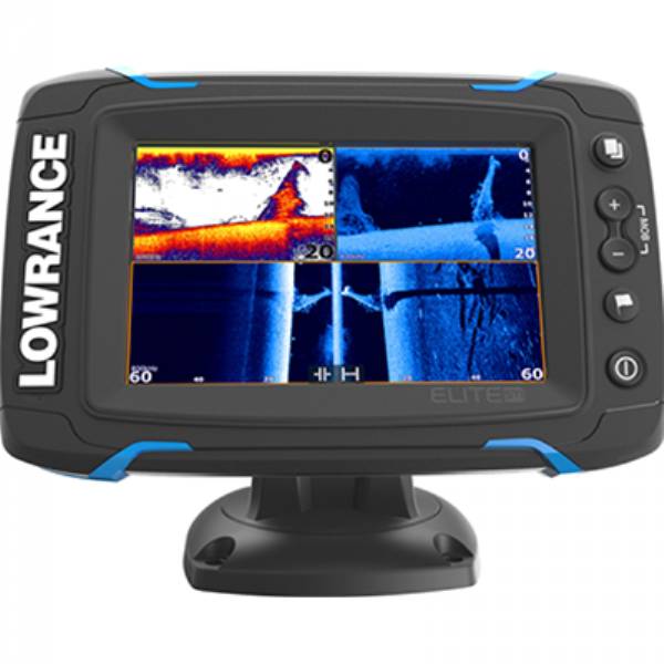
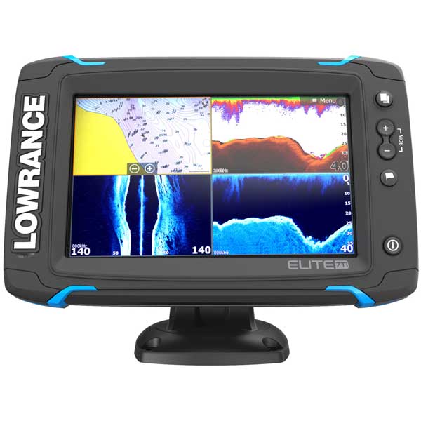
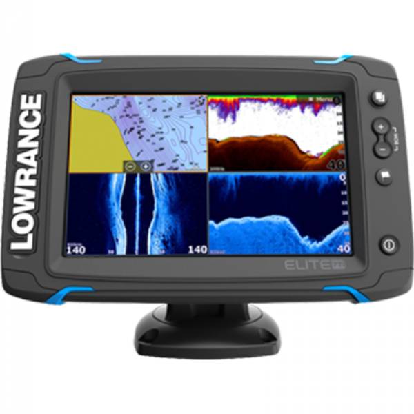
Elite-7 Ti Fishfinder/Chartplotter with HST-WSBL Skimmer Transducer, StructureScan-HD Skimmer Transducer and Y-Cable. 7-inch Fishfinder/Chartplotter with high-bright, LED-backlit display with CHIRP, DownScan and StructureScan technology, built-inKey Points
- Single-touch 7" Widescreen
- Built-in CHIRP/Broadband Sounder
- Built-in StructureScan (with TotalScan transducer)
- Built-in 10Hz GPS/GLONASS antenna
- Built-in Wireless connectivity
- Built-in Bluetooth connectivity
- Xi5 Trolling Motor control via Lowrance SmartSteer
- Best-in class screen brightness
- Single micro SD card slot
- NMEA 2000® connectivity
- Wide selection of cartography options
- Uses Quick Release Bracket
Selling Points
- Lowrance SmartSteer Technology for Xi5 Trolling Motor control
- Stand alone Fishfinder/Chartplotter
- Built in Detailed Basemap cartography (Americas models) and Navionics Basemap (Americas and ROW)
- Add on cartography available from Insight HD, Navionics, Jeppesen C-MAP and other 3rd Party Toolkit Partners
- Share waypoint data via NMEA 2000® with other displays
- Fully customizable split-screen options
- StructureMap included with built-in StructureScan (requires optional TotalScan transducer)
Specifications
General
| Display Size | 7in (178mm) Diag. |
| Display Type | WVGA color TFT LCD |
| Resolution | 800H x 480W |
| Backlight | Pure White LED |
| Display Brightness | 1200 Nits |
| Height | 6.332in (160.83mm) |
| Width | 8.641in (219.48mm) |
| Depth | 2.507in (63.68mm) |
| Weight | 3.04lb (1.38kg) |
Environmental
| Operating Temperature | 5°F to 131°F (-15°C to 55°C ) |
| Waterproof | IPX7 with card door closed |
| DOC | Part 15.103 FCC rules & CE RTTE directive 1999/5/EC |
Electrical
| Current Draw | 0.9A @ 13VDC with backlight on full |
| Operating Voltage | 12VDC |
| Supply Voltage | 10.8-17VDC |
User Interface
| Interface | Single-touch touchscreen and Limited Keypad; ZOOM +/-,WPT,LIGHT/POWER |
Chart Plotter Characteristics
| Display Modes | North up, Course up (COG), Heading up (heading with external heading sensor or COG) |
| Built-in Cartography | Detailed Basemap cartography (AMER models), Navionics basemap (AMER and ROW models) |
| Add on Cartography | Navico Insight HD, Navionics Platinum+/Platinum/Gold, Fishing HotSpots |
| Alarms | No GPS fix, Anchor, Low boat speed, XTE, Waypoint radius, Arrival |
Sonar Characteristics
| Built-in CHIRP | Yes |
| Built-in Broadband | Yes |
| Built-in StructureScan | Yes |
| Sonar Frequency | Mid/High CHIRP (83/200kHz) 455/800 kHz DownScan, Low/High CHIRP (50/200kHz) |
(*Available frequencies determined by connected transducer)
| Broadband Power | 500W RMS |
| Sonar DownScan Max Depth 455/800 kHz | 300ft (91m) |
| Sonar Broadband Max Depth Low/High (50/200 kHz) transducer | 3000ft (762m) |
| Sonar Broadband Max Depth Mid/High (83/200 kHz) transducer | 1000ft (305M) |
| Sonar Alarms | Fish, Shallow |
| TrackBack | Yes |
| Temperature Readings | Yes |
Comms/Interface
| NMEA0183 | 1 x RS422 port |
| Supported baud rates | 1200, 2400, 4800 (Default), 9600, 19200, 38400, 57600, 115200 |
| NMEA 2000 | 1 Micro-C |
| Data Card Slot | 1 micro SD card up to 32GB |
GPS/Navigation
| GPS Type | Internal high-sensitivity WAAS + EGNOS + MSAS |
| Waypoints | 3000 |
| Routes | 100 |
| Trails | 100 plots with up to 10,000 points per trail |
| GPS Alarms | Anchor, Arrival, Offcourse |
| Background Mapping | World reference basemap and enhanced U.S. basemap with over 3,000 enhanced lake maps with depth contour and shoreline detail, plus coastal depth contours/shoreline detail and spot depth soundings to 1,000 ft./305 m |
| Mapping Options | Lake Insight and Nautic Insight PRO and HD, Navionics® Gold and HotMaps® Premium, Fishing Hotspots® PRO and Jeppessen C-Map Max-N Wide. |
Item number: 000-14121-001
UPC: 9420024167700
Package weight: 11.25 lb
Other Products in the Series: