LOWRANCE HDS 10m Insight USA Multifunction Chartplotter

This item is brand new
$1,994.95
This item ships within 8 days


LGC 4000 GPS Receiver Antenna


Flush Mount f/HDS Series


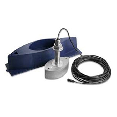
GB-22 Gimbal Bracket f/HDS-10

SPOD sail pod box uncut medium for MFD display


LMF-200 Compact Multi - Function Gauge w/out Sensor
LMF-400 Multi - Function Gauge w/out Sensor


LSS 1 StructureScan Sounder with Transducer

NEP 1 Navico Expansion Port 1
BR24 Broadband Radar

SonicHub Marine Audio Server with MP3 Dock and 2 Speakers
Suggested Maps and Software:
 | Navionics Marine Charts |
C-Map MAX-N | |
 | Cmor maps |
Contents of the package
Features
HDS-10m Multifunction GPS Chartplotter includes- Internal 16-channel GPS+WAAS (GPS+EGNOS+MSAS for non-Americas) Antenna
- Brilliant, New 10.4"/26.4 cm SolarMAX Plus Display
- Built-in High-Definition InsightMapping Options (Americas) or Navionics World Background map (non-Americas)
- Largest Selection of Chartcard Options Including Navionics Platinum+ with TurboView
- SIRIUS Satellite Weather and Stereo-Quality Radio Capability (Americas)
- Ethernetworks and NMEA 2000 Performance Networking Options, including Broadband Sounder
- Expanded New 2-Year Limited Warranty
A unique new FlyWheel dial and command soft keys give you control with the greatest of ease and speed, and to precisely guide your way, a new super-sensitive 16-channel GPS+WAAS antenna (GPS+EGNOS+MSAS for non-Americas) is built right in.
Also inside is the amazing, life-like and exclusive Insight USA (Navionics World Background map for non-Americas) cartography to enhance your on-water navigation for both Inland lakes and Coastal waters. Plus, this HDS is now fully compatible with all Navionics chartcards* - Platinum+, Platinum, Platinum HotMaps - with two high-speed SD card slots
Specifications
DISPLAY
Display Size 10.4 in \ 264 mm
Display Resolution 600 x 800 (H x W)
Display Type 16-bit color Super VGA SolarMAX PLUS TFT
Backlighting Screen/Keypad
Backlighting Type Pure white LED
Resize Display Window Yes
Sonar And GPS Overlay Data Yes (remote sonar)
Split Screen Presentation Yes
Multilanguage Display Yes
Languages Supported 23
GPS / NAVIGATION
GPS Antenna Type Internal, high-sensitivity GPS+WAAS (Americas) or GPS+EGNOS+MSAS (non-Americas)
GPS Receiver Channels 16 channels
Background Map Expanded U.S. BaseMap or Insight USA (Americas) or Worldwide background map (non-Americas)
Custom Mapping Optional Navionics® Platinum+ and Platinum chartcards with TurboView for worldwide coverage - as well as Navionics® HotMaps Platinum, Lowrance Hot Spots® PRO and LakeMaster® ProMaps (Americas)
Waypoint Storage 5000
Routes 200
Plot Trails Up to 10 trails - up to 12,000 points/trail
Man Overboard Feature Yes
RADAR
Antenna Type Optional Lowrance radar choices available
NETWORKING / CONNECTORS
NMEA 0183 Input Yes
NMEA Output 0183/2000
Connectors NMEA 2000®, NMEA 0183 and Ethernet
TECHNICAL / ENVIRONMENTAL
Built-in Backup Memory Yes
Casing Sealed and waterproof
Width 12.3 in \ 312 mm
Height 8.9 in \ 225 mm
Depth 3.6 in \ 92 mm
POWER
Power Supply 10 - 17 vDC
NMEA 2000® Load Equivalency Number 1 network load (50mA)
OTHER
Memory Card Capable Two SD/MMC memory card slots
Other Features StructureScan with optional LSS-1 module (8 color palette options), Broadband Sounder technology (with 14 color palette options), ethernet networking, optional SIRIUS Satellite Weather/Radio, FlyWheel scroll dial and new 2-year limited warranty
Item number: 140-15
UPC: -
Package weight: 9 lb
Other Products in the Series: