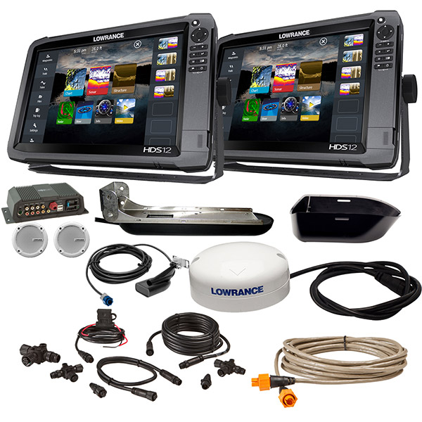
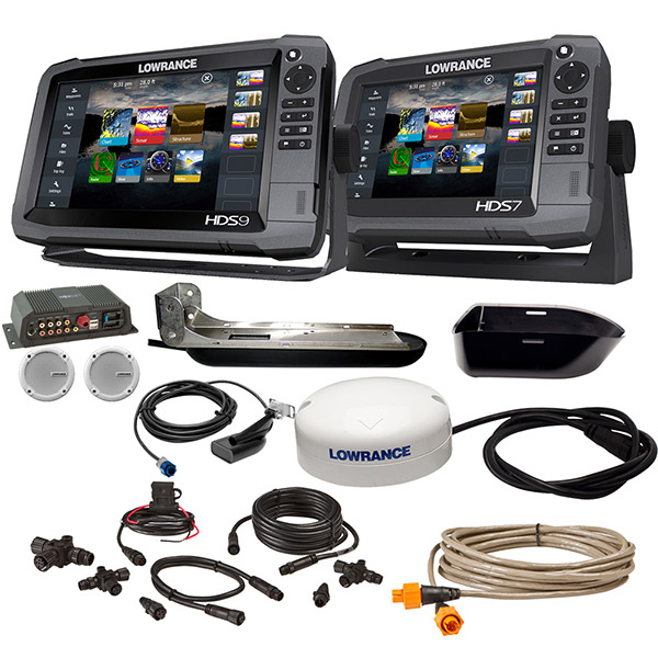
LOWRANCE HDS-9 Gen3 Insight/HDS-9 Boat in a Box w/HDI Skimmer, Sonic Hub 2
This item is brand new
$2,999.00
Backorder, ships in 3 - 4 weeks
|sw


Bezel and Door Assy, HDS-9 Gen3


B175H no connector 130-210 kHz 1kW 0 tilt CHIRP Bronze Transducer

B175L no connector 40-60 kHz 1kW 0 tilt CHIRP Bronze Transducer

B175M no connector 85-135 kHz 1kW 0 tilt CHIRP Bronze Transducer

B175H no connector 130-210 kHz 1kW 12 tilt CHIRP Bronze Transducer

B175L no connector 40-60 kHz 1kW 12 tilt CHIRP Bronze Transducer

B175M no connector 85-135 kHz 1kW 12 tilt CHIRP Bronze Transducer

B175H no connector 130-210 kHz 1kW 20 tilt CHIRP Bronze Transducer

B175L no connector 40-60 kHz 1kW 20 tilt CHIRP Bronze Transducer

B175M no connector 85-135 kHz 1kW 20 tilt CHIRP Bronze Transducer

Wide beam 0 Tilt no connector 150-250 kHz 1kW CHIRP Bronze Transducer

Wide beam 12 Tilt no connector 150-250 kHz 1kW CHIRP Bronze Transducer

Wide beam 20 Tilt no connector 150-250 kHz 1kW CHIRP Bronze Transducer

B265LH 42-210 kHz CHIRP, Thru-Hull, No Conn,1kW,Bronze

B265LM 42-135 CHIRP, Thru-Hull, No Conn, Bronze 1KW Raymarine

B275W Wide beam DT 42-250 kHz 1kW CHIRP Bronze Transducer

B75-0-H Thru-hull 0 deg tilt CHIRP Transducer no connector Bronze

B75-0-L Thru-hull 0 deg tilt CHIRP Transducer no connector Bronze

B75-0-M Thru-hull 0 deg tilt CHIRP Transducer no connector Bronze

B75-12-H Thru-hull 12 deg tilt CHIRP Transducer no connector Bronze

B75-12-L Thru-hull 12 deg tilt CHIRP Transducer no connector Bronze

B75-12-M Thru-hull 12 deg tilt CHIRP Transducer no connector Bronze

B75-20-H Thru-hull 20 deg tilt CHIRP Transducer no connector Bronze

B75-20-M Thru-hull 20 deg tilt CHIRP Transducer no connector Bronze

B765C-LM DT 40 130 kHz 600w CHIRP Thru-hull Transducer

CM275W Wide beam DT 25 42-250 kHz 1kW CHIRP Ureth Wet Box Transducer


PM111 DT LH 38 75 130 210 2kW CHIRP Ureathane Transducer
PM111W DT 150-250 2kW CHIRP Ureathane Transducer

PM265LM DT 42-135 kHz 1kW CHIRP Pocket Bronze Transducer

PM275LH-W DT 42-250 kHz 1kW CHIRP Bronze Transducer

R109C-LHW Wide beam DT 38-250 kHz 2kW CHIRP Urethane Transducer
R109C-LM Broadband 38-130 kHz CHIRP 2kw Urethane Thru-Hull Transducer

R111LH DO 38 210 kHz 2kW CHIRP In-hull/Pocket Plastic Transducer

R111-LM DO 38 130 kHz 2kW CHIRP In-hull/Pocket Plastic Transducer

R509C-LH DT 28-210 kHz 2-3kW CHIRP Epoxy Thru-Hull Transducer

R509CW Wide beam DT 25deg 28-250 kHz 2-3kW CHIRP Epoxy Thru-Hull Transducer HP fairing

R509C-LM DT 28-130 kHz 2-3kW CHIRP Epoxy Thru-Hull Transducer

R599-LH 2-3kW CHIRP Transducer

R599-LM 2-3kW CHIRP Transducer

Broadband 20 Tilt 40-60kHz CHIRP 1kwStanless Transducer
Broadband 20 Tilt 85-135kHz CHIRP 1kW lStanless Transducer

TM265LH DT 42-210 kHz 1kW CHIRP Plastic Transducer

TM265LM DT 42-135 kHz 1kW CHIRP Plastic Transducer

TM275LH-W Wide beam DT 42-250 kHz 1kW CHIRP Urethane Transducer


P79-BL 50 200 Khz Plastic In-Hull Transducer Blue

StructureScan HD Bronze Thru-Hull Transducer - Pair

B150M -BL 12 deg tilt CHIRP Transducer


SonicHub Marine Audio Server Pack

NAIS-400 System, Class B-AIS w GPS Ant

WM-3 Sirius Sat Weather, Radio Module
Suggested Maps and Software:
 | Navionics Marine Charts |
C-Map MAX-N+ | |
C-Map MAX-N | |
 | Cmor maps |
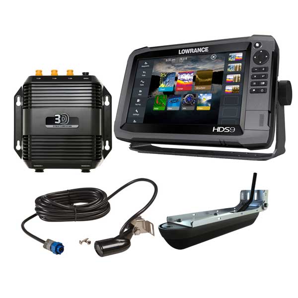
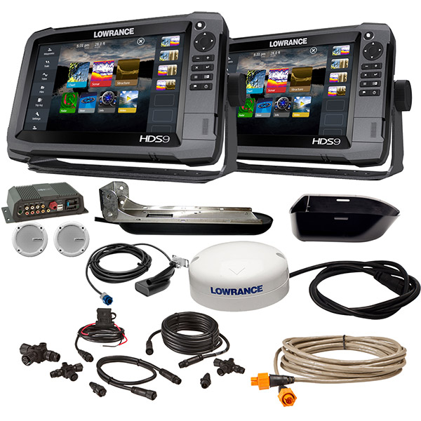
Contents of the package
- 2 - 9" HDS-9 Gen3 Insight Units
- HDI MH Skimmer
- HDI Skimmer Trolling Motor Adapter
- Sonic Hub 2 Lowrance with Speakers
- TotalScan Skimmer Mid/High/StructureScan Transducer
- Point-1 GPS Antenna with Heading Sensor
- NMEA 2000 Starter Kit
- N2K-T-RD
- 25ft Ethernet Cable
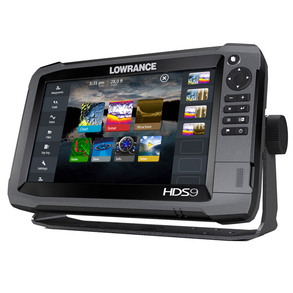
Features
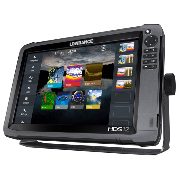
OversizedHDS-9& HDS-9 Gen3 Insight
HDS-12 and HDS-9 Gen3 Fishfinder/Chartplotter High Definition System that integrates leading-edge fishfinder technologies and the latest advances in navigation into one easy-to-use, multi-touch display.
Lowrance High Definition System (HDS) combines a brighter, multi-touch display and enhanced processor with leading-edge fishfinder technologies - including CHIRP Sonar, Broadband Sounder, StructureScan HD, DownScan Imaging and Trackback view - plus the latest advances in navigation and user interface - including internal 10Hz GPS, dual microSD-card slots, touch-plus-keypad operation and built-in wireless connectivity - all in one easy-to-use display.
Specifications
Item number: 000-13934-002
UPC: 9420024165836
Package weight: 34 lb
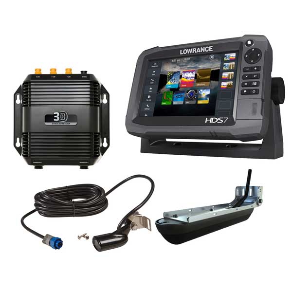
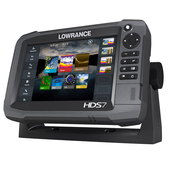
Other Products in the Series: