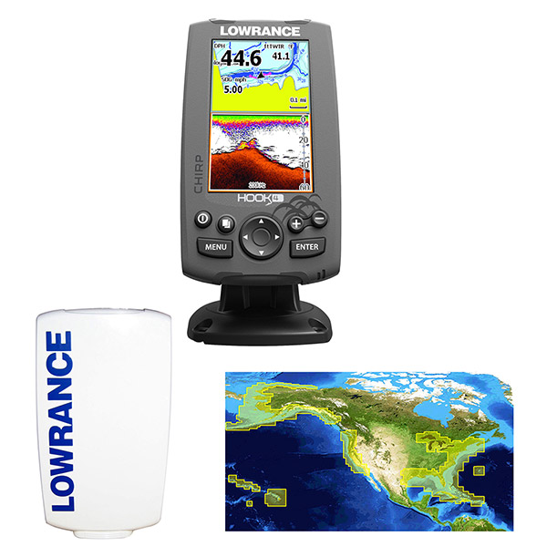
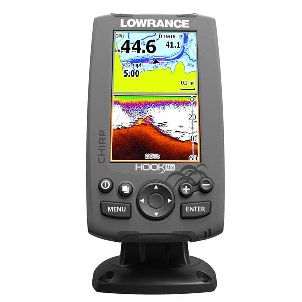
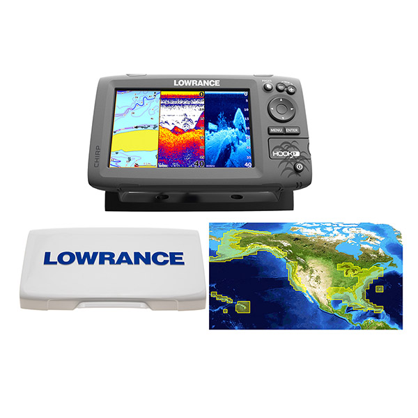
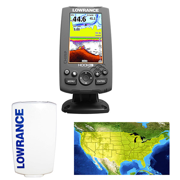
LOWRANCE HOOK-4 Combo w/83/200/455/800 HDI Transom Mount Transducer Includes Cover, Lake Insight Chart
This item is brand new
$199.00
This item ships within 2 days
|cw|sw


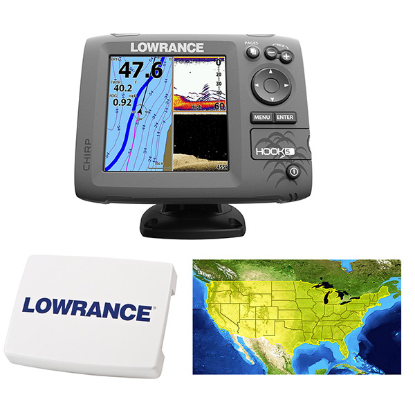
Elite-4 HDI Flush Mount Kit

Temperature Sensor

Speed and Temp Probe


P79-BL 50 200 Khz Plastic In-Hull Transducer Blue


P79-BL 50 200KHz, In-Hull Transducer, NS Series 7pin

Suggested Maps and Software:
 | Navionics Marine Charts |
 | Lowrance Maps |
 | C-Map Charts |
 | Cmor maps |
Contents of the package
- Hook-4 Combo
- Transom Mount Transducer
- Mounting Bracket
- Installation Hardware
- Documentation
Features
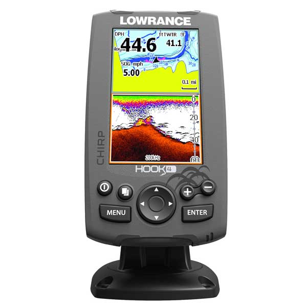
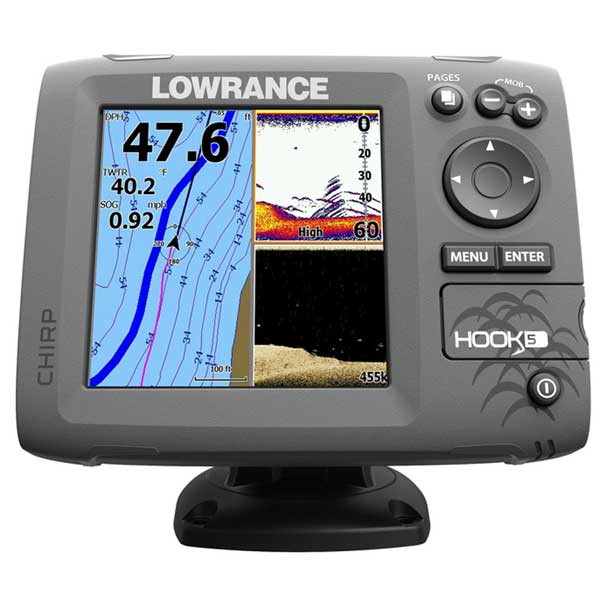
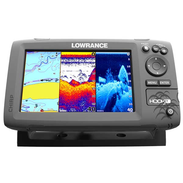
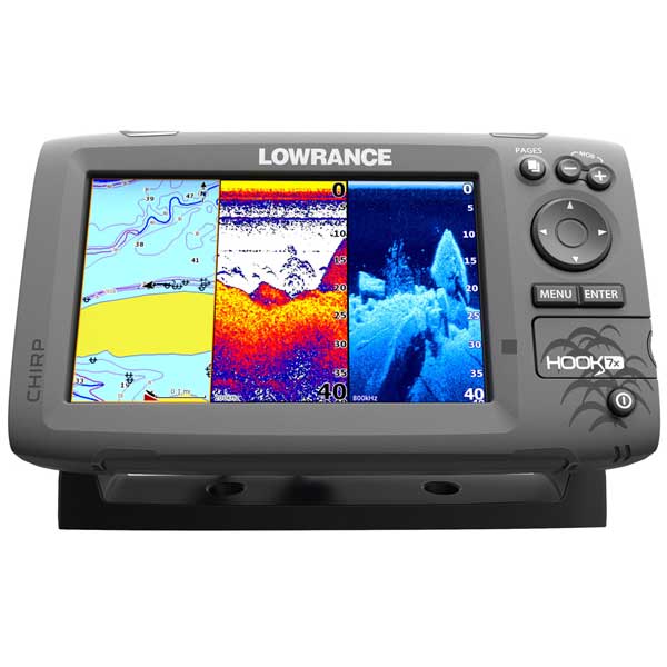
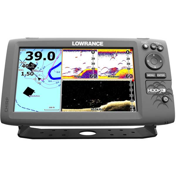
The Hook-4 combines the benefits of CHIRP Sonar and DownScan Imaging technology to give you a clear and complete view of the underwater environment beneath your boat. It features enhanced sonar sensitivity, excellent target separation and superior noise rejection, making it easier to see baitfish and gamefish targets. With a built-in GPS antenna and proven navigation features, revisiting your favorite fishing spot is simple with the Hook-4, whether you use the base map, optional high definition chart upgrades, or your own Insight Genesis custom maps.
Lowrance exclusive, brilliant, high-resolution, 4.3" color display
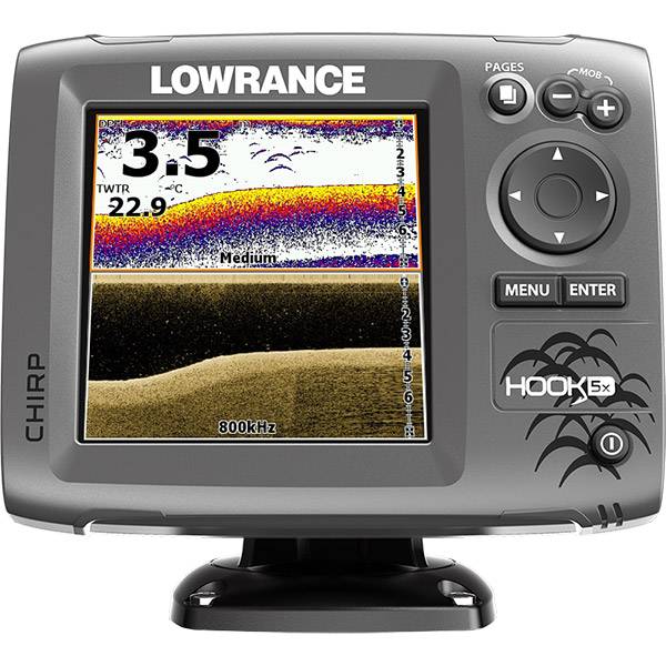
- CHIRP
Sonar plus DownScan Imaging - the power of today's leading fishfinder
technologies combined to provide the best possible view beneath your
boat
- Highly accurate, built-in GPS antenna plus a detailed
U.S. map featuring more than 3,000 lakes and rivers and coastal contours
to 1,000 feet
- Optional Americas chart upgrades include Lake
Insight and Nautic Insight PRO and HD, Navionics HotMaps® Premium and
Fishing Hotspots® PRO. Global chart upgrade options include Navionics +
- Use your Insight Genesis custom maps created from your own sonar logs
- DownScan Overlay technology overlays DownScan Imaging onto CHIRP Sonar
- Advanced
Signal Processing (ASP) reduces the need to manually adjust settings to
see fish, structure and bottom detail more clearly
- TrackBack
to review recorded sonar history including structure, transitions or
fish targets, then pinpoint locations with a waypoint
- Convenient Page selector menu with quick access to all features using one-thumb operation
- Multi-Window Display lets you quickly choose from pre-set page layouts - including a three-panel view
Specifications:
Overview
- Display :4.3" / 109.22mm
- Resolution :M16-bit color TFT 480 x 272
- Backlighting :LED
- Power Output: Max 500W RMS
- Operating Frequency :455/800 kHz (DownScan Imaging'), Med, High (CHIRP), 83kHz/200kHz
- Languages:14
- Media Port:One (1) microSD slot
- Operating Voltage:12 VDC (10-17 VDC min-max)
- Warranty:One year
Sonar
- Max Depth per Type:
- DownScan Imaging at 455 kHz: Max 300' / 91M
- CHIRP Sonar High Range/200 kHz: 1,000' / 305M
- CHIRP Sonar Med Range/83 kHz: 1000' / 305M
- Depth Alarm:Yes
- Shallow Alarm:Yes
- Temperature Readings:Yes
- Transducer Type:83/200/455/800 HDI Transom Mount Transducer
Display
- Display Resolution:480 x 272
- Display Type:16-bit color TFT
- Display Backlighting:LED
- Backlighting Levels:Adjustable Screen And Keypad
- Display Size:4.3" / 109.22mm
Technical/Environmental
- Waterproof Standard/rating: IPx7
- Product Width: 3.8" \ 96mm
- Product Depth: 2.2" \ 56mm
- Product Height: 6.6" \ 168mm (7.5" \ 189mm with bracket)
GPS Navigation
- Routes storage:100
- Waypoint Storage :3000
- GPS Antenna Type:Internal high-sensitivity WAAS + EGNOS + MSAS (optional external antenna)
- Plot Trail storage:Up to 100 trails - up to 10,000 points/trail
- GPS Alarms:Yes
- Custom Mapping:Optional
Americas chart upgrades include Lake Insight and Nautic Insight PRO,
Navionics HotMaps® Premium and Fishing Hotspots® PRO. Global chart
upgrade options include Navionics +
- Background Mapping:World reference basemap plus over 3,000 enhanced U.S. lake maps with depth contour and shoreline detail, and U.S. coastal depth contours/shoreline detail and spot depth soundings to 1,000' /305M
Specifications
Item number: 000-12647-002
UPC: 9420024158500
Package weight: 3.8 lb
Other Products in the Series: