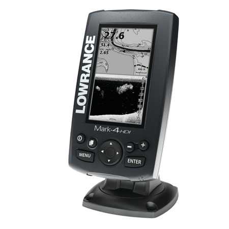
LOWRANCE Mark-4 HDI Combo 50/200 and 455/800


This item is brand new
$196.95
This item ships within 1 day


Suggested Maps and Software:
 | Navionics Marine Charts |
 | Lowrance Maps Topo |
 | Lowrance Maps Nautic Lake |
C-Map MAX-N |
Contents of the package
Features
ON SALE WHILE SUPPLIES LASTThe Mark-4 HDI combines a super-bright, LED-backlit grayscale display and a built-in GPS antenna with a full selection of todays top-selling fishfinder and chartplotter features that are easy to access and operate -- all at a surprisingly affordable price.
Lowrance-exclusive, high-resolution, 4.3-inch, LED-backlit display
Exclusive Hybrid Dual Imaging (HDI) Broadband Sounder plus DownScan Imaging -- the power of two award-winning technologies combined to provide the best possible view beneath your boat.
Highly accurate, built-in GPS antenna plus a detailed U.S. map featuring more than 3,000 lakes and rivers and coastal contours to 1,000 feet.
Optional chart upgrades include Lake Insight and Nautic Insight PRO and HD, Navionics® Gold and HotMaps® Premium, Fishing Hotspots® PRO and Jeppesen C-Map Max-N.
Create your own map from real sonar data that you record with Insight Genesis
DownScan Overlay technology overlays DownScan Imaging onto Broadband Sounder
Advanced Signal Processing (ASP) reduces the need to manually adjust settings to see fish,
structure and bottom detail more clearly
TrackBack to review recorded sonar history including structure, transitions or fish targets, then pinpoint locations with a waypoint.
New easy-to-use page selector menu with quick access to all features using one-thumb operation
Multi-Window Display lets you quickly and easily choose from pre-set page layouts -- including a three-panel view with chart, Broadband Sounder and DownScan Imaging.
Supported by Lowrance Advantage Service program
Specifications
The specified price is for: 1 itemOverview
Power Output: RMS (PTP) Max 250W RMS, 30,000W Peak to Peak (analog equivalent)
Operating Frequency 83/200 kHz + 455/800 kHz
Languages 30
Media Port One (1) high-capacity microSD slot
Operating Voltage 12 vDC (10-17 vDC min-max)
Warranty One year
Display
Display Resolution 480 x 272
Display Type Monochrome TFT
Display: Backlighting 11-Level LED
Backlighting Levels Adjustable Screen And Keypad
Display Size 4.3 in./10.92 cm.
Sonar
Depth Alarm Yes
EchoSounder Frequencies 83/200 kHz + 455/800 kHz
Shallow Alarm Yes
Temperature Readings Yes
Transducer Type Multiple selections Lowrance and Airmar®
DownScan Imaging: Max 300 ft / 91 m @ 455/800 KHz
Broadband Sounder: Max 750 ft / 229 m @ 83/200 kHz
Max Depth per Type
*Optional - Broadband Sounder: Max 2000 ft / 610 m @ 50/200 kHz
Technical/Environmental
Waterproof Standard/rating IPx7
Product Width 3.8 in \ 96 mm
Product Depth 2.2 in \ 56 mm
Power
Power Supply (Supply Voltage) 12 vDC (10-17 vDC min-max)
GPS Navigation
Navigation: Routes 100
Navigation: Waypoint
Storage 3000
GPS Antenna Type Internal high-sensitivity WAAS + EGNOS + MSAS (optional
external antenna)
Plot Trails Up to 100 trails - up to 10,000 points / trail
GPS Alarms Yes
Custom Mapping
Lake Insight and Nautic Insight PRO and HD, Navionics® Gold and HotMaps® Premium,
Fishing Hotspots® PRO and Jeppesen C-Map Max-N.
Background Mapping
US Background map with over 3,000 enhanced lake maps with depth contour and
shoreline detail, plus coastal depth contours/shoreline detail and spot depth soundings to1,000
ft./305 m
Networking Connectors
NMEA Output NMEA 0183
Other
Other Features Declaration of Conformity: Part 15.103 FCC rules & CE RTTE directive 1999/5/EC
Memory Card Capable Yes
Item number: 000-11299-001
UPC: 9420024128350
Package weight: 5.15 lb
Other Products in the Series:
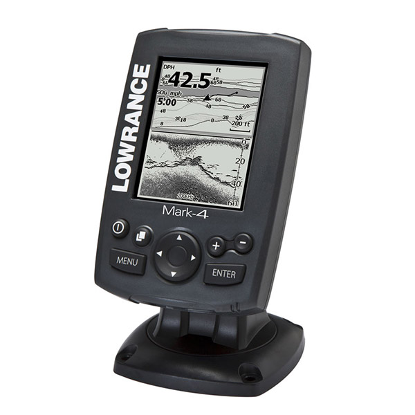 | LOWRANCE Mark-4 Combo Chartplotter Fishfinder w 83 200 kHz TM Transducer | Add to comparison |