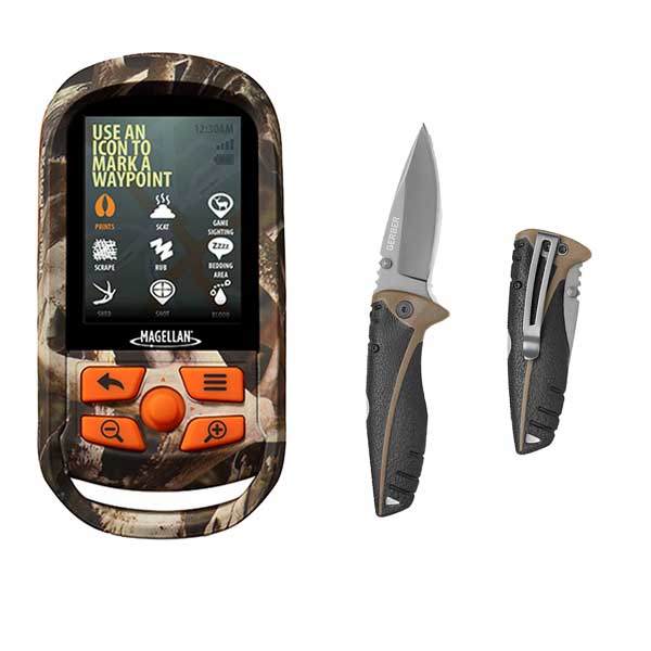
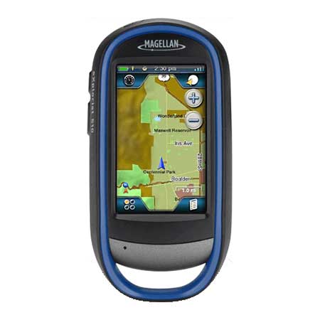
MAGELLAN EXplorist 310 Angler Edition w/3 Fishing Hot Spots of Choice
Item: CX0310SG5NA
This item is brand new
$228.95
This item ships within 2 days


This item is brand new
$228.95
This item ships within 2 days
Contents of the package
Features
eXplorist 310 Angler Edition with 3 Hot Spots of Choice
Waterproof handheld GPS receiver with core outdoor navigation features, expandable mapping, and paperless geocaching bundled with America's preferred fishing maps from Fishing Hot Spots. Accurate and detailed fishing information for over 4000 US lakes and waterways provides anglers with tactics and locations that catch fish. Whether you are fishing a lake for the first time, or have been on it your whole life, Fishing Hot Spots will make your time on the water more rewarding.
Fishing Hot Spots® maps are complete with extensively researched Fishing Points of Interest, Lake Profiles and lake specific Fishing Tips & Techniques.
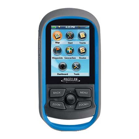
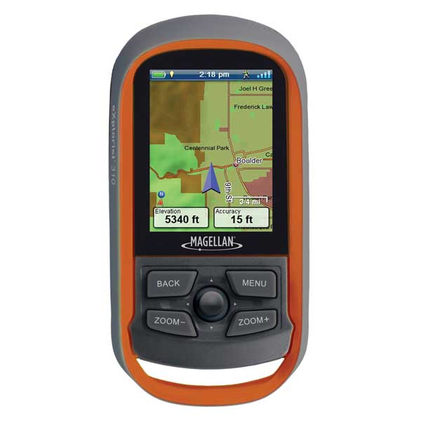
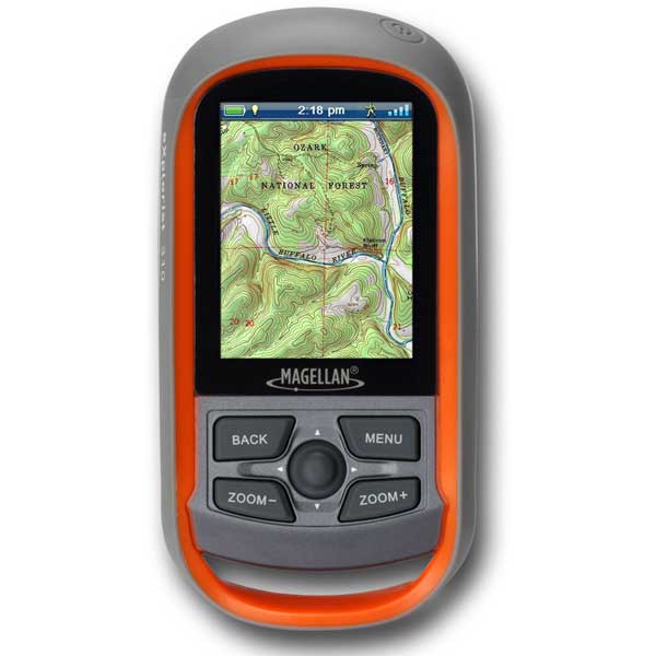
The eXplorist 310 is pre-loaded with the World Edition map, which includes a complete road network in the United States, Canada, Western Europe, and Australia and major roads throughout the rest of the world. This unique preloaded map also includes water features, urban and rural land use, and city centers. Regional versions of Magellan's Summit Series topographic maps are available for download to expand mapping coverage and level of detail.
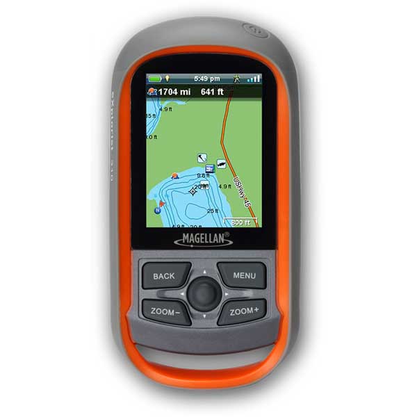
A vibrant, transflective color screen allows for the best readability in direct sunlight. To zero in on the exact location of a geocache, favorite fishing spot, or the next summit, the SiRFstarIII GPS chipset provides accuracy of 10-15 feet (3-5 meters). To keep your outdoor adventure going all day long, the device is powered by two AA batteries for 18 hours of constant usage. The eXplorist 310 is rugged, waterproof, and submersible (IPX-7). All of this is packed into a small and attractive handheld form factor that can be hung around your neck with the optional Magellan lanyard or attached to your pack with the built-in carabineer hook.
The eXplorist 310 provides unmatched assistance with navigation, such as the combination of the world's two most useful navigational tools - a compass and a map! Overlay a series of different transparent compass styles on top of a pre-loaded worldwide map that show roads, water features, parks, and city centers. Access the dashboard screen that shows a mini-compass for quick reference and customizable navigation data fields, such as latitude, longitude, heading, bearing, distance to end, trip odometer, and many more. Go back to the map screen and view your active track, which is a series of digital breadcrumbs to record all yours movements. Mark your starting point (car, trailhead, parking lot.) with a waypoint and easily navigate back to that location at the end of the day.
The eXplorist 310 supports paperless geocaching, which allows you to download more than 20 unique characteristics of each cache, including name, location, description, hider, size, difficulty, terrain, hint, spoilers, attributes, and last 20 user logs among a number of other details.
Reference your track summary to keep track of your distance travelled, elevation gained or lost, complete travel time, moving time and stopped time, and average time to find. Easily reset your track summary statistics to track the details of your next geocaching adventure.
No matter where you enjoy the outdoors, the eXplorist 310 GPS receiver will provide precise GPS signals thanks to the Satellite Based Augmentation Systems (SBAS) of WAAS, EGNOS, and MSAS; display coordinates in a myriad of different global systems, including UTM and WGS84; and accurately guide you to and from your next adventure, where ever in the world that may be!
Magellan eXplorist 310 bundled with Fishing Hot Spots (3 lake download)
Nationwide coverage including over 4,000 lakes and waterways with detailed shorelines and depth contours
Provides anglers everything they need to know about a lakes physical and biological make-up and fishery for knowing the water body and more successful fishing
Take the guesswork out of deciding where to fish by providing detailed information on specific, high fishing success locations. Primary game fish baits, lures, colors and seasons are indicated for each POI
Easy to navigate menues and rich graphics
Brilliant, sunlight readable color screen
Rugged and waterproof to IPX7 standards
High-sensitivity SiRFstarIII GPS with 3-5 meter accuracy
Preloaded World Edition Map
18 hours of battery life using 2AA batteries
Suspend mode
Paperless geocaching
500MB of user memory available
Record tracks and see "breadcrumbs" on the map screen
Track summary
NMEA message output (USB Only)
Multiple coordinates and map datums
Specifications
Battery Type AlkalineBuilt-In Memory 500MB
Cartography - Preloaded Yes
Memory Type Internal
Screen Size 2.2"
Screen Type Color
Waterproof Rating Submersible
Waypoints/Routes 500-1000/25-50
Box Dimensions 3"H x 6"W x 6"L
Item number: CX0310SG5NA
UPC: 763357128413
Package weight: 1.7 lb
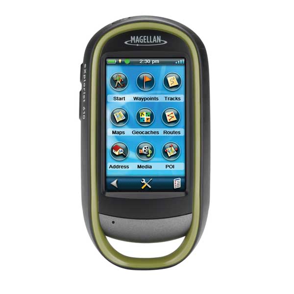
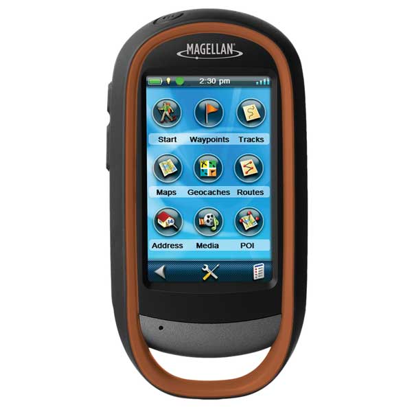
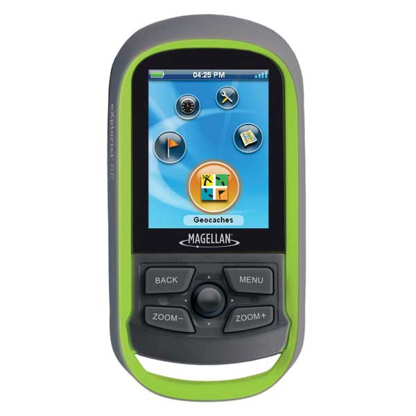
Other Products in the Series: