MAGELLAN EXplorist 510 Marine Edition w/Navionics US Waters, US Coastal, Inland

Item: TX0510SG2NA
This item is brand new
$455.95
This item ships within 2 days


This item is brand new
$455.95
This item ships within 2 days
Mounts

Contents of the package
Features
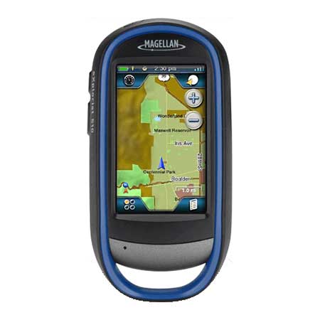
eXplorist 510 Marine Edition w/Navionics US Waters, US Coastal & Inland
Boating is much more than navigating from A to B, and Navionics is much more than award winning cartography. In fact, Navionics is a world of products that enhance your enjoyment on and off your boat. Whether you are contemplating your next outing or you are happily underway, Navionics includes coverage for the lower 48 states of lake and costal data to work with your Magellan eXplorist® handheld GPS to facilitate planning, checking charts, and sharing your experiences with family and friends. Navionics is about having fun!
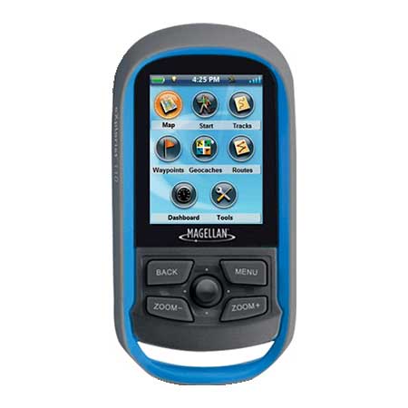
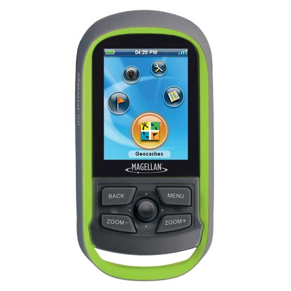
Rugged and waterproof (IPX-7), the eXplorist 510 combines high sensitivity GPS reception with easy to read mapping and accurate navigation. Find your way using more than 30 navigational data fields. Create waypoints, record tracks, and route from point to point. The integrated 3.2 mega-pixel camera, microphone, and speaker enable outdoor enthusiasts to record geo-referenced images and voice notes. Relive your outdoor adventures on the device, on your computer, or share with others on various online communities like geocaching.com.
Enjoy paperless geocaching with the eXplorist 510. Download and view more than 20 unique characteristics of each cache and view, search, filter on the device. Details include name, location, description, hider, size, difficulty, terrain, hint, and recent logs created by other geocachers.
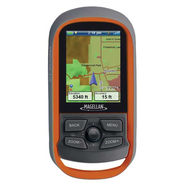
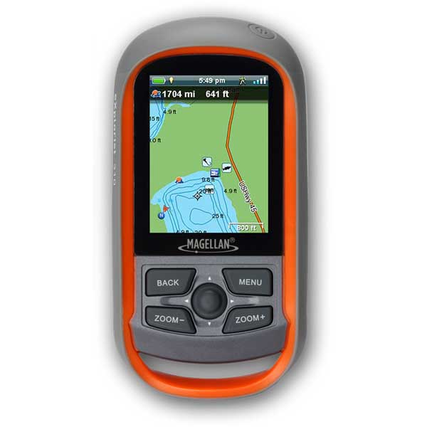
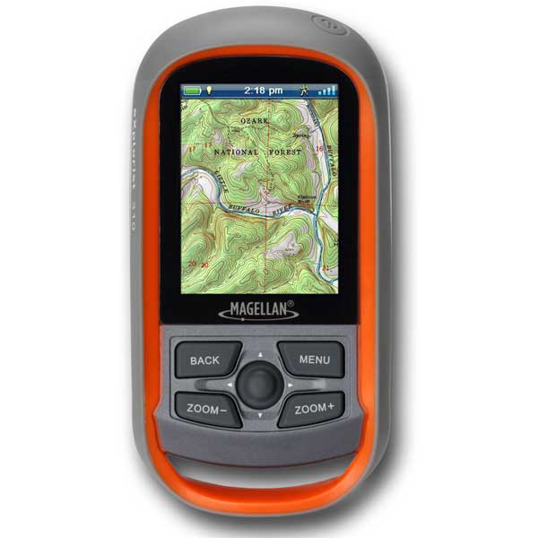
The eXplorist 510 packs the most accurate maps into the palm of your hand. The World Edition map allows for 2D or 3D viewing angles. It includes a complete road network in United States, Canada, Western Europe, and Australia and major roads throughout the rest of the world and provides cartographic orientation in almost any location. This unique, preloaded map also includes water features, urban and rural land use, and a realistic shaded relief background.
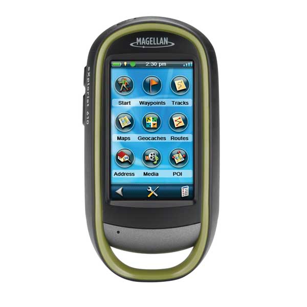
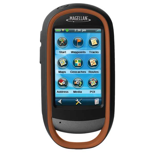
The best of both worlds, the eXplorist 510 combines the user friendliness of a touch screen with the reliability of two customizable hard buttons. Program the hard buttons to your two favorite or most used functions. Powered by two AA batteries, the eXplorist 510 will last up to 16 hours under normal conditions. To help conserve power, use the suspend mode to turn off the device but maintain GPS tracking. You can also adjust power management settings to your preference.
Magellan's award winning OneTouch favorites menu is now on our handheld devices. It provides instant access to bookmarks of favorite places. Set your home, base camp, and car. Easily re-assign a new location for each new adventure. 12 customizable icons to create personalized searches, save unique locations, or assign quick access to your favorite screens.
Bundled with Navionics Gold
Award winning plotter cartography
Award winning mobile applications
USC (User Generated Content)
Freshest Data
Best in Class' marine navigation charts from Navionics with 5' contour resolution
Comprehensive Coastal and Lakes data (12,000) all in one package
Great solution for General Navigation and the casual Angler
World Edition Preloaded Map
3.0" Touch Screen, WQVGA, TFT
Online Experience Sharing
GPX Compatible
Silent Alarms
Paperless Geocaching
3D Mapping
MicroSD Card Slot
Area Calculation
Specifications
Basemap YesBattery Type Alkaline
Built-In Memory 500MB-2GB
Card Format Micro SD
Cartography - Preloaded Yes
Cartography Brand Navionics
Cartography Type Gold
Resolution (VxH) 240 x 400
Screen Size 3.0"
Screen Type Color
Touchscreen Yes
Waterproof Rating Submersible
Waypoints/Routes 500/20
Box Dimensions 3"H x 6"W x 6"L
Item number: TX0510SG2NA
UPC: 763357128222
Package weight: 1.8 lb
Other Products in the Series: