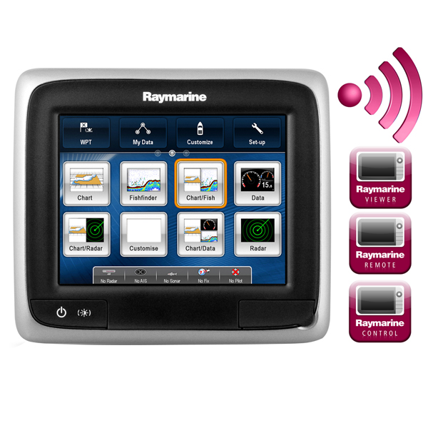
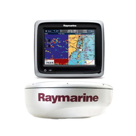
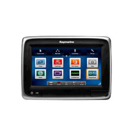
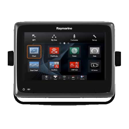
RAYMARINE A78 Value Pack with Fishfinder and Radar
Item: T70213
This item is brand new
$2,499.99
This item ships within 2 days


This item is brand new
$2,499.99
This item ships within 2 days
Autopilots

E32158
AIS650 Class B Transceiver - Includes Programming Fee
AIS650 Class B Transceiver - Includes Programming Fee
No Longer Available

E32157
AIS350 Dual Channel Receiver
AIS350 Dual Channel Receiver
No Longer Available
Mounts

RL-506
Rokk top plate for Raymarine a6/a7 - modular design
Rokk top plate for Raymarine a6/a7 - modular design
No Longer Available
RAM Mounts

Marine Networking


E70256
CP200 CHIRP SideVision Module w/o Transducer
CP200 CHIRP SideVision Module w/o Transducer
No Longer Available

E70257
CP200 CHIRP SideVision Module w Transducer
CP200 CHIRP SideVision Module w Transducer
No Longer Available

E70205
CP100 DownVision Sounder Module w Transducer
CP100 DownVision Sounder Module w Transducer
No Longer Available

E102143
CP450C Sounder Module, with CHIRP Technology
CP450C Sounder Module, with CHIRP Technology
No Longer Available
Transducers another


Transducers Raymarine


A80319
B175HW no connector 1kW 0 tilt CHIRP Bronze Transducer
B175HW no connector 1kW 0 tilt CHIRP Bronze Transducer
No Longer Available


A80323
R109LH-W 150-250 kHz 2kW CHIRP Urethane Thru-Hull Transducer
R109LH-W 150-250 kHz 2kW CHIRP Urethane Thru-Hull Transducer
No Longer Available

A80324
R509C-LH-W DT 28-60 150-250 kHz 2-3kW CHIRP Epoxy Thru-Hull Transducer
R509C-LH-W DT 28-60 150-250 kHz 2-3kW CHIRP Epoxy Thru-Hull Transducer
No Longer Available
Compatible maps
Suggested Maps and Software:
 | Navionics Marine Charts |
C-Map 4D Charts |
Contents of the package
Box Dimensions:
Length (in) 32
Width (in) 24
Height (in) 11
Weight (lbs) 40
In the box:
Length (in) 32
Width (in) 24
Height (in) 11
Weight (lbs) 40
In the box:
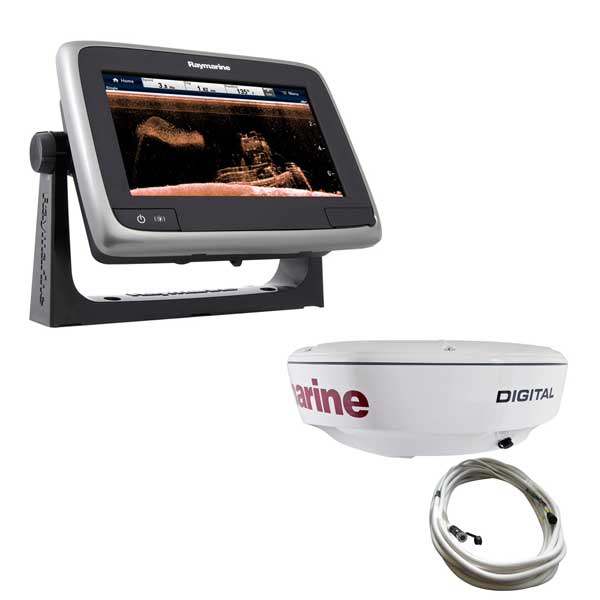
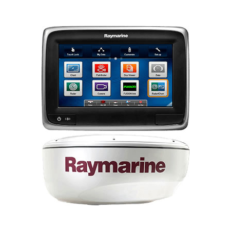
- Raymarine a78 Multi-Function Display/Sounder
- CPT100 transom mount transducer
- RD418D Radome
- 10 meter digital interconnect cable
- Crossover coupler
- 1 meter SeaTalk-hs adapter cable
- Suncover
- Mounting bracket
- Power cord
- Installation hardware
- Owner's manual
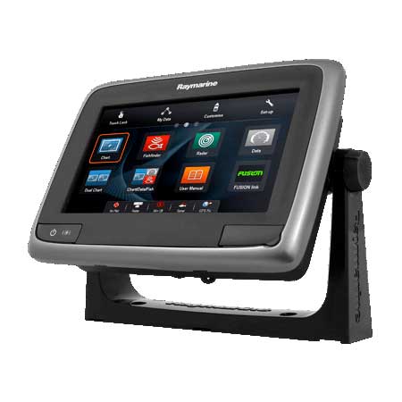
Features
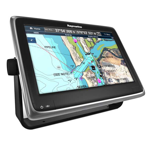
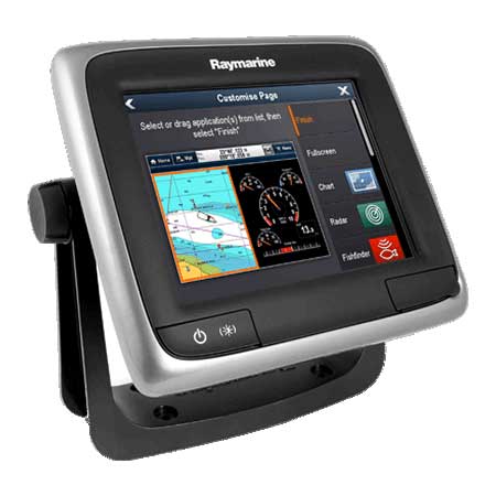
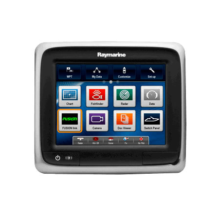
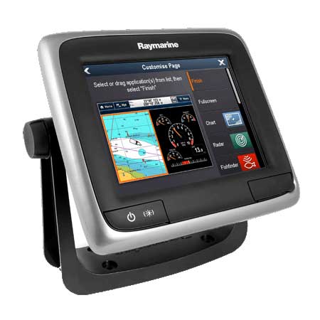
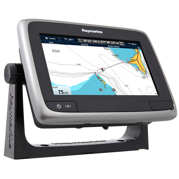
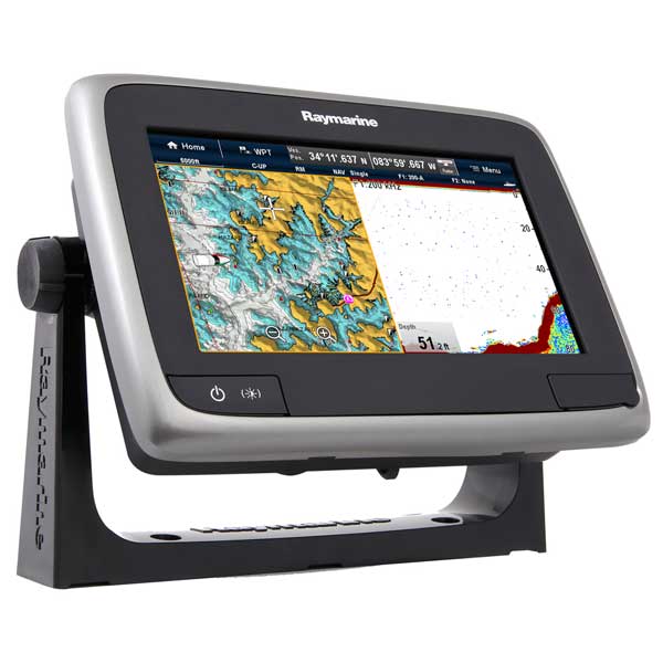
7" Touchscreen Display, Without Preloaded ChartsThe a78 is powered by Raymarine's intuitive LightHouse user interface. Just swipe, touch, and navigate. The optically bonded LCD has super-bright LED backlighting and is visible in any lighting condition.
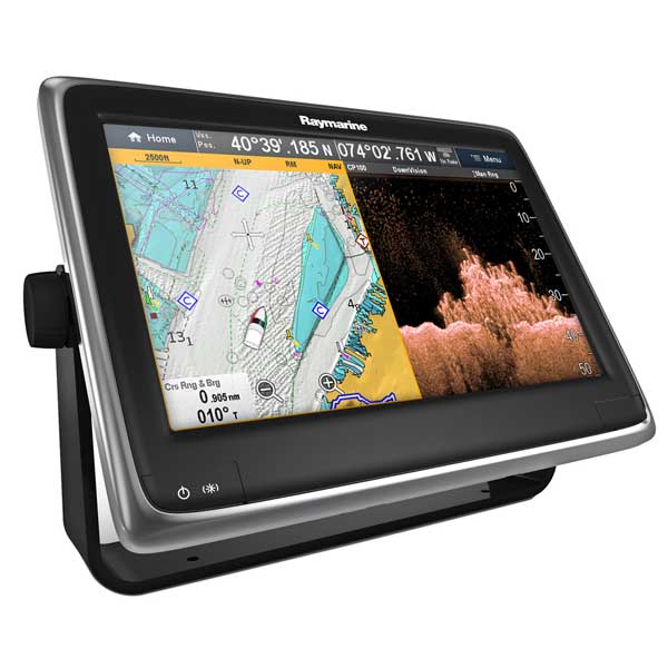
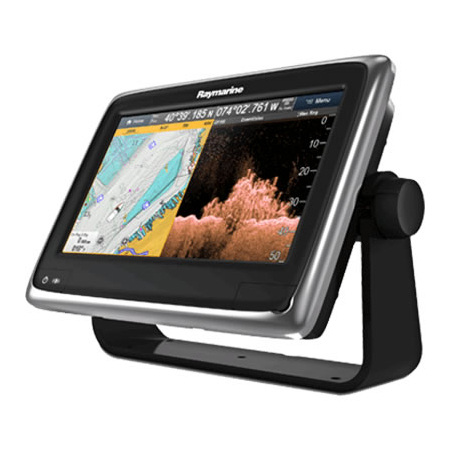
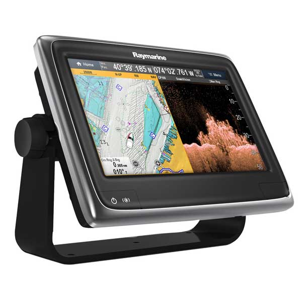
Navigation has never been easier. The a78 has a built-in 50 channel GPS, and accepts Navionics
cartography. Silver has basic navigation detail, and you can upgrade to Navionics Gold (expanded detail, tides & currents, points of interest) or Platinum (3D view, satellite photos, Coast Pilot info) charts using the front-mounted micro-SD card slot.
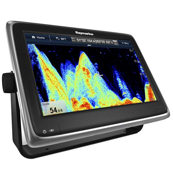
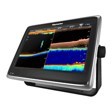
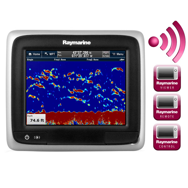
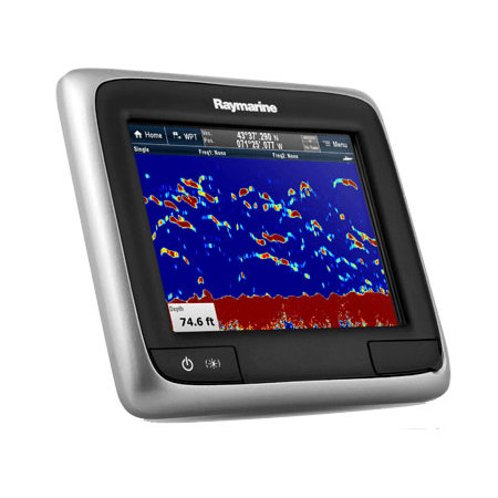
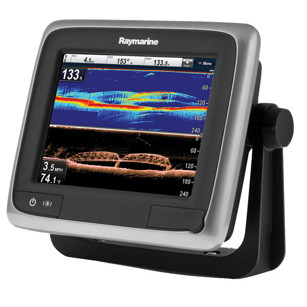
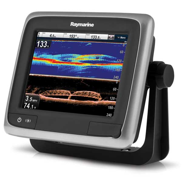
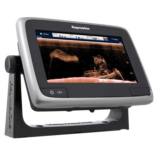
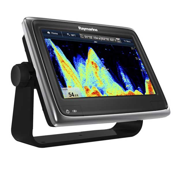
The a78 features a built-in 350KHz CHIRP DownVision sonar and a 200KHz conventional fishfinder. CHIRP DownVision sonar provides incredible, high-resolution detail of bottom structure, fish, and submerged objects.
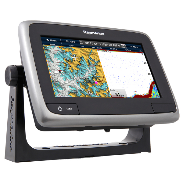
The Value Pack includes an RD418D digital radar with 4KW of power and an 18" antenna. A 10 meter interconnect cable and adapters are also included.
Small in size but big on features, the a78 has capabilities previously seen in only large-screen
displays. Optional capabilities include AIS, Autopilot integration, Sirius weather and audio, fuel
management, and video display. (Optional sensors required)
The a78 is a well-connected machine. Interface ports include SeaTalk-ng (RayNet, NMEA 2000) and SeaTalk-hs (Ethernet). An optional module lets you convert to NMEA 0183. The a78 is also Bluetooth compatible, which allows you to connect an RCU-3 wireless remote or control an compatible mp3 player or smartphone.
Specifications
Display7" touchscreen color LCD
Resolution
800 x 480 pixels (16:9 format)
Mapping
No pre-loaded chart. Accepts Navionics Silver/Gold/Platinum cartography on micro-SD card
Waypoints/Routes
Not given by Mfg.
Antenna
Internal, 50 channel
Sounder
Built-in 350KHz CHIRP DownVision and 200KHz conventional Fishfinder
Radar
Includes RD418D Radome with 10 meter cable
Other Functions
Optional AIS (receiver required); optional satellite weather & audio (receiver and
subscription required); engine monitoring (sensors required); video input (through SeaTalk-hs)
Interface
Bluetooth, NMEA 2000 (SeaTalk-ng), Ethernet (SeaTalk-hs/RayNet)
Warranty
Three year, with on-line registration
Item number: T70213
UPC: 723193785829
Package weight: 40 lb
Other Products in the Series: