GARMIN Dakota 10


AC Charger


HRM-Pro Heart Rate Monitor with Bluetooth and Running Dynamics

HRM-Pro Plus Heart Rate Monitor


Cup Holder Universal Mount RAM-A-CAN II with 6 in Flex Arm


BirdsEye Satellite Imagery Retail Card

BirdsEye Satellite Imagery US and Canada
Suggested Maps and Software:
 | MetroGuide |
 | Garmin Extras |
 | nuMaps Updates |
Contents of the package
Features
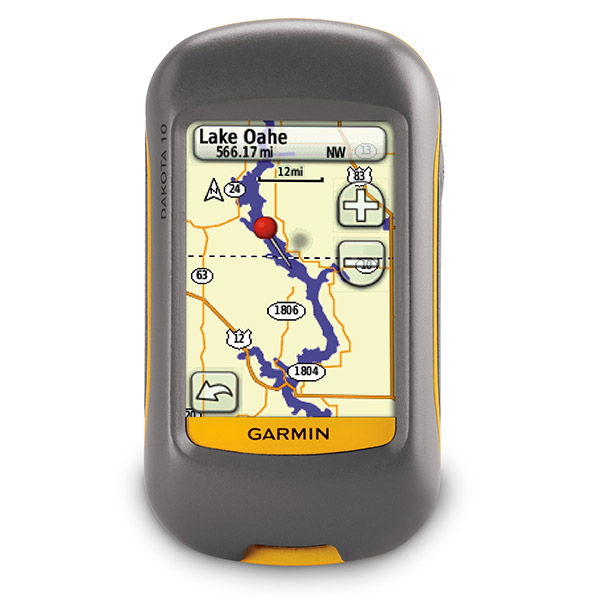
The Dakota 10 combines easy outdoor navigation with a smart touchscreen display. This palm-sized navigator gives you touchscreen navigation, high-sensitivity GPS with HotFix satellite prediction and a worldwide basemap. Oh, and its affordable and useful in all terrain.Ready for your touch
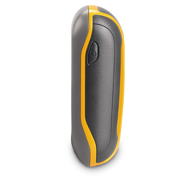
Youll see all the details you need on a rugged, sunlight-readable 2.6-inch color touchscreen display. And you wont have any trouble using the interface, which means more time appreciating nature and less time with your head buried in your GPS. And Dakota 10 can handle almost anything Mother Nature throws at it, including dust, dirt and water.
The perfect geocaching tool
With Dakota 10, youll quickly learn to love paperless geocaching. You can efficiently download 2,000 caches with important details such as terrain, hints, difficulty and description. And you wont need to print anything out or manually enter any coordinates.
Explore nature
Dakota 10s built-in worldwide basemap means you can easily navigate anywhere. Plus, you can add more maps to your Dakota 10s internal memory with Garmins variety of detailed topographic, road and marine maps.
Specifications
Installed languages: English,
Spanish, French, Deutsch, Italiano, Portugues, Cesky, Dansk,
Nederlands, Norsk, Suomi, Hrvatski, Magyar, Polski, Russian, Svenska,
Turkse, Latvian, Slovak, Slovenian, Greek, Arabic, Farsi, Bulgarian.
More languages may be available through Garmin web updater.
Physical & Performance:
Unit dimensions, WxHxD: 2.2" x 3.9" x 1.3" (5.5 x 10 x 3.3 cm)
Display size, WxH: 1.43"W x 2.15"H (3.6 x 5.5 cm); 2.6" diag (6.6 cm)
Display resolution, WxH: 160 x 240 pixels
Display type: Transflective color TFT touchscreen
Weight: 6.75 oz (191.4 g) with batteries
Battery: 2 AA batteries (not included); NiMH or Lithium recommended
Battery life: 20 hours
Waterproof: yes (IPX7)
Floats: no
High-sensitivity receiver: yes
Interface: USB
RoHS version available: yes
Maps & Memory:
Basemap: yes
Preloaded maps: no
Ability to add maps: yes
Built-in memory: 850 MB
Accepts data cards: no
Waypoints/favorites/locations: 1000
Routes: 50
Track log: 10,000 points, 200 saved tracks
Features:
Automatic routing (turn by turn routing on roads): yes (with optional mapping for detailed roads)
Electronic compass: no
Touchscreen: yes
Barometric altimeter: no
Geocaching-friendly: yes (paperless)
Outdoor GPS games: no
Hunt/fish calendar: yes
Sun and moon information: yes
Tide tables: yes
Area calculation: yes
Custom POIs (ability to add additional points of interest): yes
Unit-to-unit transfer (shares data wirelessly with similar units): no
Picture viewer: no
Item number: 010-00781-00
UPC: 753759094867
Package weight: 2 lb
 | Video by GPS4US |
 | Video by Garmin |
View latest videos by GPS4US
Visit GPS4US
 Channel.
Following reviews were written by actual customers.
Every GPS4US customer has a chance to live a feedback after receiving a product.
 by Joseph D, , 9/30/2013
I''m planning a hunting trip to Colorado next week and will use it to aid in navigating the mountainous regions we will be hunting.The unit is well built water resisitant and easy to use.Display is clear and navigating between sreeens is simple. Great deal and price.Looking forward to many years of use in the field.
Other Products in the Series:
| GARMIN Dakota 10 NOH | Add to comparison |
| GARMIN Dakota 10 Geocaching Bundle | |
| GARMIN Dakota 10 Outdoor and Geocaching Topo Bundle | |
| GARMIN Dakota 10, Bike and Hike Bundle | |
| GARMIN Dakota 20 | Add to comparison |
| GARMIN Dakota 20 NOH |