GARMIN ECHOMAP Ultra 126sv US and Coastal Canada GN plus GT56UHD-TM Transducer
This item is brand new
$2,531.95
This item ships within 1 day
|cw|sw|wi


GPS 19x NMEA 2000 GPS Receiver


Split Connector 50 ft Right Angle RJ45 Plug


Panoptix PS31 Forward Transducer

Panoptix PS60 Thru-hull Down Transducer
Panoptix PS21 LiveVu Forward Transducer
Panoptix PS21-TM Forward Transom Mount Transducer


NMEA 2000 Transducer Adapter Kit

GNT 10 NMEA 2000 - ANT Transceiver


GBT 10 Bennett Trim Tab Adapter


GT41-TH Thru-Hull CHIRP DownVu, SideVu, Traditional Transducer with Temp 12-pin
GT41-THP Traditional 600W, 50/200kHz, ClearVu/SideVu CHIRP 260kHz, 455kHz Pair w/Fairing Block
GT50M-TH Thru-Hull CHIRP DownVu, SideVu, CHIRP Traditional Transducer with Temp 12-pin
GT50M-THP Pair Thru-Hull CHIRP DownVu, SideVu, CHIRP Traditional Transducer with Temp 12-pin


Airmar Smart Triducer, Plastic Thru, NMEA 2000

Access, Smart Transducer, P39 Transom, Temp, NMEA 2000


DT800 12 tilt NMEA2000 Smart Transducer Plastic

Xdcr, Panoptix PS22-TR, LiveVu Fwd/Down


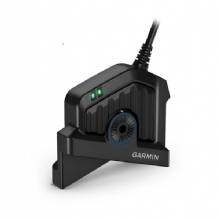

Panoptix LiveScope System GLS 10 and LVS32

Panoptix LiveScope LVS 12


Suggested Maps and Software:
 | Inland Lakes |
 | BlueChart g2, g3 Vision |
 | BlueChart g2, g3 on micro SD card with adapter |
 | Garmin Extras |
 | LakeVu HD Ultra |
 | LakeVu HD |
Contents of the package
Features
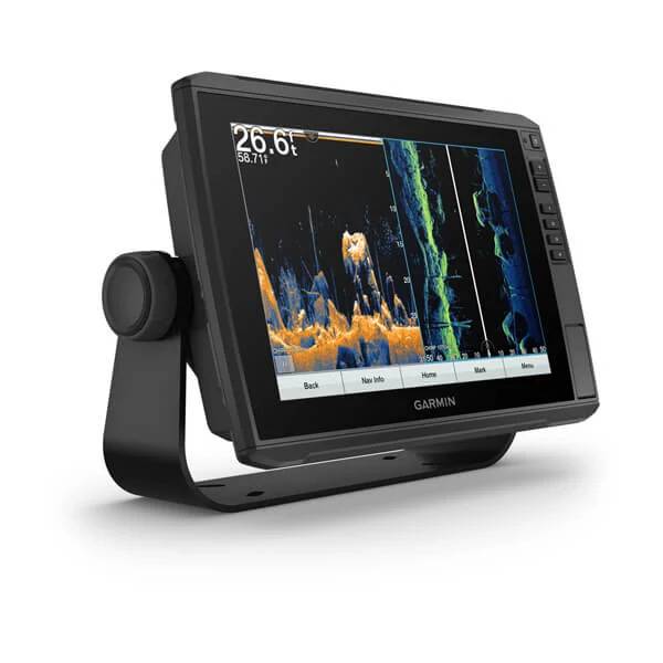
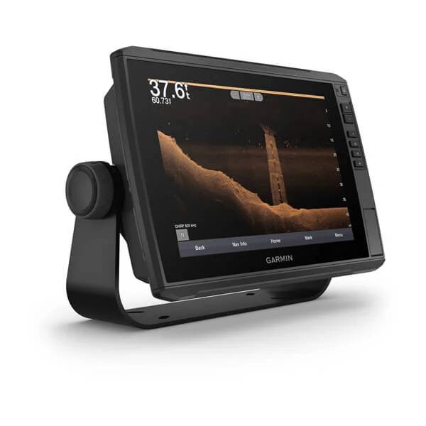
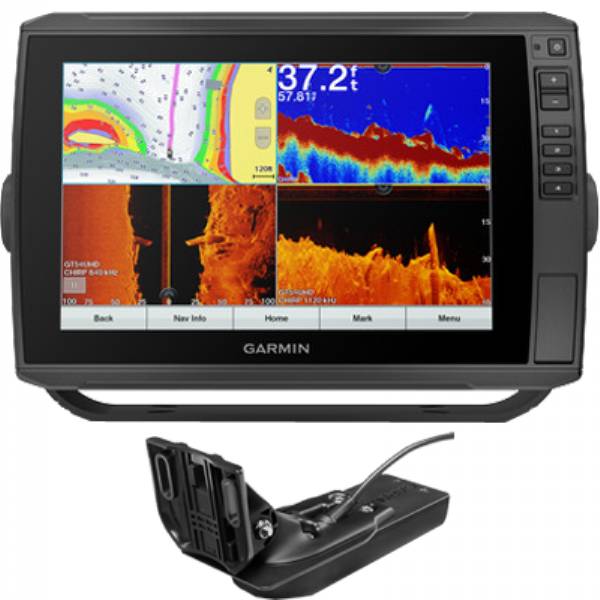
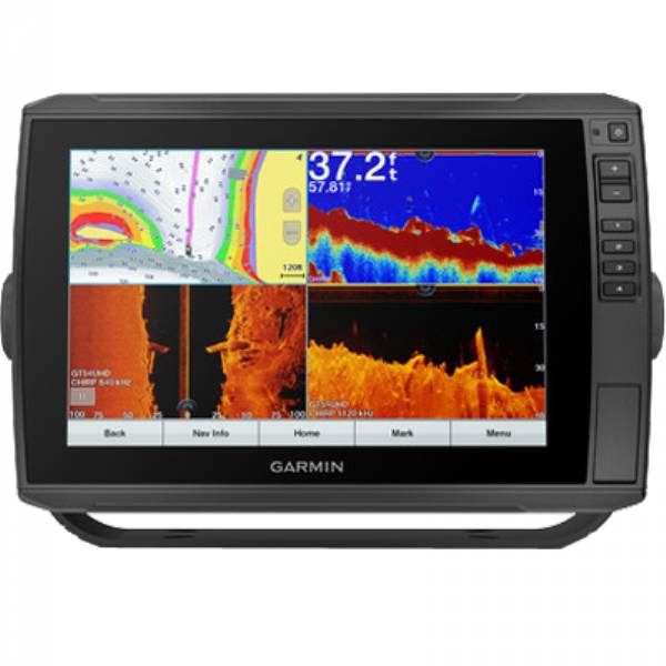
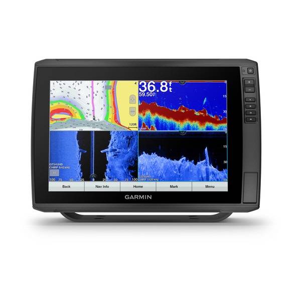
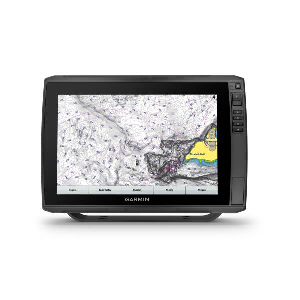
Garmin ECHOMAP Ultra 126sv, U.S. and coastal Canada Garmin Navionics+ with GT56UHD-TM transducer
Model: 010-02529-51- 12" keyed-assist in-plane switching touchscreen combo with all the built-in tools you need to find and catch fish
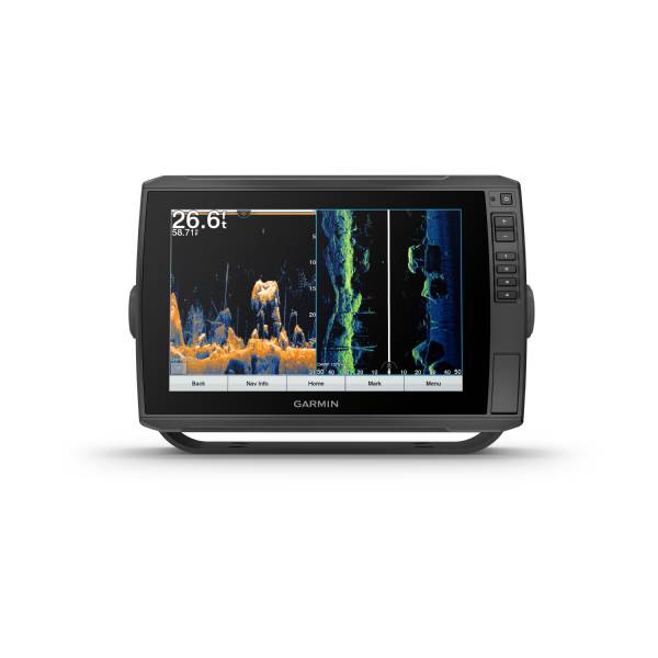
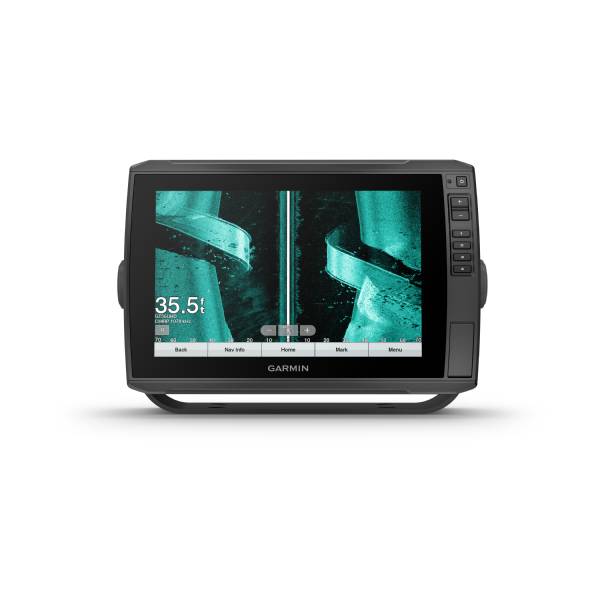
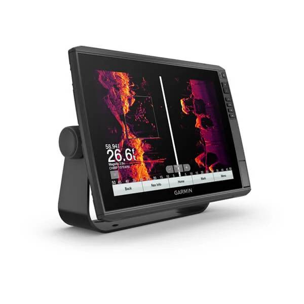
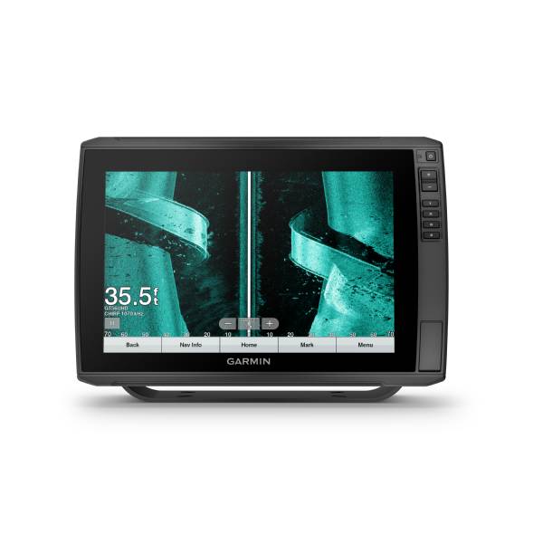
- Vivid scanning sonar color palettes make it easy to distinguish targets and structure
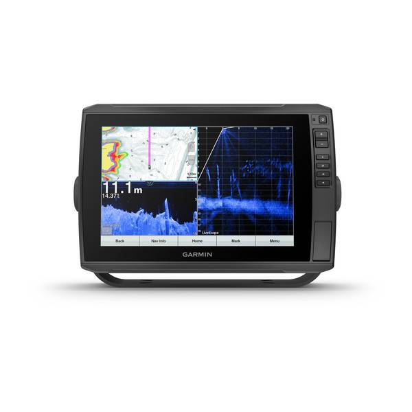
- Built-in support for the full line of live sonar products, including the LiveScope and LiveScope Plus Systems (transducers sold separately)
- Preloaded with Garmin Navionics+ charts for the U.S. and Canada, offering both coastal and inland lake coverage as well as Auto Guidance+ technology (for planning purposes only; does not replace safe navigation operations)
- Share sonar, maps, waypoints and routes with other ECHOMAP Ultra 10" and 12" units as well as ECHOMAP Plus and UHD 7" and 9" units
- Built-in Quickdraw Contours mapping software instantly creates personalized fishing maps on-screen with 1 contours as you fish
- Built-in Wi-Fi® connectivity pairs with the free ActiveCaptain® app on your compatible smartphone for access to the OneChart feature to purchase and download new charts; also receive access to daily chart updates, smart notifications, software updates, Garmin Quickdraw Community data and more
- Quick-disconnect bail mount
- Included transducer provides Garmin CHIRP traditional sonar plus Ultra High-Definition ClearVü and SideVü scanning sonars with 20% greater range
The ECHOMAP Ultra 126sv combo with a 12" keyed-assist in-plane switching touchscreen display has all the built-in fishing tools you need for successful fishing. Vivid scanning sonar color palettes make it easier than ever to distinguish targets and structure. The device also supports the LiveScope and LiveScope Plus Systems and the full line of live sonar products (transducers sold separately). Share sonar, waypoints and routes with other ECHOMAP Ultra 10" and 12" units as well as ECHOMAP Plus and UHD 7" and 9" units. The combo is preloaded with Garmin Navionics+ charts offering both coastal and inland lake coverage as well as Auto Guidance+ technology (for planning purposes only; does not replace safe navigation operations). It also includes Quickdraw Contours custom map drawing software.
Specifications
Item number: 010-02529-51UPC: 753759285197
Package weight: 13.80 lb
Other Products in the Series: