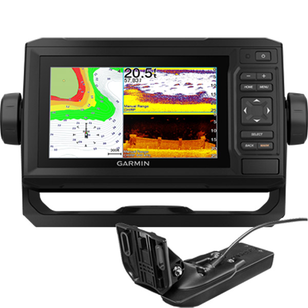
GARMIN EchoMap UHD 74sv Offshore g3 No Transducer
This item is brand new
$825.95
Backorder, ships in 3 - 4 weeks
|cw|sw|wi|ln


MotorGuide Adapter Cable 8-pin


Panoptix PS31 Forward Transducer

Panoptix PS60 Thru-hull Down Transducer
Panoptix PS21 LiveVu Forward Transducer
Panoptix PS21-TM Forward Transom Mount Transducer


NMEA 2000 Transducer Adapter Kit

GNT 10 NMEA 2000 - ANT Transceiver


GT41-TH Thru-Hull CHIRP DownVu, SideVu, Traditional Transducer with Temp 12-pin
GT41-THP Traditional 600W, 50/200kHz, ClearVu/SideVu CHIRP 260kHz, 455kHz Pair w/Fairing Block
GT50M-TH Thru-Hull CHIRP DownVu, SideVu, CHIRP Traditional Transducer with Temp 12-pin
GT50M-THP Pair Thru-Hull CHIRP DownVu, SideVu, CHIRP Traditional Transducer with Temp 12-pin


GT40-TM Transom CHIRP DownVu, SideVu, Traditional Transducer with Temp 12-pin


M260-8G 1kW 200/50kHz In-Hull Plastic Transducer


M265LH DO 42 210 kHz 1kW CHIRP In-hull/Pocket Plastic Transducer


R599LH 2-3kW CHIRP Transducer


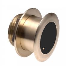
B175L no connector 1kW 12 tilt CHIRP Bronze Transducer
B175H no connector 1kW 20 tilt CHIRP Bronze Transducer

P72-8G 500W 77/200 kHz Transducer


B175M 8pin1kW 12 tilt CHIRP Transducer


B75H 0 deg tilt CHIRP Transducer


B75L 12 deg tilt CHIRP Transducer


B164 1kW 0 tilt 200/50kHz Bronze Transducer 8-pin


Wide beam bare wires 0 Tilt 150-250 kHz 1kW CHIRP Bronze Transducer
Wide beam bare wires 12 Tilt 150-250 kHz 1kW CHIRP Bronze Transducer
Wide beam bare wires 20 Tilt 150-250 kHz 1kW CHIRP Bronze Transducer
B175H no connector 1kW 0 tilt CHIRP Bronze Transducer
B175H no connector 1kW 12 tilt CHIRP Bronze Transducer
B175L 8pin 1kW 0 tilt CHIRP Bronze Transducer
B175L no connector 1kW 20 tilt CHIRP Bronze Transducer
B175M no connector 1kW 0 tilt CHIRP Bronze Transducer
B175M no connector 1kW 12 tilt CHIRP Bronze Transducer
B175M no connector 1kW 20 tilt CHIRP Bronze Transducer

B265LH CHIRP Transducer
B45-DT-8G Thru-Hull 50/200 kHz Bronz Narrow Stem 8pin Transducer

CM599 LH 2-3kW CHIRP Transducer

CM599 LM 2-3kW CHIRP Pocket Mount Transducer

PM265LM DT 42-135 kHz 1kW CHIRP Poket Bronze Transducer

R109LH 38-210 kHz 2kW CHIRP Urethane Thru-Hull Transducer

R509LH DT 28-210 kHz 2-3kW CHIRP Epoxy Thru-Hull Transducer

R509LM DT 28-130 kHz 2-3kW CHIRP Epoxy Thru-Hull Transducer

SS164 0 deg tilt 1kW Transducer 8pin

SS164 12 deg tilt 1kW Transducer 8 pin

SS164 20 deg tilt 1kW Transducer 8 pin


P32-8G DST 77/200 Khz 45/15 beam Transom Mount 8pin Triducer

TM150M 95-155 kHz Trunsom mount Plastic CHIRP 8pinTransducer
GT21-TM - Transom Mount DownVu 500W CHIRP 260/455 kHz Traditional 600W 50/200 kHz Transducer w/Temp


TM265LH DT 42-210 Khz 1kW CHIRP Urth Transom Transducer

For Garmin TM258-8G DT Cone 3-21 1kW 200/50kHz Transom 8pin Transducer


CV51M-THP ClearVu CHIRP SideVu Thru Hull Pair


Suggested Maps and Software:
 | Inland Lakes |
 | BlueChart g2, g3 Vision |
 | BlueChart g2, g3 on micro SD card with adapter |
 | Garmin Extras |
 | LakeVu HD Ultra |
 | LakeVu HD |
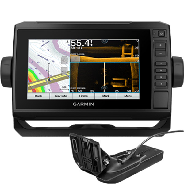
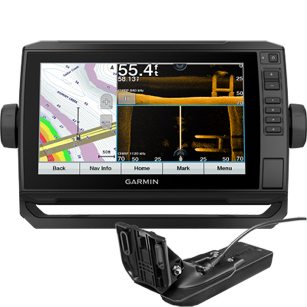
Contents of the package
- ECHOMAP UHD 74sv with BlueChart g3 for U.S.
- 8-pin transducer to 12-pin sounder adapter cable
- Power/data cable
- Tilt/swivel mount with quick release cradle
- Flush mount
- Protective cover
- Hardware
- Documentation
Features
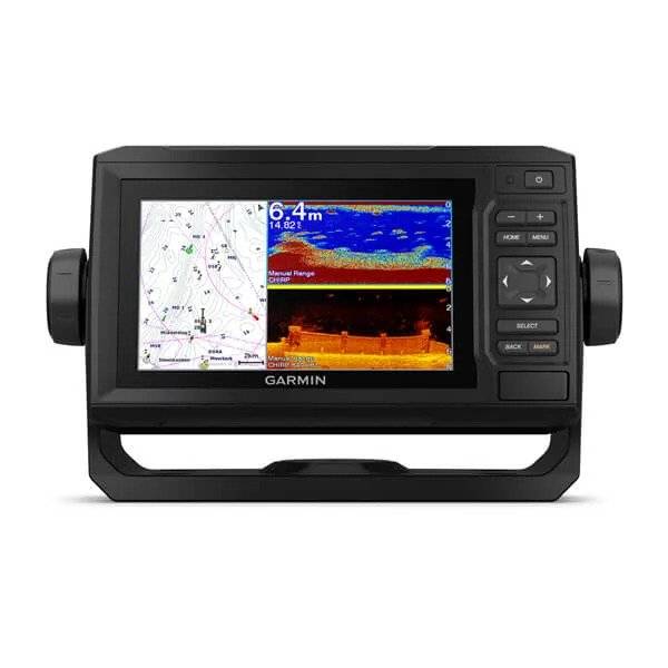
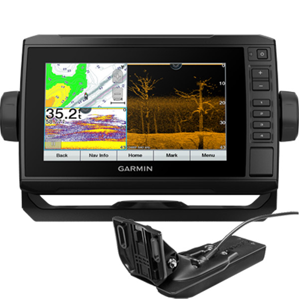
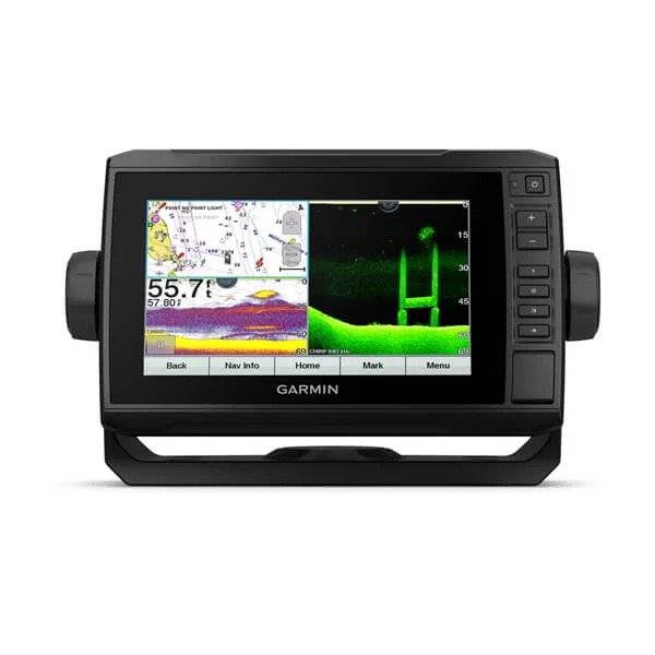
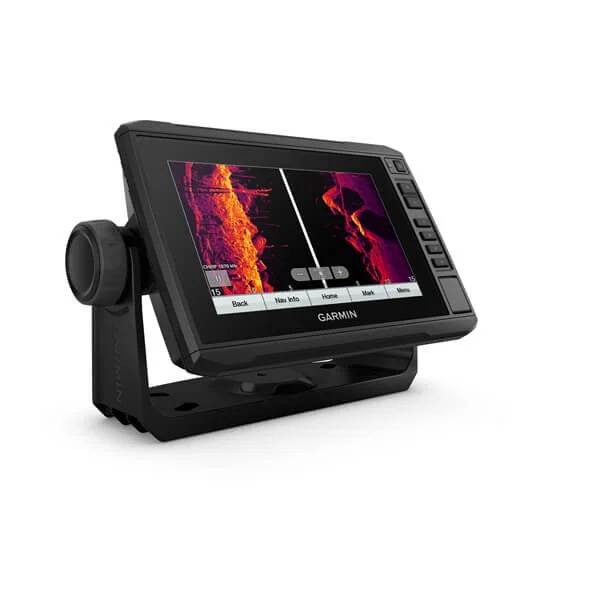
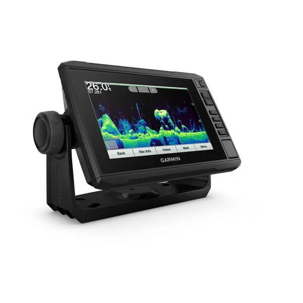
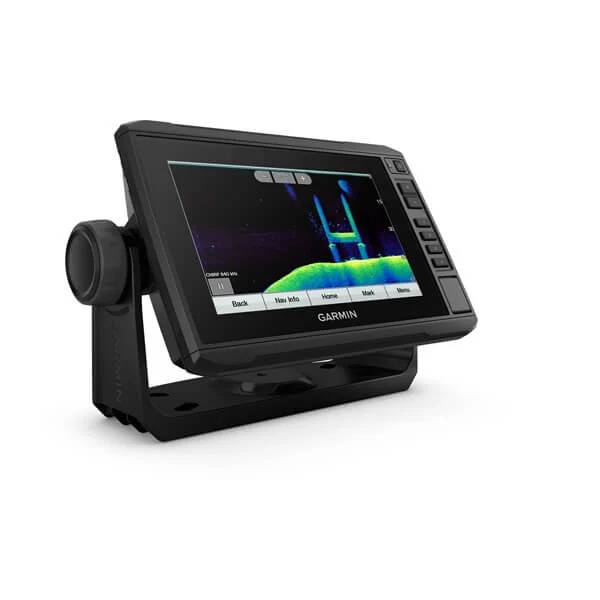
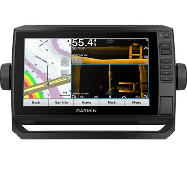
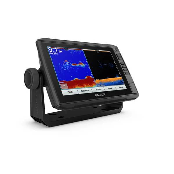
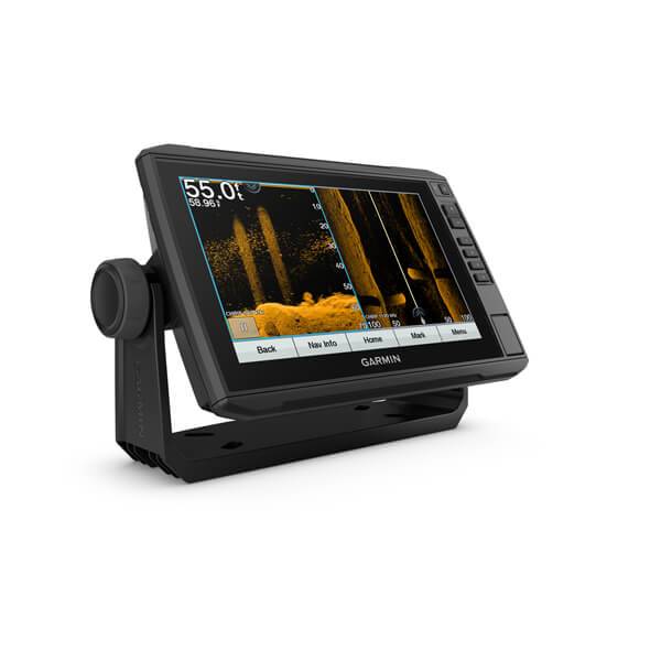
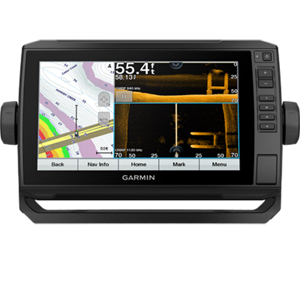
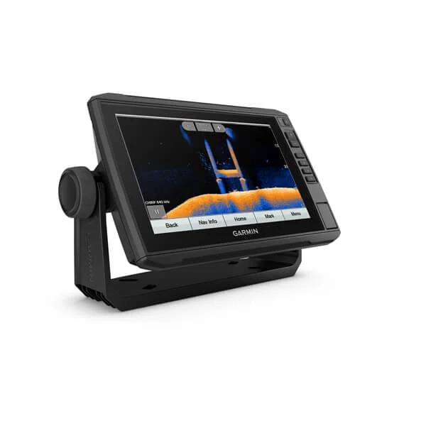
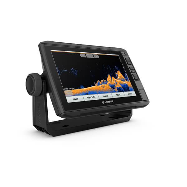
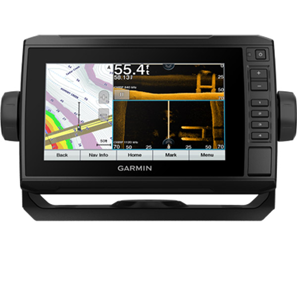
EchoMap UHD 74sv, MFG# 010-002339-00, with 7 in color LCD, internal GPS and US Offshore g3 maps. Sonar: 500 Watts, traditional, CHIRP, and Hi-Def ClearVu/SideVu imaging. WiFi capable. Transducer sold separately.Specifications
Maps & Memory | |
| Preloaded maps | BlueChart® g3 (coastal maps) |
|---|---|
| Accepts data cards | 1 microSD card; 32 GB maximum size |
| Waypoints | 5,000 |
| Routes | 100 |
| Track log | 50,000 points; 50 saved tracks |
Outdoor Recreation Features | |
| Tide tables | |
|---|---|
Chartplotter Features | |
| Garmin Sonar compatible | |
|---|---|
| Supports AIS (tracks target ships position) | |
| Supports DSC (displays position data from DSC-capable VHF radio) | |
| GCV Black Box sonar support | |
| ActiveCaptain compatible | |
| Sailing Features | |
Sonar Features & Specifications | |
| Dual-frequency (50/200 kHz) sonar capable | |
|---|---|
| Dual-beam (77/200 kHz) sonar capable | |
| Transmit power | 500 W (RMS) / 4,000 W (peak to peak) |
| CHIRP sonar technology | Yes (Built-in) |
| ClearVü | Yes with CHIRP (built-in) |
| SideVü | Yes with CHIRP (built-in) |
| Maximum depth | 2,300 ft @ 77 kHz, freshwater 1,100 ft @ 77 kHz, saltwater (depth capacity is dependent on water bottom type and other water conditions) |
| Bottom lock (shows return from the bottom up) | |
| Water temperature log and graph | |
| Sonar recording | |
| Sonar history rewind | |
Connections | |
| NMEA 2000® compatible | |
|---|---|
| Transducer pin numbers | 12 |
| NMEA 0183 input ports | 1 |
| NMEA 0183 output ports | 1 |
| Video input ports | None |
| Video output ports | None |
| Wireless connectivity | Yes |
General | |
| Physical dimensions | 9.8" x 5.5" x 2.0" (25 x 13.9 x 5.1 cm) |
|---|---|
| Display size | 6.1" x 3.4"; 7.0" diagonal (15.5 x 8.6 cm; 17.8 cm diagonal) |
| Display resolution | 400 x 800 pixels |
| Display type | WVGA display |
| Weight | 1.7 lbs.(0.77kg) |
| Water rating | IPX7 |
| Power consumption | 15W |
| Antenna | Internal or external over NMEA 2000 |
| Mounting options | Bail or flush |
| Receiver | 5 Hz |
| Garmin Marine Network ports | 1 Panoptix port |
Item number: 010-02339-00
UPC: 753759241582
Package weight: 11 lb
Other Products in the Series: