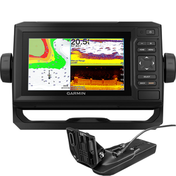
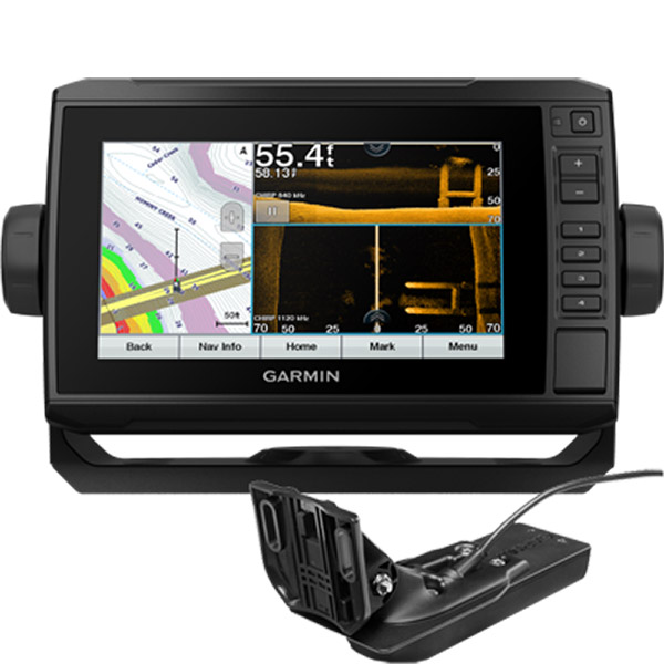
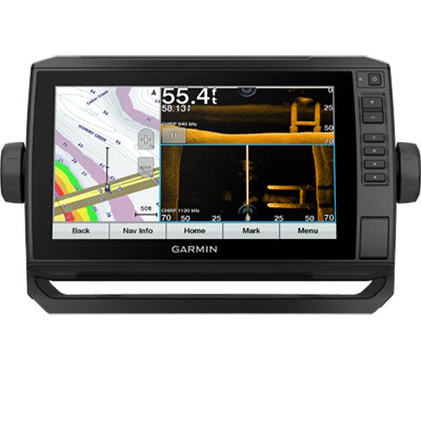
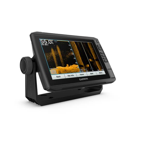
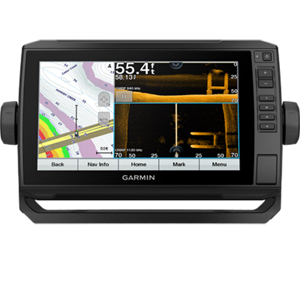
GARMIN EchoMap UHD 92sv, Basemap, w/GT56
This item is brand new
$913.95
Backorder, ships in 3 - 4 weeks
|sw|wi|ln


MotorGuide Adapter Cable 8-pin


Panoptix PS31 Forward Transducer

Panoptix PS60 Thru-hull Down Transducer
Panoptix PS21 LiveVu Forward Transducer
Panoptix PS21-TM Forward Transom Mount Transducer


NMEA 2000 Transducer Adapter Kit

GNT 10 NMEA 2000 - ANT Transceiver


GT41-TH Thru-Hull CHIRP DownVu, SideVu, Traditional Transducer with Temp 12-pin
GT41-THP Traditional 600W, 50/200kHz, ClearVu/SideVu CHIRP 260kHz, 455kHz Pair w/Fairing Block
GT50M-TH Thru-Hull CHIRP DownVu, SideVu, CHIRP Traditional Transducer with Temp 12-pin
GT50M-THP Pair Thru-Hull CHIRP DownVu, SideVu, CHIRP Traditional Transducer with Temp 12-pin


GT40-TM Transom CHIRP DownVu, SideVu, Traditional Transducer with Temp 12-pin


M260-8G 1kW 200/50kHz In-Hull Plastic Transducer


M265LH DO 42 210 kHz 1kW CHIRP In-hull/Pocket Plastic Transducer


R599LH 2-3kW CHIRP Transducer


B175L no connector 1kW 12 tilt CHIRP Bronze Transducer
B175H no connector 1kW 20 tilt CHIRP Bronze Transducer

P72-8G 500W 77/200 kHz Transducer


B175M 8pin1kW 12 tilt CHIRP Transducer


B75H 0 deg tilt CHIRP Transducer


B75L 12 deg tilt CHIRP Transducer


B164 1kW 0 tilt 200/50kHz Bronze Transducer 8-pin


Wide beam bare wires 0 Tilt 150-250 kHz 1kW CHIRP Bronze Transducer
Wide beam bare wires 12 Tilt 150-250 kHz 1kW CHIRP Bronze Transducer
Wide beam bare wires 20 Tilt 150-250 kHz 1kW CHIRP Bronze Transducer
B175H no connector 1kW 0 tilt CHIRP Bronze Transducer
B175H no connector 1kW 12 tilt CHIRP Bronze Transducer
B175L 8pin 1kW 0 tilt CHIRP Bronze Transducer
B175L no connector 1kW 20 tilt CHIRP Bronze Transducer
B175M no connector 1kW 0 tilt CHIRP Bronze Transducer
B175M no connector 1kW 12 tilt CHIRP Bronze Transducer
B175M no connector 1kW 20 tilt CHIRP Bronze Transducer

B265LH CHIRP Transducer
B45-DT-8G Thru-Hull 50/200 kHz Bronz Narrow Stem 8pin Transducer

CM599 LH 2-3kW CHIRP Transducer

CM599 LM 2-3kW CHIRP Pocket Mount Transducer

PM265LM DT 42-135 kHz 1kW CHIRP Poket Bronze Transducer

R109LH 38-210 kHz 2kW CHIRP Urethane Thru-Hull Transducer

R509LH DT 28-210 kHz 2-3kW CHIRP Epoxy Thru-Hull Transducer

R509LM DT 28-130 kHz 2-3kW CHIRP Epoxy Thru-Hull Transducer

SS164 0 deg tilt 1kW Transducer 8pin

SS164 12 deg tilt 1kW Transducer 8 pin

SS164 20 deg tilt 1kW Transducer 8 pin


P32-8G DST 77/200 Khz 45/15 beam Transom Mount 8pin Triducer

TM150M 95-155 kHz Trunsom mount Plastic CHIRP 8pinTransducer
GT21-TM - Transom Mount DownVu 500W CHIRP 260/455 kHz Traditional 600W 50/200 kHz Transducer w/Temp


TM265LH DT 42-210 Khz 1kW CHIRP Urth Transom Transducer

For Garmin TM258-8G DT Cone 3-21 1kW 200/50kHz Transom 8pin Transducer


CV51M-THP ClearVu CHIRP SideVu Thru Hull Pair


Suggested Maps and Software:
 | Inland Lakes |
 | BlueChart g2, g3 Vision |
 | BlueChart g2, g3 on micro SD card with adapter |
 | Garmin Extras |
 | LakeVu HD Ultra |
 | LakeVu HD |
Contents of the package
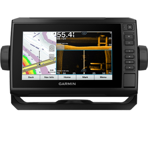
- ECHOMAP UHD 92sv with Worldwide Basemap
- GT56UHD-TM transducer
- Power/data cable
- Tilt/swivel mount
- Flush mount
- Protective cover
- Hardware
- Documentation
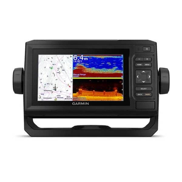
Features
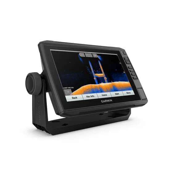
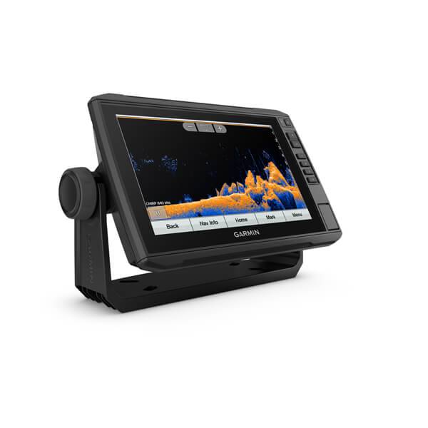
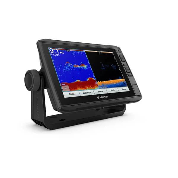
LESS TIME FINDING. MORE TIME FISHING.
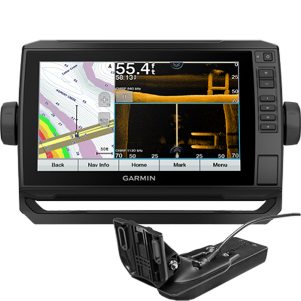
The sunlight-readable 9 touchscreen chartplotter features a quick-release bail mount, and the transducer bundle adds Ultra High-Definition scanning sonar and CHIRP traditional sonar.
See below and around your boat in incredible detail with the transducer bundle.
Navigate any waters with optional charts and maps (sold separately).
Share data and maps with select ECHOMAP devices on your network.
Manage your marine experience from nearly anywhere.
Control the most powerful trolling motor available.
Create your own maps on the fly and tailor them to fit your needs.
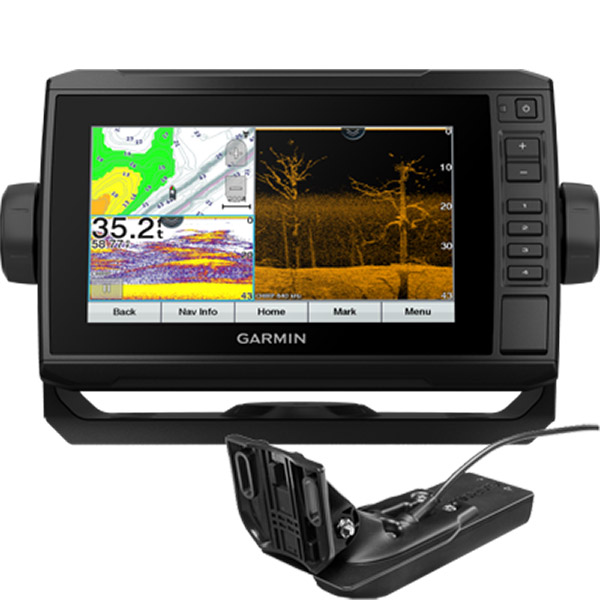
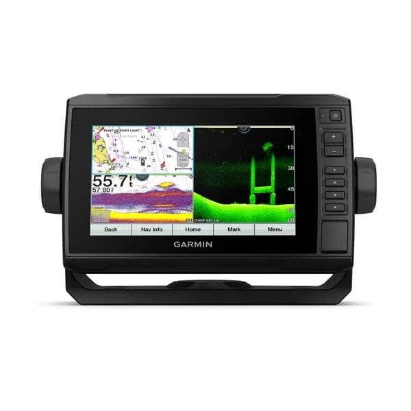
SONAR SUPPORT
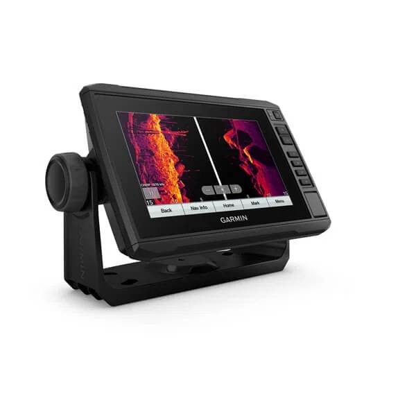
This chartplotter supports a variety of Garmin transducers (sold separately), including the Panoptix LiveScope scanning sonar system, which lets you see all around your boat in real time.
VIVID COLOR PALETTES
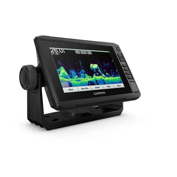
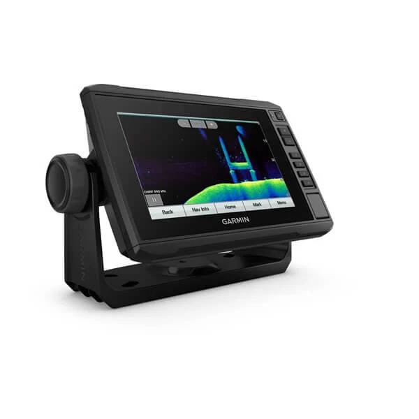
High-contrast vivid scanning sonar color palettes make it easier than ever to distinguish targets and structure.
OPTIONAL TRANSDUCER BUNDLE
Select the transducer bundle to add a GT56 transducer for Garmin CHIRP traditional sonar and Ultra High-Definition ClearVü and SideVü scanning sonars. With three scanning sonar frequencies and 20% greater range for our UHD SideVü sonar, youll get top performance at all depths.
OPTIONAL CHARTS AND MAPS
Experience unparalleled coverage and detail with support for optional BlueChart g3 Vision coastal charts featuring integrated Garmin and Navionics content.
QUICKDRAW CONTOURS
Create personalized fishing maps on-screen with 1 contours. Keep the data to yourself, or share it with the Quickdraw Community on the Garmin Connect app.
NETWORK CAPABLE
If you have multiple compatible ECHOMAP UHD or ECHOMAP Ultra devices on your boat, the 7 and 9 models can share information such as sonar, user data and charts with them.
NMEA 2000 AND NMEA 0183 NETWORKS
Connect to your compatible autopilots, digital switching, weather, Fusion-Link audio system, media, VHF, AIS, engine data, heading sensors such as the SteadyCast sensor and more from one screen.
ACTIVECAPTAIN APP
Built-in Wi-Fi connectivity pairs with the free all-in-one mobile app for access to the OneChart feature, smart notifications, software updates, Garmin Quickdraw Community data and more.
FORCE TROLLING MOTOR COMPATIBILITY
Take control of the most powerful and efficient trolling motor available, route it to waypoints, follow tracks and more from the screen of your chartplotter.
Specifications
GeneralPHYSICAL DIMENSIONS: 11.4" x 6.5" x 2.4" (28.2 x 16.4 x 6.0 cm)
DISPLAY SIZE: 7.8" x 4.8"; 9" diagonal (19.9 x 11.3 cm; 22.9 cm diagonal)
DISPLAY RESOLUTION: 400 x 800 pixels
DISPLAY TYPE: WVGA display
WEIGHT: 2.3 lbs (1.0 kg)
WATER RATING: IPX7
POWER CONSUMPTION: 18W
ANTENNA: Internal or external over NMEA 2000
MOUNTING OPTIONS: Bail or flush
RECEIVER: 5 Hz
GARMIN MARINE NETWORK PORTS: 1 Panoptix port
TRANSMIT POWER: 500 W (RMS) / 4,000 W (peak to peak)
Maps & Memory
PRELOADED MAPS: Worldwide basemap
ACCEPTS DATA CARDS: 1 microSD card; 32 GB maximum size
WAYPOINTS: 5000
TRACK LOG: 50,000 points; 50 saved tracks
ROUTES: 100
Outdoor Recreation
TIDE TABLES: Yes
Chartplotter Features
GARMIN SONAR COMPATIBLE: Yes
SUPPORTS AIS (TRACKS TARGET SHIPS POSITION): Yes
SUPPORTS DSC (DISPLAYS POSITION DATA FROM DSC-CAPABLE VHF RADIO): Yes
GCV BLACK BOX SONAR SUPPORT: Yes
ACTIVECAPTAIN COMPATIBLE: Yes
SAILING FEATURES: Yes
Sonar Features & Specifications
DUAL-FREQUENCY (50/200 KHZ) SONAR CAPABLE: Yes
DUAL-BEAM (77/200 KHZ) SONAR CAPABLE: Yes
CHIRP SONAR TECHNOLOGY: Yes (Built-in)
CLEARVÜ: Yes with CHIRP (built-in)
SIDEVÜ: Yes with CHIRP (built-in)
MAXIMUM DEPTH: 2,300 ft @ 77 kHz in freshwater and 1,100 ft @ 77 kHz in saltwater (depth capacity is dependent on water bottom type and other water conditions)
BOTTOM LOCK (SHOWS RETURN FROM THE BOTTOM UP): Yes
WATER TEMPERATURE LOG AND GRAPH: Yes
SONAR RECORDING: Yes
SONAR HISTORY REWIND: Yes
Connections
NMEA 2000 COMPATIBLE: Yes
TRANSDUCER PIN NUMBERS: 12
NMEA 0183 INPUT PORTS: 1
NMEA 0183 OUTPUT PORTS: 1
VIDEO INPUT PORTS: None
VIDEO OUTPUT PORTS: None
WIRELESS CONNECTIVITY: Yes
Item number: 010-02522-01
UPC: 753759264451
Package weight: 11 lb
Other Products in the Series: