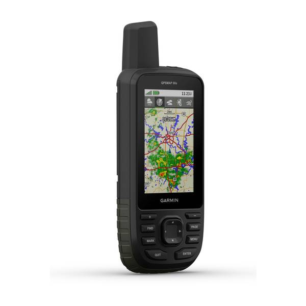
GARMIN GPSMAP 66sr Multi-Band/GNSS


This item is brand new
$399.99
This item ships within 4 days
an


Speed/Cadence bike sensor (GSC 10)
Heart rate monitor

Premium Heart rate monitor Soft Strap

Tempe Wireless Temperature Sensor


Heart rate monitor HRM-Run

Heart rate monitor HRM-Tri

Heart rate monitor HRM-Run

HRM-Pro Heart Rate Monitor with Bluetooth and Running Dynamics

HRM-Pro Plus Heart Rate Monitor

Bike Speed Sensor 2

Bike Cadence Sensor 2

Bike Speed Sensor 2 and Cadence Sensor 2 Bundle


Cup Holder Universal Mount RAM-A-CAN II with 6 in Flex Arm


Lanyard 17 inch


Carabiner clip

Lanyard Carabiner

Chirp Wireless geocaching beacon

BirdsEye Satellite Imagery Retail Card
Virb X
Virb Xe
NOH Virb XE
VIRB XE Cycling Bundle
VIRB XE Auto Racing Bundle
VIRB XE Aviation Bundle
VIRB Ultra 30
VIRB Camera
VIRB Elite Camera Dark
VIRB Elite Camera
BirdsEye Satellite Imagery US and Canada
Suggested Maps and Software:
 | Inland Lakes |
 | BlueChart g2, g3 on micro SD card with adapter |
 | Garmin Street Maps and City Navigation |
 | Garmin Topographic Maps |
 | LakeVu HD |
Contents of the package
USB cable
Carabiner clip
Documentation
Features
NAVIGATE YOUR NEXT ADVENTUREWhether youre hiking, hunting, climbing, geocaching, kayaking or mountain biking, explore more by using this premium, rugged handheld with a 3 color display, preloaded maps and multiple frequencies for our most accurate position to date.
No squinting necessary with this large, sunlight-readable color display.
Multi-band technology and expanded GNSS satellite support guide the way in challenging locations.
Maps as pretty as a picture and just as detailed without a subscription.
See the peaks and valleys clearly with TopoActive maps for the U.S. and Canada.
Having Active Weather is like having your own personal weather forecaster on your journey1.
Explore more with up to 36 hours of battery life in GPS mode and up to 450 hours in Expedition mode.
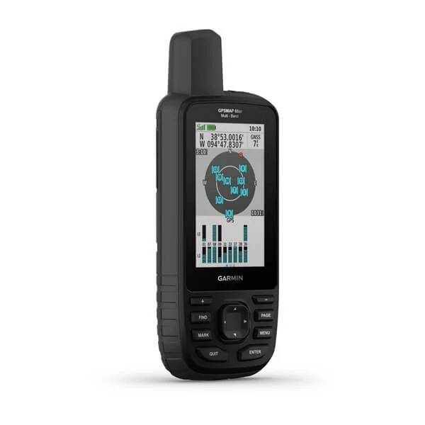
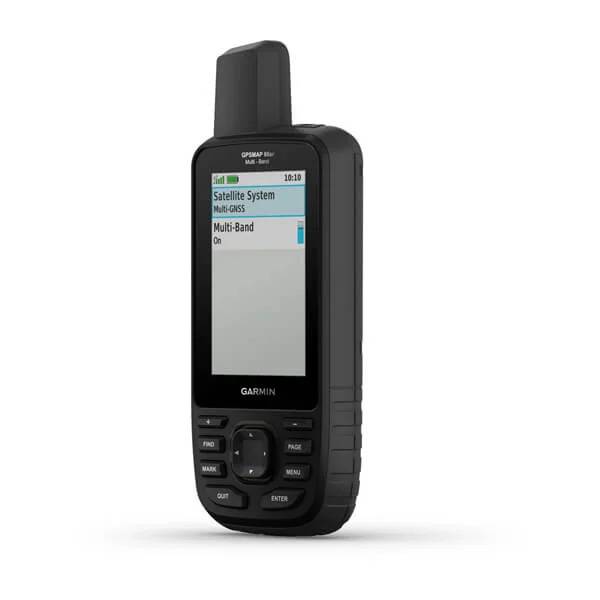
EXPANDED GNSS SUPPORT
Multi-band technology and expanded GNSS support (GPS, GLONASS, Galileo, QZSS and IRNSS) provide optimal accuracy in steep country, urban canyons and forests with dense trees.
ABC SENSORS
Navigate every trail with ABC sensors, including an altimeter for elevation data, barometer to monitor weather and 3-axis electronic compass.
BIRDSEYE SATELLITE IMAGERY
Download high-resolution photo-realistic maps directly to your device without an annual subscription. Easily find trails, pick stand locations, find parking, create waypoints and more.
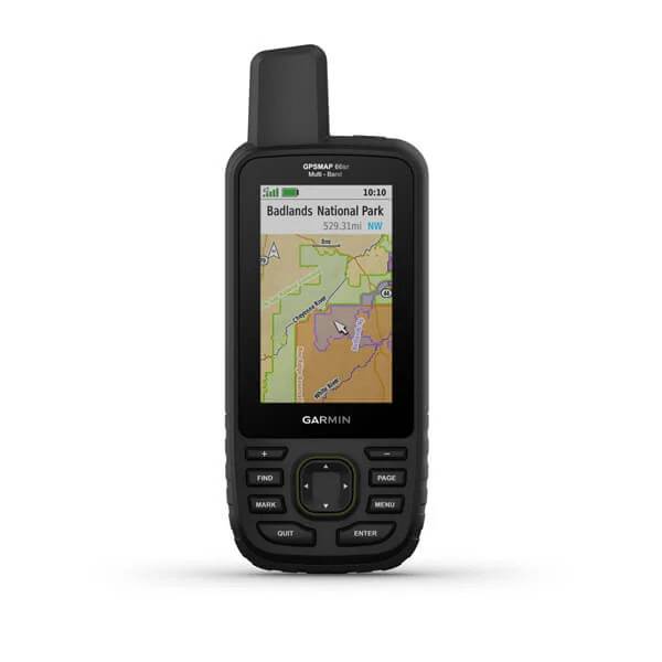
PRELOADED TOPO MAPS
Preloaded TopoActive U.S. and Canada maps show you terrain contours, topographic elevations, summits, parks, coastlines, rivers, lakes and geographical points.
PUBLIC LAND BOUNDARIES
Optional display of federal public land boundaries on topographical maps helps you know that youre venturing where youre supposed to be.
ACTIVE WEATHER
When paired with your compatible smartphone, you can get real-time forecast information and live weather radar, so youre aware of the surrounding conditions1.
BUILT FOR ADVENTURE
This handheld is built to military standards for thermal, shock and water performance (MIL-STD-810), and its even compatible with night vision goggles.
LED FLASHLIGHT
The GPSMAP 66 series helps you keep gear to a minimum with a built-in LED flashlight that can be used as a beacon to signal for help.
GEOCACHING
Get automatic cache updates from Geocaching Live, including descriptions, logs and hints. When connected via Wi-Fi® technology or to the Garmin Connect app2, each find will upload to your Geocaching.com profile.
GARMIN EXPLORE APP
Plan, review and sync waypoints, routes and tracks by using the Garmin Explore app2 and website. You can even review completed activities while still in the field.
BATTERY LIFE
Internal Lithium-ion rechargeable battery provides up to 36 hours of battery life in GPS mode and up to 3 weeks in Expedition mode.
Specifications
GeneralPHYSICAL DIMENSIONS: 2.5" x 6.4" x 1.4" (6.2 x 16.3 x 3.5 cm)
DISPLAY SIZE: 1.5"W x 2.5"H (3.8 x 6.3 cm); 3" diag (7.6 cm)
DISPLAY RESOLUTION: 240 x 400 pixels
DISPLAY TYPE: transflective color TFT
WEIGHT: 8.1 oz (230 g) with batteries
BATTERY TYPE: Rechargeable, internal lithium-ion
BATTERY LIFE: Up to 36 hours; Up to 450 hours in expedition mode
WATER RATING: IPX7
MIL-STD-810: yes (thermal, shock, water)
HIGH-SENSITIVITY RECEIVER: Yes
INTERFACE: high speed micro USB and NMEA 0183 compatible
MEMORY/HISTORY: 16 GB (user space varies based on included mapping)
Maps & Memory
PRELOADED MAPS: yes (TopoActive; routable)
ABILITY TO ADD MAPS: Yes
BASEMAP: Yes
AUTOMATIC ROUTING (TURN BY TURN ROUTING ON ROADS): Yes
MAP SEGMENTS: 15000
BIRDSEYE: yes (direct to device)
INCLUDES DETAILED HYDROGRAPHIC FEATURES (COASTLINES, LAKE/RIVER SHORELINES, WETLANDS AND PERENNIAL AND SEASONAL STREAMS): Yes
INCLUDES SEARCHABLE POINTS OF INTERESTS (PARKS, CAMPGROUNDS, SCENIC LOOKOUTS AND PICNIC SITES): Yes
DISPLAYS NATIONAL, STATE AND LOCAL PARKS, FORESTS, AND WILDERNESS AREAS: Yes
EXTERNAL MEMORY STORAGE: yes (32 GB max microSD card)
WAYPOINTS/FAVORITES/LOCATIONS: 10000
TRACKS: 250
TRACK LOG: 20000 points, 250 saved gpx tracks, 300 saved fit activities
ROUTES: 250, 250 points per route; 50 points auto routing
RINEX LOGGING: Yes
Sensors
GPS: Yes
GLONASS: Yes
GALILEO: Yes
BAROMETRIC ALTIMETER: Yes
COMPASS: Yes (tilt-compensated 3-axis)
GPS COMPASS (WHILE MOVING): Yes
Daily Smart Features
CONNECT IQ (DOWNLOADABLE WATCH FACES, DATA FIELDS, WIDGETS AND APPS): Yes
VIRB® REMOTE: Yes
PAIRS WITH GARMIN CONNECT MOBILE: Yes
ACTIVE WEATHER : Yes
SMART NOTIFICATIONS ON HANDHELD: Yes
Safety and Tracking Features
LIVETRACK: Yes
Outdoor Recreation
POINT-TO-POINT NAVIGATION: Yes
COMPATIBLE WITH BASECAMP: Yes
AREA CALCULATION: Yes
HUNT/FISH CALENDAR: Yes
SUN AND MOON INFORMATION: Yes
XERO LOCATIONS: Yes
GEOCACHING-FRIENDLY: yes (Geocache Live)
CUSTOM MAPS COMPATIBLE: yes (500 custom map tiles)
PICTURE VIEWER: Yes
INREACH REMOTE WIDGET: Yes
LED BEACON FLASHLIGHT: Yes
Outdoor Applications
COMPATIBLE WITH GARMIN EXPLORE APP: Yes
GARMIN EXPLORE WEBSITE COMPATIBLE: Yes
Connections
WIRELESS CONNECTIVITY: yes (Wi-Fi®, BLUETOOTH®, ANT+®)
Item number: 010-02431-00
UPC: 753759257774
Package weight: 0.9 lb
Other Products in the Series:
 | GARMIN GPSMAP 66i with Satellite Communicator | Add to comparison |
 | GARMIN GPSMAP 66s NOH | Add to comparison |
 | GARMIN GPSMAP 66s | Add to comparison |
 | GARMIN GPSMAP 66s Refurbished, Used, Good condition NOH | |
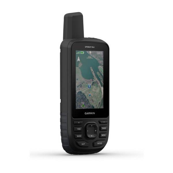 | GARMIN GPSMAP 66st | Add to comparison |