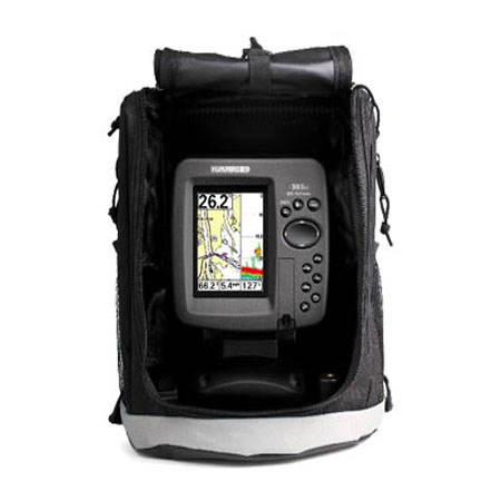
HUMMINBIRD 398ci SI Combo


Cables

720003-1
EC W10 Transducer Ext. Cable, 7 pin, 10 ft
EC W10 Transducer Ext. Cable, 7 pin, 10 ft
No Longer Available

700030-1
AS-HHGPS Handheld GPS Connection Kit
AS-HHGPS Handheld GPS Connection Kit
No Longer Available

720003-2
EC-W30 30 ft Transducer Extension cable
EC-W30 30 ft Transducer Extension cable
No Longer Available
Mounts

740077-1
MS-M, Quick disconnect mount system, MFG 740077-1
MS-M, Quick disconnect mount system, MFG 740077-1
No Longer Available

Marine Networking


Sensors and Boards

730021-1
SW Speed Sensor, MFG 730021-1, Transom mount, with 20 ft cable
SW Speed Sensor, MFG 730021-1, Transom mount, with 20 ft cable
No Longer Available

730000-1
TS-W Temp/Speed Sensor
TS-W Temp/Speed Sensor
No Longer Available
Transducers Humminbird


Compatible maps
Suggested Maps and Software:
 | Navionics Marine Charts |
Contents of the package
- 398ci HD SI
- Transom mount transducer
- Mounting bracket
- Installation hardware
- Owner's manual
Features
The 398ci SI Combo features a brilliant 240H x 320V, 3.5" display with LED backlight. Side Imaging® and Down Imaging® sonar with 4000 watts PTP power output, Precision Internal GPS Chartplotting with built-in UniMap© cartography with a card slot for optional maps and saving waypoints along with a Tilt & Swivel Quick Disconnect mounting system. The design also allows for in-dash mounting with option kit. Maximize your angling experience with the Humminbird 398ci SI fishfinder GPS system.Side Imaging Sonar
Side Imaging Sonar -- Gain a 180 degree side to side perspective on the world below the surface.
For greater on-water flexibility, 360 Imaging lets you choose from five beam speed settings. Lower beam speeds lead to higher image quality but lower refresh rates. Conversely, higher beam speeds result in lower image quality but higher refresh rates. With five options, you can find the ideal setting for your boat speed, water conditions, and need for detail.
It's all in the details. Gain a 180 degree side-to-side perspective on the world below the surface with remarkable Humminbird Side Imaging. In an instant, the ultra-thin beam scans the area up to 240 feet to the left and right of your boat location-for total coverage of up to 480 feet. The return image for each slice is then added to the images taken immediately before and after to build an incredible view of the lake bottom. You can then magnify the detail of the image with the zoom feature or mark the GPS location of promising cover or structure directly on the screen.
Side Imaging's high-frequency beams reveal structure, cover, and contour changes with crystal clarity. The images are so real you might think it's a camera, but it?s not, so it doesn?t matter how murky the water is.
Down Imaging Sonar
Down Imaging Sonar -- Get a fish-eye's view of what's happening below your boat. Incredible images are created with High-frequency sound waves
Sometimes, to catch fish, not only do you have to think like one, you've got to see like one. Get a fish-eye's view of what's happening below your boat with Humminbird Down Imaging. These incredible images are created with high frequency sound waves emitted in ultra-thin slices. The sonar returns from these waves produce a "portrait." As you patrol the water, you'll watch fish, reefs, timber, brush, bridge pilings, rocks, and any other structure or cover pop with stunning detail.
Switchfire
SwitchFire Sonar -- Take command of how your sonar returns appear with our Clear and Max Modes.
Building on our legacy of sonar innovation, exclusive Humminbird SwitchFire puts anglers in complete command of how their sonar returns appear. With two unique display modes, you can adjust to your fishing conditions on the fly. Add or remove detail; account for water depth, temperature and turbulence; even experiment with lure presentations-all at the push of a button. SwitchFire adds a whole new dimension to 2D fish-finding. It's one more reason Humminbird is simply, clearly, better.
DualBeam Plus Sonar
Two beams combine for great detail and a wide coverage area. Use the narrow beam for high-accuracy returns and bottom. Use the wide beam when you want a larger search area.
Internal GPS
GPS antenna built into the head unit
Get unparalleled GPS technology out of the box. Many Humminbird fishfinders have our powerful Precision GPS/WAAS receiver built right in and provides fast position fixes accurate within 2.5 meters.
For those models without it, there are several options:
Add the Humminbird Precision GPS/WAAS receiver for permanent GPS capability on your boat. Use Humminbird?s adapter and the NMEA output on your own handheld GPS unit, or use Humminbird?s InterLink to allow two fishfinders to access one GPS receiver.
Single Card Slot
Single SD Card Slot -- Use for advanced cartography or to save your screenshots, sonar recordings and waypoints.
Unimap Cartography
The Humminbird UniMap is a built-in map covering the contiguous US coastline, inland lakes and rivers at 30 meters per pixel resolution.
Specifications
Display Size - Diagonal:3.5"Display Pixel Matrix:240H x 320V
Display Type:Color TFT
Display Colors Grayscale:256 Colors
Sonar Standard:Side Imaging, Down Imaging, DualBeam PLUS
Standard Sonar Coverage:20°, 60° & (2) 85° @ -10db (Total of 180°)
Standard Sonar Frequency:200/83/455 kHz
Sonar Optional:QuadraBeam PLUS
Target Separation:2 1/2"
Power Output RMS:500 Watts
Power Output Peak to Peak:4000 Watts
Depth Capability:100 ft (SI/DI), 1500 ft
Temperature:Included
Speed:GPS Speed Included
Backlight:Yes
Mount A Unit Size:5.25"W x 7.4"H x 4"D
Mount B Unit Size:5.25"W x 5.12"H x 1.12"D
Unit Mount Type:Quick Disconnect/Optional In-Dash Mounting Kit
Transducer Standard:XNT-9-SI-180-T
Transducer Mounting:Transom
Power Input:10-20 VDC
Power Draw:380 mA
GPS Receiver:Included
GPS Tracking:Included
GPS Chartplotting:Included
Waypoints, Routes, Tracks/Points:2,500, 50, 50/20,000
Lakemaster:Optional
Navionics Gold/HotMaps:Optional
Navionics Platinum +:Not Supported
Platinum Capable:Not Supported
C-Map:Not Supported
360 Imaging:Not Supported
iPilotLINK:Not Supported
Radar2:Not Supported
NMEA2000:Not Supported
5 Port Expansion Module:Not Supported
WeatherSense:Not Supported
Precision GPS:Included
Heading Sensor GPS:Not Supported
PC Connect:Optional
GPS Connecton Link:Not Supported
AS Interlink:Not Supported
AIS Compatability:Not Supported
SwitchFire Sonar:Included
Screen Snap Shot:Included
Sonar Recording:Included
Upgradable Internal Software:Included
Split Screen Zoom:Included
Split Screen Bottom Lock:Included
3D Chart View:Included
Large Digits View:Included
Wide/Narrow Cone Split Screen:Included
Custom View Selections:Included
Custom Digital Readout:Included
View Preset Keys:Not Supported
Temperature Graph:Not Supported
Temperature Alarm:Included
Freeze Frame:Included
Instant Image Update:Included
Mark Structure on Sonar:Included
Selective Fish ID+:Included
Real Time Sonar:Included
Triplog:Included
X-Press Menu System:Included
MMC Compartment Available:Yes
MMC #Slots:1
Item number: 409380-1
UPC: 082324042843
Package weight: 4 lb
Product Reviews
Following reviews were written by actual customers.
Every GPS4US customer has a chance to live a feedback after receiving a product.
 by David I, , 8/1/2014
So far greAt! Good depth finder -even@20 mph, Small size perfect for my small skiff .gps no detail w/o optional card. Instructions are good
Following reviews were written by actual customers.
Every GPS4US customer has a chance to live a feedback after receiving a product.
by David I, , 8/1/2014So far greAt! Good depth finder -even@20 mph, Small size perfect for my small skiff .gps no detail w/o optional card. Instructions are good
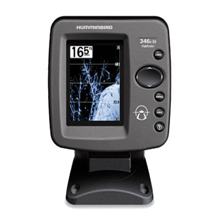
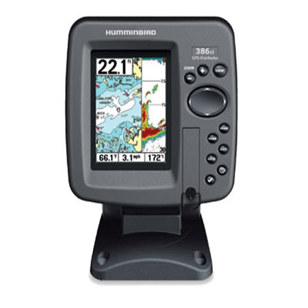
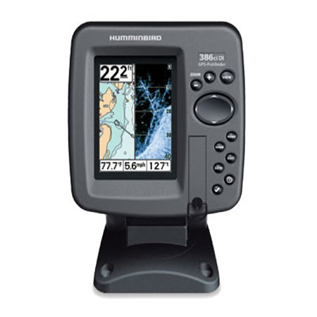
Other Products in the Series: