|
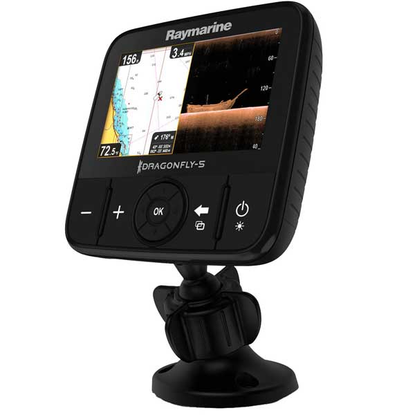
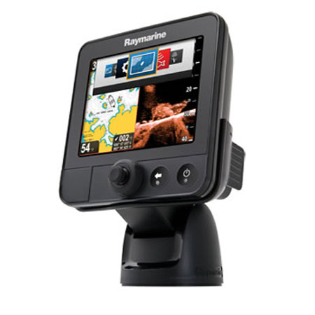
RAYMARINE Dragonfly 7 Combo with Navionics Silwer ROW Charts, With Transducer
|
Item: E70231-RW
|
|
This Item is Brand New
$899.99
|
|
Contents of the PackageDimensions 7.5"W x 6"H x 2.2"D, add 2.6"H for bracket In the box:- Dragonfly 7 Plotter/Sounder
- CPT-60 Transom mount transducer
- Tilt/Swivel bracket
- Installation hardware
- Owner's manual
Features 
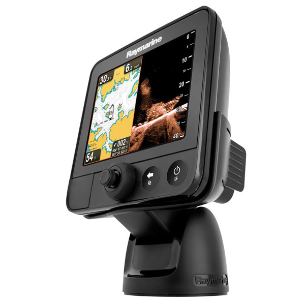
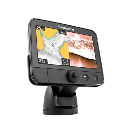
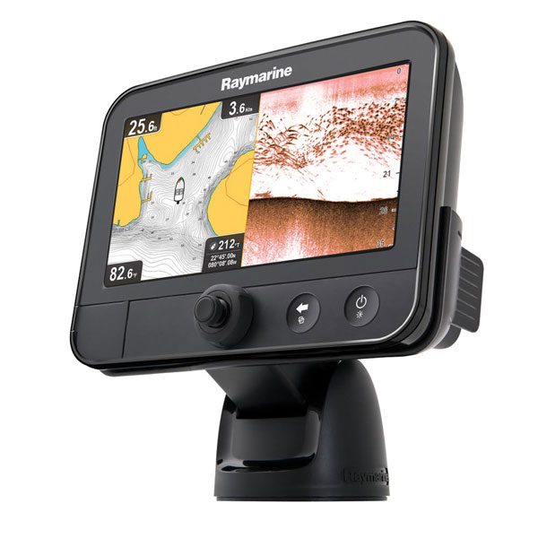
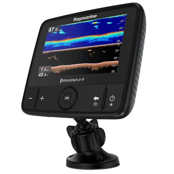
Raymarine Dragonfly 7 GPS/Sonar without Transducer or Charts 7" Widescreen LCD with High-Definition CHIRP Sonar
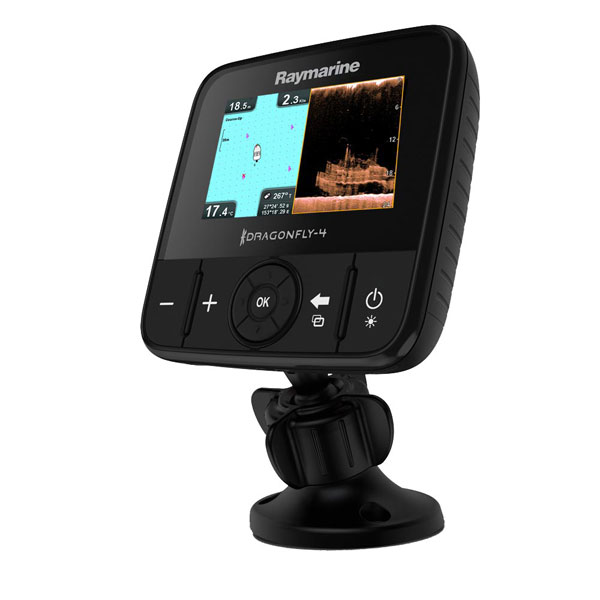
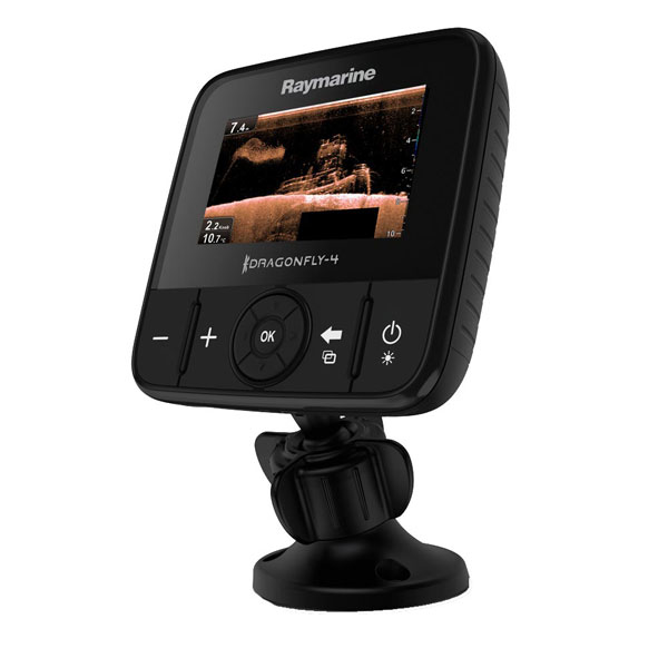
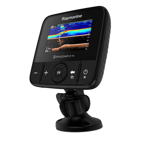
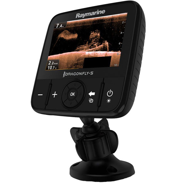
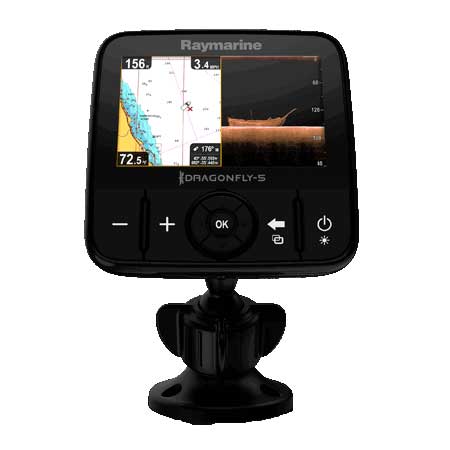
View
the world beneath your boat with the photo-like clarity of CHIRP
DownVision™ sonar, the first high-resolution imaging sonar for anglers
to use CHIRP technology. Dragonfly's dual channel CHIRP technology lets
you explore structure and target fish like never before. 
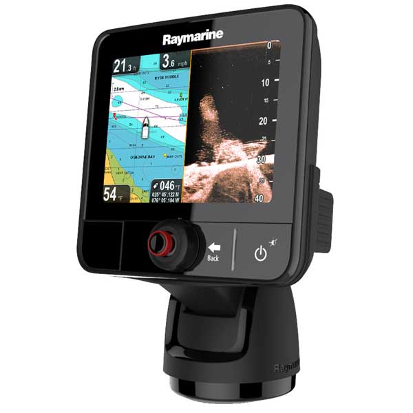
Whether you
are a professional guide or weekend bass angler, you will appreciate
Dragonfly’s cutting edge sonar performance and simple operation. Simply
dial through sonar and GPS displays and quickly become a Dragonfly
expert.Dragonfly is built with two discrete CHIRP sonar channels. The
first is the ultrahigh-resolution DownVision channel and the second is a
high-resolution fish targeting sonar channel. View each sonar channel
independently or switch to dual sonar split screen mode for the ultimate
in underwater intelligence.Dragonfly features a widescreen 7”
ultra-bright 1500 nit color display that is optically bonded for maximum
visibility and high contrast even in the bright summer sun. Dragonfly’s
tilt and swivel mounting holster has a small mounting footprint, making
it easy to mount Dragonfly anywhere on board. For added on board
security, Dragonfly’s convenient quick-release tilt and swivel holster
can be secured with an optional Thule locking cylinder.
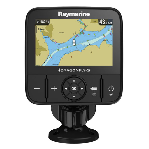
Built in 50-channel GPS sensor with fast-acquisition technology Available with industry leading Navionics charts included on microSD Easy Screen Switcher Automatic Sonar Optimization; No Adjustment Required Simple Three Button Control Uni-controller - joystick cursor and rotary dial Rugged enclosure built to IPX6 and IPX7 waterproof and submersion standards Single power and transducer connector with thumb-friendly locking collar
Specifications
Display 7" diag. widescreen color LCD Resolution 800 x 640 pixels; VGA Antenna Internal 50 channel GPS Power Not specified Frequency 200 KHz conventional sonar and 350KHz Wide-Beam CHIRP sonar Transducer Transom mount transducer included Mapping Navionics charts on CD Waypoints/Routes 3,000 waypoints; 15 tracks of up to 10,000 trackpoints Interface NMEA 0183; SeaTalk-ng (NMEA 2000) Other Functions Quick release tilit/swivel bracket with optional lock Warranty One Year
Item number: E70231-RW UPC: 723193786956 Shipping weight: 5.9 lb |
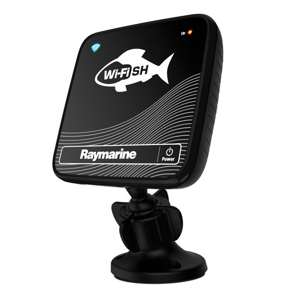
Other Products in the Series:
 | RAYMARINE Dragonfly 4 Pro w/ C-Map Essentials EURO | Add to comparison
|
 | RAYMARINE Dragonfly 4 Pro w/o Charts | Add to comparison
|
 | RAYMARINE Dragonfly 4 Pro with Rest of World C-Map Essentials | Add to comparison
|
 | RAYMARINE Dragonfly 4 Pro, C-Map US Essen. w/Transducer | Add to comparison
|
 | RAYMARINE Dragonfly 4 Pro, Navioniics Gold w/Transducer | Add to comparison
|
 | RAYMARINE Dragonfly 4DV DownVision Sonar w/Transducer | Add to comparison
|
 | RAYMARINE Dragonfly 4DVS DownVis./Std Sonar w/Transducer | Add to comparison
|
 | RAYMARINE Dragonfly 5 Pro w/ C-Map Essentials EURO | Add to comparison
|
 | RAYMARINE Dragonfly 5 Pro w/ C-Map Essentials ROW | Add to comparison
|
 | RAYMARINE Dragonfly 5 Pro w/o Charts | Add to comparison
|
 | RAYMARINE Dragonfly 5 Pro, C-Map US Essen. w/Transducer | Add to comparison
|
 | RAYMARINE Dragonfly 5 Pro, Navioniics Gold w/Transducer | Add to comparison
|
 | RAYMARINE Dragonfly 5DVS DownVis./Std Sonar w/Transducer | Add to comparison
|
 | RAYMARINE Dragonfly 5M Plotter, C-Map US Essen | Add to comparison
|
 | RAYMARINE Dragonfly 5M Plotter, Navionics Gold US | Add to comparison
|
 | RAYMARINE Dragonfly 5M w/ C-Map Essentials EURO | Add to comparison
|
 | RAYMARINE Dragonfly 5M w/ C-Map Essentials ROW | Add to comparison
|
 | RAYMARINE Dragonfly 5M w/o charts | Add to comparison
|
 | RAYMARINE Dragonfly 6 w/ C-Map Essentials EURO | Add to comparison
|
 | RAYMARINE Dragonfly 6 w/ C-Map Essentials ROW | Add to comparison
|
 | RAYMARINE Dragonfly 6 with US C-map and Transducer | Add to comparison
|
 | RAYMARINE Dragonfly 6, Navionics Gold US, w/Transducer | Add to comparison
|
 | RAYMARINE Dragonfly 6, No charts, w/o Transducer | Add to comparison
|
 | RAYMARINE Dragonfly 7 C-Map US Essentials, w/Transducer | Add to comparison
|
 | RAYMARINE Dragonfly 7 Combo w/o Charts, no Transducer | Add to comparison
|
 | RAYMARINE Dragonfly 7 Combo w/o Charts, With Transducer | Add to comparison
|
 | RAYMARINE Dragonfly 7 Combo with Navionics Gold US Charts, With Transducer | Add to comparison
|
 | RAYMARINE Dragonfly 7 Navionics north america gold, w/Transducer | Add to comparison
|
 | RAYMARINE Dragonfly 7 PRO combo, without charts | Add to comparison
|
 | RAYMARINE Dragonfly 7 PRO combo. C-Map Ess. US | Add to comparison
|
 | RAYMARINE Dragonfly 7 PRO combo. Navionics plus US | Add to comparison
|
 | RAYMARINE Dragonfly 7 w/ C-Map Essentials ROW | Add to comparison
|
 | RAYMARINE Dragonfly GPS/Sonar with Navionics Gold US Charts | Add to comparison
|
 | RAYMARINE Dragonfly GPS/Sonar with Navionics rest of the orld Charts | Add to comparison
|
 | RAYMARINE Dragonfly Sonar/GPS w/o charts | Add to comparison
|
 | RAYMARINE Wi-Fish Black Box DownVision Sonar | Add to comparison
|
Accessories:
Compatible maps: |
Cables |
|
Cases and Covers |
|
RAM Mounts |
|
Transducers Raymarine |
|
|
Suggested Maps and Software:
 | Navionics Marine Charts Navionics charts are now a fundamental tool of navigation, featuring water depths, navaids, obstructions, and other information necessary for safe navigation. Marine and lake maps presented. |
 | C-Map 4D Charts C-MAP 4D MAX+ is the latest evolution of electronic charting technology, combining award-winning vector chart data with exclusive Dynamic Raster Charts and the ability to view charts in 2D or amazing 3D presentation with high-resolution satellite imagery. Packed with innovative features designed to enhance every cruising, fishing or sailing experience
|
 | Cmor maps CMOR Mapping data is the result of methodical surveys with
high-resolution echosounders. There is no interpolation, no guesswork,
and no unverified "hotspots" reported by local captains. All you see is a
complete, accurate, and highly detailed representation of the bottom,
including many features that are not shown on any other chart or fishing
map |
|
| |