|
RAYMARINE Dragonfly 7 Navionics north america gold, w/Transducer
|
Item: E70231-NAG
|
|
This Item is Brand New
$785.95
|
|
Contents of the Package Raymarine Dragonfly 7" Sonar/GPS Display 
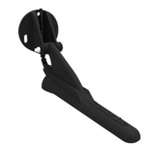
Tilt/Swivel mounting bracket True Dual Beam Transom Mount Transducer assembly with mounting bracket and sealing cap Navionics Gold Chart User Guide
Features 
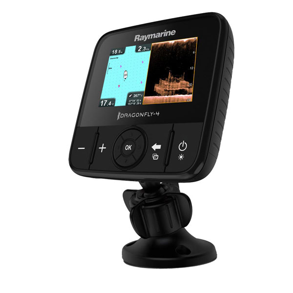
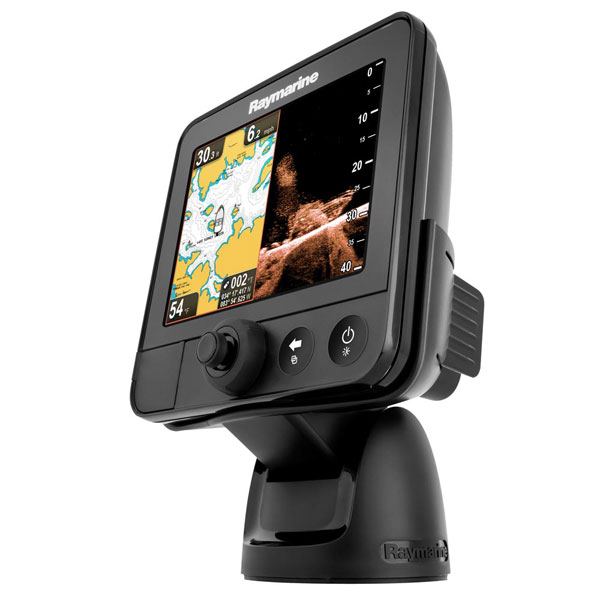
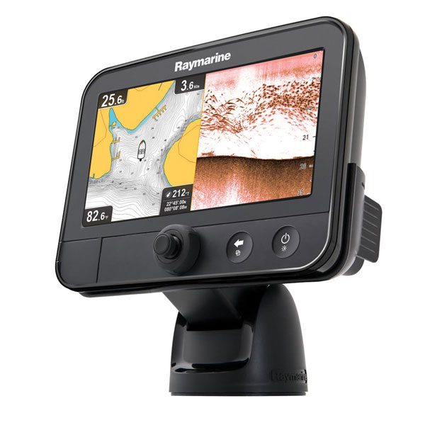
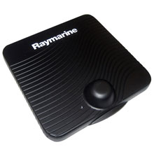
Dragonfly7 GPS/Fishfinder Combo w/Transom Mount Transducer - Navionics North America Gold
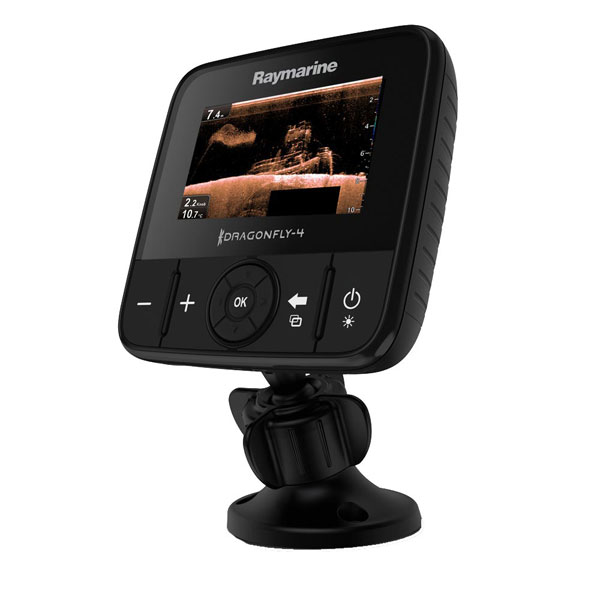
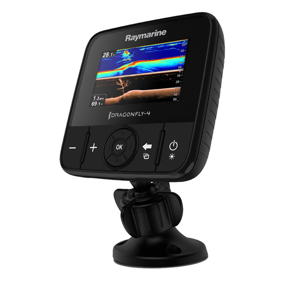
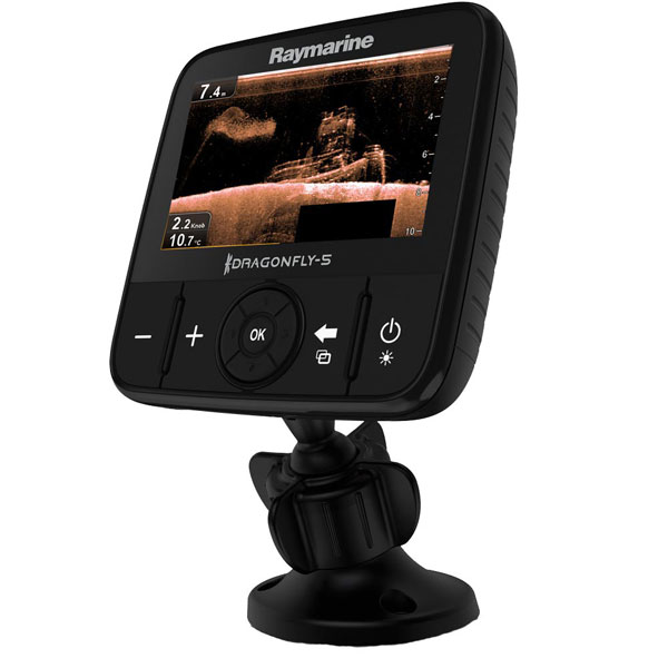
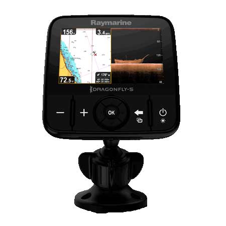
With Raymarine's affordable, high-performance Dragonfly series of combination sonar/GPS, the power and crisp detail of ClearPulseŽ CHIRP sonar is now within the reach of the inland and coastal salt water angler. Using Raymarine's exclusive ClearPulseŽ technology and a true 2-channel transducer, users see dramatically revealing images of fish and the structures where they hide--in both DownVision and conventional sonar simultaneously.
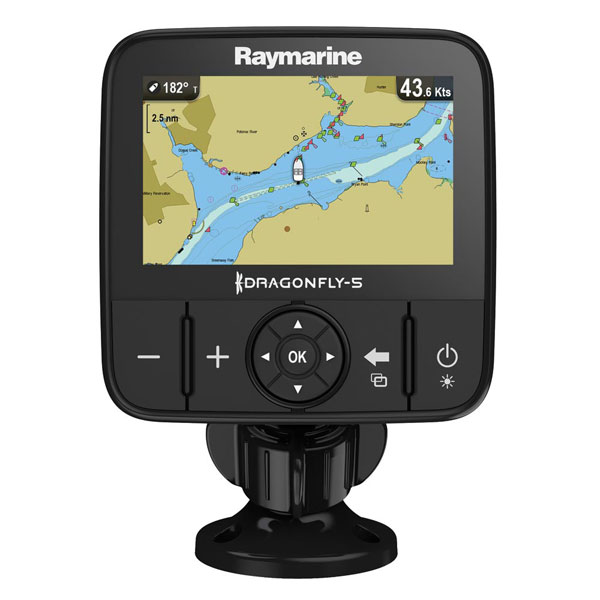
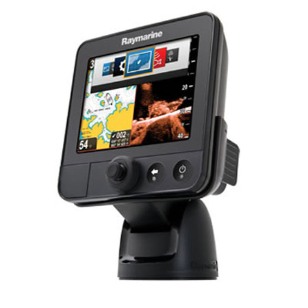
Dragonfly's intuitive display interface and simple Unicontroller is easy to use right out of the box. Built-in 50-channel GPS also simplifies installation and its fast-acquisition position technology ensures added navigation confidence (with up to 3,000 waypoints, 150 routes and 15 tracks of up to 10,000 trackpoints).
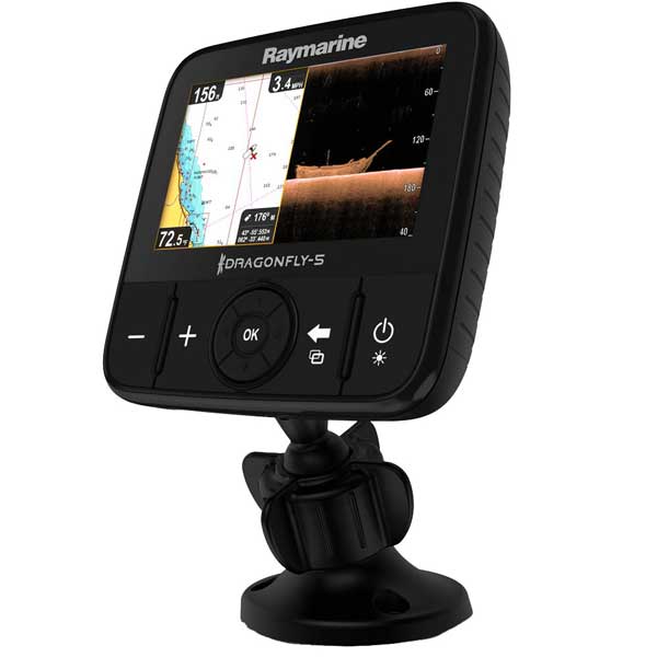
The Raymarine Dragonfly combo sonar/GPS units feature a large 7" ultra-bright 1600 nit display for maximum visibility even in direct sun. For added security, use the quick-release swivel bracket with an available Thule lock core.
Large 7" 800x480 WVGA LCD with brilliant 1600 nit display is easy to read even in the brightest sunlight Raymarine's exclusive ClearPulseŽ CHIRP technology delivers unrivaled resolution for structure and fish detection Powerful two channel digital sonar engine simultaneously displays Down Vision and conventional sonar images True dual beam transom-mount transducer accurately reveals fish location (25 degree wide beam) and extremely detailed views of structure (1.4 degree narrow fan beam), plus a high precision temperature sensor High resolution Down Vision images up to 250 ft. Conventional sonar performance up to 600 ft. Lightning fast chart redraws with dedicated graphics co-processor Built-in high performance 50 channel GPS sensor with fast-acquisition technology Innovative design combines large display area and small mounting footprint
Specifications
Nominal supply voltage: 12v Operating voltage range: 10.2 - 16.6v Waterproofing standard: IPX6 and IPX7 Display size: 7" Display resolution: WVGA (800x 480) Color depth: 24 bit Chart Compatibility: Navionics Connections: Power/transducer combined input Frequency 200 kHz Sonar and 350 kHz Down Vision
Item number: E70231-NAG UPC: 723193793602 Shipping weight: 5.9 lb |
Other Products in the Series:
 | RAYMARINE Dragonfly 4 Pro w/ C-Map Essentials EURO | Add to comparison
|
 | RAYMARINE Dragonfly 4 Pro w/o Charts | Add to comparison
|
 | RAYMARINE Dragonfly 4 Pro with Rest of World C-Map Essentials | Add to comparison
|
 | RAYMARINE Dragonfly 4 Pro, C-Map US Essen. w/Transducer | Add to comparison
|
 | RAYMARINE Dragonfly 4 Pro, Navioniics Gold w/Transducer | Add to comparison
|
 | RAYMARINE Dragonfly 4DV DownVision Sonar w/Transducer | Add to comparison
|
 | RAYMARINE Dragonfly 4DVS DownVis./Std Sonar w/Transducer | Add to comparison
|
 | RAYMARINE Dragonfly 5 Pro w/ C-Map Essentials EURO | Add to comparison
|
 | RAYMARINE Dragonfly 5 Pro w/ C-Map Essentials ROW | Add to comparison
|
 | RAYMARINE Dragonfly 5 Pro w/o Charts | Add to comparison
|
 | RAYMARINE Dragonfly 5 Pro, C-Map US Essen. w/Transducer | Add to comparison
|
 | RAYMARINE Dragonfly 5 Pro, Navioniics Gold w/Transducer | Add to comparison
|
 | RAYMARINE Dragonfly 5DVS DownVis./Std Sonar w/Transducer | Add to comparison
|
 | RAYMARINE Dragonfly 5M Plotter, C-Map US Essen | Add to comparison
|
 | RAYMARINE Dragonfly 5M Plotter, Navionics Gold US | Add to comparison
|
 | RAYMARINE Dragonfly 5M w/ C-Map Essentials EURO | Add to comparison
|
 | RAYMARINE Dragonfly 5M w/ C-Map Essentials ROW | Add to comparison
|
 | RAYMARINE Dragonfly 5M w/o charts | Add to comparison
|
 | RAYMARINE Dragonfly 6 w/ C-Map Essentials EURO | Add to comparison
|
 | RAYMARINE Dragonfly 6 w/ C-Map Essentials ROW | Add to comparison
|
 | RAYMARINE Dragonfly 6 with US C-map and Transducer | Add to comparison
|
 | RAYMARINE Dragonfly 6, Navionics Gold US, w/Transducer | Add to comparison
|
 | RAYMARINE Dragonfly 6, No charts, w/o Transducer | Add to comparison
|
 | RAYMARINE Dragonfly 7 C-Map US Essentials, w/Transducer | Add to comparison
|
 | RAYMARINE Dragonfly 7 Combo w/o Charts, no Transducer | Add to comparison
|
 | RAYMARINE Dragonfly 7 Combo w/o Charts, With Transducer | Add to comparison
|
 | RAYMARINE Dragonfly 7 Combo with Navionics Gold US Charts, With Transducer | Add to comparison
|
 | RAYMARINE Dragonfly 7 Combo with Navionics Silwer ROW Charts, With Transducer | Add to comparison
|
 | RAYMARINE Dragonfly 7 PRO combo, without charts | Add to comparison
|
 | RAYMARINE Dragonfly 7 PRO combo. C-Map Ess. US | Add to comparison
|
 | RAYMARINE Dragonfly 7 PRO combo. Navionics plus US | Add to comparison
|
 | RAYMARINE Dragonfly 7 w/ C-Map Essentials ROW | Add to comparison
|
 | RAYMARINE Dragonfly GPS/Sonar with Navionics Gold US Charts | Add to comparison
|
 | RAYMARINE Dragonfly GPS/Sonar with Navionics rest of the orld Charts | Add to comparison
|
 | RAYMARINE Dragonfly Sonar/GPS w/o charts | Add to comparison
|
 | RAYMARINE Wi-Fish Black Box DownVision Sonar | Add to comparison
|
Accessories:
Compatible maps: |
Cables |
|
Cases and Covers |
|
RAM Mounts |
|
Transducers Raymarine |
|
|
Suggested Maps and Software:
 | Navionics Marine Charts Navionics charts are now a fundamental tool of navigation, featuring water depths, navaids, obstructions, and other information necessary for safe navigation. Marine and lake maps presented. |
 | C-Map 4D Charts C-MAP 4D MAX+ is the latest evolution of electronic charting technology, combining award-winning vector chart data with exclusive Dynamic Raster Charts and the ability to view charts in 2D or amazing 3D presentation with high-resolution satellite imagery. Packed with innovative features designed to enhance every cruising, fishing or sailing experience
|
 | Cmor maps CMOR Mapping data is the result of methodical surveys with
high-resolution echosounders. There is no interpolation, no guesswork,
and no unverified "hotspots" reported by local captains. All you see is a
complete, accurate, and highly detailed representation of the bottom,
including many features that are not shown on any other chart or fishing
map |
|
| |