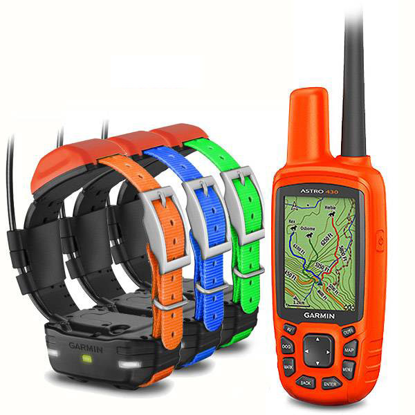
GARMIN Astro 220 bundle (Astro 220 and DC 30)


VHF antenna (2-pack)


Field Bag


Cup Holder Universal Mount RAM-A-CAN II with 6 in Flex Arm


DC 20 GPS Dog Tracking Transmitter with Harness

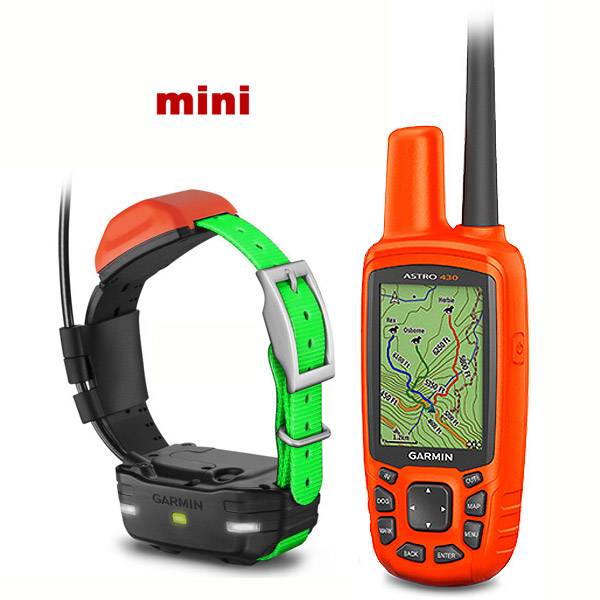
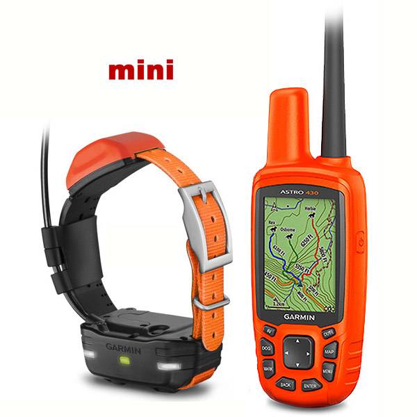
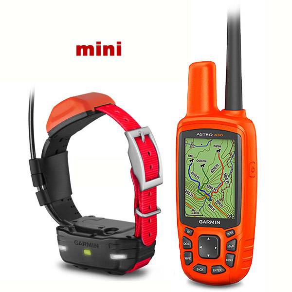
DC 40 GPS Dog Tracking Collar


Suggested Maps and Software:
 | Inland Lakes |
 | BlueChart g2, g3 on micro SD card with adapter |
 | Garmin Street Maps and City Navigation |
 | Garmin Topographic Maps |
 | Garmin Extras |
Contents of the package
Features
Click for bundle with DC 40
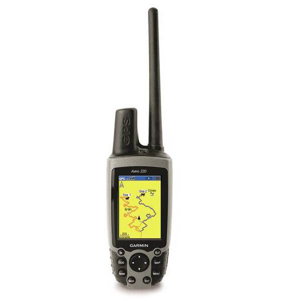
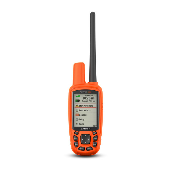
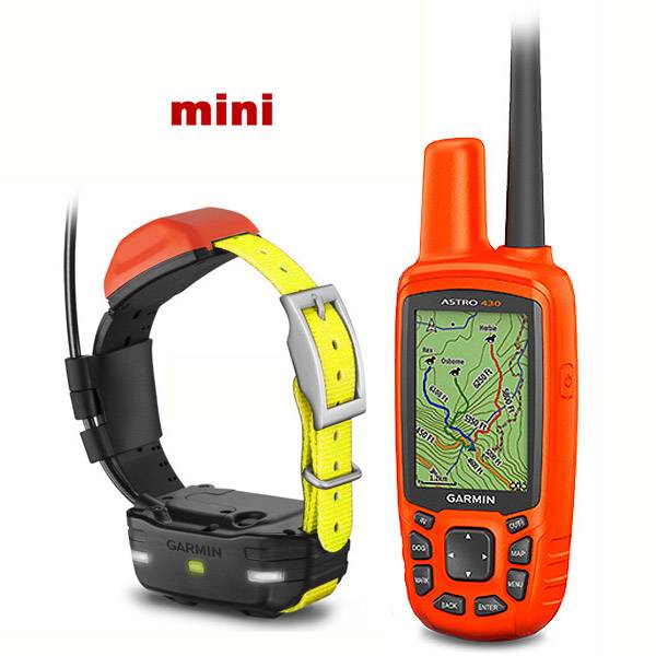
Introducing Astro, the first high sensitivity GPS-enabled dog tracking system for hunters and sportsmen. This unique system pinpoints your dogs position and shows you exactly where he is, even when you cant see or hear him.
Setup
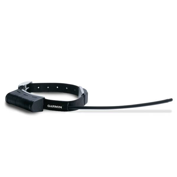
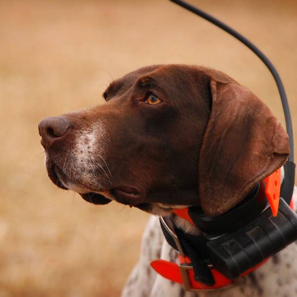
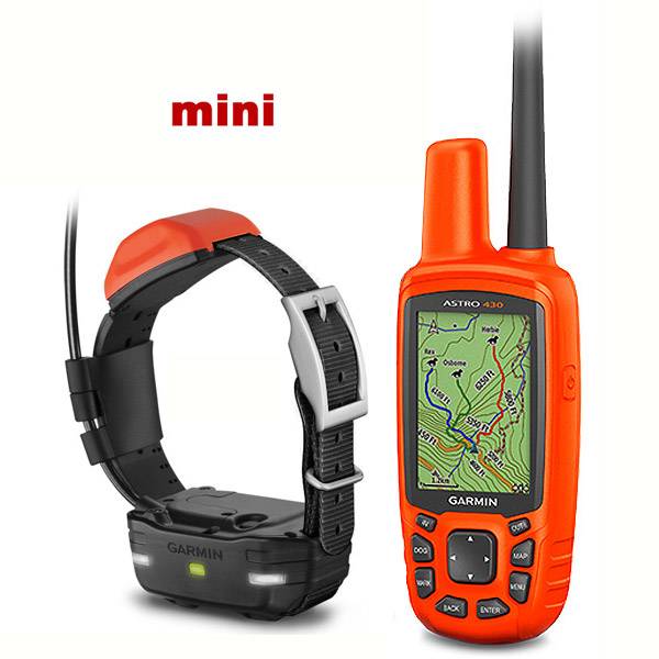
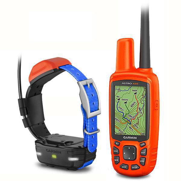
The Astro system includes a bright color-screen handheld GPS device and the rugged, all-weather DC 30 collar. The collar has an integrated GPS transmitter and is specially weighted so the antenna will always point to the sky for optimum signal. To get started, just take Astro outdoors and turn on the handheld and transmitter to acquire GPS satellite signals. Then attach the DC 30 to your dog. Now youre ready to turn him loose no other setup required.
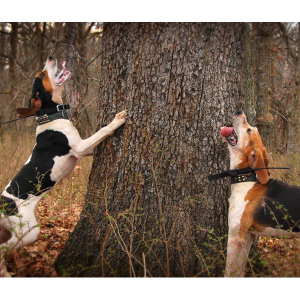
Dog Tracking
As often as every five seconds, your dogs DC 30 transmits his position to your handheld, and you can see his current location and a trail of where hes been on the Map page of your handheld. Switch over to the Dog Tracker page to view a compass pointing to your dogs location as well as his current status: whether hes running, sitting, on point or treeing quarry. Astro can also sound an alarm to let you know instantly when your dog goes on point.
Astro boasts a high-sensitivity GPS receiver that can track your dogs position even in the densest cover. You can track up to ten dogs at one time with Astro, at a distance of up to seven miles away (depending on terrain). The system transmits information by line-of-sight, so it reaches farthest in flat, open territory.
Astro lets you save other special waypoints, such as "Truck" and "Lodge," so you can save the location of these places quickly and easily for each hunt. Astro also offers special waypoint icons to represent food plots, tree stands and other hunting-related points.
Full-featured GPS
Astro shines when youre out on the hunt, but it also excels in getting you back to your truck at the end of the day, or even back home again. In fact, the Astro handheld has all the features of top-line handheld outdoor devices, including a barometric altimeter, electronic compass, microSD card slot, celestial information, area calculator and rugged, IPX7 waterproof exterior. With optional detailed city street maps, you can search for over 6 million points of interest and create a route on roads with exact turn-by-turn directions.


NOT FOR SALE IN AUSTRALIA
Specifications
Physical & Performance:
Unit dimensions, WxHxD: 2.3" x 6.3" x 1.3" (5.7 x 15.9 x 3.2 cm) (Astro 220)
Display size, WxH: 1.5" x 2.2" (3.8 x 5.6 cm)
Display resolution, WxH: 160 x 240 pixels
Display type: 256-color TFT
Weight: 6.5 oz (185 g) without batteries
Battery: 2 AA batteries (not included)
Battery life: 24 hours
Waterproof: yes (IPX7)
High-sensitivity receiver: yes
Interface: USB
Maps & Memory:
Basemap: yes
Ability to add maps: yes
Built-in memory: none
Accepts data cards: microSD card (not included)
Waypoints/favorites/locations: 1,000
Routes: 50
Track log: 10,000 points; 20 saved tracks
Features:
Automatic routing (turn by turn routing on roads): yes
Electronic compass: yes
Barometric altimeter: yes
Hunt/fish calendar: yes
Sun and moon information: yes
Area calculation: yes
Other:
Frequency band: MURS
Range: DC-20: 5 miles (line of sight)
DC-30: 7 miles (line of sight)
Additional: Tracks up to 10 dogs simultaneously
Item number: 010-00596-01
UPC: 753759080150
Package weight: 6 lb
 | Video by GPS4US |
View latest videos by GPS4US
Visit GPS4US
 Channel.
Following reviews were written by actual customers.
Every GPS4US customer has a chance to live a feedback after receiving a product.
TOP 20 DISPLAYED
 by Magdalena M, , 5/26/2012
very happy with my gps. could not go without it.
by michael Q, , 10/3/2011Hi have not received it yet,need a invoice of $89.95 for parts to clear customs in NZ,thanks Michael Quest
by MIHO S, , 8/30/2011Good goods! Good seller!
by BRUCE T, , 8/17/2011Works well in New Zealand.
by GREGORY P, , 8/5/2011fast delivery top dealer
by alex T, , 7/31/2011great price excellent service
by CHRISTIAN M, , 7/24/2011SUPER MATERIEL MAISON SERIEUSE DOMMAGE QUE LE MANUEL NET PAS EN FRANCAIS ENCORE MERCI
by NICOLE S, , 7/21/2011FANTASTIC ITEM, PROMPT DELIVERY, VERY HAPPY WITH OVERALL ORDER
by Magdalena M, , 7/15/2011Great! Very happy with my buy.
by Jarkko P, , 6/27/2011excellent choice if you love your dog and don''t wanna lose him dog in the woods
by Nicolas F, , 6/27/2011 by giuseppe R, , 6/19/2011very fast very good thank you
by ERIC V, , 6/15/2011tres bon produit de bonne qualite
by Olivier T, , 5/28/2011Very good
by BUFFAZ L, , 5/25/2011GOOG
by Leon C, , 5/25/2011thanks it a great product makes hunting great and more food for the table.also gps4us was easy to use. cheers
by francois B, , 5/13/2011Hello, Good material, easy to use and very convenient.
by André R, , 5/12/2011Très bon produit et en plus très bien présenté.
by Andre B, , 5/7/2011love it.the best
by BUFFAZ L, , 5/3/2011OK
Read all
Other Products in the Series:
| GARMIN Astro 220 bundle (Astro 220 and DC 40) | Add to comparison |
 | GARMIN Astro 220, no battery cover NOH | Add to comparison |
| GARMIN Astro 320 and DC 30 Bundle | Add to comparison |
| GARMIN Astro 320 and DC 40 Bundle | Add to comparison |
| GARMIN Astro 320 and DC 50 Bundle with 90 day wty | |
| GARMIN Astro 320 and T 5 mini Bundle T5 | |
 | GARMIN Astro 320 Pre-owned | Add to comparison |
| GARMIN Astro 320 T5 Orange T 5 Bundle | |
| GARMIN Astro 320 with Hard Carrying Case | |
| GARMIN Astro 430 and 2 x T5 Collars Bundle | |
 | GARMIN Astro 430 and 2 x T5 mini Collars | Add to comparison |
| GARMIN Astro 430 and 3 x T5 Collars Bundle | |
 | GARMIN Astro 430 and 3 x T5 mini Collars | Add to comparison |
| GARMIN Astro 430 and 4 x T5 Collars Bundle | |
| GARMIN Astro 430 and 5 x T5 Collars Bundle | |
 | GARMIN Astro 430 Handheld Only | Add to comparison |
| GARMIN Astro 430 Handheld Only, Pre-owned | Add to comparison |
| GARMIN Astro 430 Handheld, Refurbished NOH | Add to comparison |
| GARMIN Astro 430 Handheld, Used, no accessories NOH | |
| GARMIN Astro 430 Refurbished and T5 mini Dog Tracking Bundle T 5 NOH | Add to comparison |
| GARMIN Astro 430 Refurbished T5 mini Dog Tracking, Basic Accessories Bundle NOH | Add to comparison |
 | GARMIN Astro 430 T5 Black Dog Tracking Bundle T 5 | |
 | GARMIN Astro 430 T5 Blue Dog Tracking Bundle T 5 | |
 | GARMIN Astro 430 T5 Blue Dog Tracking Bundle T 5 Refurbished NOH | |
 | GARMIN Astro 430 T5 Blue Dog Tracking, Refurbished, Basic Accessories Bundle NOH | |
| GARMIN Astro 430 T5 Blue Dog Tracking, Refurbished, Warranty replacement Service NOH | |
 | GARMIN Astro 430 T5 Burgundy Dog Tracking Bundle T 5 | |
 | GARMIN Astro 430 T5 Dark Green Dog Tracking Bundle T 5 | |
 | GARMIN Astro 430 T5 Gray Dog Tracking Bundle T 5 | |
 | GARMIN Astro 430 T5 Light Green Dog Tracking Bundle T 5 | |
 | GARMIN Astro 430 T5 mini Black T 5 Bundle | Add to comparison |
 | GARMIN Astro 430 T5 mini Blue T 5 Bundle | Add to comparison |
 | GARMIN Astro 430 T5 mini Light Green T 5 Bundle | Add to comparison |
 | GARMIN Astro 430 T5 mini Orange T 5 Bundle | Add to comparison |
 | GARMIN Astro 430 T5 mini Red T 5 Bundle | Add to comparison |
 | GARMIN Astro 430 T5 mini Yellow T 5 Bundle | Add to comparison |
 | GARMIN Astro 430 T5 Orange Dog Tracking Bundle T 5 | |
 | GARMIN Astro 430 T5 Pink Dog Tracking Bundle T 5 | |
 | GARMIN Astro 430 T5 Purple Dog Tracking Bundle T 5 | |
 | GARMIN Astro 430 T5 Red Dog Tracking Bundle T 5 | |
 | GARMIN Astro 430 T5 White Dog Tracking Bundle T 5 | |
 | GARMIN Astro 430 T5 Yellow Dog Tracking Bundle T 5 | |
 | GARMIN Astro 430 T5 Yellow School Bus Dog Tracking Bundle T 5 | |
| GARMIN Astro bundle (Astro 220 and DC 20) NOH | |
| GARMIN DC 20 GPS Dog Tracking Transmitter with Harness | Add to comparison |
| GARMIN DC 30 GPS Dog Tracking Collar, Without Accessories NOH | |
 | GARMIN USED Astro 430 T5 Blue Dog Tracking, Refurbished, Used, no Accessories Bundle NOH | |
 | GARMIN Xero C1 Pro Chronograph | Add to comparison |
| GARMIN Xero C2 Chronograph | Add to comparison |