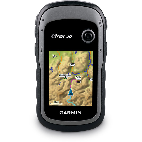
GARMIN Etrex 30


Adapters Chargers


010-10723-00US
AC Charger
AC Charger
No Longer Available


Cables


Cases and Covers

Fitness

010-10644-00
Speed/Cadence bike sensor (GSC 10)
Speed/Cadence bike sensor (GSC 10)
No Longer Available
010-10997-00
Heart rate monitor
Heart rate monitor
No Longer Available

010-10997-02
Premium Heart rate monitor Soft Strap
Premium Heart rate monitor Soft Strap
Out of stock

010-11092-30
Tempe Wireless Temperature Sensor
Tempe Wireless Temperature Sensor
No Longer Available


010-12955-00
HRM-Pro Heart Rate Monitor with Bluetooth and Running Dynamics
HRM-Pro Heart Rate Monitor with Bluetooth and Running Dynamics
No Longer Available

010-13118-00
HRM-Pro Plus Heart Rate Monitor
HRM-Pro Plus Heart Rate Monitor
No Longer Available
Kits

Mounts


RAM Mounts


RAM Mounts Build your own


RAP-299-2U
Cup Holder Universal Mount RAM-A-CAN II with 6 in Flex Arm
Cup Holder Universal Mount RAM-A-CAN II with 6 in Flex Arm
No Longer Available


Straps, Holsters, Clips


010-10404-00
Neck Lanyard
Neck Lanyard
Out of stock

013-00052-00
Lanyard 17 inch
Lanyard 17 inch
No Longer Available


010-12897-01
Carabiner clip
Carabiner clip
Out of stock

010-12668-02
Lanyard Carabiner
Lanyard Carabiner
Out of stock
Other

010-11092-20
Chirp Wireless geocaching beacon
Chirp Wireless geocaching beacon
Out of stock
010-01363-01
Virb X
Virb X
Out of stock
010-01363-11
Virb Xe
Virb Xe
No Longer Available
010-01363-11
NOH Virb XE
NOH Virb XE
Out of stock
010-01363-20
VIRB XE Cycling Bundle
VIRB XE Cycling Bundle
No Longer Available
010-01363-40
VIRB XE Auto Racing Bundle
VIRB XE Auto Racing Bundle
No Longer Available
010-01363-30
VIRB XE Aviation Bundle
VIRB XE Aviation Bundle
No Longer Available
010-01088-00
VIRB Camera
VIRB Camera
No Longer Available
010-01088-15
VIRB Elite Camera Dark
VIRB Elite Camera Dark
No Longer Available
010-01088-10
VIRB Elite Camera
VIRB Elite Camera
No Longer Available
Compatible maps
Also available


Suggested Maps and Software:
 | Inland Lakes |
 | Garmin Street Maps and City Navigation |
 | Garmin Topographic Maps |
 | Garmin Extras |
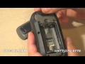
Contents of the package
- eTrex 30
- USB cable
- Manual
Features
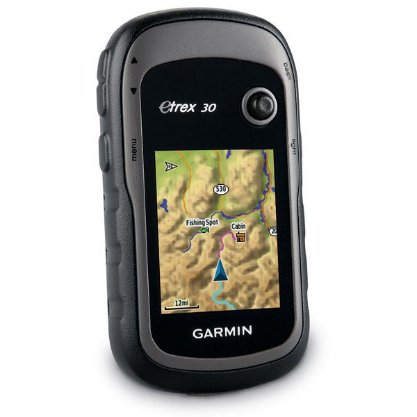
What does the eTrex 30 do? Well, for one, it improves on one of the most popular and reliable GPS handhelds. It features paperless geocaching, expanded mapping capabilities and an improved interface to create a more versatile, user-friendly eTrex, while keeping its toughness and durability intact.Tough against the weather
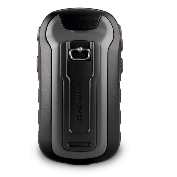
The eTrex 30 features a 2.2-inch, 65,000 color sunlight readable display. And the eTrex 30 is strong against the weather with its durable and waterproof body. Whether youre facing dust, dirt, water or humidity, the eTrex 30 is a survivor against the elements.
New tools for your trek
The eTrex 30 gives you a 3-axis tilt-compensated electronic compass which shows your heading even when you arent moving or holding it level. Garmin also included a barometric altimeter, tracking pressure changes to pinpoint your precise altitude. Plus, use your eTrex 30 to plot barometric pressure over time to tip you off to changing weather.
Mobility is key
eTrex 30s wide range of compatible mounts means you can use it on your car, motorcycle or boat, ATV or bicycle. Of course, you can also use it in your hand. The auto mount capability and City Navigator NT® maps give you turn-by-turn driving directions. Or you can use the rugged mount for your motorcycle or ATV.
The GLONASS advantage
Youve never seen this before. How do we know? Because the eTrex series are the first consumer-grade receivers that can simultaneously track both GPS and GLONASS satellites. GLONASS satellites, developed by the Russian Federation in 2012, locks on to positions an average of 20 percent faster than GPS. When using both GLONASS and GPS, the eTrex 30 can lock onto 24 more satellites than using just GPS.
Customize with your maps
The eTrex 30 features a microSD card slot and 1.7 GB of internal memory, allowing you to load TOPO 24K maps. Hit the water by plugging in BlueChart® g2 preloaded cards, and get step-by-step directions to the beach with City Navigator NT® map data. eTrex 30 supports BirdsEye Satellite Imagery (but youll need a subscription) that gives you the power to download satellite images and integrate them with your maps.
Go social
eTrex 30 allows you to let your friends know where you are and what youve found. You can share your waypoints, tracks, geocaches and routes wirelessly with other compatible Garmin GPS devices. All you have to do is press send to transfer your information.
Know where you are
Even in deep canyons or heavy cover, eTrex uses its high-sensitivity, WAAS-enabled GPS receiver and HotFix satellite prediction to find your position quickly and precisely.
Bring your geocaching to the next level
eTrex 30 is the perfect device for your geocaching adventures. It supports geocaching GPX files for downloading and storing geocaching details. eTrex 30 stores and displays key geocaching information, including location, terrain, difficulty, hints and descriptions. All you have to do is upload the GPX files to your unit. Visit OpenCaching.com to begin.
Specifications
Installed languages: English,
Spanish, French, Deutsch, Italiano, Portugues, Cesky, Dansk,
Nederlands, Norsk, Suomi, Hrvatski, Magyar, Polski, Russian, Svenska,
Turkse, Latvian, Slovak, Slovenian, Greek, Arabic, Farsi, Bulgarian, Romana.
More languages may be available through Garmin web updater.
Unit dimensions, WxHxD: 2.1" x 4.0" x 1.3" (5.4 x 10.3 x 3.3 cm)
Display size, WxH: 1.4" x 1.7" (3.5 x 4.4 cm); 2.2" diag (5.6 cm)
Display resolution, WxH: 176 x 220 pixels
Display type: transflective, 65-K color TFT
Weight: 5 oz (141.7 g) with batteries
Battery: 2 AA batteries (not included); NiMH or Lithium recommended
Battery life: 25 hours
Waterproof: yes (IPX7)
Floats: no
High-sensitivity receiver: yes
Interface: USB
Maps & Memory:
Basemap: yes
Preloaded maps: no
Ability to add maps: yes
Built-in memory: 1.7 GB
Accepts data cards: microSD card (not included)
Waypoints/favorites/locations: 2000
Routes: 200
Track log: 10,000 points, 200 saved tracks
Features & Benefits:
Automatic routing (turn by turn routing on roads): yes (with optional mapping for detailed roads)
Electronic compass: yes (tilt-compensated, 3-axis)
Touchscreen: no
Barometric altimeter: yes
Camera: no
Geocaching-friendly: yes (paperless)
Custom maps compatible: yes
Photo navigation (navigate to geotagged photos): yes
Outdoor GPS games: no
Hunt/fish calendar: yes
Sun and moon information: yes
Tide tables: yes
Area calculation: yes
Custom POIs (ability to add additional points of interest): yes
Unit-to-unit transfer (shares data wirelessly with similar units): yes
Picture viewer: no
Garmin Connect compatible (online community where you analyze, categorize and share data): yes
Item number: 010-00970-20
UPC: 753759975906
Package weight: 2 lb
 | Video by GPS4US |
 | Video by GPS4US |
View latest videos by GPS4US
Visit GPS4US
 Channel.
Product Reviews
Following reviews were written by actual customers.
Every GPS4US customer has a chance to live a feedback after receiving a product.
 by Wade W, , 4/11/2013
I''ve used it to geocache for a few days. Looking forward to trying it on a hike in the next month or so.
by gizele D, , 8/24/2012
excellent
by Cesar F Arriaga G, , 8/17/2012
excellent
 by Christopher L, , 5/22/2012
Works as advertised. Very nicely sized and comfortable to hold or mount. Fast turn on, warm up and satellite acquisition. Great for boating.
by CHANDRA SHEKHAR S, , 4/25/2012
gr8 gps, good reception and user friendly
Following reviews were written by actual customers.
Every GPS4US customer has a chance to live a feedback after receiving a product.
by Wade W, , 4/11/2013I''ve used it to geocache for a few days. Looking forward to trying it on a hike in the next month or so.
by gizele D, , 8/24/2012excellent
by Cesar F Arriaga G, , 8/17/2012excellent
by Christopher L, , 5/22/2012Works as advertised. Very nicely sized and comfortable to hold or mount. Fast turn on, warm up and satellite acquisition. Great for boating.
by CHANDRA SHEKHAR S, , 4/25/2012gr8 gps, good reception and user friendly
Other Products in the Series: