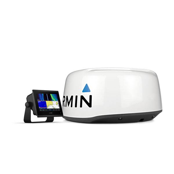
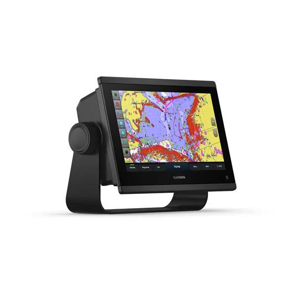
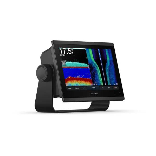
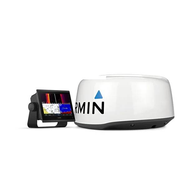
GARMIN GPSMAP 1243xsv Combo with BlueChart US g3 and Lakevu g3


This item is brand new
$2,488.95
This item ships within 1 day
|cw|sw|wi|ln


GPS 19x NMEA 2000 GPS Receiver


GXM 52 - SiriusXM Marine Receiver
GHP 10 Marine Autopilot System with GHC 20
GHP 10 Marine Autopilot System with GHC 10

GHP 10V Marine Autopilot System with GHC 10
GHP 10V Marine Autopilot System with GHC 20

GHP 12 Sailboat Autopilot System with GHC 10

GHP 20 Marine Autopilot System for Steer-by-Wire with GHC 10

GHP 20 Marine Autopilot System for Viking with GHC 10
GHP 20 Marine Autopilot System for Yamaha Helm Master with GHC 10
GHP 20 Marine Autopilot System with SmartPump and GHC 10

GHP Reactor Hydraulic Autopilot Corepack

GHP Reactor Mechanical Retrofit Solenoid Corepack

GHP Reactor Hydraulic Corepack with SmartPump

GHP Reactor Steer-by-wire Standard Corepack

GHP Reactor Steer-by-wire Corepack for Yamaha Helm Master

GHP Reactor Steer-by-wire Corepack for Viking VIPER

GHP Reactor Steer-by-wire Corepack for Volvo-Penta

GHP Compact Reactor Hydraulic Autopilot Starter Pack


GSD 26 Digital Sonar
GCV 10 SideVu DownVu CHIRP Scanning Sonar

GSD 21 Analog Sonar
GSD 22 Digital Sonar


Ais 300
Ais 600
VHF 300 Black
VHF 300 AIS Black
VHF 100 Black
VHF 100i Black
VHF 100 Silver Grey
VHF 100i International
Vhf 110
VHF 200 Black
VHF 200i Black
VHF 200 Silver Gray
VHF 200i International
VHF 210 AIS Marine Radio
VHF 300 Silver Gray
VHF 300i International
VHF 300i Black
VHF 300i AIS Black
VHF 300 AIS Silver Gray
VHF 300i AIS International


Nautix In-view Display


Split Connector 50 ft Right Angle RJ45 Plug


Panoptix PS31 Forward Transducer
Panoptix PS60 Thru-hull Down Transducer
Panoptix PS21 LiveVu Forward Transducer
Panoptix PS21-TM Forward Transom Mount Transducer


NMEA 2000 Transducer Adapter Kit

GNT 10 NMEA 2000 - ANT Transceiver
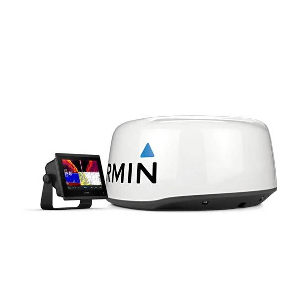
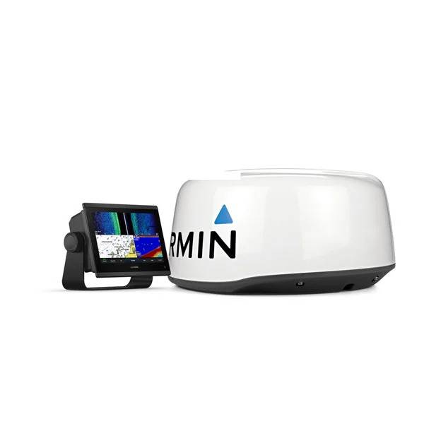
GMR 18 HD Radar
GMR 18 xHD Radar
GMR 24 xHD Radar

GMR 604 xHD Open Array and Pedestal

GMR 606 xHD Open Array and Pedestal

GMR 1204 xHD Open Array and Pedestal

GMR 1206 xHD Open Array and Pedestal

GMR 404/406 Radar Pedestal
GMR 404 Open Array Radar
GMR 406 Open Array Radar
GMR 18 Radar

GMR 24 Radar
GMR Fantom 18 Solid-state Radar
GMR Fantom 24 Solid-state Radar
GMR Fantom 4
GMR Fantom 6

GMR 18 HD Plus Radar
GMR 24 HD Radar
GMR 404 xHD Open Array Radar and Pedestal
GMR 406 xHD Open Array Radar and Pedestal

GMR 424 xHD2 Open Array Radar and Pedestal

GMR 624 xHD2 Open Array Radar and Pedestal

GMR 626 xHD2 Open Array Radar and Pedestal

GMR 1224 xHD2 Open Array Radar and Pedestal

GMR 1226 xHD2 Open Array Radar and Pedestal

GBT 10 Bennett Trim Tab Adapter


GC 10 NTSC Marine Camera
GC 10 NTSC Reverse Marine Camera

GWind, GMI 20, DST800 Bundle


GWind, GMI 20, GNX 20, DST800 Bundle

GWind, GMI 20, DST800, GNX 20 Wireless Bundle

9-axis Heading Sensor


GC 12 Marine Camera

GC 10 PAL Marine Camera
GC 10 PAL Reverse Marine Camera
GCL 20 NTSC Low-light Imaging Camera
GCT 20 QVGA 30Hz Thermal Imaging Camera
GCT 30 VGA 9Hz Thermal Imaging Camera
GCL 20 PAL Low-light Imaging Camera
GCT 20 QVGA 9Hz Thermal Imaging Camera
GCT 30 VGA 30Hz Thermal Imaging Camera

Gmi 10


GNX Wind Wired Sail Pack

GNX Wind Wireless Sail Pack

GWS 10 Wind Sensor with GMI 20 Bundle

GWS 10 Wind Sensor with GMI 20 and DST800 Bundle

GWS 10 Wind Sensor with GMI 10 and Smart Triducer Bundle
GWS 10 Wind Sensor
GWS 10 Wind Sensor with GMI 10 Bundle


GWind Wireless Transducer


GWind, GMI 20, DST800 Wireless Bundle


GNX gWind Wireless Pack


GT41-TH Thru-Hull CHIRP DownVu, SideVu, Traditional Transducer with Temp 12-pin
GT41-THP Traditional 600W, 50/200kHz, ClearVu/SideVu CHIRP 260kHz, 455kHz Pair w/Fairing Block
GT50M-TH Thru-Hull CHIRP DownVu, SideVu, CHIRP Traditional Transducer with Temp 12-pin
GT50M-THP Pair Thru-Hull CHIRP DownVu, SideVu, CHIRP Traditional Transducer with Temp 12-pin


GT40-TM Transom CHIRP DownVu, SideVu, Traditional Transducer with Temp 12-pin


M260-8G 1kW 200/50kHz In-Hull Plastic Transducer


M265LH DO 42 210 kHz 1kW CHIRP In-hull/Pocket Plastic Transducer


R599LH 2-3kW CHIRP Transducer


B175L no connector 1kW 12 tilt CHIRP Bronze Transducer
B175H no connector 1kW 20 tilt CHIRP Bronze Transducer

P72-8G 500W 77/200 kHz Transducer


B75H 0 deg tilt CHIRP Transducer


B75L 12 deg tilt CHIRP Transducer


B164 1kW 0 tilt 200/50kHz Bronze Transducer 8-pin


Wide beam bare wires 0 Tilt 150-250 kHz 1kW CHIRP Bronze Transducer
Wide beam bare wires 12 Tilt 150-250 kHz 1kW CHIRP Bronze Transducer
Wide beam bare wires 20 Tilt 150-250 kHz 1kW CHIRP Bronze Transducer
B175H no connector 1kW 0 tilt CHIRP Bronze Transducer
B175H no connector 1kW 12 tilt CHIRP Bronze Transducer
B175L 8pin 1kW 0 tilt CHIRP Bronze Transducer
B175L no connector 1kW 20 tilt CHIRP Bronze Transducer
B175M no connector 1kW 0 tilt CHIRP Bronze Transducer
B175M no connector 1kW 12 tilt CHIRP Bronze Transducer
B175M no connector 1kW 20 tilt CHIRP Bronze Transducer

B265LH CHIRP Transducer
B45-DT-8G Thru-Hull 50/200 kHz Bronz Narrow Stem 8pin Transducer

CM599 LH 2-3kW CHIRP Transducer

CM599 LM 2-3kW CHIRP Pocket Mount Transducer

PM265LM DT 42-135 kHz 1kW CHIRP Poket Bronze Transducer

R109LH 38-210 kHz 2kW CHIRP Urethane Thru-Hull Transducer

R509LH DT 28-210 kHz 2-3kW CHIRP Epoxy Thru-Hull Transducer

R509LM DT 28-130 kHz 2-3kW CHIRP Epoxy Thru-Hull Transducer

SS164 0 deg tilt 1kW Transducer 8pin

SS164 12 deg tilt 1kW Transducer 8 pin

SS164 20 deg tilt 1kW Transducer 8 pin


P32-8G DST 77/200 Khz 45/15 beam Transom Mount 8pin Triducer

TM150M 95-155 kHz Trunsom mount Plastic CHIRP 8pinTransducer
GT21-TM - Transom Mount DownVu 500W CHIRP 260/455 kHz Traditional 600W 50/200 kHz Transducer w/Temp


TM265LH DT 42-210 Khz 1kW CHIRP Urth Transom Transducer

For Garmin TM258-8G DT Cone 3-21 1kW 200/50kHz Transom 8pin Transducer


Airmar Smart Triducer, Plastic Thru, NMEA 2000

Access, Smart Transducer, P39 Transom, Temp, NMEA 2000


DT800 12 tilt NMEA2000 Smart Transducer Plastic


CV51M-THP ClearVu CHIRP SideVu Thru Hull Pair


Wireless Remote Control
Virb X
Virb Xe

GRID (Remote Input Device)
NOH Virb XE

Meteor 300 Marine Audio System

Meteor 300 Marine Audio System with Speakers
VIRB XE Cycling Bundle
VIRB XE Auto Racing Bundle
VIRB XE Aviation Bundle
VIRB Ultra 30


Suggested Maps and Software:
 | Inland Lakes |
 | BlueChart g2, g3 Vision |
 | BlueChart g2, g3 on micro SD card with adapter |
 | Garmin Extras |
 | LakeVu HD |
Contents of the package
- GPSMAP 1243xsv chartplotter
- microSD card preinstalled
- Power cable
- NMEA 2000® T-connector
- NMEA 2000 drop cable (2 meters)
- Bail mount kit with knobs
- Flush mount kit with gasket
- Protective cover
- Trim piece snap covers
- Documentation
- 8-pin transducer to 12-pin sounder adapter cable
Features
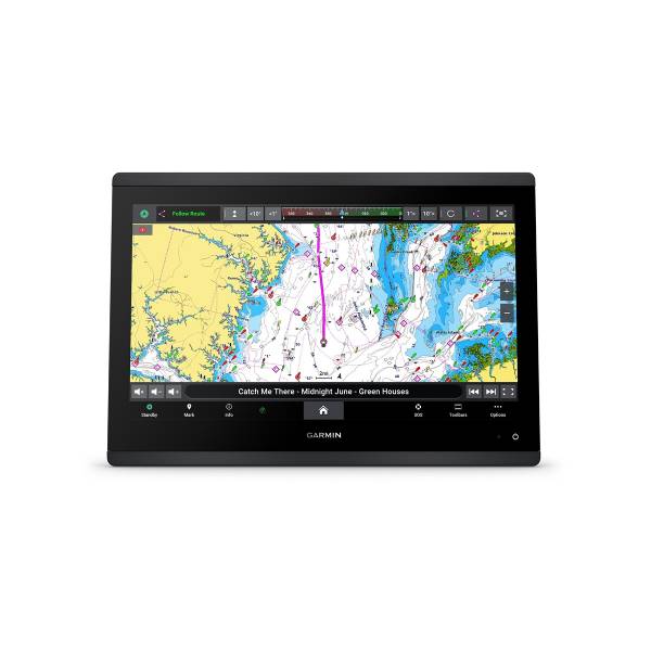
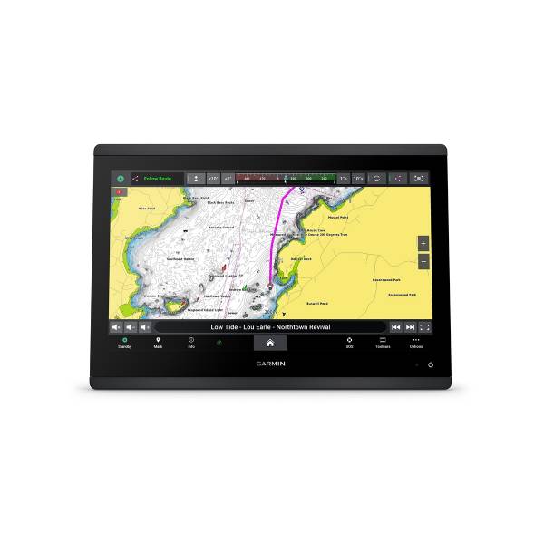
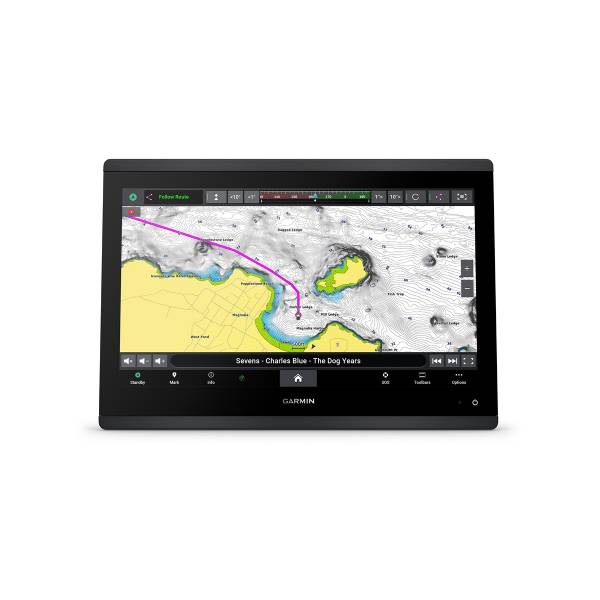
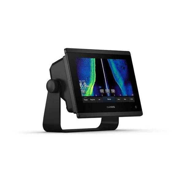
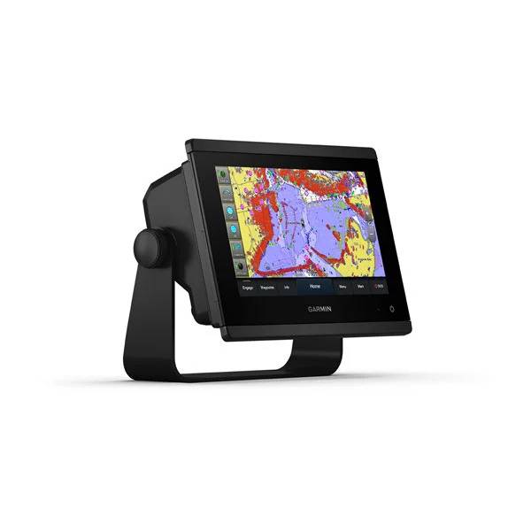
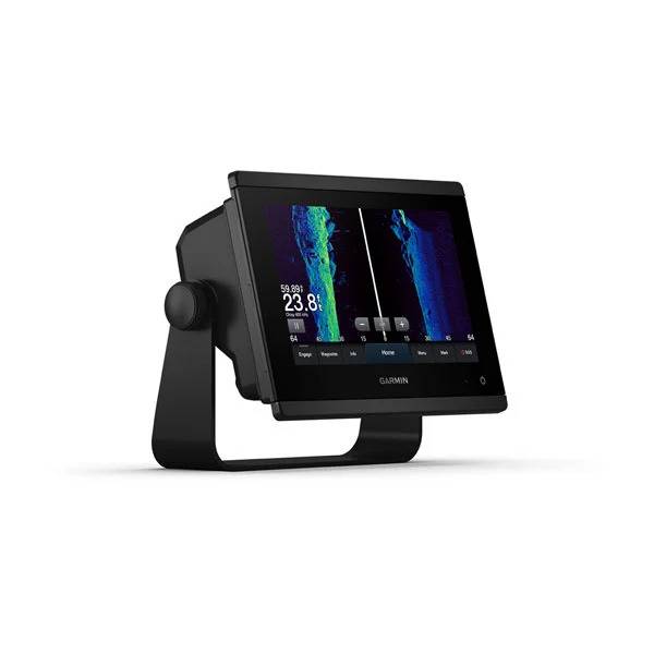
Garmin GPSMAP 1243xsv SideVü, ClearVü and Traditional CHIRP Sonar with BlueChart® g3 coastal charts and LakeVü g3
Model: 010-02367-03- Easily integrate with more engines.
- Connect to compatible third-party devices with OneHelm digital switching.
- Easily build your marine system using the best of network connectivity.
- Navigate any waters with preloaded mapping and coastal charts.
- See below your boat with built-in sonar capabilities.
- Manage your marine experience from nearly anywhere1.
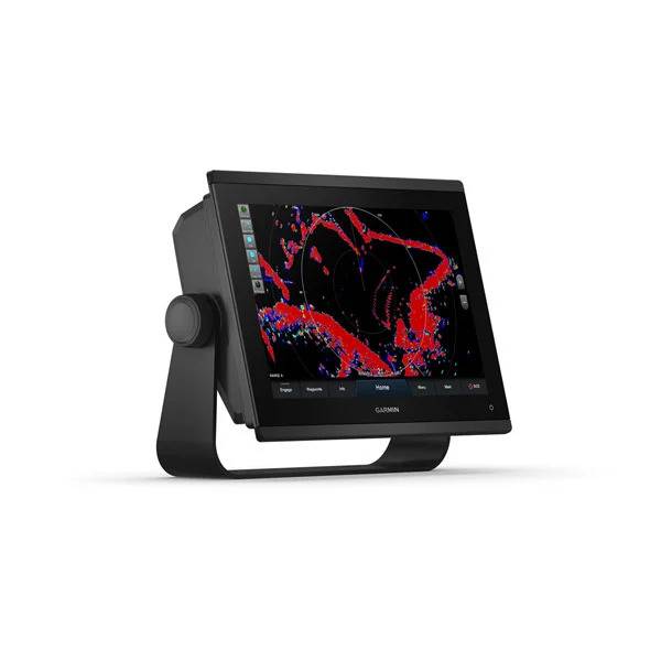
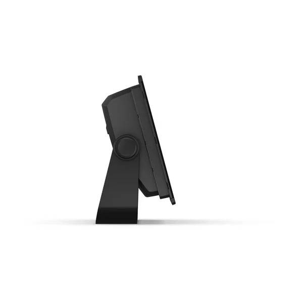
With its sleek design, powerful processing and upgraded IPS display, this advanced 12" chartplotter/sonar combo integrates seamlessly into your Garmin marine system.
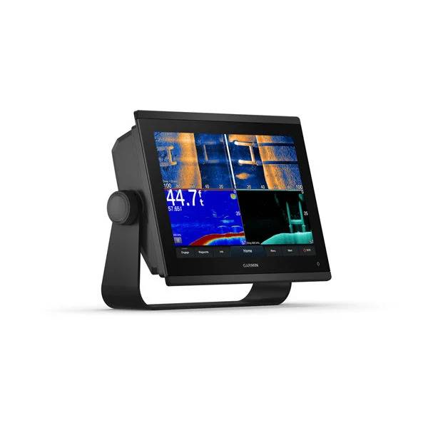
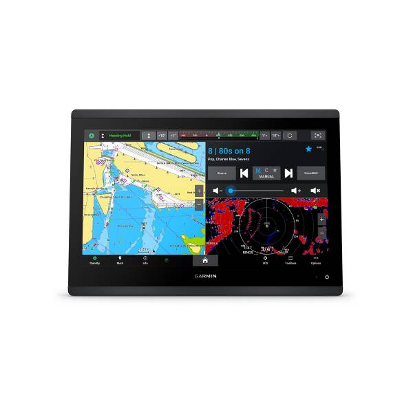
Get built-in Ultra High-Definition SideVü and ClearVü scanning sonars with vivid, high-contrast color palettes to help distinguish fish from structure. GPSMAP 1243xsv also supports 1 kW CHIRP traditional sonar capabilities.
Pair with Panoptix or Panoptix LiveScope easy-to-interpret live sonar (transducer sold separately) to see all around your boat in real time.
With its ultrasleek design, vivid sonar color palette and high-resolution 12" in-plane switching display, this large format chartplotter/sonar combo offers improved sunlight readability and wide-angle visibility.
Experience unparalleled coverage and detail with preloaded BlueChart® g3 coastal charts and LakeVü g3 inland maps featuring integrated Garmin and Navionics® content and Auto Guidance3 technology.
Upgrade to our reliable premium charts2, which add even more unparalleled features, such as high-resolution relief shading, to help you on each trip.
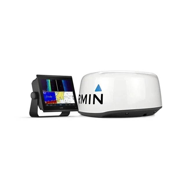
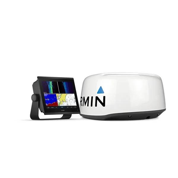
If you have multiple compatible Garmin devices on your boat, you can share information such as maps, user data, radar and IP camera video among them.
Connect to compatible autopilots, digital switching, weather, Fusion-Link audio system, media, VHF, AIS and more from one screen.
Built-in Wi-Fi® connectivity pairs with the free all-in-one mobile app for access to the OneChart feature, smart notifications2, software updates, Garmin Helm digital switching, Garmin Quickdraw Community data and more4.
Connect with some of your favorite devices, such as quatix® marine watches, gWind Wireless 2 transducers, GNX Wind marine instruments and wireless remote controls.
Now you can connect your chartplotter to different kinds of engines, including select Yamaha engines.
This exclusive feature brings together all the operations and capabilities of select third-party devices, such as EmpirBus digital switching, on one screen.
This exclusive feature brings together all the operations and capabilities of select third-party devices, such as EmpirBus digital switching, on one screen.
Specifications
| General | |
| PHYSICAL DIMENSIONS | 12.1" x 8.9" x 3.2" (30.8 x 22.8 x 8.2 cm) |
| DISPLAY SIZE | 10.3" x 6.4"; 12.1" diagonal |
| DISPLAY RESOLUTION | 1280 x 800 pixels |
| DISPLAY TYPE | WXGA display |
| WEIGHT | 6.6 lbs. (3.0 kg) |
| WATER RATING | IPX7 |
| POLARIZED SUPPORT | Yes |
| POWER CONSUMPTION | Max power usage at 10 Vdc: 26.5 W Typical current draw at 12 Vdc: 1.7 A Max current draw at 12 Vdc: 2.2 A |
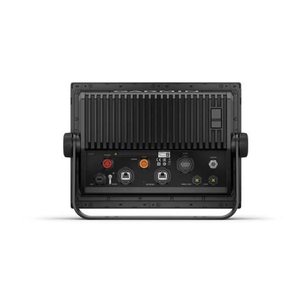
| ANTENNA | Internal or external over NMEA 2000 |
| MOUNTING OPTIONS | Bail, flush |
| RECEIVER | 10 Hz high-sensitivity |
| GARMIN MARINE NETWORK PORTS | 2 |
| Maps & Memory | |
| PRELOADED MAPS | BlueChart® g3 (coastal maps) and LakeVü g3 (inland maps) |
| ACCEPTS DATA CARDS | 2 microSD cards (back of unit) |
| WAYPOINTS | 5,000 |
| TRACK LOG | 50,000 points; 50 saved tracks |
| ROUTES | 100 |
| Outdoor Recreation | |
| TIDE TABLES | Yes |
| Chartplotter Features | |
| GARMIN RADAR COMPATIBLE | Yes |
| GARMIN SONAR COMPATIBLE | Yes (built-in) |
| GARMIN SMARTMODE COMPATIBLE (CUSTOMIZABLE MONITOR PRESETS) | Yes |
| SUPPORTS AIS (TRACKS TARGET SHIPS POSITION) | Yes |
| SUPPORTS DSC (DISPLAYS POSITION DATA FROM DSC-CAPABLE VHF RADIO) | Yes |
| SUPPORTS FUSION-LINK COMPATIBLE RADIOS | Yes |
| GSD BLACK BOX SONAR SUPPORT | Yes |
| GCV BLACK BOX SONAR SUPPORT | Yes |
| ACTIVECAPTAIN COMPATIBLE | Yes |
| GRID (GARMIN REMOTE INPUT DEVICE) COMPATIBLE | Yes |
| WIRELESS REMOTE COMPATIBLE | Yes |
| SAILING FEATURES | Yes |
| Sonar Features & Specifications | |
| DUAL-FREQUENCY (50/200 KHZ) SONAR CAPABLE | Yes |
| DUAL-BEAM (77/200 KHZ) SONAR CAPABLE | Yes |
| FREQUENCIES SUPPORTED | Traditional: 50/77/83/200 kHz CHIRP (low, medium, high) ClearVü (260/455/800 kHz) (dependent on transducer) |
| CHIRP SONAR TECHNOLOGY | Yes (Built-in) |
| CLEARVü | Yes with CHIRP (built-in) |
| SIDEVü | Yes with CHIRP (built-in) |
| MAXIMUM DEPTH | 5,000 ft at 1kW (depth capacity is dependent on water bottom type and other water conditions) |
| BOTTOM LOCK (SHOWS RETURN FROM THE BOTTOM UP) | Yes |
| WATER TEMPERATURE LOG AND GRAPH | Yes |
| SONAR RECORDING | Yes |
| SONAR HISTORY REWIND | Yes |
| Connections | |
| NMEA 2000® COMPATIBLE | Yes |
| TRANSDUCER PIN NUMBERS | 12-pin (orange) |
| NMEA 0183 INPUT PORTS | 1 (Differential) |
| NMEA 0183 OUTPUT PORTS | 1 (Differential) |
| VIDEO INPUT PORTS | 1 BNC |
| VIDEO OUTPUT PORTS | 1 HDMI |
| J1939 COMPATIBLE | Yes |
| WIRELESS CONNECTIVITY | Yes |
Item number: 010-02367-03
UPC: 753759250645
Package weight: 8.80 lb
Other Products in the Series: