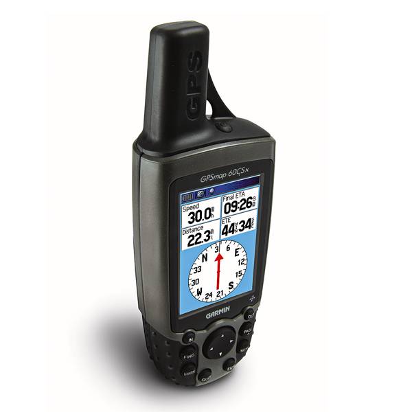
GARMIN GPSMAP 60CSx


AC adapter, USA, 4 Pin

GA 30 GPS antenna (GA 29 replacement)
GA 27C low-profile remote automobile antenna

GA 25MCX low profile remote GPS antenna


Cup Holder Universal Mount RAM-A-CAN II with 6 in Flex Arm


Suggested Maps and Software:
 | Inland Lakes |
 | BlueChart g2, g3 on micro SD card with adapter |
 | Garmin Street Maps and City Navigation |
 | Garmin Topographic Maps |
Contents of the package
Features
With all its exciting features, the GPSMAP 60CSx is sure to enhance your performance. Its high-sensitivity GPS receiver has improved satellite reception, no matter your surrounding terrain. And the barometric altimeter gives you stunningly accurate elevation data. Use the electronic compass to get your heading and direction, even when youre not moving. It also comes with a built-in Americas autoroute basemap that includes highways, exits and tide data. Plus, you get an IPX7 waterproof case and a large color TFT display.
If you want to store extra maps from the optional MapSource software, your GPSMAP 60CSx includes a blank 65 megabyte microSD card. And dont worry about getting the card slot wet, its located inside the waterproof battery compartment.


Specifications
Physical & Performance:
Unit dimensions, WxHxD: 2.4" x 6.1" x 1.3" (6.1 x 15.5 x 3.3 cm)
Display size, WxH: 1.5" x 2.2" (3.8 x 5.6 cm)
Display resolution, WxH: 160 x 240 pixels
Display type: 256 level color TFT
Weight: 7.5 oz (213 g) with batteries
Battery: 2 AA batteries (not included)
Battery life: 18 hours, typical
Waterproof: yes (IPX7)
Floats: no
High-sensitivity receiver: yes
Interface: serial and USB
RoHS version available: yes
Maps & Memory:
Basemap: yes
Preloaded maps: no
Ability to add maps: yes
Built-in memory: no
Accepts data cards: 64 MB microSD card (included)
Waypoints/favorites/locations: 1000
Routes: 50
Track log: 10,000 points, 20 saved tracks
Features:
Automatic routing (turn by turn routing on roads): yes
Electronic compass: yes
Touchscreen: no
Barometric altimeter: yes
Geocaching-friendly: yes
Outdoor GPS games: yes
Hunt/fish calendar: yes
Sun and moon information: yes
Tide tables: no
Area calculation: yes
Custom POIs (ability to add additional points of interest): yes
Unit-to-unit transfer (shares data wirelessly with similar units): no
Picture viewer: no
Item number: 010-00422-00
UPC: 753759049126
Package weight: 2 lb
Other Products in the Series:
| GARMIN Gpsmap 60 | Add to comparison |
| GARMIN Gpsmap 60Cs | Add to comparison |
| GARMIN GPSMAP 60CSx | Add to comparison |
| GARMIN GPSMAP 60Cx | Add to comparison |
| GARMIN GPSMAP 60Cx NOH |