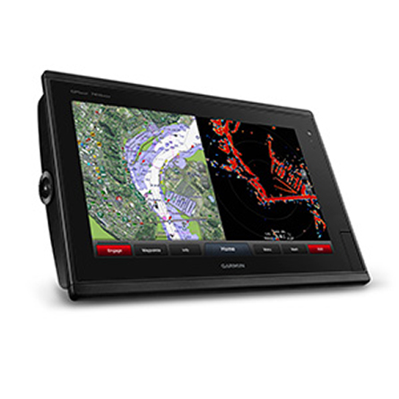
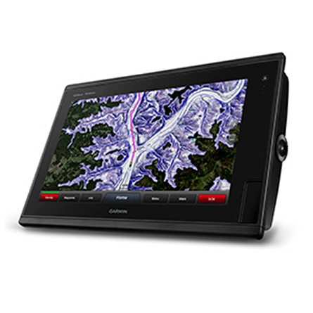
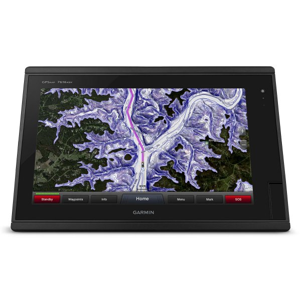
- GPSMAP 7616xsv preloaded with BlueChart® g2 and LakeVü HD coastal maps
- J1939 connector which offers a dedicated CAN port for receiving engine data
- Power/data cable
- NMEA 2000® drop cable
- T-connector
- Flush mount kit
- Protective cover
- Documentation
GARMIN GPSMAP 7616xsv J1939


Item: 010-01402-13
This item is brand new
$4,778.95
Backorder, ships in 3 - 4 weeks
|cw|sw|wi


This item is brand new
$4,778.95
Backorder, ships in 3 - 4 weeks
|cw|sw|wi
Adapters Chargers
Antennas

010-01010-10
GPS 19x NMEA 2000 GPS Receiver
GPS 19x NMEA 2000 GPS Receiver
No Longer Available

010-01146-00
GXM 52 - SiriusXM Marine Receiver
GXM 52 - SiriusXM Marine Receiver
No Longer Available
Autopilots

010-00705-05
GHP 10 Marine Autopilot System with GHC 20
GHP 10 Marine Autopilot System with GHC 20
No Longer Available

010-00705-00
GHP 10 Marine Autopilot System with GHC 10
GHP 10 Marine Autopilot System with GHC 10
No Longer Available

010-00705-20
GHP 10V Marine Autopilot System with GHC 10
GHP 10V Marine Autopilot System with GHC 10
No Longer Available

010-00705-25
GHP 10V Marine Autopilot System with GHC 20
GHP 10V Marine Autopilot System with GHC 20
No Longer Available

010-00705-30
GHP 12 Sailboat Autopilot System with GHC 10
GHP 12 Sailboat Autopilot System with GHC 10
No Longer Available

010-00705-55
GHP 20 Marine Autopilot System for Steer-by-Wire with GHC 10
GHP 20 Marine Autopilot System for Steer-by-Wire with GHC 10
No Longer Available

010-00705-56
GHP 20 Marine Autopilot System for Viking with GHC 10
GHP 20 Marine Autopilot System for Viking with GHC 10
No Longer Available

010-00705-57
GHP 20 Marine Autopilot System for Yamaha Helm Master with GHC 10
GHP 20 Marine Autopilot System for Yamaha Helm Master with GHC 10
No Longer Available

K10-00163-00
GHP 20 Marine Autopilot System with SmartPump and GHC 10
GHP 20 Marine Autopilot System with SmartPump and GHC 10
No Longer Available

010-00705-15
GHP Reactor Hydraulic Autopilot Corepack
GHP Reactor Hydraulic Autopilot Corepack
No Longer Available

010-00705-45
GHP Reactor Mechanical Retrofit Solenoid Corepack
GHP Reactor Mechanical Retrofit Solenoid Corepack
No Longer Available

010-00705-65
GHP Reactor Hydraulic Corepack with SmartPump
GHP Reactor Hydraulic Corepack with SmartPump
No Longer Available

010-00705-80
GHP Reactor Steer-by-wire Standard Corepack
GHP Reactor Steer-by-wire Standard Corepack
No Longer Available

010-00705-81
GHP Reactor Steer-by-wire Corepack for Yamaha Helm Master
GHP Reactor Steer-by-wire Corepack for Yamaha Helm Master
No Longer Available

010-00705-82
GHP Reactor Steer-by-wire Corepack for Viking VIPER
GHP Reactor Steer-by-wire Corepack for Viking VIPER
No Longer Available

010-00705-85
GHP Reactor Steer-by-wire Corepack for Volvo-Penta
GHP Reactor Steer-by-wire Corepack for Volvo-Penta
No Longer Available

010-00705-01
GHP Compact Reactor Hydraulic Autopilot Starter Pack
GHP Compact Reactor Hydraulic Autopilot Starter Pack
No Longer Available
Black Box Sounders

010-00958-00
GSD 26 Digital Sonar
GSD 26 Digital Sonar
No Longer Available

010-01156-02
GCV 10 SideVu DownVu CHIRP Scanning Sonar
GCV 10 SideVu DownVu CHIRP Scanning Sonar
No Longer Available

010-00502-00
GSD 21 Analog Sonar
GSD 21 Analog Sonar
No Longer Available

010-00397-00
GSD 22 Digital Sonar
GSD 22 Digital Sonar
No Longer Available
Cables
Cases and Covers
Communication

010-00892-00
Ais 300
Ais 300
No Longer Available

010-00865-00
Ais 600
Ais 600
No Longer Available

010-00756-10
VHF 300 Black
VHF 300 Black
No Longer Available

010-00757-10
VHF 300 AIS Black
VHF 300 AIS Black
No Longer Available

010-00754-10
VHF 100 Black
VHF 100 Black
No Longer Available
010-00754-11
VHF 100i Black
VHF 100i Black
No Longer Available

010-00754-00
VHF 100 Silver Grey
VHF 100 Silver Grey
No Longer Available
010-00754-01
VHF 100i International
VHF 100i International
No Longer Available

010-01653-00
Vhf 110
Vhf 110
No Longer Available

010-00755-10
VHF 200 Black
VHF 200 Black
No Longer Available
010-00755-11
VHF 200i Black
VHF 200i Black
No Longer Available

010-00755-00
VHF 200 Silver Gray
VHF 200 Silver Gray
No Longer Available
010-00755-01
VHF 200i International
VHF 200i International
No Longer Available

010-01654-00
VHF 210 AIS Marine Radio
VHF 210 AIS Marine Radio
No Longer Available

010-00756-00
VHF 300 Silver Gray
VHF 300 Silver Gray
No Longer Available
010-00756-01
VHF 300i International
VHF 300i International
No Longer Available
010-00756-11
VHF 300i Black
VHF 300i Black
No Longer Available
010-00757-11
VHF 300i AIS Black
VHF 300i AIS Black
No Longer Available
010-00757-00
VHF 300 AIS Silver Gray
VHF 300 AIS Silver Gray
No Longer Available
010-00757-01
VHF 300i AIS International
VHF 300i AIS International
No Longer Available
Connectors
Kits

010-01669-00
Nautix In-view Display
Nautix In-view Display
No Longer Available
Memory
Mounts
Marine Networking

010-11090-03
Split Connector 50 ft Right Angle RJ45 Plug
Split Connector 50 ft Right Angle RJ45 Plug
No Longer Available

010-01406-00
Panoptix PS60 Thru-hull Down Transducer
Panoptix PS60 Thru-hull Down Transducer
No Longer Available

010-01588-00
Panoptix PS21 LiveVu Forward Transducer
Panoptix PS21 LiveVu Forward Transducer
No Longer Available

010-01588-01
Panoptix PS21-TM Forward Transom Mount Transducer
Panoptix PS21-TM Forward Transom Mount Transducer
No Longer Available
NMEA 2000

010-11525-00
NMEA 2000 Transducer Adapter Kit
NMEA 2000 Transducer Adapter Kit
No Longer Available

010-01134-00
GNT 10 NMEA 2000 - ANT Transceiver
GNT 10 NMEA 2000 - ANT Transceiver
No Longer Available
Radars

010-00572-02
GMR 18 HD Radar
GMR 18 HD Radar
No Longer Available

010-00959-00
GMR 18 xHD Radar
GMR 18 xHD Radar
No Longer Available

K10-00012-02
GMR 604 xHD Open Array and Pedestal
GMR 604 xHD Open Array and Pedestal
No Longer Available

K10-00012-03
GMR 606 xHD Open Array and Pedestal
GMR 606 xHD Open Array and Pedestal
No Longer Available
K10-00012-04
GMR 1204 xHD Open Array and Pedestal
GMR 1204 xHD Open Array and Pedestal
No Longer Available
K10-00012-05
GMR 1206 xHD Open Array and Pedestal
GMR 1206 xHD Open Array and Pedestal
No Longer Available

010-00484-02
GMR 404/406 Radar Pedestal
GMR 404/406 Radar Pedestal
No Longer Available

010-00484-00
GMR 404 Open Array Radar
GMR 404 Open Array Radar
No Longer Available

010-00484-01
GMR 406 Open Array Radar
GMR 406 Open Array Radar
No Longer Available

010-00572-00
GMR 18 Radar
GMR 18 Radar
No Longer Available

010-00572-01
GMR 24 Radar
GMR 24 Radar
No Longer Available

010-01706-00
GMR Fantom 18 Solid-state Radar
GMR Fantom 18 Solid-state Radar
No Longer Available

K10-00012-13
GMR Fantom 4
GMR Fantom 4
No Longer Available

K10-00012-14
GMR Fantom 6
GMR Fantom 6
No Longer Available

010-01719-00
GMR 18 HD Plus Radar
GMR 18 HD Plus Radar
No Longer Available

010-00572-03
GMR 24 HD Radar
GMR 24 HD Radar
No Longer Available

K10-00012-06
GMR 404 xHD Open Array Radar and Pedestal
GMR 404 xHD Open Array Radar and Pedestal
No Longer Available

K10-00012-07
GMR 406 xHD Open Array Radar and Pedestal
GMR 406 xHD Open Array Radar and Pedestal
No Longer Available

K10-00012-08
GMR 424 xHD2 Open Array Radar and Pedestal
GMR 424 xHD2 Open Array Radar and Pedestal
No Longer Available

K10-00012-09
GMR 624 xHD2 Open Array Radar and Pedestal
GMR 624 xHD2 Open Array Radar and Pedestal
No Longer Available

K10-00012-10
GMR 626 xHD2 Open Array Radar and Pedestal
GMR 626 xHD2 Open Array Radar and Pedestal
No Longer Available

K10-00012-11
GMR 1224 xHD2 Open Array Radar and Pedestal
GMR 1224 xHD2 Open Array Radar and Pedestal
No Longer Available

K10-00012-12
GMR 1226 xHD2 Open Array Radar and Pedestal
GMR 1226 xHD2 Open Array Radar and Pedestal
No Longer Available
Sensors and Boards

010-11372-00
GC 10 NTSC Marine Camera
GC 10 NTSC Marine Camera
No Longer Available
010-11372-01
GC 10 NTSC Reverse Marine Camera
GC 10 NTSC Reverse Marine Camera
No Longer Available

010-01248-10
GWind, GMI 20, DST800 Bundle
GWind, GMI 20, DST800 Bundle
No Longer Available

010-01248-30
GWind, GMI 20, GNX 20, DST800 Bundle
GWind, GMI 20, GNX 20, DST800 Bundle
No Longer Available

010-01248-40
GWind, GMI 20, DST800, GNX 20 Wireless Bundle
GWind, GMI 20, DST800, GNX 20 Wireless Bundle
No Longer Available
010-11372-02
GC 10 PAL Marine Camera
GC 10 PAL Marine Camera
No Longer Available
010-11372-03
GC 10 PAL Reverse Marine Camera
GC 10 PAL Reverse Marine Camera
No Longer Available

010-11372-11
GCL 20 NTSC Low-light Imaging Camera
GCL 20 NTSC Low-light Imaging Camera
No Longer Available

010-11372-21
GCT 20 QVGA 30Hz Thermal Imaging Camera
GCT 20 QVGA 30Hz Thermal Imaging Camera
No Longer Available

010-11372-30
GCT 30 VGA 9Hz Thermal Imaging Camera
GCT 30 VGA 9Hz Thermal Imaging Camera
No Longer Available
010-11372-10
GCL 20 PAL Low-light Imaging Camera
GCL 20 PAL Low-light Imaging Camera
No Longer Available
010-11372-20
GCT 20 QVGA 9Hz Thermal Imaging Camera
GCT 20 QVGA 9Hz Thermal Imaging Camera
No Longer Available
010-11372-31
GCT 30 VGA 30Hz Thermal Imaging Camera
GCT 30 VGA 30Hz Thermal Imaging Camera
No Longer Available

010-00687-10
Gmi 10
Gmi 10
No Longer Available

010-01248-50
GNX Wind Wired Sail Pack
GNX Wind Wired Sail Pack
No Longer Available

010-01616-20
GNX Wind Wireless Sail Pack
GNX Wind Wireless Sail Pack
No Longer Available

010-00747-02
GWS 10 Wind Sensor with GMI 20 Bundle
GWS 10 Wind Sensor with GMI 20 Bundle
No Longer Available

010-00747-03
GWS 10 Wind Sensor with GMI 20 and DST800 Bundle
GWS 10 Wind Sensor with GMI 20 and DST800 Bundle
No Longer Available

010-00747-01
GWS 10 Wind Sensor with GMI 10 and Smart Triducer Bundle
GWS 10 Wind Sensor with GMI 10 and Smart Triducer Bundle
No Longer Available

010-00737-00
GWS 10 Wind Sensor
GWS 10 Wind Sensor
No Longer Available

010-00747-00
GWS 10 Wind Sensor with GMI 10 Bundle
GWS 10 Wind Sensor with GMI 10 Bundle
No Longer Available

010-01248-00
GWind Wireless Transducer
GWind Wireless Transducer
No Longer Available

010-01248-20
GWind, GMI 20, DST800 Wireless Bundle
GWind, GMI 20, DST800 Wireless Bundle
No Longer Available
Transducers another
Transducers Garmin 4/12/18-pin ( Transducer Guide )

010-01964-10
GT41-TH Thru-Hull CHIRP DownVu, SideVu, Traditional Transducer with Temp 12-pin
GT41-TH Thru-Hull CHIRP DownVu, SideVu, Traditional Transducer with Temp 12-pin
No Longer Available

010-01964-11
GT41-THP Traditional 600W, 50/200kHz, ClearVu/SideVu CHIRP 260kHz, 455kHz Pair w/Fairing Block
GT41-THP Traditional 600W, 50/200kHz, ClearVu/SideVu CHIRP 260kHz, 455kHz Pair w/Fairing Block
No Longer Available

010-01965-10
GT50M-TH Thru-Hull CHIRP DownVu, SideVu, CHIRP Traditional Transducer with Temp 12-pin
GT50M-TH Thru-Hull CHIRP DownVu, SideVu, CHIRP Traditional Transducer with Temp 12-pin
No Longer Available

010-01965-11
GT50M-THP Pair Thru-Hull CHIRP DownVu, SideVu, CHIRP Traditional Transducer with Temp 12-pin
GT50M-THP Pair Thru-Hull CHIRP DownVu, SideVu, CHIRP Traditional Transducer with Temp 12-pin
No Longer Available

010-01963-00
GT40-TM Transom CHIRP DownVu, SideVu, Traditional Transducer with Temp 12-pin
GT40-TM Transom CHIRP DownVu, SideVu, Traditional Transducer with Temp 12-pin
No Longer Available
Transducers Garmin 8-pin/bare wires In-hull ( Transducer Guide )

010-10641-20
M260-8G 1kW 200/50kHz In-Hull Plastic Transducer
M260-8G 1kW 200/50kHz In-Hull Plastic Transducer
No Longer Available

010-11644-20
M265LH DO 42 210 kHz 1kW CHIRP In-hull/Pocket Plastic Transducer
M265LH DO 42 210 kHz 1kW CHIRP In-hull/Pocket Plastic Transducer
No Longer Available

010-11641-30
R599LH 2-3kW CHIRP Transducer
R599LH 2-3kW CHIRP Transducer
No Longer Available
Transducers Garmin 8-pin/bare wires Thru-hull ( Transducer Guide )

010-11809-21
B175L no connector 1kW 12 tilt CHIRP Bronze Transducer
B175L no connector 1kW 12 tilt CHIRP Bronze Transducer
No Longer Available
010-11808-22
B175H no connector 1kW 20 tilt CHIRP Bronze Transducer
B175H no connector 1kW 20 tilt CHIRP Bronze Transducer
No Longer Available

010-10200-20
P72-8G 500W 77/200 kHz Transducer
P72-8G 500W 77/200 kHz Transducer
No Longer Available

B175C-12-H-8G
B175H 8pin 1kW 12 tilt CHIRP Transducer
B175H 8pin 1kW 12 tilt CHIRP Transducer
No Longer Available

010-11634-20
B75H 0 deg tilt CHIRP Transducer
B75H 0 deg tilt CHIRP Transducer
No Longer Available

010-11635-21
B75L 12 deg tilt CHIRP Transducer
B75L 12 deg tilt CHIRP Transducer
No Longer Available

B175C-0-HW
Wide beam bare wires 0 Tilt 150-250 kHz 1kW CHIRP Bronze Transducer
Wide beam bare wires 0 Tilt 150-250 kHz 1kW CHIRP Bronze Transducer
No Longer Available
B175C-12-HW
Wide beam bare wires 12 Tilt 150-250 kHz 1kW CHIRP Bronze Transducer
Wide beam bare wires 12 Tilt 150-250 kHz 1kW CHIRP Bronze Transducer
No Longer Available
B175C-20-HW
Wide beam bare wires 20 Tilt 150-250 kHz 1kW CHIRP Bronze Transducer
Wide beam bare wires 20 Tilt 150-250 kHz 1kW CHIRP Bronze Transducer
No Longer Available
010-11808-20
B175H no connector 1kW 0 tilt CHIRP Bronze Transducer
B175H no connector 1kW 0 tilt CHIRP Bronze Transducer
No Longer Available
010-11808-21
B175H no connector 1kW 12 tilt CHIRP Bronze Transducer
B175H no connector 1kW 12 tilt CHIRP Bronze Transducer
No Longer Available
010-11809-20
B175L 8pin 1kW 0 tilt CHIRP Bronze Transducer
B175L 8pin 1kW 0 tilt CHIRP Bronze Transducer
No Longer Available
010-11809-22
B175L no connector 1kW 20 tilt CHIRP Bronze Transducer
B175L no connector 1kW 20 tilt CHIRP Bronze Transducer
No Longer Available
010-11810-20
B175M no connector 1kW 0 tilt CHIRP Bronze Transducer
B175M no connector 1kW 0 tilt CHIRP Bronze Transducer
No Longer Available
010-11810-21
B175M no connector 1kW 12 tilt CHIRP Bronze Transducer
B175M no connector 1kW 12 tilt CHIRP Bronze Transducer
No Longer Available
010-11810-22
B175M no connector 1kW 20 tilt CHIRP Bronze Transducer
B175M no connector 1kW 20 tilt CHIRP Bronze Transducer
No Longer Available

010-11645-20
B265LH CHIRP Transducer
B265LH CHIRP Transducer
No Longer Available

010-10983-20
B45-DT-8G Thru-Hull 50/200 kHz Bronz Narrow Stem 8pin Transducer
B45-DT-8G Thru-Hull 50/200 kHz Bronz Narrow Stem 8pin Transducer
No Longer Available

010-11813-30
CM599 LH 2-3kW CHIRP Transducer
CM599 LH 2-3kW CHIRP Transducer
No Longer Available

010-11813-20
CM599 LM 2-3kW CHIRP Pocket Mount Transducer
CM599 LM 2-3kW CHIRP Pocket Mount Transducer
No Longer Available

010-11642-20
R109LH 38-210 kHz 2kW CHIRP Urethane Thru-Hull Transducer
R109LH 38-210 kHz 2kW CHIRP Urethane Thru-Hull Transducer
No Longer Available

010-11640-20
R509LH DT 28-210 kHz 2-3kW CHIRP Epoxy Thru-Hull Transducer
R509LH DT 28-210 kHz 2-3kW CHIRP Epoxy Thru-Hull Transducer
No Longer Available

010-11640-30
R509LM DT 28-130 kHz 2-3kW CHIRP Epoxy Thru-Hull Transducer
R509LM DT 28-130 kHz 2-3kW CHIRP Epoxy Thru-Hull Transducer
No Longer Available

010-11869-20
SS164 0 deg tilt 1kW Transducer 8pin
SS164 0 deg tilt 1kW Transducer 8pin
No Longer Available

010-11869-21
SS164 12 deg tilt 1kW Transducer 8 pin
SS164 12 deg tilt 1kW Transducer 8 pin
No Longer Available

010-11869-22
SS164 20 deg tilt 1kW Transducer 8 pin
SS164 20 deg tilt 1kW Transducer 8 pin
No Longer Available
Transducers Garmin 8-pin/bare wires Transom ( Transducer Guide )

010-11928-20
TM150M 95-155 kHz Trunsom mount Plastic CHIRP 8pinTransducer
TM150M 95-155 kHz Trunsom mount Plastic CHIRP 8pinTransducer
No Longer Available

010-12219-00
GT21-TM - Transom Mount DownVu 500W CHIRP 260/455 kHz Traditional 600W 50/200 kHz Transducer w/Temp
GT21-TM - Transom Mount DownVu 500W CHIRP 260/455 kHz Traditional 600W 50/200 kHz Transducer w/Temp
Out of stock

CM260-8G
For Garmin Cone 19/6 1kW 50/200KHz 8pin Tank-Mount Transducer
For Garmin Cone 19/6 1kW 50/200KHz 8pin Tank-Mount Transducer
No Longer Available

CM270W-8G
For Garmin Beam 25 1kW 50/200KHz 8pin Tank-Mount Wide-Beam Transducer
For Garmin Beam 25 1kW 50/200KHz 8pin Tank-Mount Wide-Beam Transducer
No Longer Available

010-11395-00
For Garmin TM260 1kW DT 200/50kHz plastic Transom Mount 6 pin Transducer
For Garmin TM260 1kW DT 200/50kHz plastic Transom Mount 6 pin Transducer
No Longer Available

010-11646-20
TM265LH DT 42-210 Khz 1kW CHIRP Urth Transom Transducer
TM265LH DT 42-210 Khz 1kW CHIRP Urth Transom Transducer
No Longer Available
Transducers Garmin Network ( Transducer Guide )

010-11051-00
Airmar Smart Triducer, Plastic Thru, NMEA 2000
Airmar Smart Triducer, Plastic Thru, NMEA 2000
No Longer Available

010-11050-20
Access, Smart Transducer, P39 Transom, Temp, NMEA 2000
Access, Smart Transducer, P39 Transom, Temp, NMEA 2000
No Longer Available

010-11105-01
DT800 12 tilt NMEA2000 Smart Transducer Plastic
DT800 12 tilt NMEA2000 Smart Transducer Plastic
No Longer Available
Various
Other

010-10878-10
Wireless Remote Control
Wireless Remote Control
Out of stock

010-01290-00
Meteor 300 Marine Audio System
Meteor 300 Marine Audio System
No Longer Available

010-01290-01
Meteor 300 Marine Audio System with Speakers
Meteor 300 Marine Audio System with Speakers
No Longer Available

010-01529-03
VIRB Ultra 30
VIRB Ultra 30
No Longer Available
Compatible maps
Suggested Maps and Software:
 | Inland Lakes |
 | BlueChart g2, g3 Vision |
 | BlueChart g2, g3 on micro SD card with adapter |
 | Garmin Extras |
 | LakeVu HD |
Contents of the package
Features
16-inch Multi-touch Widescreen Chartplotter/Sonar Combo16-inch multi-touch widescreen display (1366x768 WXGA) preloaded with both BlueChart® g2 and LakeVü HD coastal maps
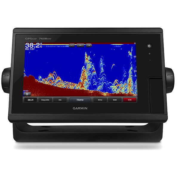
Built-in dual CHIRP sonar plus CHIRP DownVü and CHIRP SideVü scanning sonar with the clearest images on the water (transducer sold separately)
High-sensitivity internal 10 Hz GPS/GLONASS
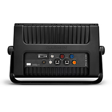
Fully network capable for Garmin Marine Network and NMEA 2000®, plus NMEA 0183 support
Supports premium GSD sonar module
Designed for sportsfishermen, cruisers, sailors and sailing racers who demand high performance, ease of operation, and feature integration in a chartplotter/sonar combo. The 16-inch multi-touch widescreen GPSMAP 7616xsv includes built-in dual CHIRP sonar plus CHIRP DownVü and CHIRP SideVü scanning sonar with the clearest images on the water. Also supports 50 kHz/200 kHz, 77 kHz/200 kHz plus Minn Kota® and MotorGuide® trolling motor transducers. Internal 10 Hz GPS updates your position and heading 10 times per second.
Fully network capable, including Garmin Network and NMEA 2000 (radar, autopilot, instruments, multiple screens, FUSION-Link, sensors, black box sonar, digital switching, thermal cameras, GRID and more), GPSMAP 7616xsv also offers the conveniences of built-in Wi-Fi® connectivity.
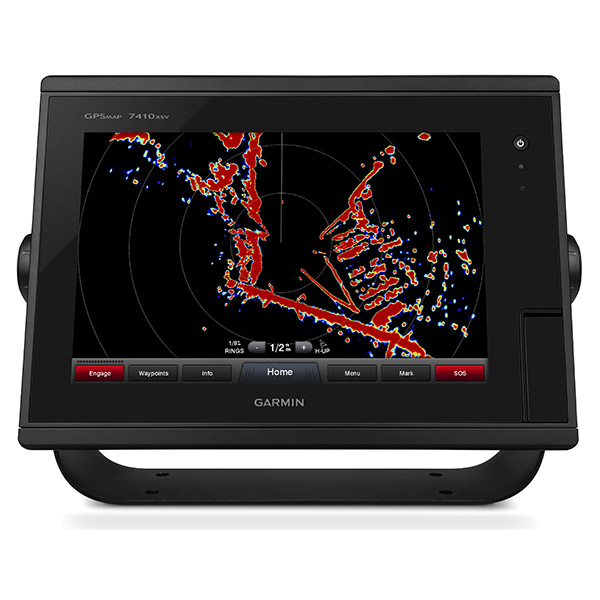
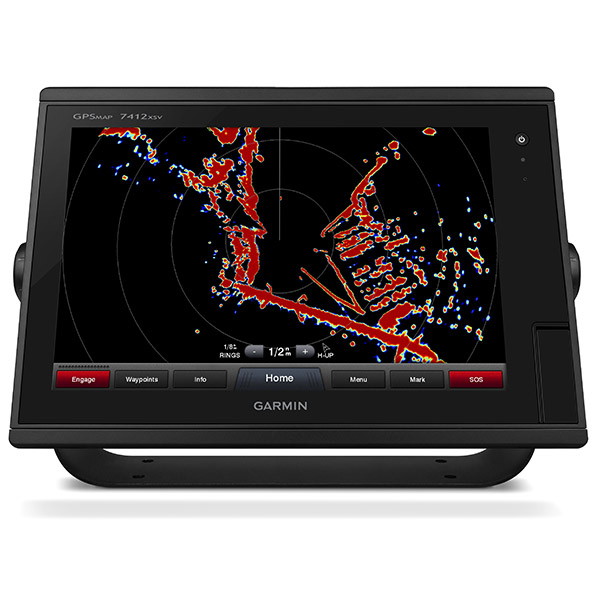
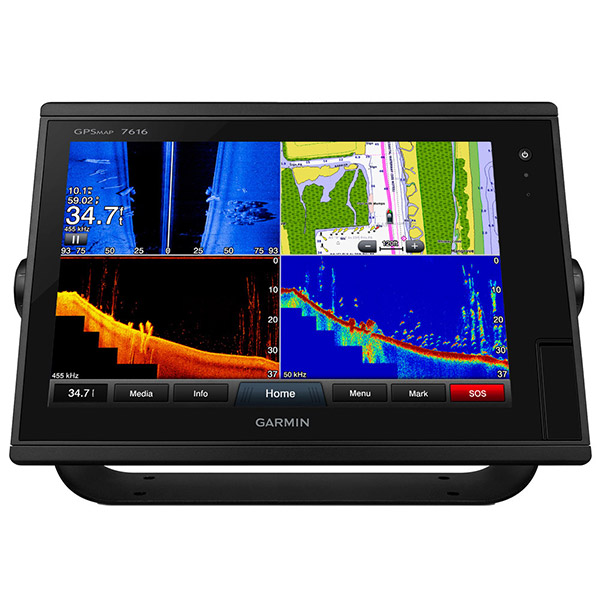
Built-in Advanced Sonar Capabilities
The built-in sonar capabilities of the GPSMAP 7616xsv include 1 kW dual CHIRP sonar, the most sophisticated sonar technology available for the fishing and boating public. It also includes both CHIRP DownVü and CHIRP SideVü scanning sonar that provide nearly photographic sonar images of fish and structure that passes below and to the sides of your boat. DownVü and SideVü provide the clearest scanning sonar images on the water. Also supported are 50 kHz/200 kHz, 77 kHz/200 kHz and Minn Kota and MotorGuide trolling motor transducers (transducers sold separately).
Garmin Marine Network and NMEA 2000 Support
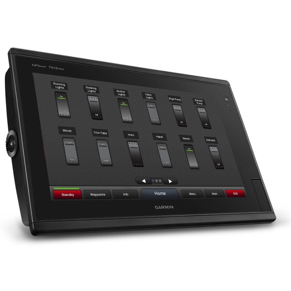
Full-network compatibility allows you to add more to your boat. GPSMAP 7616xsv supports radar, autopilot, instruments, multiple screens, FUSION-Link, sensors, remote sonar modules, digital switching, thermal cameras, GRID and more.
Add Array or Dome Radar
You can add your choice of Garmin marine radar, including our powerful xHD2 open array radars or xHD dome radars that pair ease of use with advanced open array features.
Network Sharing
GPSMAP 7616xsv allows you to share features with other compatible GPSMAP units, such as radar, supplemental maps and user data, including waypoints, routes and tracks. User data entered into 1 chartplotter can be automatically synced with other chartplotters in a network.
Heading, Position Refreshed 10 Times per Second
Fast, responsive 10 Hz GPS/GLONASS refreshes your position and heading 10 times each second to make your movement on the screen more fluid. It makes dropping up to 5,000 accurate waypoints and finding your way back them quick and easy.
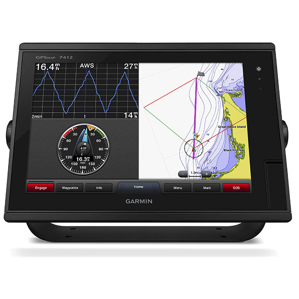
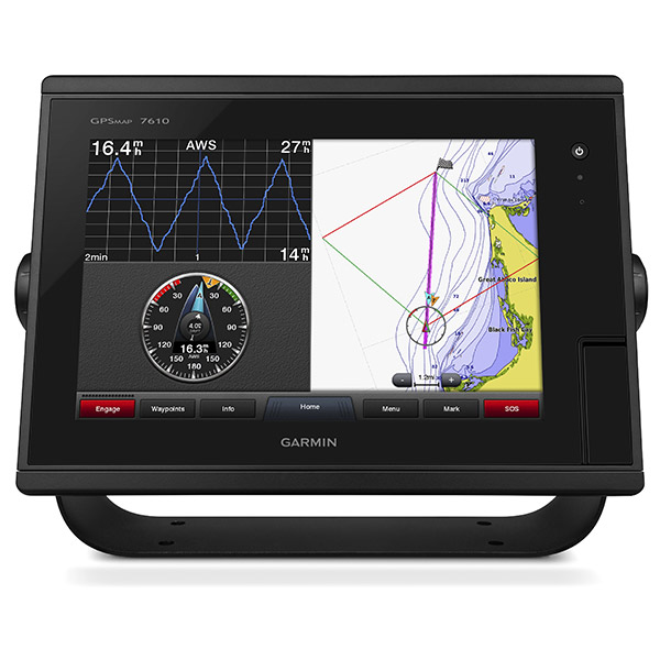
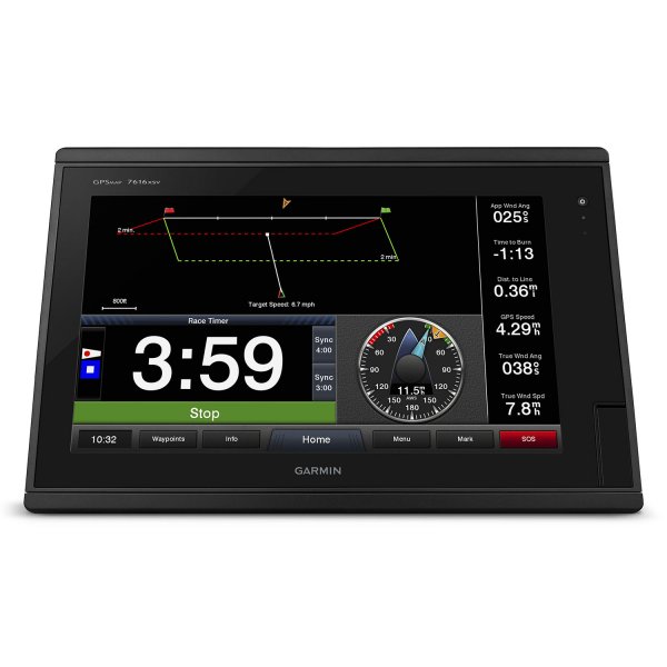
Special Sailing Features
Supported sailing features include laylines, enhanced wind rose, heading and course-over-ground lines, true wind data fields and tide/current/time slider. Racing features include pre-race guidance, synchronized race timer, virtual starting line, time to burn and lay line data fields. Gauge displays are designed to provide important need-to-know information at a glance, including true and apparent wind angle, set and drift, true or apparent wind speed, horizontal or vertical graphs, and a data bar with customizable data fields.
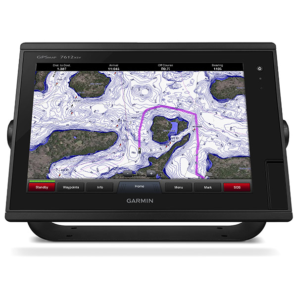
Preloaded BlueChart g2 Maps
In addition to the basic charts, tidal stations, currents, depth contours, IALA symbols and included fishing charts, BlueChart g2 offers smooth transitioning between zoom levels and more seamless continuity across chart boundaries. You can customize your screens with Safety Shading which allows you to contour shade for all depth contours shallower than what you determine is your safe depth. Fishing charts emphasize bathymetric contours with less visual clutter on the display. And theres also a choice of standard 2-D direct overhead or 3-D over-the-bow map views for easier chart reading and orientation.
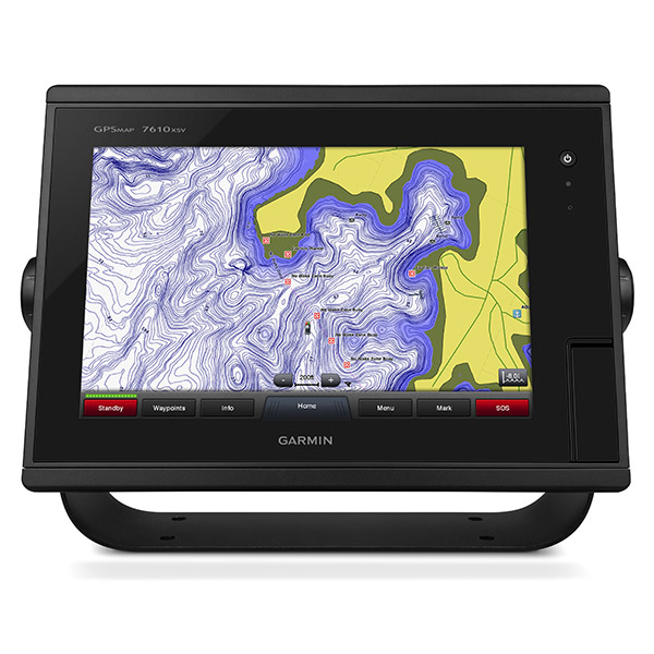
Preloaded LakeVü HD Maps
These highly detailed freshwater maps include 17,000+ U.S. lakes, rivers and reservoirs. Included in those are more than 5,700 HD lakes with 1-foot contours shoreline to shoreline; excellent detail of underwater features plus Safety Shading that allows you to designate a minimum depth; interstates, highways, general roads and bridges; designated fishing areas; and points of interest, such as docks, boat ramps, marinas and campgrounds.
Upgrade to our Best Maps on the Water
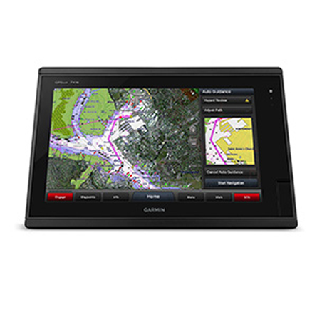
Two SD card slots provide expandable memory for accessory map purchases such as LakeVü HD Ultra with MaxDef Lakes or BlueChart g2 Vision® that add Garmin patented Auto Guidance and other great features.
GND 10 Black Box Interface
The GND 10 black box interface seamlessly integrates Nexus instruments and sensors with the Garmin family. It converts data between the Nexus network and NMEA 2000 to provide trouble-free compatibility between Nexus and Garmin products, including gWind and gWind Race transducers.
Compatible with gWind Transducers
gWind, gWind Wireless and gWind Race transducers feature twin-fin technology with 3-bladed propeller. Connect to the NMEA 2000 and compatible Garmin chartplotters via the GND 10 black box bridge.
FUSION-Link Entertainment System
Enjoy the ability to control all compatible FUSION-Link-enabled audio systems directly from your compatible chartplotter display.
Built-in Wi-Fi/ANT
Built-in Wi-Fi/ANT® for use with Garmin Helm and BlueChart® Mobile.
View, Control Your Device from a Smartphone or Tablet
Garmin Helm allows you to view and control your compatible chartplotter from a compatible smartphone or tablet while providing enhanced situational awareness for the mariner. Easily switch between portrait and landscape mode to accommodate mounting preferences. When using an iPhone® or iPad®, you can even record a movie of your chartplotter screen to share with friends and family.
Get Onboard with BlueChart Mobile
With BlueChart Mobile 2.0, a free app downloaded from the App Store, you can get reliable weather information while you plan marine routes on your iPad or iPhone then wirelessly transfer them to your boats compatible networked Garmin chartplotter. Continue acquire current weather information from your cellular-based Apple® device and stream that data onto your chartplotter screen. Even if you dont have a Garmin chartplotter, you can still take advantage of the tremendous features of BlueChart Mobile on your compatible Apple device.
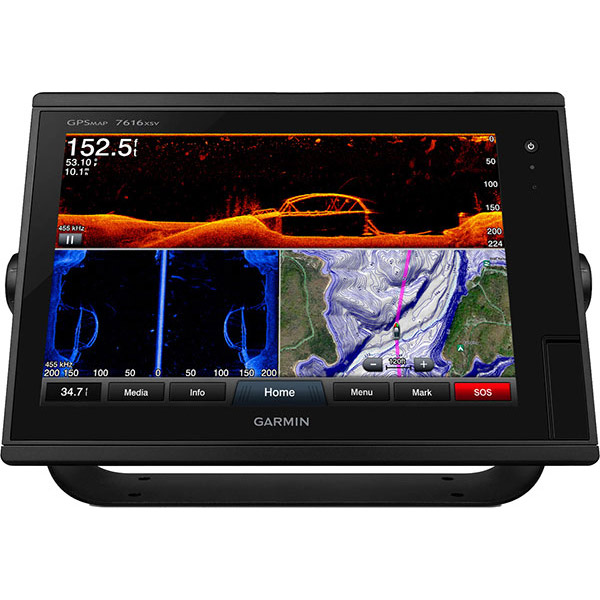
Panoptix Down Transducer
With 1 Panoptix Down transducer, you get 3 remarkable views, allowing you to actually see fish and bait swimming around under your boat in real time. You can even see fish in the water column in 3-D, from the bottom to the surface. You can be stationary yet still see things in 3-D below your boat.
LIVEVÜ DOWN
Shows real-time moving sonar images below the boat. This screen shows bait drop echo trail movement in purple with sonar history data at left.
REALVÜ 3-D DOWN
Scans the area below the boat from front to back and side to side. This screen shows a school of fish sitting against the back side of vertical face, on Pport side of boat 35 feet deep.
REALVÜ 3-D HISTORICAL
Scrolls through the data as the boat moves to show the history of entire water columns from the bottom to the surface and all of the fish in between. This screen shows the boat passing over a stream channel with a school of fish between 30 to 40 feet.
Panoptix Forward Transducer
One Panoptix Forward transducer provides 2 impressive views, even while your boat is stationary. It shows the bottom plus fish and bait swimming in the water column in front of your boat in real time. You can even see your lure as you reel it in. You can also get 3-D views of fish and structure in front of your boat.
LIVEVÜ FORWARD
Updates are provided with a single ping, providing real-time moving images of whats in the water. This screen shows a large target (a diver) approaching the boat.
REALVÜ 3-D FORWARD
Digitally scans the area in front of the boat, creating a forward-looking 3-D view of the bottom, structure and fish. This screen shows fish targets at 10 feet and drawing bottom depth of 20 feet.
iPhone and iPad are trademarks of Apple Inc., registered in the U.S. and other countries. App Store is a service mark of Apple Inc. Android and Google Play are trademarks of Google Inc.?Wi-Fi is a registered trademark of the Wi-Fi Alliance.
Specifications
Physical & Performance |
|
| Physical dimensions | 16.8" x 10.8" x 3.4" (42.7 x 27.4 x 8.6 cm) |
| Display size, WxH |
13.6" x 7.6"; 15.6" diagonal (34.5 x 19.3 cm; 39.6 cm diagonal) |
| Display resolution, WxH | 1366 x 768 pixels |
| Display type | WXGA display |
| Weight | 9.5 lbs. |
| Water rating | IPX7 |
| Antenna | Internal with external connection |
| NMEA 2000® compatible |
|
| NMEA 0183 compatible |
|
| SiriusXM Weather & Radio compatible |
|
| Power consumption |
|
| Mounting options | Flat and flush, bail with optional accessory |
| Garmin Marine Network ports |
2 |
Maps & Memory |
|
| Preloaded maps |
BlueChart® g2 (coastal maps) and LakeVü HD (inland maps) |
| Accepts data cards | 2 SD cards |
| Waypoints | 5,000 |
| Routes | 100 |
| Track log | 50,000 points; 50 saved tracks |
Chartplotter Features |
|
| Garmin Radar compatible |
|
| Garmin Sonar compatible |
Yes |
| Supports AIS (tracks target ships position) |
|
| Supports DSC (displays position data from DSC-capable VHF radio) |
|
| Tide tables |
|
| Garmin Meteor Audio System compatible |
|
| Supports Fusion-Link compatible marine radios |
|
| GSD Black Box sonar support |
|
| GCV Black Box sonar support |
|
| BlueChart® Mobile (planning) compatible |
|
| Garmin Helm compatible |
|
| GRID (Garmin Remote Input Device) compatible |
|
| Wireless remote compatible |
|
Sonar Features & Specifications |
|
| Dual-frequency (50/200 kHz) sonar capable |
|
| Dual-beam (77/200 kHz) sonar capable |
|
| Frequencies supported |
Traditional: 50/200, 77/200, 83/200 Single Channel CHIRP: 40-250 Dual Channel CHIRP: 40-250 SideVü/DownVü: CHIRP 455/800 & CHIRP 260/455 (dependent on transducer) |
| CHIRP sonar technology | Yes (Built-in) |
| DownVü |
Yes with CHIRP (built-in) |
| SideVü |
Yes with CHIRP (built-in) |
| Maximum depth | 5,000 ft at 1kW (depth capacity is dependent on water bottom type and other water conditions) |
| Bottom lock (shows return from the bottom up) |
|
| Water temperature log and graph |
|
| Sonar recording |
|
| Sonar history rewind |
|
Connections |
|
| NMEA 0183 input ports | 2 |
| NMEA 0183 output ports | 2 |
| Video input ports |
2 Composite |
| Video output ports |
1 DVI-D |
| Wireless connectivity |
|
Additional |
|
| Additional |
|
Compare products
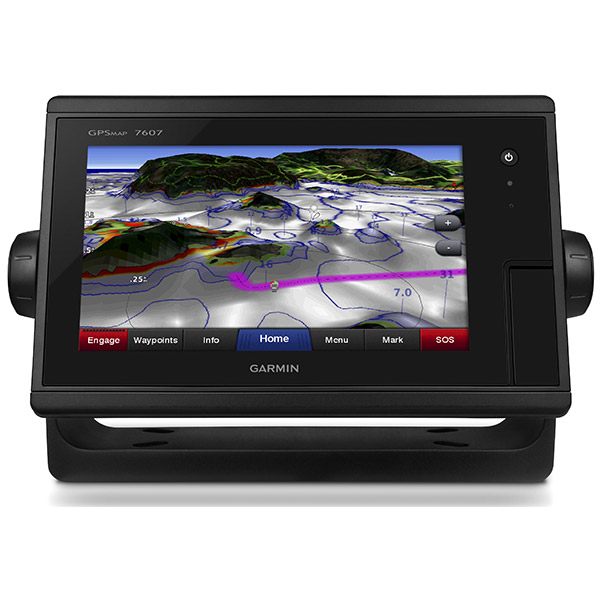
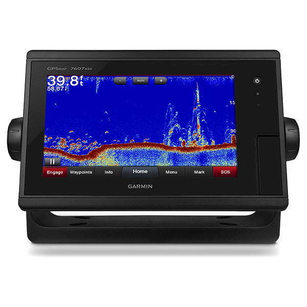
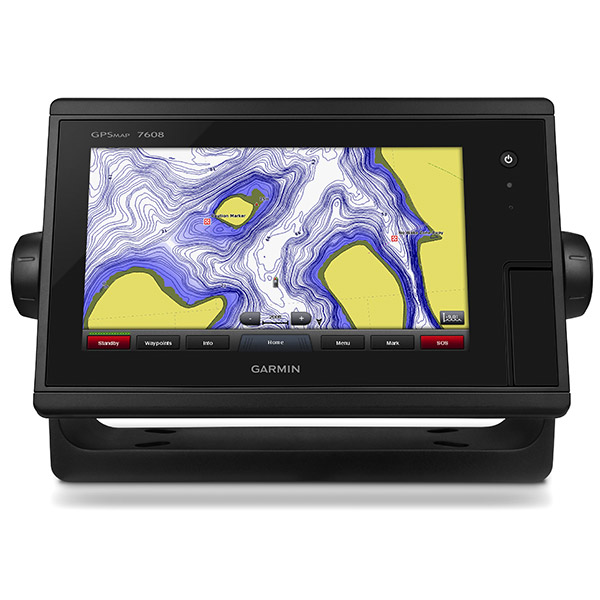
| GPSMAP 74XX / 76XX | GPSMAP 74XXxsv / 76XXxsv | |
| Hi-Res Multi-Touch Widescreen Display - Anti-Glare film & LED backlight for sunlight readability | | |
| Display Type / Resolution | 7diagonal, WVGA - 800 x 480 8 diagonal, WSVGA - 1024 x 600 10 diagonal, WXGA - 1280 x 800 12 diagonal, WXGA - 1280 x 800 16 diagonal, WXGA - 1366 x 768 | 7diagonal, WVGA - 800 x 480 8 diagonal, WSVGA - 1024 x 600 10 diagonal, WXGA - 1280 x 800 12 diagonal, WXGA - 1280 x 800 16 diagonal, WXGA - 1366 x 768 |
| Internal 10 Hz GPS Receiver | | |
| Preloaded Maps | GPSMAP 7400: Worldwide Basemap GPSMAP 7600: U.S. BlueChart g2 & U.S. LakeVü HD | GPSMAP 7400xsv: Worldwide Basemap GPSMAP 7600xsv: U.S. BlueChart g2 & U.S. LakeVü HD |
| Sonar | No internal sonar. Can display other sonar sources present on the network | Built-in Traditional, DownVü, SideVü |
| Frequencies Supported (kHz) | No internal sonar. Can display other sonar sources present on the network | Traditional: 50/200, 77/200, 83/200 (up to 1 kW) Single Channel CHIRP: 40-250 Dual Channel CHIRP: 40-250 SideVü/DownVü: CHIRP 455/800 & CHIRP 260/455 |
| Maximum Depth Capabilities | No internal sonar. Can display other sonar sources present on the network | DownVü: 750 ft SideVü: 500 ft Traditional: 5,000 ft |
| Accepts Data Cards - For optional mapping and user data storage | GPSMAP 7X07: 2 microSD cards GPSMAP 7X08, 7X10, 7X12, 7X16: 2 SD cards | GPSMAP 7X07xsv: 2 microSD cards GPSMAP 7X08sxv, 7X10, 7X12, 7X16: 2 SD cards |
| Internal Sonar Sharing | Yes - receive only | Yes - transmit and receive |
| Network Chart Sharing | | |
| Garmin Radar Compatible- Control radar via GPSMAP display | | |
| Garmin Autopilot Compatible - Control autopilot via GPSMAP display | | |
| Sounder Support - GSD 24, 25, 26, and GCV 10 | | |
| AIS and DSC Support | | |
| Utilizes Garmin SmartMode | | |
| FUSION-Link Support - Control audio via GPSMAP display | | |
| SiriusXM Weather & Radio Compatible | | |
| Camera Support - FLIR Thermal Cameras - IP Cameras | | |
| Apps - BlueChart Mobile and Garmin Helm | | |
| Wireless Connectivity | Wi-Fi / ANT | Wi-Fi / ANT |
| NMEA 2000® and NMEA 0183 | | |
| Garmin Marine Network | | |
| Inputs / Outputs - GPSMAP 7X07 / 7X08 Series | NMEA 0183 input ports: 2 NMEA 0183 output ports: 2 Video input ports: 1 Composite Video output ports: 0 Garmin Marine Network ports: 2 | NMEA 0183 input ports: 2 NMEA 0183 output ports: 2 Video input ports: 1 Composite Video output ports: 0 Garmin Marine Network ports: 2 |
| Inputs / Outputs - GPSMAP 7X10 / 7X12 Series | NMEA 0183 input ports: 2 NMEA 0183 output ports: 2 Video input ports: 2 Composite Video output ports: 1 DVI-D Garmin Marine Network ports: 2 | NMEA 0183 input ports: 2 NMEA 0183 output ports: 2 Video input ports: 2 Composite Video output ports: 1 DVI-D Garmin Marine Network ports: 2 |
| Mounting Options | GPSMAP 7, 8, 10, and 12: Bail & flush mount included GPSMAP 16: Flush mount included, bail mount optional All GPSMAP 7400/7600 series models can be flat mounted | GPSMAP 7, 8, 10, and 12: Bail & flush mount included GPSMAP 16: Flush mount included, bail mount optional All GPSMAP 7400/7600 series models can be flat mounted |
Item number: 010-01402-13
UPC: 753759132569
Package weight: 13.8 lb
Other Products in the Series: