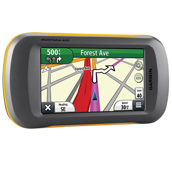
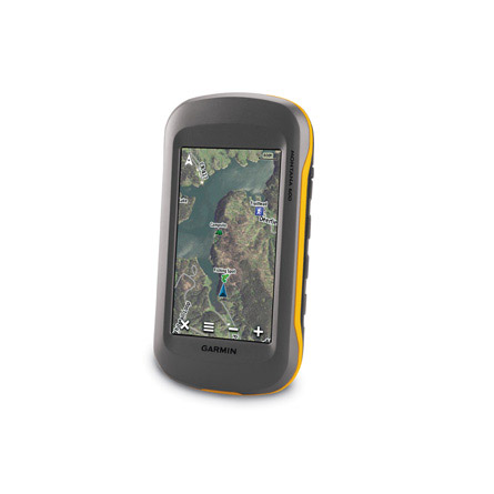
GARMIN Montana 600


GA 25MCX low profile remote GPS antenna


Lithium-Ion Battery Charger

Lithium-Ion Battery Charger


Speed/Cadence bike sensor (GSC 10)
Heart rate monitor

Premium Heart rate monitor Soft Strap

Tempe Wireless Temperature Sensor


HRM-Pro Heart Rate Monitor with Bluetooth and Running Dynamics

HRM-Pro Plus Heart Rate Monitor


Marine Mount with Power Cable


Friction Mount Kit with Speaker


Cup Holder Universal Mount RAM-A-CAN II with 6 in Flex Arm


Chirp Wireless geocaching beacon

BirdsEye Satellite Imagery Retail Card
Virb X
Virb Xe
NOH Virb XE
VIRB XE Cycling Bundle
VIRB XE Auto Racing Bundle
VIRB XE Aviation Bundle
VIRB Ultra 30
VIRB Camera
VIRB Elite Camera Dark
VIRB Elite Camera
BirdsEye Satellite Imagery US and Canada
Suggested Maps and Software:
 | Inland Lakes |
 | BlueChart g2, g3 on micro SD card with adapter |
 | Garmin Street Maps and City Navigation |
 | Garmin Topographic Maps |
 | Garmin Extras |
Contents of the package
- Montana 600
- Lithium-ion battery pack
- USB cable
- AC charger
- Quick start manuals
- Owner's manual on disk
Features
No matter what youre doing, if youre outdoors, the Montana 600 will be your guide. The 4-inch color touchscreen has a dual orientation displayand supports several mapping options like BirdsEye Satellite Imagery, BlueChart g2 and TOPO US 24k. Plus, Montana 600 boasts a 3-axis
tilt-compensated compass and barometric altimeter, so youll always know your altitude and direction. And, when youre using the Montana 600 in
your car with the separate auto mount and City Navigator NT maps, you get spoken turn-by-turn directions.
Crystal clear
Youll see everything with the Montanas 4-inch sunlight-readable touchscreen display. That means vivid colors and amazing high-resolution images.
The interface is easy to use, so youll spend more time admiring nature and less time with your head buried in your GPS. Of course, the Montana
600 is waterproof and durable enough to withstand almost anything Mother Nature can throw at it. So no matter if youre on your boat, RV, ATV or
just your hiking boots, the Montana is there for you.
Versatile, just for you
The Montana 600 is compatible with a variety of mounts, so you can use it on your ATV, in your boat, in your car or in your hand. For turn-by-turn
directions in your car, use the auto mount with City Navigator maps. Use the rugged mount for your motorcycle or ATV. Above all, dont shy away
from the terrain. The Montana 600 has the maps and mounts to get you where you need to go.
Customize your maps
Youll have zero problems adding Garmins variety of detailed topographic, marine and road maps to your Montana 600. The microSD card slot makes
sure of that. The load TOPO 24k maps and get going, or insert BlueChart g2 preloaded cards and hit your boat. If youre driving, City Navigator
map data will make your road trip easier. The Montana 600 supports subscription-based BirdsEye Satellite Imagery, so you can download satellite
images and integrate them with your maps. Plus, Montana 600 works with Custom Maps, free software that turns paper and electronic maps into
downloadable gold mines.
Go social
The Montana 600 lets you share routes, tracks, waypoints and geocaches with other compatible Garmin users. Just press send to give your friends
your favorite hikes or caches.
Know where you are
The high-sensitivity, WAAS-enabled GPS receiver and HotFix satellite prediction means the Montana 600 can tell you where you are quickly and
accurately. And, no matter your surrounding terrain, it keeps your fix.
Know your position
With a 3-axis tilt-compensated electronic compass, the Montana 600 shows your heading even when youre not moving or holding it level. Plus, the
barometric altimeter tracks changes in pressure to give you an accurate altitude. You can even use it to plot barometric pressure over time, which
helps you anticipate changes in the weather.
Twice the power
When it comes to batteries, you have options. The Montana 600 features a dual battery system that uses a rechargeable lithium-ion pack or regular
AA batteries.
A geocachers dream
Your Montana 600 supports GPX files, so you can download geocaches to your unit. Just visit OpenCaching.com to start. The Montana stores and
displays key information like difficulty, terrain, hints and descriptions.


Specifications
Installed languages: English,
Spanish, French, Deutsch, Italiano, Portugues, Cesky, Dansk,
Nederlands, Norsk, Suomi, Hrvatski, Magyar, Polski, Russian, Svenska,
Turkse, Latvian, Slovak, Slovenian, Greek, Arabic, Farsi, Bulgarian, Romana.
More languages may be available through Garmin web updater.
Unit dimensions, WxHxD: 2.9" x 5.7" x 1.4" (7.48 x 14.42 x 3.64 cm)
Display size, WxH: 2"W x 3.5"H (5.06 x 8.93 cm); 4" diag (10.2 cm)
Display resolution, WxH: 272 x 480 pixels
Display type: bright, transflective 65k color TFT, dual-orientation touchscreen; sunlight readable
Weight: 10.2 oz (289 g) with included lithium-ion battery pack; 11.7 oz (333 g) with 3 AA batteries (not included)
Battery: rechargeable lithium-ion (included) or 3 AA batteries (not included); NiMH or Lithium recommended
Battery life: up to 16 hours (lithium-ion); up to 22 hours (AA batteries)
Waterproof: yes (IPX7)
Floats: no
High-sensitivity receiver: yes
Interface: high-speed USB and NMEA 0183 compatible
Maps & Memory:
Basemap: yes
Ability to add maps: yes
Built-in memory: 3.0 GB
Accepts data cards: microSD card (not included)
Waypoints/favorites/locations: 2000
Routes: 200
Track log: 10,000 points, 200 saved tracks
Features:
Automatic routing (turn by turn routing on roads): yes (with optional mapping for detailed roads)
Electronic compass: yes (tilt-compensated, 3-axis)
Touchscreen: yes
Barometric altimeter: yes
Camera: no
Geocaching-friendly: yes (paperless)
Custom maps compatible: yes
Photo navigation (navigate to geotagged photos): yes
Outdoor GPS games: no
Hunt/fish calendar: yes
Sun and moon information: yes
Tide tables: yes
Area calculation: yes
Custom POIs (ability to add additional points of interest): yes
Unit-to-unit transfer (shares data wirelessly with similar units): yes
Picture viewer: yes
Garmin Connect compatible (online community where you analyze, categorize and share data): yes
Item number: 010-00924-00
UPC: 753759975746
Package weight: 2 lb
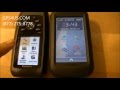
 | Video by GPS4US |
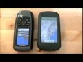
 | Video by GPS4US |
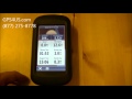
 | Video by GPS4US |
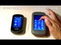
 | Video by GPS4US |
 | Video by GPS4US |
 | Video by GPS4US |
 | Video by GARMIN |
 | Video by Garmin |
View latest videos by GPS4US
Visit GPS4US
 Channel.
Following reviews were written by actual customers.
Every GPS4US customer has a chance to live a feedback after receiving a product.
 by EDUARD P, , 3/2/2016
It`s ok
 by David W, , 11/12/2015
I needed the water proof and tough design, plus the ability to load and follow tracks. But it has already needed to powered off/on 5-6 times in the first few usage. Not what I would expect for this much money.
 by Curtis G, , 2/10/2012
I like this a lot for the reasons everybody has covered. Screen brightness has been fine for me. Big Glitches:
1----On the several other Garmin units I have owned (including 76cxs), you could view the PROPERTIES of a track. That included the acreage. The Montana has no view of properties at all. You can display it on the map but that's it. No time, date, etc.
I know the data are still in there because you can transfer a Track to Mapsource and see all the properties including acreage. The only way to get acreage on the Montana is to choose a special menu item to Measure Acreage. THEN !.. you have record the acreage. Big boo boo!
2---Since everything is touch screen, you have to lock the screen before you put the unit in your pocket to avoid accidentally disturbing the display setting. That's ok. BUT... the display never turns off. So... if you walk for a couple hours, the display stays on and drains your battery. Big boo boo!
by Lorri, , 1/9/2012i am new to the GPS but friends recommended this model as it has everything for me to keep for a long time and learn on the go as the user interface is nice and easy to grasp
by Galin P, , 12/20/2011Some earlier gps models with touchscreens tended to expose calibration shift, however this Montana 600 is wonderful and works like a charm, an excellent value for the price and I like it
by Curtis G, , 11/13/2011Garmin has nailed it with this one. Nothing left wanting. The perfect product?..I think maybe it is.
by Stephen R, , 11/13/2011Love it. Used it for 2 hikes and while driving on my return home. The display is much better than my Oregon. It is much easier to see while driving also. I will be using it in China next month and during a hike across England next year. The internal battery is great. Used only 50% in 5 hours. Added many maps internally and on an SD card.
by David H, , 11/13/2011This display is higher definition than my GPSMap60Cx & the technology of the 60Cx is being phased out. Too bad as the 60Cx is MUCH, MUCH more useful & easier to use. It used to only take an annoying 30 min of tech support to get my maps unlocked with the 60Cx. The 600 took 3 hrs one day & 1.8 hrs the next day. In my 11 yrs of using Garmin GPS & maps, the 600 is a GIANT step backwards. They still seem to have the best maps of where I want to go, but the 600 & BaseCamp software are indicative that Garmin is trying to drive us away with very crummy stuff.
by Gerry B, , 10/29/2011It is fantastic. Used it on a Colorado Elk hunt and it was better and faster then previous Garmin GPS we had in the mountains
by Bruce N, , 10/19/2011Like most things about the GPS, but there seem to be some software glitches. There are times when the map goes blank, seems to be related to creating a waypoint while navigating. Menus are great and the screen is HUGE!
by Camilo D, , 10/9/2011Seems to be a fantastic unit, perhaps too customizable. My use will be primarily for roads (motorcycle). The visibility is incredible good.
by Jeremy H, , 8/24/2011Love it! Exactly what I was looking for, but when will they give up on their clunky OS and just load android on the thing?
by Wayne H, , 7/19/2011I''m still getting used to it. Easy to use. love the map and compass on the same screen in geocaching mode. Big screen for my bad eyes. Would buy another one if I lose this one.
by Bill L, , 7/14/2011Awesome unit, does everything I wanted and much more. I bought the 24K TOPO maps for my region to go with it.
by Thomas S, , 7/12/2011Fantastic. Great unit.
Other Products in the Series: