


- Montana 600t Camo
- Lithium-ion battery pack
- USB cable
- AC charger
- Manuals
GARMIN Montana 600t Camo


Item: 010-00924-21
This item is brand new
$454.95
This item ships within 1 day


This item is brand new
$454.95
This item ships within 1 day
Adapters Chargers
Antennas

010-10702-00
GA 25MCX low profile remote GPS antenna
GA 25MCX low profile remote GPS antenna
No Longer Available
Batteries

010-11921-06
Lithium-Ion Battery Charger
Lithium-Ion Battery Charger
No Longer Available

010-13153-00
Lithium-Ion Battery Charger
Lithium-Ion Battery Charger
Out of stock
Cables
Cases and Covers
Fitness

010-10644-00
Speed/Cadence bike sensor (GSC 10)
Speed/Cadence bike sensor (GSC 10)
No Longer Available
010-10997-00
Heart rate monitor
Heart rate monitor
No Longer Available

010-10997-02
Premium Heart rate monitor Soft Strap
Premium Heart rate monitor Soft Strap
Out of stock

010-11092-30
Tempe Wireless Temperature Sensor
Tempe Wireless Temperature Sensor
No Longer Available

010-12955-00
HRM-Pro Heart Rate Monitor with Bluetooth and Running Dynamics
HRM-Pro Heart Rate Monitor with Bluetooth and Running Dynamics
No Longer Available

010-13118-00
HRM-Pro Plus Heart Rate Monitor
HRM-Pro Plus Heart Rate Monitor
No Longer Available
Memory
Mounts

010-11654-06
Marine Mount with Power Cable
Marine Mount with Power Cable
Out of stock

010-12456-04
Friction Mount Kit with Speaker
Friction Mount Kit with Speaker
No Longer Available
RAM Mounts
RAM Mounts Build your own

RAP-299-2U
Cup Holder Universal Mount RAM-A-CAN II with 6 in Flex Arm
Cup Holder Universal Mount RAM-A-CAN II with 6 in Flex Arm
No Longer Available
Other

010-11092-20
Chirp Wireless geocaching beacon
Chirp Wireless geocaching beacon
Out of stock

010-11543-00
BirdsEye Satellite Imagery Retail Card
BirdsEye Satellite Imagery Retail Card
No Longer Available
010-01363-01
Virb X
Virb X
Out of stock
010-01363-11
Virb Xe
Virb Xe
No Longer Available
010-01363-11
NOH Virb XE
NOH Virb XE
Out of stock
010-01363-20
VIRB XE Cycling Bundle
VIRB XE Cycling Bundle
No Longer Available
010-01363-40
VIRB XE Auto Racing Bundle
VIRB XE Auto Racing Bundle
No Longer Available
010-01363-30
VIRB XE Aviation Bundle
VIRB XE Aviation Bundle
No Longer Available
010-01529-03
VIRB Ultra 30
VIRB Ultra 30
No Longer Available
010-01088-00
VIRB Camera
VIRB Camera
No Longer Available
010-01088-15
VIRB Elite Camera Dark
VIRB Elite Camera Dark
No Longer Available
010-01088-10
VIRB Elite Camera
VIRB Elite Camera
No Longer Available
010-11753-00
BirdsEye Satellite Imagery US and Canada
BirdsEye Satellite Imagery US and Canada
No Longer Available
Compatible maps
Suggested Maps and Software:
 | Inland Lakes |
 | BlueChart g2, g3 on micro SD card with adapter |
 | Garmin Street Maps and City Navigation |
 | Garmin Topographic Maps |
 | Garmin Extras |
Contents of the package
Features
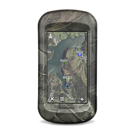
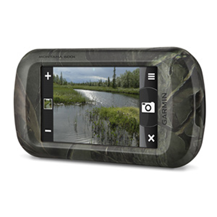
Big, Tough Camo-patterned GPS with Preloaded TOPO Maps4" dual-orientation, glove-friendly touchscreen display
Preloaded TOPO U.S. 100K maps
3-axis compass with barometric altimeter
Supports BirdsEye satellite imagery, Garmin Custom Maps and photo navigation
Uses rechargeable lithium-ion battery pack or AA batteries
Take it hiking. Take it hunting. Take it on the water. Montana 600t Camo features a bold 4" color touchscreen dual orientation display and comes preloaded with TOPO U.S. 100K maps. It supports multiple mapping options such as BirdsEye Satellite Imagery and BlueChart® g2, and has key features for the outdoors such as a 3-axis tilt-compensated compass and barometric altimeter. Buy the auto mount and a City Navigator NT® map to get spoken turn-by-turn driving directions.
See the Big View
Montana 600t Camo features a 4" sunlight-readable touchscreen display that offers crystal clear enhanced colors and displays high-resolution images. Its easy-to-use interface means youll spend more time enjoying the outdoors and less time searching for information. Both durable and waterproof, Montana 600t Camo is built to withstand the elements. Bumps, dust, dirt, humidity and water are no match for this rugged navigator.
Go Anywhere
With an array of compatible mounts, Montana is designed for use on ATVs, in boats, as a handheld or in your car. Use the auto mount with City Navigator maps for spoken, turn-by-turn driving directions, or the rugged mount for your motorcycle or ATV.
Go Everywhere
Adding more maps to Montana is easy. Plug in BlueChart® g2 preloaded cards for a great day on the water, or load City Navigator map data for turn-by-turn driving directions. Add satellite images to your maps with BirdsEye Satellite Imagery (subscription required). Or, transform paper maps into files you can download to your Montana with Custom Maps.
Share Wirelessly
With Montana 600t Camo you can share your waypoints, tracks, routes and geocaches wirelessly with other compatible Garmin GPS users. So now your friends also can enjoy your favorite hike or cache simply press send to transfer your information to similar units, and let the games begin.
Keep Your Fix
With its high-sensitivity, WAAS-enabled GPS receiver and HotFix® satellite prediction, Montana 600t Camo locates your position quickly and precisely and maintains its GPS location even in heavy cover and deep canyons. The advantage is clear whether youre in deep woods or just near tall buildings and trees, you can count on Montana 600t Camo to help you find your way when you need it the most.
Navigate with Ease
Montana 600t Camo has a built-in 3-axis tilt-compensated electronic compass, which shows your heading even when youre standing still, without holding it level. Its barometric altimeter tracks changes in pressure to pinpoint your precise altitude, and you even can use it to plot barometric pressure over time, which can help you keep an eye on changing weather conditions.
Double Your Power
Montana 600t Camo features a one-of-a-kind dual battery system. Youll have the option of using the rechargeable lithium-ion pack or traditional AA batteries whichever suits your needs better.
Find Fun
Montana 600t Camo supports geocaching GPX files for downloading geocaches and details straight to it. By going paperless, you're not only helping the environment but also improving efficiency. Montana 600 stores and displays key information, including location, terrain, difficulty, hints and descriptions, which means no more manually entering coordinates and paper print outs. Simply upload the GPX file to your device and start hunting for caches.
Plan Your Next Trip
Take charge of your next adventure with BaseCamp, software that lets you view and organize maps, waypoints, routes, and tracks. This free trip-planning software even allows you to create Garmin Adventures that you can share with friends, family or fellow explorers. BaseCamp displays topographic map data in 2-D or 3-D on your computer screen, including contour lines and elevation profiles. It also can transfer an unlimited amount of satellite images to your device when paired with a BirdsEye Satellite subscription.
Specifications
Installed languages: English,
Spanish, French, Deutsch, Italiano, Portugues, Cesky, Dansk,
Nederlands, Norsk, Suomi, Hrvatski, Magyar, Polski, Russian, Svenska,
Turkse, Latvian, Slovak, Slovenian, Greek, Arabic, Farsi, Bulgarian, Romana.
More languages may be available through Garmin web updater.
Unit dimensions, WxHxD 2.9" x 5.7" x 1.4" (7.48 x 14.42 x 3.64 cm)
Display size, WxH 2"W x 3.5"H (5.06 x 8.93 cm); 4" diag (10.2 cm)
Display resolution, WxH 272 x 480 pixels
Display type bright, transflective 65k color TFT, dual-orientation touchscreen; sunlight readable
Weight 10.2 oz (289 g) with included lithium-ion battery pack; 11.7 oz (333 g) with 3 AA batteries (not included)
Battery rechargeable lithium-ion (included) or 3 AA batteries (not included); NiMH or Lithium recommended
Battery life up to 16 hours (lithium-ion); up to 22 hours (AA batteries)
Waterproof Yes (IPX7)
Floats No
High-sensitivity receiver Yes
Interface high-speed USB and NMEA 0183 compatible
Maps & Memory:
Basemap Yes
Preloaded maps yes (topographic)
Ability to add maps Yes
Built-in memory 3.0 GB
Accepts data cards microSD card (not included)
Waypoints/favorites/locations 4000
Routes 200
Track log 10,000 points, 200 saved tracks
Features & Benefits:
Automatic routing (turn by turn routing on roads) Yes (with optional mapping for detailed roads)
Electronic compass Yes (tilt-compensated 3-axis)
Touchscreen Yes
Barometric altimeter Yes
Camera no
Geocaching-friendly Yes (Paperless)
Custom maps compatible Yes
Photo navigation (navigate to geotagged photos) Yes
Hunt/fish calendar Yes
Sun and moon information Yes
Tide tables Yes
Area calculation Yes
Custom POIs (ability to add additional points of interest) Yes
Unit-to-unit transfer (shares data wirelessly with similar units) Yes
Picture viewer Yes
Garmin Connect compatible (online community where you analyze, categorize and share data) Yes
Item number: 010-00924-21
UPC: 753759109189
Package weight: 2 lb
 | Video by GPS4US |
 | Video by GPS4US |
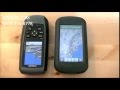 | Video by GPS4US |
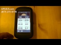 | Video by GPS4US |
View latest videos by GPS4US
Visit GPS4US
 Channel.
Other Products in the Series: