Contents of the package
- Rino 650t
- 1 year BirdsEye Satellite Imagery subscription¹
- USB cable
- Lithium-ion battery pack
- AC charger
- Carabiner clip
- Documentation
¹Software download required. Use the
included BirdsEye Satellite Imagery subscription with BaseCamp to
transfer an unlimited amount of high-resolution satellite images to the
handheld device for 1-year. Once those images have been integrated into
the device they can be accessed whenever you need them even after the
initial 1-year offer has run out. Additional BirdsEye Satellite Imagery
subscriptions can be purchased.
Features
GPS Navigator, TOPO Maps and Radio in Your Hand FRS/GMRS radio and touchscreen GPS navigator
Preloaded TOPO U.S. 100K maps and included 1-year BirdsEye Satellite Imagery subscription
5 W transmit power
High-sensitivity GPS receiver
3-axis electronic compass and barometric altimeter
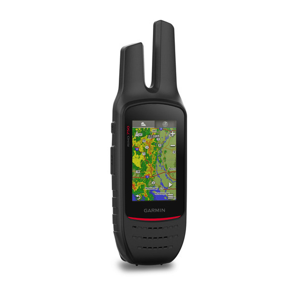
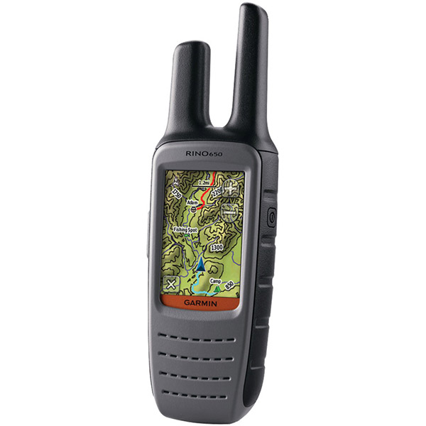
Rino 650t is an FRS/GMRS radio and touchscreen GPS navigator with preloaded TOPO U.S. 100K maps, 3-axis electronic compass, barometric altimeter and 5 W transmit power. It supports advanced mapping capabilities like BirdsEye Satellite Imagery (1-year subscription included).
Pinpoint Your PositionWith its high-sensitivity GPS receiver and quad helix antenna, Rino 650t quickly finds your position and maintains it even in heavy cover. Plus, a built-in barometric altimeter and 3-axis compass make it easy to get your bearings without the need to hold it level.
See Your SurroundingsThe device comes with preloaded TOPO U.S. 100K maps, so you can navigate with ease. Adding more maps is easy with the wide array of detailed Garmin topographic, marine and road maps. With its microSD card slot, Rino 650t lets you load TOPO U.S. 24K maps and hit the trail or plug in BlueChart® g2 preloaded cards for a great day on the water. The device also supports BirdsEye Satellite Imagery (1-year subscription included), that lets you download satellite images to your device and integrate them with your maps. In addition, Rino 650t is compatible with Custom Maps, free software that transforms paper and electronic maps into downloadable maps for your device.
Find Your FriendsRino 650t has a unique Position Reporting capability that lets you send your exact location to other Rino users so they can see it on their map page. Plus, improved audio performance means its easy to communicate with any other conventional FRS/GMRS radios in the area. It can be useful in an emergency, or just a handy way to keep tabs on your hunting party, hiking partner, family or friends.
Stay in TouchWith plenty of transmit power, Rino 650t also lets you send unit-to-unit text messages to other Rino users in your area. It's ideal for loud or windy conditions, or just when you don't want to disturb the wildlife. It also lets you share your waypoints, tracks, routes and geocaches wirelessly with other compatible Garmin handheld devices.
View Weather Watches and WarningsFor added safety, Rino 650t features a built-in NOAA weather radio that can help you avoid hazardous weather. The radio supports Specific Area Message Encoding, which allows you to see National Weather Service warnings and watches displayed county-by-county on the map screen.
Plan Your Next TripTake charge of your next adventure with BaseCamp, software that lets you view and organize maps, waypoints, routes and tracks. This free trip-planning software even allows you to create Garmin Adventures that you can share with friends, family or fellow explorers. BaseCamp displays topographic map data in 2-D or 3-D on your computer screen, including contour lines and elevation profiles. It also can transfer an unlimited amount of satellite images to your device when paired with a BirdsEye Satellite Imagery subscription (1-year subscription included).
Turn Your Computer Into a BaseStationThe all-new BaseStation lets you turn your laptop (loaded with BaseCamp) into a field command center for tracking multiple Rino units. View real-time GPS information on the larger display of your computer with Rino serving as a router/antenna. And because its Garmin GPS-based, you're in control of safer, more effective search and rescue operations, even when Internet and cell phone service isnt.
Specifications
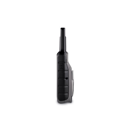
Physical & Performance |
| Physical dimensions | 2.4" x 7.5" x 1.8" (6.0 x 19.0 x 4.5 cm) |
| Display size, WxH | 1.43" x 2.15" (3.6 x 5.5 cm); 2.6" diag (6.6 cm) |
| Display resolution, WxH | 160 x 240 pixels |
| Display type | 2.6" transflective, 65K color TFT |
| Weight | 11.3 oz (320 g) with battery pack |
| Battery | removable, rechargeable lithium-ion battery pack |
| Battery life | 14 hours (up to 18 hours with optional AA battery pack) |
| Water rating | IPX7 |
| High-sensitivity receiver |
|
| Interface | high-speed USB and NMEA 0183 compatible |
| Barometric altimeter |
|
| Electronic compass | Yes (tilt-compensated 3-axis) |
| Transmit power | 0.5 watts FRS, 5.0 watts, GMRS |
Maps & Memory |
| Basemap |
|
| Preloaded maps | yes (topographic) |
| Ability to add maps |
|
| Built-in memory | 4.5 GB |
| Accepts data cards | microSD card (not included) |
| Waypoints/favorites/locations | 2000 |
| Routes | 200 |
| Track log | 10,000 points, 200 saved tracks |
Outdoor Features |
| Automatic routing (turn by turn routing on roads) |
|
| Geocaching-friendly |
|
| Hunt/fish calendar |
|
| Sun and moon information |
|
| Area calculation |
|
| Picture viewer |
|
Two-way Radio Features |
| Frequency band | FRS and GMRS |
| Channels | 22 |
| Squelch codes | 38 (CTCSS); 83 (DCS) |
| Range | Up to 2 miles over FRS; up to 20 miles over GMRS |
| VOX (voice activation) |
|
| Location reporting (send and receive GPS positions) |
|
| productSpecOtherVibration_RINO |
|
| NOAA weather radio |
|
Item number: 010-00928-10
UPC: 753759141653
Package weight: 2.2 lb


 by Leslie P, , 11/13/2016