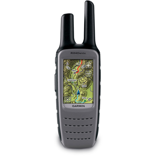
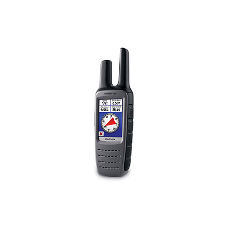
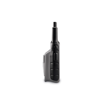
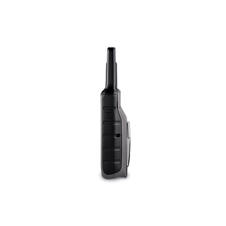
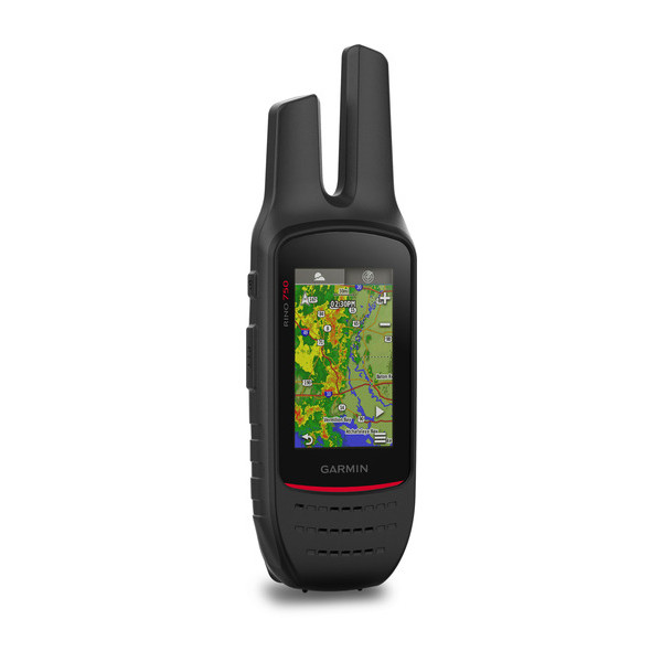
GARMIN Rino 655t


AC Charger, Open box


Li-ion Battery Pack


Premium Heart rate monitor Soft Strap

Tempe Wireless Temperature Sensor


HRM-Pro Heart Rate Monitor with Bluetooth and Running Dynamics

HRM-Pro Plus Heart Rate Monitor


Cup Holder Universal Mount RAM-A-CAN II with 6 in Flex Arm


Lanyard 17 inch


Carabiner clip

Lanyard Carabiner

Ear receiver with push-to-talk microphone

Chirp Wireless geocaching beacon

BirdsEye Satellite Imagery Retail Card

Virb X
Virb Xe
NOH Virb XE
VIRB Camera
VIRB Elite Camera Dark
VIRB XE Cycling Bundle
VIRB XE Auto Racing Bundle
VIRB XE Aviation Bundle
VIRB Ultra 30
VIRB Elite Camera
BirdsEye Satellite Imagery US and Canada

Suggested Maps and Software:
 | Inland Lakes |
 | BlueChart g2, g3 on micro SD card with adapter |
 | Garmin Street Maps and City Navigation |
 | Garmin Topographic Maps |
 | Garmin Extras |
Contents of the package
- Rino 655t
- Lithium-ion battery pack
- USB cable
- AC charger
- Carabiner clip
- Owner's manual
- Quick start guide
Features
When you receive your Rino 655t, you get a 5 W FRS GMRS radio preloaded with TOPO100k maps on a 2.6-inch glove-friendly touchscreen in vivid color. This GPS unit is
chalk full of impressive features, including a barometric altimeter, NOAA weather
radio, a 5-megapixel camera and a 3-axis compass.
Know where you are
Your Rino 655t tells you exactly where you are at all times. Thats because its quad
helix antenna and high-sensitivity GPS receiver can pinpoint your position no matter
your cover or terrain. And, the 3-axis compass and barometric altimeter let you get
your bearings even when you arent holding it level.
See whats around you
You can navigate anywhere you need to go with the preloaded TOPO 100k maps, which
include coverage of the entire United States. And, if you need more maps, you can add
them from Garmins variety of detailed topographic, marine and road maps The Rino
655ts microSD card slot allows you to download TOPO US 24k maps for a long hike. If
youre hitting the water, plug in BlueChart g2 preloaded cards. Your Rino 655t also
supports subscription-based BirdsEye Satellite imagery, which allows you to download
and integrate satellite images to your unit. Plus, the Rino 655t works with Custom
Maps, the free software that converts paper and electronic maps into downloadable
gems.
Let others know where you are
With the Rino 655ts Position Reporting feature, you can send your exact location to
other Rino users. It shows up right on their map page. Communication with other area
FRS/GMRS radios is easy with improved audio performance. The Rino 655t is the perfect
way to keep tabs on your family, friends, hunting partner or hiking party.
Go social
Wireless sharing is a standout feature of the Rino 655t. You can share your tracks,
waypoints, geocaches and routes wirelessly with compatible Garmin GPS users with ANT+
capability. You can also send text messages to other Rino users in your area, which
is perfect for when you need to be silence.
Picture this
The Rino 655t gives you a built-in 5 megapixel autofocus camera so you can capture
all the important moments of your trip. The camera automatically geotags each photo
so you can always find your way back to that location.
Know the weather
The Rino 655t helps keep you out of hazardous weather with its built-in NOAA weather
radio that supports Specific Area Message Encoding, allowing you access to National
Weather Service warnings and watches, by county.


Specifications
Installed languages: English,
French.
Physical & Performance:
Unit dimensions, WxHxD: 2.4" x 7.5" x 1.8" (6.0 x 19.0 x 4.5 cm)
Display size, WxH: 1.6" x 2.2" (4.1 x 5.6 cm); 2.6" diag (6.6 cm)
Display resolution, WxH: 160 x 240 pixels
Display type: transflective, 65-K color TFT
Weight: 11.3 oz (320 g) with battery pack
Battery: removable, rechargeable lithium-ion battery pack
Battery life: 14 hours (up to 18 hours with optional AA battery pack)
Waterproof: yes (IPX7)
High-sensitivity receiver: yes
Interface: high-speed USB and NMEA 0183 compatible
Maps & Memory:
Basemap: yes
Ability to add maps: yes
Built-in memory: 4.5 GB
Accepts data cards: microSD card (not included)
Waypoints/favorites/locations: 2000
Routes: 200
Track log: 10,000 points, 200 saved tracks
Features:
Automatic routing (turn by turn routing on roads): yes
Electronic compass: yes
Barometric altimeter: yes
Hunt/fish calendar: yes
Sun and moon information: yes
Area calculation: yes
Other:
Frequency band: FRS and GMRS
Channels: 22
Squelch codes: 38 (CTCSS); 83 (DCS)
Transmit power: 0.5 watts FRS, 2.0 watts GMRS (Canada), 5.0 watts, GMRS (US)
Range: Up to 2 miles over FRS; up to 20 miles over GMRS
VOX (voice activation): yes
Location reporting (send and receive GPS positions): yes
Vibration alert: yes
NOAA weather radio: yes
External temperature recording: no
Additional: Preloaded maps: yes (topographic)
Camera: yes (5 megapixel with autofocus; 4x digital zoom; automatic geo-tagging)
Picture viewer: yes
Unit-to-unit transfer and ANT+ compatible: yes (HR monitor and cadence sensor supported)
Item number: 010-00928-02
UPC: 753759975807
Package weight: 2.5 lb
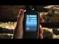
 | Video by GPS4US |
 | Video by Garmin |
 | Video by Garmin |
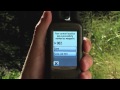 | Video by Garmin |
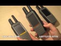 | Video by GPS4US |
 | Video by GPS4US |
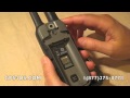
View latest videos by GPS4US
Visit GPS4US
 Channel.
Following reviews were written by actual customers.
Every GPS4US customer has a chance to live a feedback after receiving a product.
 by marc H, , 9/17/2013
nice easy to use
by marc H, , 7/15/2013i like and its frendly user
by Stephen B, , 7/8/2013works great
by KARL S, , 5/16/2013Love it!!!
by Yerbolat K, , 3/7/2013great device! great doing business with gps4us.
by STEPHANE J, , 3/5/2013thank you its exactly the good stuff!
by DAVE A, , 1/5/2013Haven''t used it yet
by GERARDO A Q, , 11/13/2012Excelent product!!
by Glen J, , 5/14/2012works great and seemed easy to get up and working
by JULIO CESAR L, , 1/9/2012excelent product I am very happy! I
by Dean D, , 12/27/2011:-)
 by toby J, , 10/18/2011
Took a little to figure out at first. Had a 130 before. But works well.
Other Products in the Series:
| GARMIN Rino 110 | Add to comparison |
| GARMIN Rino 120 | Add to comparison |
| GARMIN Rino 130 | Add to comparison |
| GARMIN Rino 520 | |
| GARMIN Rino 520HCx | Add to comparison |
| GARMIN Rino 530 | |
| GARMIN Rino 530HCx | Add to comparison |
| GARMIN Rino 530HCx NOH | |
| GARMIN Rino 610 | Add to comparison |
| GARMIN Rino 610 NOH | |
| GARMIN Rino 650 NOH | |
| GARMIN Rino 650 | Add to comparison |
| GARMIN Rino 650t | Add to comparison |
| GARMIN Rino 650t REFURBISHED NOH | |
| GARMIN Rino 655t NOH | |
| GARMIN Rino 750 NOH | |
 | GARMIN Rino 750 | Add to comparison |
| GARMIN Rino 750, Refurb NOH | Add to comparison |
| GARMIN Rino 755T | Add to comparison |
| GARMIN Rino 755t Referb. NOH |