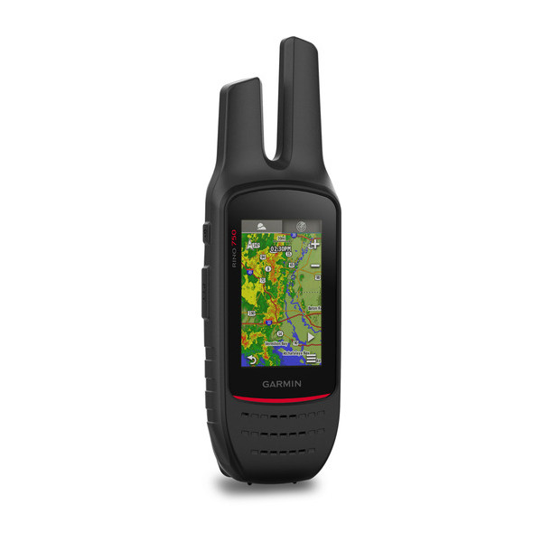
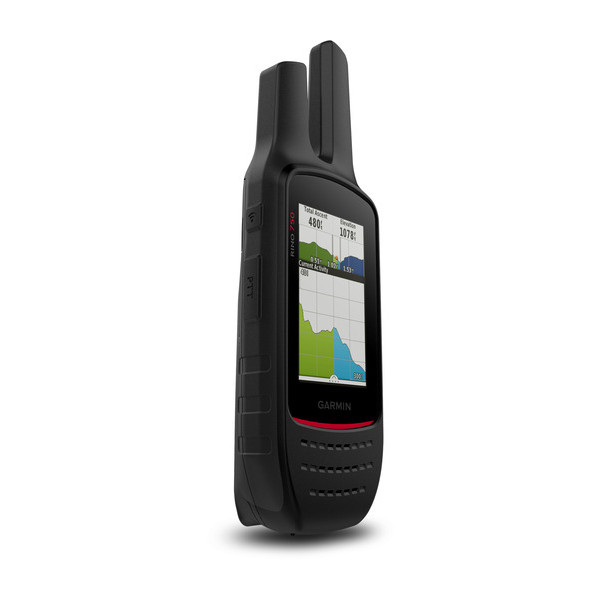
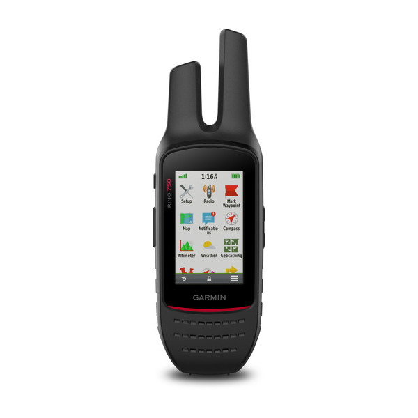
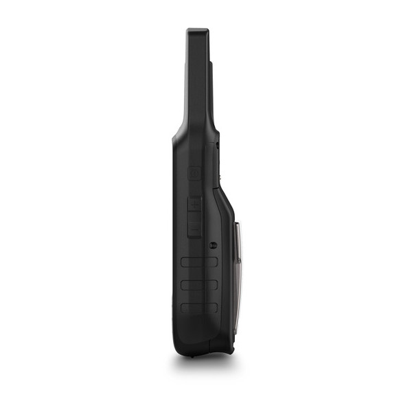
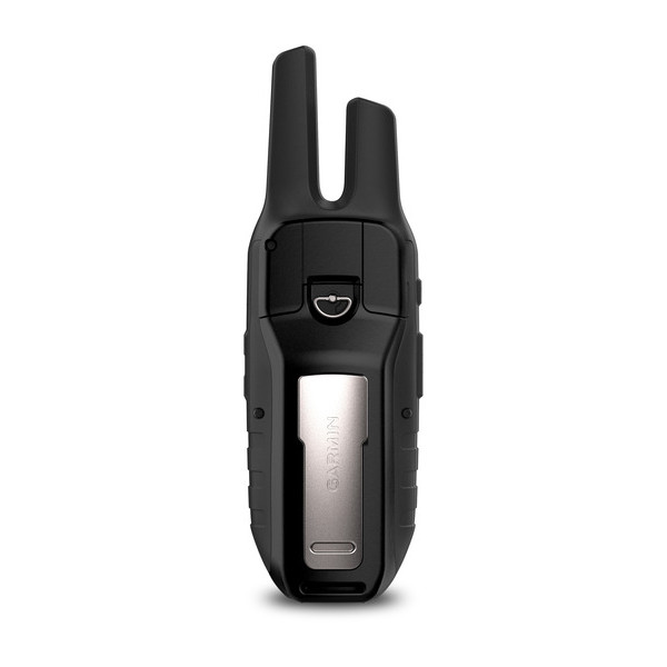
GARMIN Rino 750


This item is brand new
$519.95
Request price match
Backorder, ships in 3 - 4 weeks
|sw


AC Charger, Open box


Premium Heart rate monitor Soft Strap

Tempe Wireless Temperature Sensor


HRM-Pro Heart Rate Monitor with Bluetooth and Running Dynamics

HRM-Pro Plus Heart Rate Monitor


Cup Holder Universal Mount RAM-A-CAN II with 6 in Flex Arm


Lanyard 17 inch


Carabiner clip

Lanyard Carabiner

Ear receiver with push-to-talk microphone

Chirp Wireless geocaching beacon

BirdsEye Satellite Imagery Retail Card

Virb X
Virb Xe
NOH Virb XE
VIRB Camera
VIRB Elite Camera Dark
VIRB XE Cycling Bundle
VIRB XE Auto Racing Bundle
VIRB XE Aviation Bundle
VIRB Ultra 30
VIRB Elite Camera
BirdsEye Satellite Imagery US and Canada
Suggested Maps and Software:
 | Inland Lakes |
 | BlueChart g2, g3 on micro SD card with adapter |
 | Garmin Street Maps and City Navigation |
 | Garmin Topographic Maps |
 | Garmin Extras |
Contents of the package
- Rino 750
- Lithium-ion battery pack
- USB cable
- AC charger
- Carabiner clip
- Documentation
Features
5 W GMRS two-way radio offers extended range, up to 20 miles; communicate by voice or unit-to-unit text messaging
High-sensitivity GPS and GLONASS satellite reception; tracks in more challenging environments than GPS alone
Position reporting feature shows locations of other Rino users on the same channel; lets them know where to find you in an emergency1
3 sunlight-readable touchscreen with dual orientation (landscape or portrait view)
Dual battery system provides up to 14 hours between charges on lithium-ion pack or up to 18 hours with optional AA batteries (sold separately)
Combining map-guided trail navigation with two-way radio communication, the Rino 750 and 755t handhelds bring a whole new level of confidence to your outdoor adventures. Both models feature a unique position reporting capability that lets you send your exact location to other Rino users so they can see it on their map displays.
Communicate by Voice or Text
Both Rino 750 and 755t models feature powerful 5 W GMRS two-way radios that lets you easily stay in touch with your fellow hunters, hikers or explorers in the field. You can also maintain nonverbal contact by exchanging unit-to-unit text messages with other Rino users in your area.
Pinpoint Your Position
Dual GPS and GLONASS satellite reception enables our Rino series handhelds to accurately track and maintain your position even in heavy cover, deep canyons or remote, off-the-grid locations. Each Rino also lets you share your waypoints, tracks, routes and geocaches wirelessly with other compatible Garmin handheld devices. A built-in barometric altimeter and 3-axis compass make it easy to get your bearings. And both Rino 750 and 755t support advanced mapping capabilities such as BirdsEye Satellite Imagery. In addition, Rino 755t comes with an 8-megapixel camera plus preloaded TOPO 100K mapping for an even more detailed view of the terrain.
See Your Surroundings
Both the Rino 750 and 755t handhelds come with a worldwide shaded-relief basemap. With our wide array of detailed topographic, marine and road maps available, its easy to install additional mapping products. Just use the units microSD card slot to load the compatible mapping options you want. Or you can use our free Custom Maps software to transform paper and electronic maps into downloadable maps for your device.
Keep a Close Eye on the Weather
With support for Active Weather forecasts and animated radar tracking, Rino 750 and 755t give you a vital edge in weather awareness. Get real-time conditions, forecasts and alerts (in areas with coverage) directly on your handheld display when the Rino is paired with a compatible smartphone¹ and the Garmin Connect Mobile app. For added situational awareness, a built-in NOAA weather radio supports Specific Area Message Encoding, which allows you to see National Weather Service warnings and watches displayed county-by-county on the map screen.
Wireless Connectivity Features
Syncing your Rino 750 or 755t handhelds with a compatible Bluetooth®-enabled headset enhances your radio communications even under adverse weather or windy conditions.
By syncing your device with a compatible smartphone¹, you can also receive smart notifications (calls, texts, emails and more) right on your display so you can stay focused on the trail ahead while staying connected with friends and family back home. For added flexibility, you can even customize your Rino handhelds display with free downloads of apps, widgets and data fields from our Connect IQ online store².
Think Rugged and Robust
Durable and water-rated to IPX7, the Rino 750/755t series is built to keep you in touch and on track, no matter what the elements throw at you. Each device features a vivid, dual-orientation, 3 color touchscreen thats glove-friendly and easy to read, even in bright sunlight. And a dual battery system lets you use the included rechargeable lithium-ion power pack or AA battery pack (sold separately).
Turn Your Computer Into a BaseStation
Garmin BaseStation lets you turn your laptop (BaseCamp software required) into a field command center for tracking multiple Rino units. View real-time GPS information on the larger display of your computer while Rino serves as a router/antenna. And because its Garmin GPS-based, you're in control of more effective search and rescue operations, even when internet or cell phone service isnt available.
¹See Garmin.com/BLE for compatibility
²Apps, widgets and data fields will be introduced when they become available; not all products may be available all the time. Please check our website for current inventory of Connect IQ products.
Weather is not available in all areas.
Specifications
Maps & Memory |
|
| Ability to add maps | |
|---|---|
| Basemap | |
| Storage and Power Capacity | microSD card (not included) |
| Waypoints/favorites/locations | 10,000 |
| Routes | 250 |
| Track log | 20,000 points, 200 saved tracks |
Sensors |
|
| Barometric altimeter | |
|---|---|
| Compass | Yes (tilt-compensated 3-axis) |
Outdoor Recreation Features |
|
| Area calculation | |
|---|---|
| Automatic routing (turn by turn routing on roads) | |
| Geocaching-friendly | |
| Hunt/fish calendar | |
| Sun and moon information | |
| Camera | no |
| Picture viewer | |
Two-way Radio Features |
|
| Frequency band | GMRS |
|---|---|
| Channels | 22 |
| Squelch codes | 38 (CTCSS); 83 (DCS) |
| Range | Up to 20 miles over GMRS (US); up to 13 km over GMRS (Canada) |
| VOX (voice activation) | |
| Location reporting (send and receive GPS positions) | |
| Vibration alert | |
| NOAA weather radio | |
Additional |
|
| Additional |
|
|---|---|
General |
|
| Physical dimensions | 2.6 x 7.9 x 1.6 (6.6 x 20.1 x 4.1 cm) |
|---|---|
| Display size | 1.53 x 2.55 (3.8 x 6.4 cm); 3.0" diag (7.6 cm) |
| Display resolution | 240 x 400 pixels |
| Display type | 3.0" transflective, 65K color TFT |
| Weight | 12.3 oz (348 g) with battery pack |
| Battery | removable, rechargeable lithium-ion battery pack; AA battery pack (not included) |
| Battery life | up to 14 hours (up to 18 hours with optional AA battery pack at 2 watts) |
| Water rating | IPX7 |
| Memory/History | 1.7 GB |
| Transmit power | 5.0 watts, GMRS |
| High-sensitivity receiver | |
| Interface | high-speed USB and NMEA 0183 compatible |
Item number: 010-01958-05
UPC: 753759160890
Package weight: 1.9 lb
Other Products in the Series:
 | GARMIN Rino 110 | Add to comparison |
| GARMIN Rino 120 | Add to comparison |
| GARMIN Rino 130 | Add to comparison |
 | GARMIN Rino 520 | |
| GARMIN Rino 520HCx | Add to comparison |
| GARMIN Rino 530 | |
| GARMIN Rino 530HCx | Add to comparison |
| GARMIN Rino 530HCx NOH | |
| GARMIN Rino 610 | Add to comparison |
| GARMIN Rino 610 NOH | |
| GARMIN Rino 650 NOH | |
| GARMIN Rino 650 | Add to comparison |
| GARMIN Rino 650t | Add to comparison |
| GARMIN Rino 650t REFURBISHED NOH | |
| GARMIN Rino 655t NOH | |
| GARMIN Rino 655t | Add to comparison |
| GARMIN Rino 750 NOH | |
| GARMIN Rino 750, Refurb NOH | Add to comparison |
| GARMIN Rino 755T | Add to comparison |
| GARMIN Rino 755t Referb. NOH |