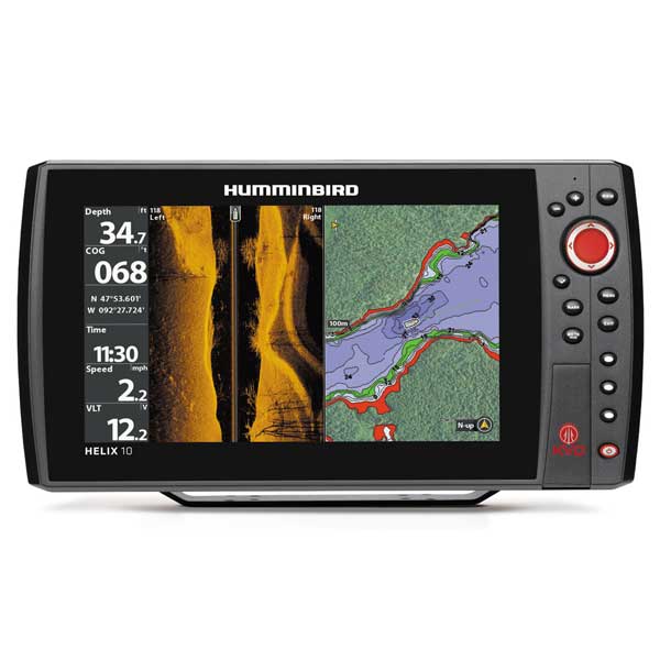
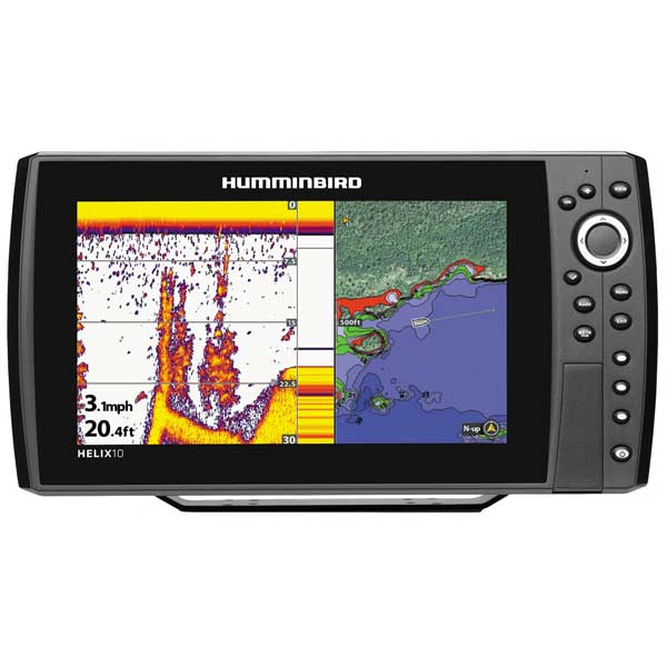
HUMMINBIRD Helix 10 Sonar/GPS Combo
This item is brand new
$1,558.95
Backorder, ships in 3 - 4 weeks
|cw|sw|wi


EC W10 Transducer Ext. Cable, 7 pin, 10 ft


AS-HHGPS Handheld GPS Connection Kit

EC-W30 30 ft Transducer Extension cable


MHX-XMK Kayak Transducer Mounting Kit


In-Dash Mount Kit Helix 12


Gimbal Mount Helix 12


AS 360SSI Transducer


P72 XPT 9 20 T Depth transducer w temp

XTH 9 20 Depth transducer

XTH 9 20 P Depth transducer

XFM 9 20 Depth transducer


XNT 9 20 Depth Transducer, MFG 710214-1, 83 200KHz, 6020 beam angle


Lakemaster wisconsin - version 7.0 - microsd/sd
Lakemaster wisconsin plus - version 2.0 - microsd/sd
Lakemaster chart northeast states plus - microsd - version 2
Lakemaster chart - midatlantic states - version 2.0 - microsd/sd

Lakemaster mid atlantic states plus - mircosd - version 2.0


Suggested Maps and Software:
 | Navionics Marine Charts |
 | Humminbird Contour Elite |
 | Humminbird LakeMaster |
 | Humminbird AutoChart |
Contents of the package
Transom mount transducer
Mounting Bracket
Installation hardware
Owner's manual
Features
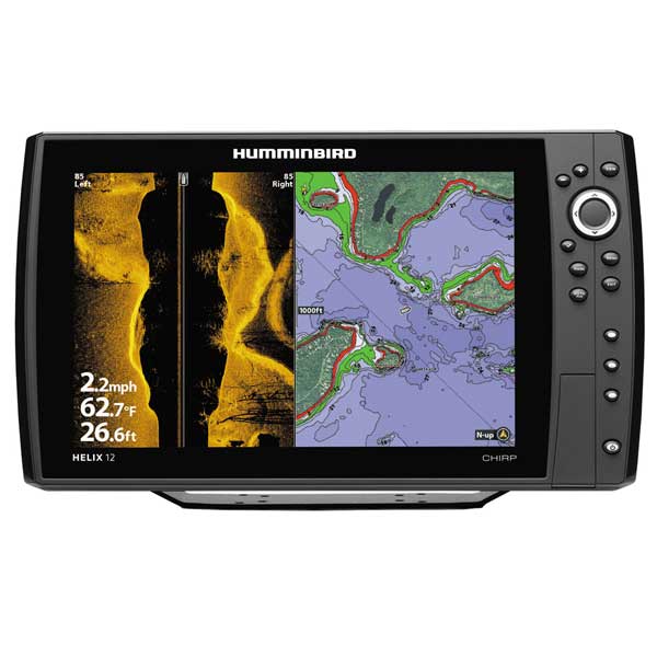
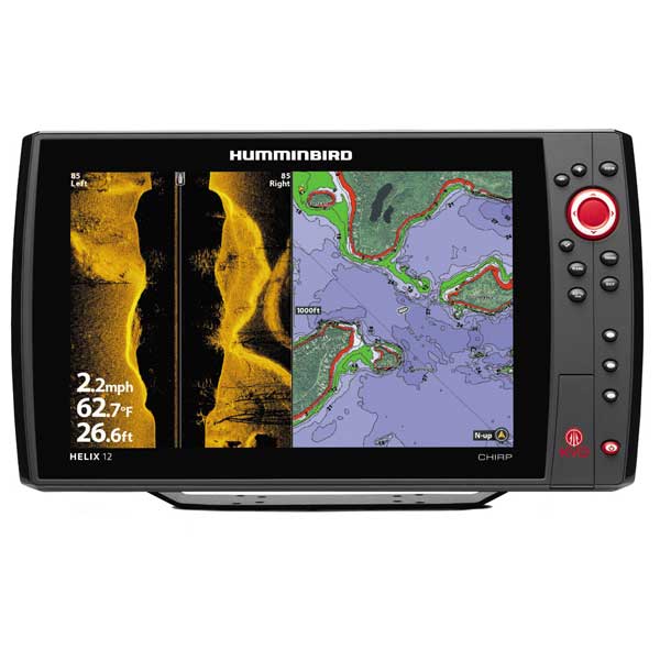
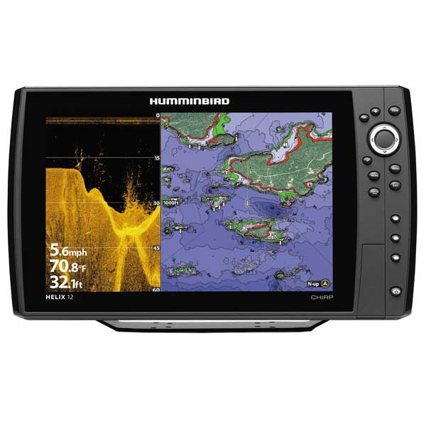
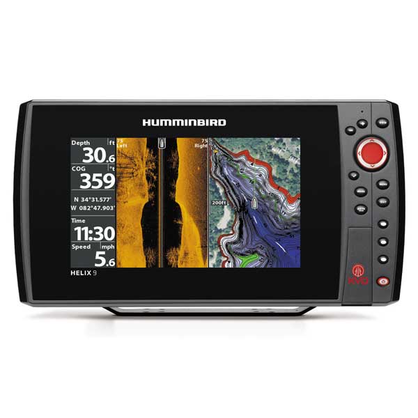
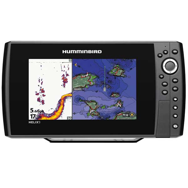
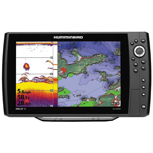
Helix 12 CHIRP GPS, w/ 83/200KHz XdcrHELIX 12 CHIRP/GPS Combo
The HELIX 12 CHIRP GPS features a large 12.1" display with LED backlight, CHIRP sonar with up to 8000 Watts PTP power output, GPS Chartplotting with built-in ContourXD maps, and Ethernet networking capabilities. Includes unit cover.
*Optional 50 kHz transducers available for extreme deepwater use and to obtain 1000 watts
*Optional Chirp transducer purchase required for 28kHz to 540kHz and maximum 5000 ft depth performance
Display Size - Diagonal: 12.1"
Display Pixel Matrix: 800V x 1280H
Display Type: Color TFT
Display Colors Grayscale: 65,000 Colors
Sonar Standard:Broadband CHIRP/DualBeam PLUS
Standard Sonar Coverage:20° & 60° @ -10db
Standard Sonar Frequency:200/83/50* kHz
Target Separation:2.5"
Power Output RMS:1000 Watts*
Power Output Peak to Peak:8000 Watts*
Depth Capability: 1500 ft & 3000 ft*
Temperature:Built-In Transducer
Speed: GPS Speed Included
Backlight:LED
Mount A Type:Gimbal
Mounting Options:Optional In-Dash Mounting Kit
Transducer Standard: XNT 9 20 T
Transducer Mounting:Transom
Power Input:10-20 VDC
Power Draw:750mA
GPS Receiver:Included
GPS Tracking:Included
GPS Chartplotting:Included
Waypoints, Routes, Tracks/Points:2,500, 47, 50/20,000
Humminbird Mapping:Optional
Navionics Gold/HotMaps:Optional
Navionics Platinum+:Optional
Platinum Capable:Optional
C-Map 4D:Not Supported
360 Imaging:Optional
i-Pilot Link:Optional
HD Radar:Optional
NMEA 2000:Optional
5 Port Expansion Module:Optional
WeatherSense:Not Supported
Precision GPS:Included
Heading Sensor GPS:Optional
PC Connect:Optional
External GPS Receiver:Optional
AS Interlink:Not Supported
AIS Compatability:Optional
SwitchFire Sonar:Included
Screen Snap Shot:Included
Sonar Recording:Included
Humminbird PC:Included
Upgradable Internal Software:Included
Split Screen Zoom:Included
Split Screen Bottom Lock:Included
3D Chart View:Included
Large Digits View:Included
Wide/Narrow Cone Split Screen:Included
Custom View Selections:Included
Custom Digital Readout:Included
View Preset Keys:Included
Temperature Graph:Included
Temperature Alarm:Included
Freeze Frame:Included
Instant Image Update:Included
Mark Structure on Sonar:Included
Selective Fish ID+:Included
Real Time Sonar:Included
Triplog:Included
X-Press Menu System:Included
Card Reader Available:Yes
# Card Slots:2
Specifications
Included Transducer XNT-9-20-TDisplay 12.1" diag. Color LCD
Resolution 1280 x 800 pixels
Antenna Internal GPS
Power 1000 Watts
Frequency 28-540 KHz CHIRP Dual Beam Switchfire Sonar
Transducer 83/200 KHz Transom mount transducer included
Mapping Buit-in UniMap for U.S. coastal and inland waters. Ability to add Navionics Gold/HotMaps via
Micro-SD card (2 slots).
Waypoints/Routes 2500 Waypoints, 45 Routes, 50 tracks, 20,000 trackpoints
Interface NMEA 0183, Ethernet
Other Functions Screen snap shot, zoom, bottom lock, 3D chart view, digital readout, Fish ID. Optional 360°
Imaging, MinnKota i-Pilot Link.
Dimensions TBD
Warranty One year
Item number: 410000-1
UPC: 082324047671
Package weight: 14 lb
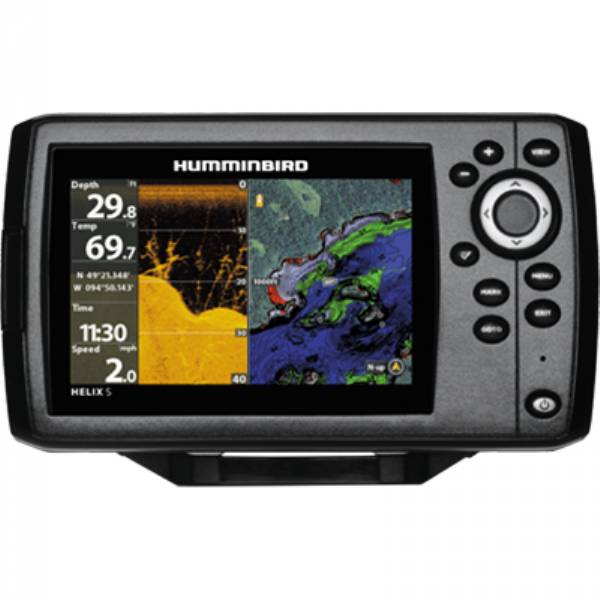
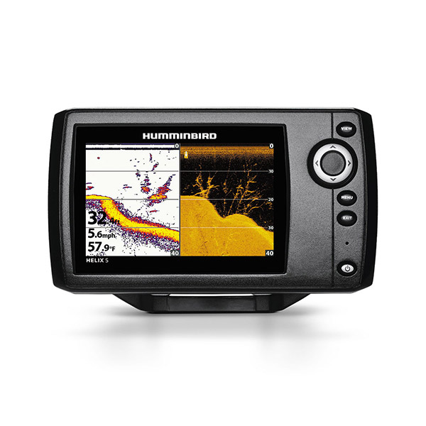
Other Products in the Series: