HUMMINBIRD Helix 10 chrip mega si gps g2n combo Refurbished


Antennas


Cables


700030-1
AS-HHGPS Handheld GPS Connection Kit
AS-HHGPS Handheld GPS Connection Kit
No Longer Available

720003-2
EC-W30 30 ft Transducer Extension cable
EC-W30 30 ft Transducer Extension cable
No Longer Available

Mounts


RAM Mounts

Marine Networking


Sensors and Boards

730000-1
TS-W Temp/Speed Sensor
TS-W Temp/Speed Sensor
No Longer Available
Transducers Humminbird

408310-1
AS 360SSI Transducer
AS 360SSI Transducer
No Longer Available


710210-1
XPTH 9 HDSI 180 T Down Side Imaging depth transducer w temp
XPTH 9 HDSI 180 T Down Side Imaging depth transducer w temp
No Longer Available

710214-1
XNT 9 20 Depth Transducer, MFG 710214-1, 83 200KHz, 6020 beam angle
XNT 9 20 Depth Transducer, MFG 710214-1, 83 200KHz, 6020 beam angle
No Longer Available

710164-1
XP-9-20 Puck 200/83 kHz Beam 20/60 ThruHull Transducer
XP-9-20 Puck 200/83 kHz Beam 20/60 ThruHull Transducer
No Longer Available

710165-1
XAP-9-20 Angled Puck Transducer
XAP-9-20 Angled Puck Transducer
No Longer Available
Various


410180-1
RC-2 wireless remote f/bluetooth helix units
RC-2 wireless remote f/bluetooth helix units
No Longer Available
600025-5
Lakemaster wisconsin - version 7.0 - microsd/sd
Lakemaster wisconsin - version 7.0 - microsd/sd
No Longer Available
600025-6
Lakemaster wisconsin plus - version 2.0 - microsd/sd
Lakemaster wisconsin plus - version 2.0 - microsd/sd
No Longer Available
600045-4
Lakemaster chart northeast states plus - microsd - version 2
Lakemaster chart northeast states plus - microsd - version 2
No Longer Available
600043-3
Lakemaster chart - midatlantic states - version 2.0 - microsd/sd
Lakemaster chart - midatlantic states - version 2.0 - microsd/sd
No Longer Available


600043-4
Lakemaster mid atlantic states plus - mircosd - version 2.0
Lakemaster mid atlantic states plus - mircosd - version 2.0
No Longer Available


Also available


Contents of the package
Features
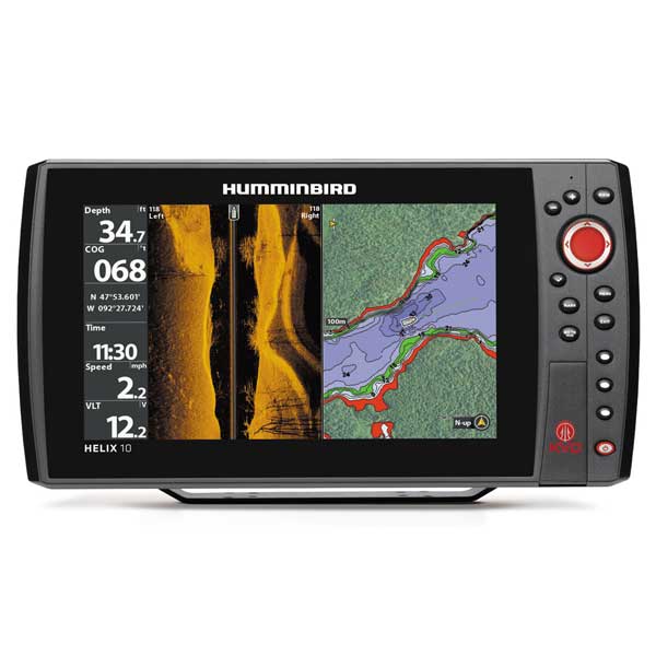
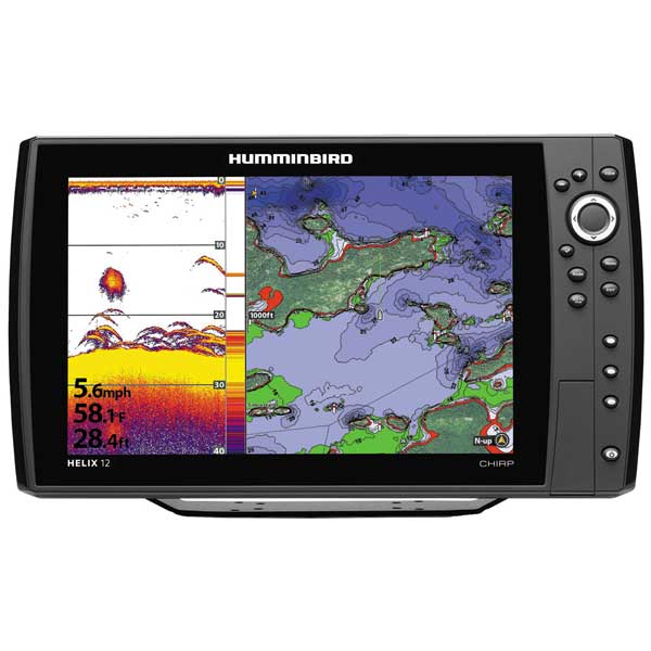
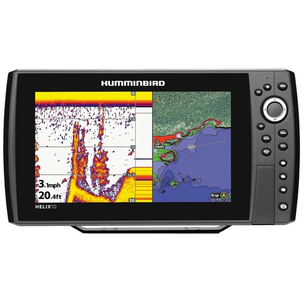
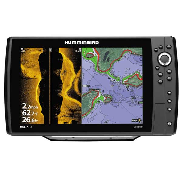
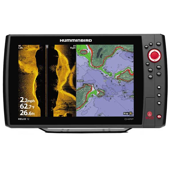
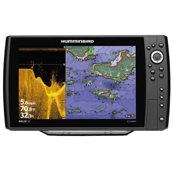
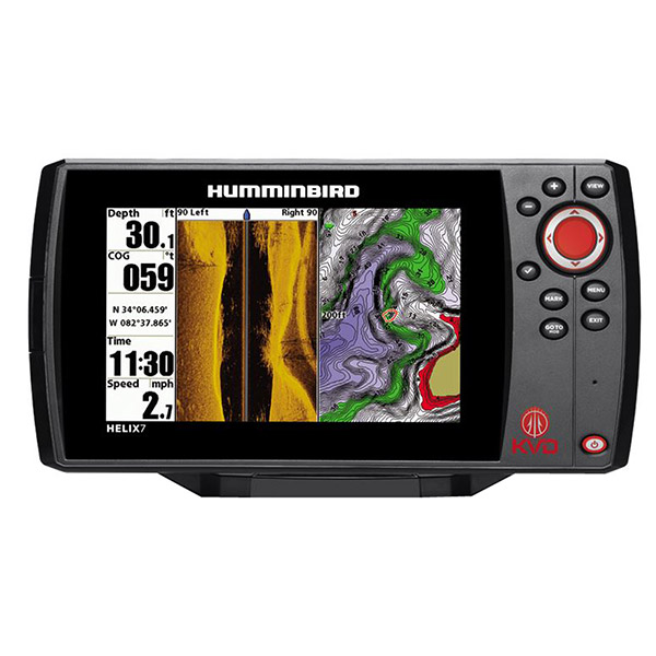
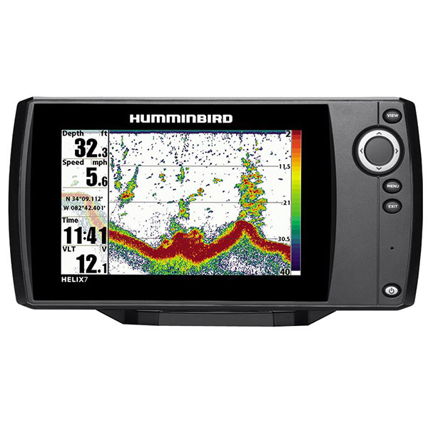
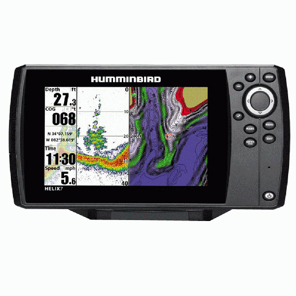
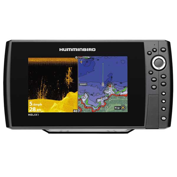
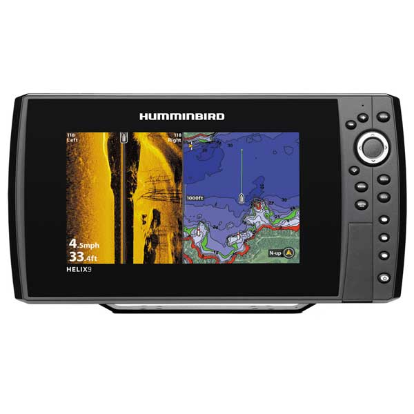
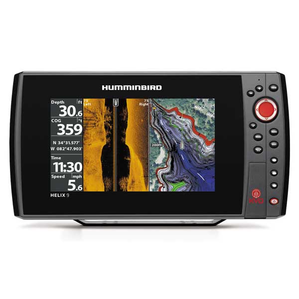
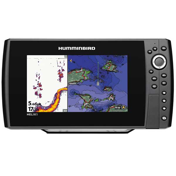
HELIX 10 CHIRP MEGA SI GPS G2NThe HELIX 10 CHIRP MEGA SI GPS G2N features a large 10.1" display with LED backlight, CHIRP-ing MEGA Side Imaging, MEGA Down Imaging and 2D sonar. Includes GPS chartplotting, built-in Bluetooth, Ethernet networking capabilities, AutoChart Live with depth, vegetation and bottom hardness mapping, and unit cover.
455kHz Side Imaging provides 800 ft of side to side coverage.
455kHz Down Imaging works to a depth of 400 feet.
1.2 MHz Side Imaging provides 250 feet of side to side coverage.
1.2 MHz Down Imaging works to a depth of 125 feet.
Broad Band Chrip
Exclusive Multi-Range Chirp -- View low, mid and high Chirp ranges, either individually or all at once
360 Imaging
360 Imaging - We have you surrounded. 360 Imaging allows you to isolate your sweep, see 5 preset views or see all around you.
Side Imagine Sonar
Side Imaging Sonar -- Gain a 180° side to side perspective on the world below the surface.
Down Imaging Sonar
Down Imaging Sonar -- Get a fish-eye's view of what's happening below your boat. Incredible images are created with High-frequency sound waves.
HD Radar
In darkness and fog, busy channels and treacherous weather, situational awareness is the name of the game.
NMEA 2000
Get an at-a-glance view of fuel consumption, engine performance and other vessel data.
Autochart Live
Make a map where there is no map. Our patent pending AutoChart Live allows you to create digital, detailed maps live and on the water. You can also use it to enhance your existing charts.
Wireless
Take wireless control of your Humminbird with our new Bluetooth Remote and Dongle.
i-Pilot Link
i-Pilot Link is an integrated GPS Trolling System available on select Minn Kota Ulterra, Terrova and PowerDrive V2 motors which enable your motor and Humminbird to communicate.
Dual Card Slots
Dual SD Card Slots -- Use one slot for advanced cartography and the other to save screenshots, sonar recordings and waypoints.
Ethernet
Rig up the ultimate fishing system. Use our 5-Port Ethernet switch to link together multiple Humminbird head units or share transducers.
Specifications
Basemap
Yes
Card Format
Micro SD
Cartography - Preloaded
No
Cartography Brand
Humminbird/Navionics
Cartography Type
Humminbird/Navionics Gold/Hotmaps
Frequency
83/200/455/800
Included Transducer
XM-9-20-MSI-T
Internal/External Antenna
Internal
Resolution (VxH)
1024 x 600
Screen Size
10.1"
Screen Type
Color
Speed/Temp
Both
Touchscreen
No
Transducer Type
Transom Mount
Waterproof Rating
Waterproof
Watts RMS - Max
1000
Waypoints/Routes
2,500/47
Weather Capable
No
Item number: 410120-1
UPC: 082324048593
Package weight: 14 lb
Other Products in the Series: