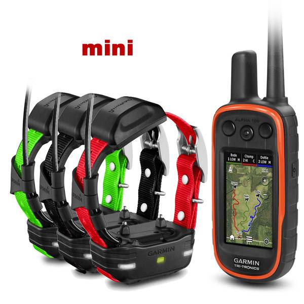
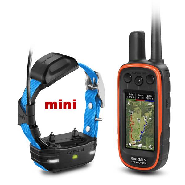
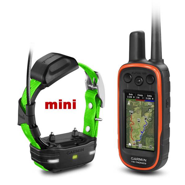
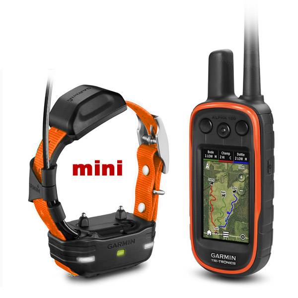
GARMIN Alpha 100 and Orange TT 10 Dog Tracking and Training Bundle, 90 day wty


VHF antenna (2-pack)


Field Bag


Cup Holder Universal Mount RAM-A-CAN II with 6 in Flex Arm


Lanyard 17 inch


Carabiner clip

Lanyard Carabiner


Chirp Wireless geocaching beacon

BirdsEye Satellite Imagery Retail Card

Virb X
Virb Xe
NOH Virb XE

VIRB Ultra 30
VIRB XE Cycling Bundle
VIRB XE Auto Racing Bundle
VIRB XE Aviation Bundle
VIRB Camera
VIRB Elite Camera Dark
VIRB Elite Camera
BirdsEye Satellite Imagery US and Canada

DriveTrack 70LMT

DriveTrack 71

Montana 700

Montana 700i

Montana 750i


Suggested Maps and Software:
 | Inland Lakes |
 | BlueChart g2, g3 on micro SD card with adapter |
 | Garmin Street Maps and City Navigation |
 | Garmin Topographic Maps |
 | Garmin Extras |
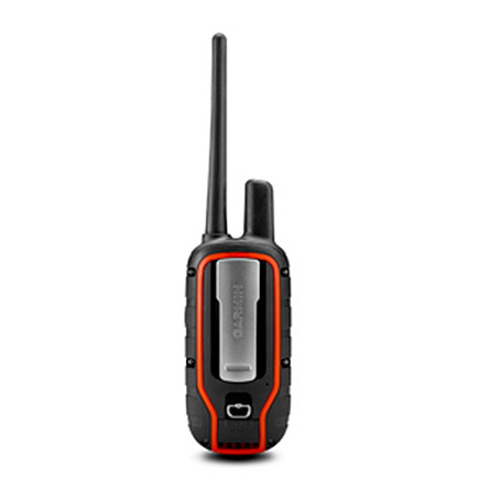
Contents of the package
- Alpha 100 handheld
- Rechargeable user-replaceable Li-ion pack
- Belt clip
- Extended range antenna
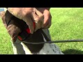
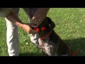
- TT 10 dog device with orange collar strap
- Charge clip
- AC adapter
- Vehicle power cable
- Split adapter cable
- USB cable
- Short and long contact point set with wrench and non-stim plug
Features
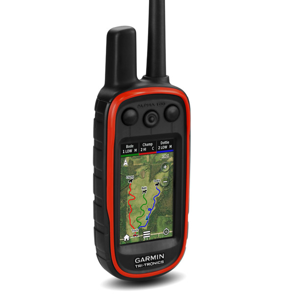
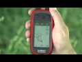
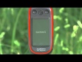
The Alpha 100 gives you the ultimate tool in tracking your sporting dogs. Using Garmins GPS dog tracking technology and Tri-Tronics electric dog training, the Alpha 100 integrated handheld system lets you track and train your dogs from a range of up to 9 miles. Youll know their exact position as often as every 2.5 seconds.Use the Alpha 100 and TT 10 to locate up to 20 dogs or hunters at once, using a large, glove-friendly touchscreen display. And, Alpha 100s 100,000 preloaded topographical maps mean youll never be lost.
Know where your dogs are
With the Alpha 100 or TT 10, you can keep track of up to 20 dogs or hunters. The Alpha 100 will send you notifications when your dog is treed or on point. It will also tell you how fast each of your dogs is moving.
A powerful training tool
The Alpha 100 is also a valuable tool for training your dogs to stop chasing unwanted game. You can communicate with each dog individually through easily accessible training buttons that offer safe and effective features. That includes 18 levels of momentary and 18 levels of continuous stimulation and an audible tone command. Further, you can use the lockout setting to avoid accidentally using these commands.
A better battery life
You can switch your TT 10 to Rescue Mode to save battery life. Once it reaches a specific battery level, the TT 10 slows down its 2.5-second update rate to two minutes. This provides a longer life for your TT 10, giving you additional time to find your dog.
Track and train your dogs
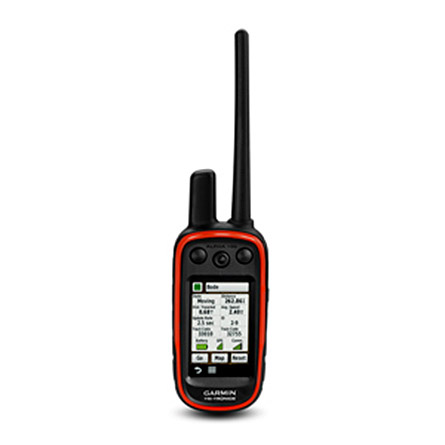
Use the compass screen to get in-depth speed, direction and distance for up to 20 dogs. Further, you can command each dog individually without affecting the others.
Help your dogs avoid hazards
Avoid danger before it happens. Keep your dogs away from hazards by using the Alpha 100 to set up virtual boundaries on your map. If your dog strays outside of your boundaries, youll get an alert immediately.
A birds eye on your dogs
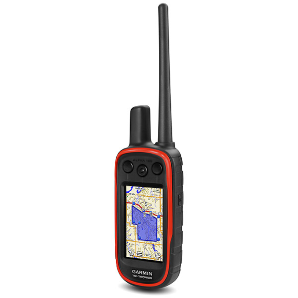
You can use BirdsEye Satellite imagery to track and train up to three dogs based on their location. The highly-detailed raster maps give you a realistic view of roads, parking, buildings and terrain such as lakes, rivers and tree lines, and offer a perfect addition to your Alpha 100s topographic maps.
Find your friends
Use the Alpha 100 to locate others in your hunting group. You can set your screen to show both dogs and fellow hunters using Alpha handhelds.
Professional Tracker. Professional Trainer.
Glove-friendly 3 color touchscreen
Preloaded 100K U.S. TOPO maps
Electronic compass
Barometric altimeter
Hunter-to-hunter position reporting with preset messaging capability
Waterproof (IPX7) design
Rechargeable, user-replaceable Li-ion battery pack
Compare collars
| T 5 | DC 50 | TT 15 | TT 10 | |
| High-Sensitivity GPS | | | | |
| GLONASS | | | | |
| Stimulation levels | | | ||
| Tone | | | ||
| Vibration | | |||
| LED beacon lights | | | | |
| Rescue mode | | | | |
| Contact points (long & short) | | | ||
| Includes two antennas (181/2 & 221/2) | | | | |
| VIRB® control | w/Alpha 100 only | w/ Alpha 100 only | ||
| Top-mounted GPS antenna color | Orange | Black | Black | Black |
| Water rating | 1ATM(10m) | 1ATM(10m) | 1ATM(10m) | 1ATM(10m) |
| Battery life | 20-40 hrs | 26-54 hrs | 20-40 hrs | 20-40 hrs |
| Battery type | rechargeable lithium-ion | rechargeable lithium-ion | rechargeable lithium-ion | rechargeable lithium-ion |
| Replaceable 1" collar straps | | | | |
| Handheld compatibility | Astro® 320 or Alpha 100 | Astro 320 | Astro 320 or Alpha 100 | Alpha 100 |
Specifications
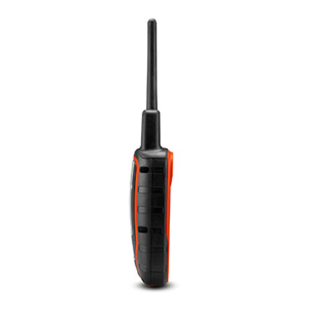
Physical & Performance:Unit dimensions, WxHxD: 2.5" x 6.5" x1.5 (6.4 x 16.5 x 3.8 cm)
Display size, WxH: 1.5" x 2.6" (3.8 x 6.3 cm); 3" diag (7.6 cm)
Display resolution, WxH: 200 x 400 pixels
Display type: transflective, 65-K color TFT touchscreen
Weight: 8.8 oz (250 g) with standard antenna and battery
Battery: rechargeable lithium-ion (included)
Battery life: up to 20 hours (Alpha 100)
Waterproof: yes (IPX7)
Floats: no
High-sensitivity receiver: yes
Interface: USB
Maps & Memory:
Basemap: yes
Preloaded maps: yes (topographic)
Ability to add maps: yes
Built-in memory: 4.0 GB, 500 MB available for user storage (with topo maps loaded)
Accepts data cards: microSD card (not included)
Waypoints/favorites/locations: 4000
Routes: 200
Track log: 10,000 points, 200 saved tracks
Features & Benefits:
Automatic routing (turn by turn routing on roads): yes (with optional mapping for detailed roads)
Electronic compass: yes (tilt-compensated, 3-axis)
Touchscreen: yes
Barometric altimeter: yes
Camera: no
Custom maps compatible: yes
Photo navigation (navigate to geotagged photos): yes
Outdoor GPS games: no
Hunt/fish calendar: yes
Sun and moon information: yes
Tide tables: yes
Area calculation: yes
Custom POIs (ability to add additional points of interest): yes
Unit-to-unit transfer (shares data wirelessly with similar units): yes
Picture viewer: no
Garmin Connect compatible (online community where you analyze, categorize and share data): yes
Additional:
Range: up to 9 miles line of sight
Frequency band: MURS (not compatible with Astro)
Tracks up to 20 dogs (TT10) and buddies (Alpha 100) simultaneously
Item number: 010-01041-00
UPC: 753759990275
Package weight: 3 lb
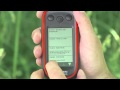
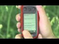
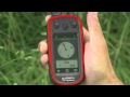
 | Video by GPS4US |
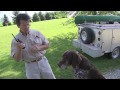
 | Video by GPS4US |
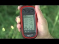
 | Video by GPS4US |
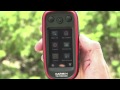
 | Video by GARMIN |
 | Video by GARMIN |
 | Video by GARMIN |
 | Video by GARMIN |
 | Video by GARMIN |
 | Video by GARMIN |
 | Video by GARMIN |
 | Video by GARMIN |
 | Video by GARMIN |
 | Video by GARMIN |
 | Video by GARMIN |
View latest videos by GPS4US
Visit GPS4US
 Channel.
Following reviews were written by actual customers.
Every GPS4US customer has a chance to live a feedback after receiving a product.
 by David B, , 7/16/2014 by ANTONELLO A, , 1/2/2014
Simply the best!
by pietro G, , 1/19/2013 by Rudy M, , 12/24/2012Super
by SAINT-MARCEL L, , 10/19/2012Very good product
Other Products in the Series:
| GARMIN Alpha 100 and 2 x TT 15 Dog Tracking and Training Bundle TT15 | |
 | GARMIN Alpha 100 and 2 x TT 15 mini Dog Tracking and Training Collars TT15 | Add to comparison |
| GARMIN Alpha 100 and 3 x TT 15 Dog Tracking and Training Bundle TT15 | |
 | GARMIN Alpha 100 and 3 x TT 15 mini Dog Tracking and Training Collars TT15 | Add to comparison |
| GARMIN Alpha 100 and 4 x TT 15 Dog Tracking and Training Bundle TT15 | |
| GARMIN Alpha 100 and 5 x TT 15 Dog Tracking and Training Bundle TT15 | |
 | GARMIN Alpha 100 and Black TT 15 Dog Tracking and Training Bundle TT15 | Add to comparison |
| GARMIN Alpha 100 and Black TT 15 mini Dog Tracking and Training Bundle TT15 | Add to comparison |
 | GARMIN Alpha 100 and Black TT 15X Dog Tracking and Training set TT15X | |
| GARMIN Alpha 100 and Blue TT 15 Dog Tracking and Training Bundle TT15 | |
 | GARMIN Alpha 100 and Blue TT 15 mini Dog Tracking and Training Bundle TT15 | Add to comparison |
| GARMIN Alpha 100 and Burgundy TT 15 Dog Tracking and Training Bundle TT15 | |
| GARMIN Alpha 100 and Dark Green TT 15 Dog Tracking and Training Bundle TT15 | |
| GARMIN Alpha 100 and Grey TT 15 Dog Tracking and Training Bundle TT15 | |
| GARMIN Alpha 100 and Light Green TT 15 Dog Tracking and Training Bundle TT15 | |
 | GARMIN Alpha 100 and Light Green TT 15 mini Dog Tracking and Training Bundle TT15 | Add to comparison |
| GARMIN Alpha 100 and Orange TT 15 Dog Tracking and Training Bundle TT15 | |
 | GARMIN Alpha 100 and Orange TT 15 mini Dog Tracking and Training Bundle TT15 | Add to comparison |
| GARMIN Alpha 100 and Pink TT 15 Dog Tracking and Training Bundle TT15 | |
| GARMIN Alpha 100 and Purple TT 15 Dog Tracking and Training Bundle TT15 | |
| GARMIN Alpha 100 and Red TT 15 Dog Tracking and Training Bundle TT15 | |
 | GARMIN Alpha 100 and Red TT 15 mini Dog Tracking and Training Bundle TT15 | Add to comparison |
| GARMIN Alpha 100 and TT 15X essential bundle TT15 NOH | |
| GARMIN Alpha 100 and White TT 15 Dog Tracking and Training Bundle TT15 | |
| GARMIN Alpha 100 and Yellow School Bus TT 15 Dog Tracking and Training Bundle TT15 | |
| GARMIN Alpha 100 and Yellow TT 15 Dog Tracking and Training Bundle TT15 | |
 | GARMIN Alpha 100 and Yellow TT 15 mini Dog Tracking and Training Bundle TT15 | Add to comparison |
| GARMIN Alpha 100 GPS Dog Tracking and Training Handheld, Refurbished NOH | |
| GARMIN Alpha 100 GPS Dog Tracking and Training Handheld. Pre-owned | Add to comparison |
| GARMIN Alpha 100 GPS Dog Tracking and Training Handheld. Refurbished NOH | Add to comparison |
 | GARMIN Alpha 100 GPS Handheld only, no collars, Refurbished NOH | |
 | GARMIN Alpha 100 Refurbished and TT 15X Dog Tracking and Training Bundle TT15 NOH | |
 | GARMIN Alpha 100 Refurbished and TT 25 Dog Tracking and Training Bundle TT25 NOH | |
| GARMIN Alpha 100 Refurbished and TT 25 Essential Bundle TT25 NOH |