C-MAP MAX NA-M320 -Passamaquoddy Bay ME-NC Bathy - C-Card
Item: NA-M320C-CARD
This item is brand new
$279.00
Backorder, ships in 3 - 4 weeks
|cw


This item is brand new
$279.00
Backorder, ships in 3 - 4 weeks
|cw
Contents of the package
Features
NA-M320-CNA-M320 C-CARD FORMAT PASSAMAQUODDY BAY ME -NC BATH
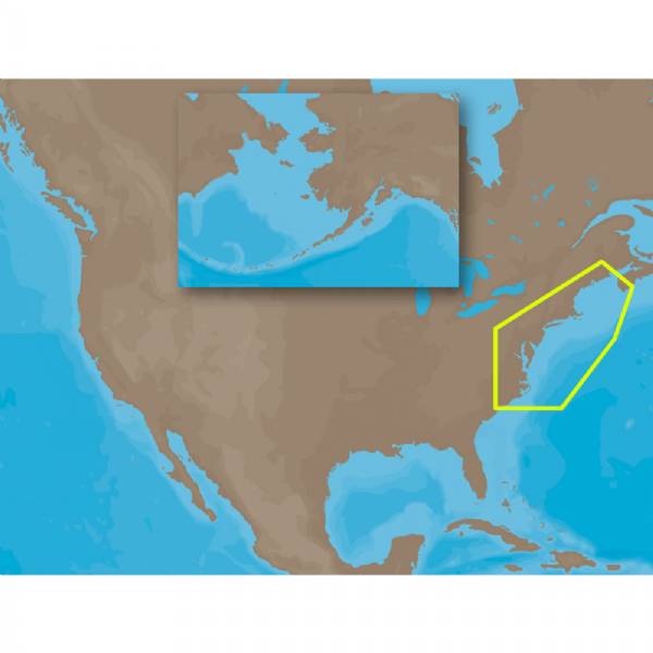
NA-M320 => Passamaquoddy Bay to Cape Lookout
Coverage includes offshore bathymetric details from Passamaquoddy Bay, ME to Cape Lookout, NC. Coverage extends from the coastline out to the Atlantic Canyons - Hudson, Baltimore, Oceanographer and others. Fishing Contour Charts do not include coastal navigational features and are recommended for offshore fishing only.
Specifications
Item number: NA-M320C-CARD
UPC: 686074018709
Package weight: 0.1 lb
Other Products in the Series:
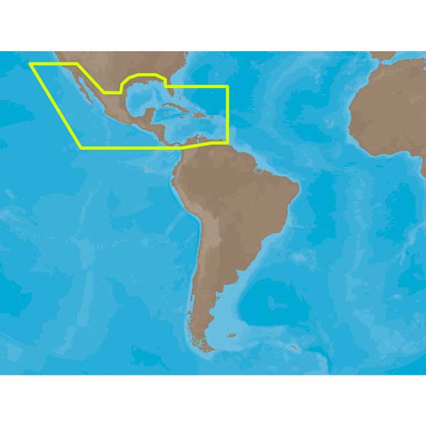 | C-MAP MAX NA-M027 - Central America, The Caribbean - C-Card | Add to comparison |
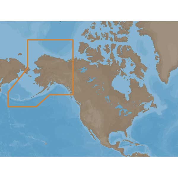 | C-MAP MAX NA-M028 - Alaska - C-Card | Add to comparison |
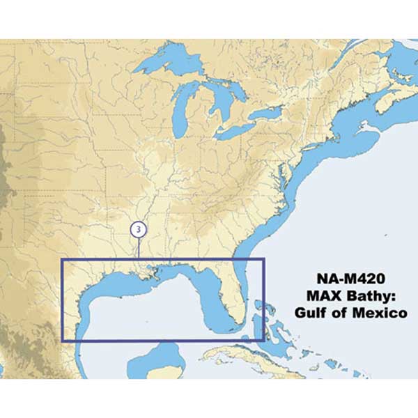 | C-MAP NA-M420 Gulf of Mexico Bathy Chart - C-Card | Add to comparison |
List of Compatible Units:
Note: Displayed are products sold in gps4us store.
There might be more GPS units compatible with chosen accessory.