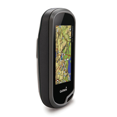
GARMIN Oregon 650


AC Charger


Speed/Cadence bike sensor (GSC 10)
Heart rate monitor

Premium Heart rate monitor Soft Strap

Replacement Soft Strap for Heart Rate Monitor

Tempe Wireless Temperature Sensor


Replacement Soft Strap for HRM3 Heart Rate Monitor

HRM-Pro Heart Rate Monitor with Bluetooth and Running Dynamics

HRM-Pro Plus Heart Rate Monitor


Cup Holder Universal Mount RAM-A-CAN II with 6 in Flex Arm


Chirp Wireless geocaching beacon

BirdsEye Satellite Imagery Retail Card
Virb X
Virb Xe
NOH Virb XE
VIRB XE Cycling Bundle
VIRB XE Auto Racing Bundle
VIRB XE Aviation Bundle
VIRB Ultra 30
VIRB Camera
VIRB Elite Camera Dark
VIRB Elite Camera
BirdsEye Satellite Imagery US and Canada
Suggested Maps and Software:
 | Inland Lakes |
 | BlueChart g2, g3 on micro SD card with adapter |
 | Garmin Street Maps and City Navigation |
 | Garmin Topographic Maps |
 | Garmin Extras |
 | LakeVu HD |
Contents of the package
- Oregon 650
- Worldwide basemap
- NiMH battery pack
- USB/charging cable
- AC adapter
- Carabiner clip
- Documentation
Features
The Oregon 650 will take you to a new level of GPS mapping. Its high-sensitivityGPS and GLONASS satellite tracking means faster acquiring time, even if youre
under heavy cover. You get a worldwide basemap with shaded relief and an ultra-fast
processor. You can use multi-touch to zoom and pan, even if youre wearing gloves.
Plus, the reflective LCD display makes maps vivid in both the glaring sun and a
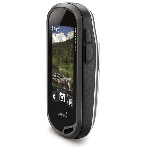
full moon. You can also use the 8-megapixel autofocus camera with digital zoom and
automatic flash/torch to mark all your important moments. And customizable buttons
allow 1-touch image capture and waypoint marking.
Snapshots
The Oregon 650s digital camera will become your best friend. It boasts an
8-megapixel autofocus digital camera that allows you to geotag each photo with its
location, which means you can always navigate back to that spot. You can share all
your photos with a USB cable through Garmin Adventures online community. If you
need more storage, no problem. Just insert a microSD card. Youll also be able to
see photos from other devices on your microSD card with Oregons picture viewer.
Keep it running
The Oregon 650 comes with an amazing dual battery system. You can use the
internally rechargeable, included NiMH pack which charges when the device is
connected to external power, or AA batteries.
A touching experience
Built for the outdoors, the Oregon 650 gives you an amazingly readable touchscreen.
Its strengthened for impact resistant, but sensitive enough to use with gloves. It
can withstand almost anything Mother Nature throws at it.
Know where youre heading
With a built-in 3-axis tilt-compensated electronic compass, your Oregon 650 shows
your heading even when youre standing still or not holding it level. If you want
to know your altitude, the barometric altimeter tracks pressure changes to show you
how high youre standing. It even tracks barometric pressure over time, which can
help you predict the weather. Plus, the high-sensitivity WAAS- and GLONASS-enabled
GPS receiver and HotFix satellite prediction shows you your location quickly and
accurately, no matter where you are.
Go social
Oregon 550 allows you to share your waypoints, tracks, geocaches and routes
wirelessly with other compatible Garmin handheld users. You can also share photos,
Garmin Adventures and Custom Maps. All you have to do is press send to transfer
your information.
Customize your maps
Youll have no problem adding your own maps to your Oregon 650. Load TOPO 24K maps
and head out on your hike. You can also add Trailhead Series TOPO maps for
well-known hikes like the Appalachian Trail. Load City Navigator maps for
turn-by-turn road directions, or satellite images with subscription-based BirdsEye
Satellite imagery. You can also add BlueChart g2 maps for your day on the water.
Geocaching like a champ
Oregon 650 can hold up to 4 million caches. Yep. 4 million. You can download every
cache on OpenCaching.com, load caches from GSAK or use a program supporting GGZ
files.* You can filter important details like terrain, difficulty, size and type
and connect to chirp-enabled caches or record your logs in the field.
Plan ahead
You can plan your next trip with BaseCamp, the software that allows you to see and
organize your maps, waypoints, routes and tracks. Its free, and it lets you create
Garmin Adventures to share with your friends. BaseCamp shows topographic map data
in 2D or 3D right on your computer screen. Youll see elevation profiles and
contour lines. And, when you pair with subscription-based BirdsEye Satellite
Imagery, you can transfer unlimited satellite images to your Oregon 650.
Specifications
Installed languages: English,
Spanish, French, Deutsch, Italiano, Portugues, Cesky, Dansk,
Nederlands, Norsk, Suomi, Hrvatski, Magyar, Polski, Russian, Svenska,
Turkse, Latvian, Slovak, Slovenian, Greek, Arabic, Farsi, Bulgarian, Romana, Hebrew.
More languages may be available through Garmin web updater.
Unit dimensions, WxHxD: 2.4" x 4.5" x 1.3" (6.1 x 11.4 x 3.3 cm)
Display size, WxH: 1.5"W x 2.5"H (3.8 x 6.3 cm); 3" diag (7.6 cm)
Display resolution, WxH: 240 x 400 pixels
Display type: transflective color TFT touchscreen
Weight: 7.4 oz (209.8 g) with batteries
Battery: rechargeable NiMH pack (included) or 2 AA batteries (not included); NiMH or Lithium recommended
Battery life: 16 hours
Waterproof: yes (IPX7)
Floats: no
High-sensitivity receiver: yes
Interface: high-speed USB and NMEA 0183 compatible
Maps and Memory:
Basemap: yes
Preloaded maps: no
Ability to add maps: yes
Built-in memory: 3.5 GB
Accepts data cards: microSD card (not included)
Waypoints/favorites/locations: 4000
Routes: 200
Track log: 10,000 points, 200 saved tracks
Features and Benefits:
Automatic routing (turn by turn routing on roads): yes (with optional mapping for detailed roads)
Electronic compass: yes (tilt-compensated, 3-axis)
Touchscreen: yes
Barometric altimeter: yes
Camera: yes (8 megapixel with autofocus; digital zoom)
Geocaching-friendly: yes (paperless)
Custom maps compatible: yes
Photo navigation (navigate to geotagged photos): yes
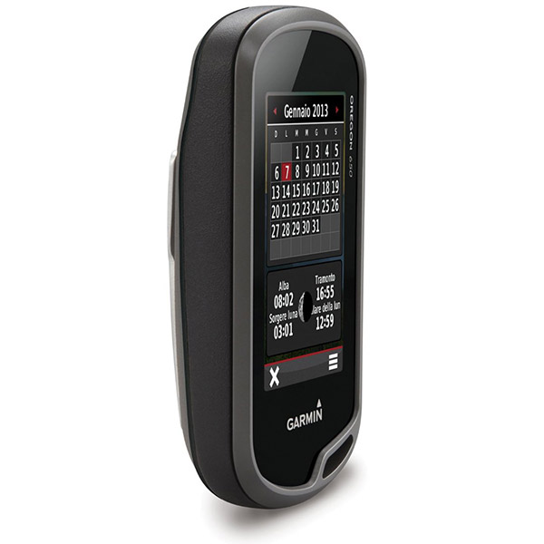
Hunt/fish calendar: yes
Sun and moon information: yes
Tide tables: Yes (with optional Bluechart)
Area calculation: yes
Custom POIs (ability to add additional points of interest): yes
Unit-to-unit transfer (shares data wirelessly with similar units): yes (plus images and custom maps)
Picture viewer: yes
Garmin Connect compatible (online community where you analyze, categorize and share data): yes
Item number: 010-01066-20
UPC: 753759997458
Package weight: 1.4 lb
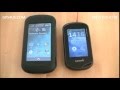 | Video by GPS4US |
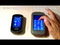 | Video by GPS4US |
 | Video by GPS4US |
View latest videos by GPS4US
Visit GPS4US
 Channel.
Following reviews were written by actual customers.
Every GPS4US customer has a chance to live a feedback after receiving a product.
 by amna H, , 9/10/2015
excelent
Other Products in the Series:
| GARMIN Oregon 200 | Add to comparison |
| GARMIN Oregon 200 NOH | |
| GARMIN Oregon 300 NOH | |
| GARMIN Oregon 300 | Add to comparison |
| GARMIN Oregon 400c | Add to comparison |
| GARMIN Oregon 400c NOH | |
| GARMIN Oregon 400i NOH | |
| GARMIN Oregon 400i | Add to comparison |
| GARMIN Oregon 400t | Add to comparison |
| GARMIN Oregon 400t NOH | |
| GARMIN Oregon 450 | Add to comparison |
| GARMIN Oregon 450 NOH | |
| GARMIN Oregon 450t NOH | |
| GARMIN Oregon 450t | Add to comparison |
| GARMIN Oregon 550 NOH | |
| GARMIN Oregon 550 | Add to comparison |
| GARMIN Oregon 550t | Add to comparison |
| GARMIN Oregon 550t NOH | |
| GARMIN Oregon 600 | Add to comparison |
| GARMIN Oregon 600 NOH | |
| GARMIN Oregon 600t NOH | Add to comparison |
| GARMIN Oregon 600t | Add to comparison |
| GARMIN Oregon 650t | Add to comparison |
| GARMIN Oregon 700 NOH | Add to comparison |
| GARMIN Oregon 700 | Add to comparison |
| GARMIN Oregon 750 | Add to comparison |
| GARMIN Oregon 750t | Add to comparison |