GARMIN Oregon 700


This item is brand new
$289.95
This item ships within 1 day


AC Charger


Speed/Cadence bike sensor (GSC 10)
Heart rate monitor

Premium Heart rate monitor Soft Strap

Replacement Soft Strap for Heart Rate Monitor

Tempe Wireless Temperature Sensor


Replacement Soft Strap for HRM3 Heart Rate Monitor

HRM-Pro Heart Rate Monitor with Bluetooth and Running Dynamics

HRM-Pro Plus Heart Rate Monitor


Cup Holder Universal Mount RAM-A-CAN II with 6 in Flex Arm


Chirp Wireless geocaching beacon

BirdsEye Satellite Imagery Retail Card
Virb X
Virb Xe
NOH Virb XE
VIRB XE Cycling Bundle
VIRB XE Auto Racing Bundle
VIRB XE Aviation Bundle
VIRB Ultra 30
VIRB Camera
VIRB Elite Camera Dark
VIRB Elite Camera
BirdsEye Satellite Imagery US and Canada
Suggested Maps and Software:
 | Inland Lakes |
 | BlueChart g2, g3 on micro SD card with adapter |
 | Garmin Street Maps and City Navigation |
 | Garmin Topographic Maps |
 | Garmin Extras |
 | LakeVu HD |
Contents of the package
- Oregon 700
- USB cable
- Carabiner clip
- Documentation
Features
Rugged GPS/GLONASS Handheld with Built-in Wi-Fi® and MoreHigh-sensitivity dual GPS and GLONASS satellite reception for better performance in challenging environments than GPS alone
Redesigned antenna enables better reception and performance; 3-axis compass with accelerometer and barometric altimeter sensors
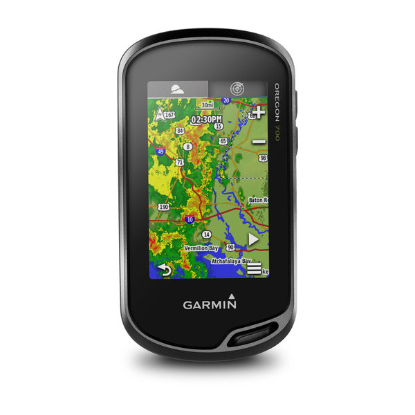
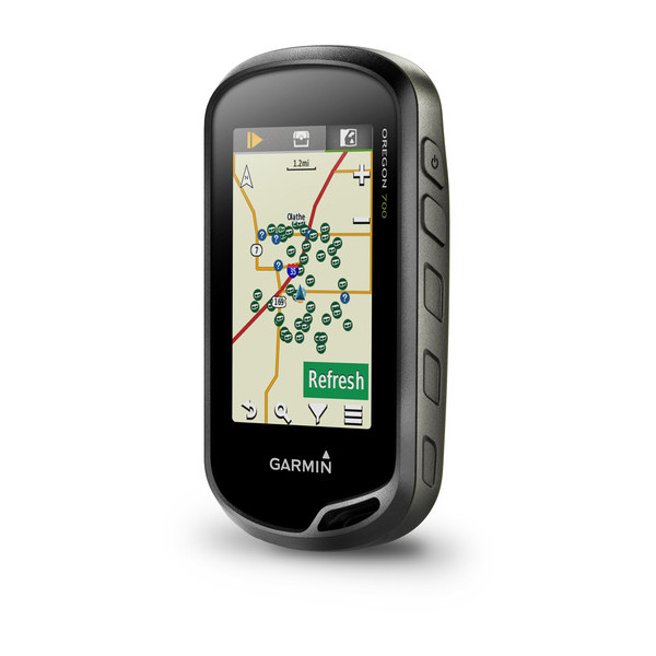
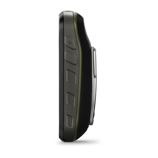
3-inch sunlight-readable touchscreen with dual orientation (landscape or portrait view)
Expanded wireless connectivity (Wi-Fi, Bluetooth®, ANT+® capable); supports Active Weather and Geocaching Live
Bluetooth®-enabled smart notifications¹ and automatic uploads to Garmin Connect online community
Thanks to a redesigned antenna for better satellite reception, the Oregon 700 GPS and GLONASS handheld puts even more of the great outdoors at your fingertips. Whether youre hiking, hunting, climbing, kayaking, trail riding or whatever, this rugged navigator is ready for anything. It features multilink wireless connectivity (Wi-Fi, Bluetooth and ANT+), Active Weather support with animated radar overlays, a 1-year BirdsEye Satellite Imagery subscription and a built-in 3-axis compass with barometric altimeter.
Find Fun with Geocaching.com
The wireless Wi-Fi link and Bluetooth links on your Oregon 700 makes it easier than ever to enjoy a superior geocaching experience. You can set your device to automatically stay up to date with all the latest caches from Geocaching.com. No more manual entry of coordinates or printing out cache details on paper.
More Connectivity, Less Complexity
The expanded wireless capabilities of Oregon 700 make it easier than ever to download software, receive smart notifications¹ and upload adventures to our Garmin Connect online community. You can even share LiveTrack location data or geocache discoveries, unit-to-unit, with other compatible Garmin handheld devices. Smart notifications via Bluetooth connectivity with a compatible smartphone let you receive emails, texts and alerts right on your device. So you can see whats going on while youre getting away from it all.
Navigate Your Way
The Oregon 700 handheld provides comprehensive navigation and tracking to guide you on and off the beaten path, using GPS and GLONASS plus ABC (altimeter, barometer and compass) sensor capabilities. The built-in altimeter provides elevation data to accurately monitor ascent and descent, while the barometer can be used to predict weather changes by showing short-term trends in air pressure. The 3-axis electronic compass keeps your bearing, whether youre moving or not. Theres also a TracBack® feature on Oregon 700 to help you navigate back to your starting point the same way you came. You can also mark locations, such as your campsite, vehicle or other points of interest, to which you'd like return navigation.
Enjoy the View on a Vivid Display
The Oregon 700 handheld features a bright, sunlight-readable 3-inch color touchscreen display with dual orientation for landscape or portrait views. It easily supports multiple mapping options such as BlueChart® g2 HD for water navigation or City Navigator® NT for turn-by-turn driving directions. Durable and water-rated to IPX7, the Oregon series is built to keep delivering vital mapping and tracking data, no matter what the elements throw at you. Plus, you can even customize your Oregons display with free downloads of apps, widgets and data fields from the Garmin Connect IQ online store².
Plan Your Next Trip
Take charge of your next adventure with BaseCamp, software that lets you view and organize maps, waypoints, routes and tracks. This free trip-planning software even allows you to create Garmin Adventures that you can share with friends, family or fellow explorers online. BaseCamp displays on your computer screen any topographic map data stored on the device, including contour lines and elevation profiles. It also can transfer an unlimited amount of satellite images to your device when paired with a BirdsEye Satellite Imagery subscription.
¹See Garmin.com/BLE for compatibility
²Apps, widgets and data fields will be introduced when they become available; not all products may be available all the time. Please check our website for current inventory of Connect IQ products
Specifications
Physical & Performance
| Physical dimensions | 2.4" x 4.5" x 1.3" (6.1 x 11.4 x 3.3 cm) |
|---|---|
| Display size, WxH | 1.5"W x 2.5"H (3.8 x 6.3 cm); 3" diag (7.6 cm) |
| Display resolution, WxH | 240 x 400 pixels |
| Display type | transflective color TFT touchscreen |
| Touchscreen | |
| Weight | 7.4 oz (209.8 g) with batteries |
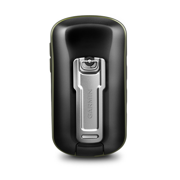
| Battery | 2 AA batteries (not included); NiMH or Lithium recommended, rechargeable NiMH pack (optional) |
| Battery life | up to 16 hours |
| Water rating | IPX7 |
| High-sensitivity receiver | |
| Interface | high-speed USB and NMEA 0183 compatible |
| Barometric altimeter | |
| Electronic compass | Yes (tilt-compensated 3-axis) |
| Unit-to-unit transfer (shares data wirelessly with similar units) | Yes (plus images and custom maps) |
Maps & Memory | |
| Basemap | |
|---|---|
| Ability to add maps | |
| Built-in memory | 1.7 GB |
| Accepts data cards | microSD card up to 32 GB (not included) |
| Custom POIs (ability to add additional points of interest) | |
| Waypoints/favorites/locations | 10,000 |
| Routes | 250 |
| Track log | 20,000 points, 250 saved tracks |
Outdoor Features | |
| Automatic routing (turn by turn routing on roads) | Yes (with optional mapping for detailed roads) |
|---|---|
| Geocaching-friendly | Yes (Paperless) |
| Custom maps compatible | |
| Hunt/fish calendar | |
| Sun and moon information | |
| Tide tables | |
| Area calculation | |
| Picture viewer | |
Garmin Connect | |
| Garmin Connect compatible (online community where you analyze, categorize and share data) | |
|---|---|
Additional | |
| Additional |
|
|---|---|
Product comparison
| Oregon 700 | Oregon 750 | Oregon 750t | |
| 3-inch color sunlight-readable touchscreen display with dual orientation | | | |
| Worldwide basemap with shaded relief | | | |
| BirdsEye Satellite Imagery (1-year subscription) | | | |
| High-sensitivity, WAAS-enabled GPS receiver with HotFix® feature and GLONASS support | | | |
| Geocaching Live | | | |
| Active Weather support | | | |
| Wi-Fi®, Bluetooth®, ANT+® capable | | | |
| IPX7 water rating1 | | | |
| Electronic compass | | | |
| Barometric altimeter | | | |
| Connect IQTM compatible | | | |
| Rechargeable NiMH battery pack included | | | |
| AC adapter included | | | |
| 8 megapixel autofocus camera with LED flash/torch | | | |
| Preloaded TOPO maps for U.S. or Canada | |
Item number: 010-01672-00
UPC: 753759161170
Package weight: 1.8 lb
Other Products in the Series:
| GARMIN Oregon 200 | Add to comparison |
| GARMIN Oregon 200 NOH | |
| GARMIN Oregon 300 NOH | |
| GARMIN Oregon 300 | Add to comparison |
| GARMIN Oregon 400c | Add to comparison |
| GARMIN Oregon 400c NOH | |
| GARMIN Oregon 400i NOH | |
| GARMIN Oregon 400i | Add to comparison |
| GARMIN Oregon 400t | Add to comparison |
| GARMIN Oregon 400t NOH | |
| GARMIN Oregon 450 | Add to comparison |
| GARMIN Oregon 450 NOH | |
| GARMIN Oregon 450t NOH | |
| GARMIN Oregon 450t | Add to comparison |
| GARMIN Oregon 550 NOH | |
| GARMIN Oregon 550 | Add to comparison |
| GARMIN Oregon 550t | Add to comparison |
| GARMIN Oregon 550t NOH | |
| GARMIN Oregon 600 | Add to comparison |
| GARMIN Oregon 600 NOH | |
| GARMIN Oregon 600t NOH | Add to comparison |
| GARMIN Oregon 600t | Add to comparison |
| GARMIN Oregon 650 | Add to comparison |
| GARMIN Oregon 650t | Add to comparison |
| GARMIN Oregon 700 NOH | Add to comparison |
| GARMIN Oregon 750 | Add to comparison |
| GARMIN Oregon 750t | Add to comparison |