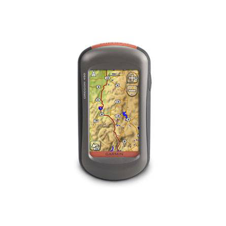
GARMIN Oregon 450


AC Charger


Speed/Cadence bike sensor (GSC 10)
Heart rate monitor

Premium Heart rate monitor Soft Strap

Replacement Soft Strap for Heart Rate Monitor

Tempe Wireless Temperature Sensor


Replacement Soft Strap for HRM3 Heart Rate Monitor

HRM-Pro Heart Rate Monitor with Bluetooth and Running Dynamics

HRM-Pro Plus Heart Rate Monitor


Cup Holder Universal Mount RAM-A-CAN II with 6 in Flex Arm


Chirp Wireless geocaching beacon

BirdsEye Satellite Imagery Retail Card
Virb X
Virb Xe
NOH Virb XE
VIRB XE Cycling Bundle
VIRB XE Auto Racing Bundle
VIRB XE Aviation Bundle
VIRB Camera
VIRB Elite Camera Dark
VIRB Elite Camera
BirdsEye Satellite Imagery US and Canada
Suggested Maps and Software:
 | Inland Lakes |
 | BlueChart g2, g3 on micro SD card with adapter |
 | Garmin Street Maps and City Navigation |
 | Garmin Topographic Maps |
 | Garmin Extras |
Contents of the package
Features
Get in touch with nature with the Oregon 450. The next-generation handheld device gives you a sunlight readable touchscreen with a built-in basemap with shaded relief, a high-sensitivity receiver, barometric altimeter, 3-axis electronic compass, microSD card slot, picture viewer and more. You can even exchange tracks, waypoints, routes and geocaches with similar units.Touch and go
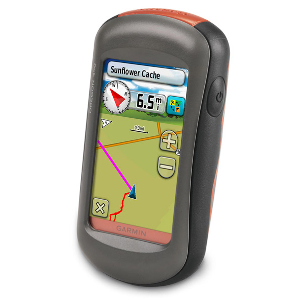
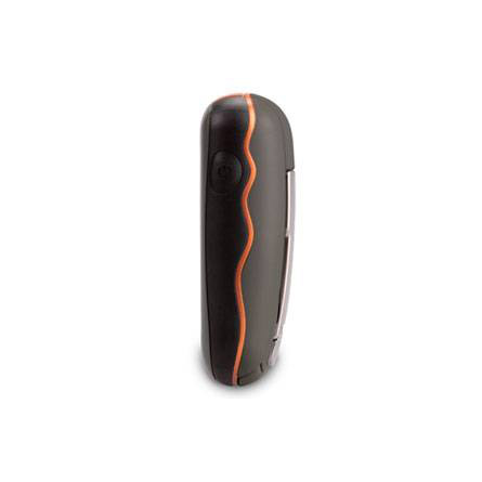
With the Oregon 450, youll be able to clearly see your high-resolution images on its color, 3-inch diagonal, sunlight readable touchscreen display. The simple interface gives you more time to admire your surroundings and less time with your face buried in your GPS. User-selectable dashboards mean you can customize the Oregon 450s display appearance. Its durable, waterproof body can withstand the elements, whether they are bumps, dust, dirt, water or humidity.
Explore more
Your Oregon 450 features a built-in worldwide basemap with shaded contours. Just touch the screen to navigate. Youll get the big picture of your surrounding terrain with its digital elevation maps, which show shaded contours at higher zoom levels.
Go social
Oregon 450 allows you to share your waypoints, tracks, geocaches and routes wirelessly with other compatible Oregon, Dakota and Colorado users. All you have to do is press send to transfer your information.
A geocachers dream
Oregon 450 is the perfect device for your geocaching adventures. It supports geocaching.com GPX files for downloading and storing geocaching details and it stores and displays key geocaching information, including location, terrain, difficulty, hints and descriptions. All you have to do is upload the GPX files to your unit. After your adventure, you can check out photos with Oregon 450s picture viewer.
Know where you are
Oregon 450 gives you a 3-axis tilt-compensated electronic compass, which shows your heading even when you arent moving or holding it level. Garmin also included a barometric altimeter, tracking pressure changes to pinpoint your precise altitude. Plus, use your Oregon 450 to plot barometric pressure over time to anticipate the changing weather. You can keep track of upcoming elevation with enhanced track navigation. Even in deep canyons or heavy cover, Oregon 450 uses its high-sensitivity, WAAS-enabled GPS receiver and HotFix satellite prediction to find your position quickly and precisely.
Customize with your maps
You can use optional preloaded MicroSD cards to track all of your land and water activities. When you insert a MapSource card with detailed street maps, Oregon gives you turn-by-turn directions. You can get a better perspective of your elevation by adding topographic maps to use Oregons 3-D map view. Use BlueChart g2 to make your day on the water even better with depth contours, harbors and navaids. And dont worry about getting the card slot wet. Its located inside the waterproof battery compartment.
Sync up
Connect your Oregon 450 to your computer to get a detailed activity analysis and send tracks to your outdoor device using Garmin Connect, a site which gives you an activity table, and allows you to see your activities using Google Earth. You can also see other routes from millions of Garmin Connect users and share your activities on Twitter and Facebook.
Specifications
Installed languages: English,
Spanish, French, Deutsch, Italiano, Portugues, Cesky, Dansk,
Nederlands, Norsk, Suomi, Hrvatski, Magyar, Polski, Russian, Svenska,
Turkse, Latvian, Slovak, Slovenian, Greek, Arabic, Farsi, Bulgarian.
More languages may be available through Garmin web updater.
Unit dimensions, WxHxD: 2.3" x 4.5" x 1.4" (5.8 x 11.4 x 3.5 cm)
Display size, WxH: 1.53"W x 2.55"H (3.8 x 6.3 cm); 3" diag (7.6 cm)
Display resolution, WxH: 240 x 400 pixels
Display type: Transflective color TFT touchscreen
Weight: 6.8 oz (192.7 g) with batteries
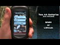
Battery: 2 AA batteries (not included); NiMH or Lithium recommended
Battery life: 16 hours
Waterproof: yes (IPX7)
Floats: no
High-sensitivity receiver: yes
Interface: high-speed USB and NMEA 0183 compatible
RoHS version available: yes
Maps & Memory:
Basemap: yes
Preloaded street maps: no
Ability to add maps: yes
Built-in memory: 850 MB
Accepts data cards: microSD card (not included)
Waypoints/favorites/locations: 2000
Routes: 200
Track log: 10,000 points, 200 saved tracks
Features:
Automatic routing (turn by turn routing on roads): yes (with optional mapping for detailed roads)
Electronic compass: yes (tilt-compensated, 3-axis)
Touchscreen: yes
Barometric altimeter: yes
Camera: no
Geocaching-friendly: yes (paperless)
Custom maps compatible: yes
Outdoor GPS games: yes (Wherigo only)
Hunt/fish calendar: yes
Sun and moon information: yes
Tide tables: yes
Area calculation: yes
Custom POIs (ability to add additional points of interest): yes
Unit-to-unit transfer (shares data wirelessly with similar units): yes
Picture viewer: yes
Item number: 010-00697-40
UPC: 753759100537
Package weight: 0.9 lb
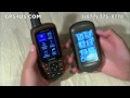
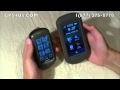
 | Video by GPS4US |
 | Video by GPS4US |
 | Video by GARMIN |
 | Video by GARMIN |
 | Video by Garmin |
 | Video by Garmin |
 | Video by Garmin |
 | Video by Garmin |
 | Video by Garmin |
 | Video by Garmin |
View latest videos by GPS4US
Visit GPS4US
 Channel.
Following reviews were written by actual customers.
Every GPS4US customer has a chance to live a feedback after receiving a product.
TOP 20 DISPLAYED
 by Vincent S, , 9/11/2012
Easy to use even for someone with very little gps experience.
by Phil C, , 8/8/2012I love the Oregon - it is simple to use for what I do (archaeology surveys). Touch screen is easy to navigate and bloody tough too. It is a nice compact model.
by Galin P, , 8/8/2012Good Handheld
 by K Michelle S, , 7/27/2012
Still learning how to use it. Not as easy to use as our other older Garmin E Trex.
by Debbie C, , 5/19/2012I d. I ordered it for my son-in-law who is in the Army and currently stationed in Korea.
by Curtis J, , 5/15/2012Top little unit
by Kevin F, , 5/12/2012Great working GPS. Bought for geocaching, and it works like advertised!
 by barry J, , 4/23/2012
A step up from my previous Garmin. Bought the map on DVD and downloaded. Still difficult to read on the LED, but better than the competitive models.
by Dustin D, , 4/20/2012Great device, big improvement over my Vista CX - Great reception, even in the trees
by Martina S, , 4/5/2012It works! ;-)
by Petr S, , 3/29/2012Very nice device. Very good price, very good functions and very good quality.
by Petr S, , 3/24/2012Product is not received yet, but i think it''s good.
by Thomas L, , 3/21/2012I really do love it. I bought it for one reason, it is to tell me if i am hunting in the right spot or not. With the state land owners maps, it is the best purchase i have made in 25 years. Thank you Garmin for the 450.
by Phil C, , 3/11/2012very easy to use and holds data I need for archaeological survey - beats the pants of the Map60 CSX!
by Rex W, , 2/24/2012We''re very impressed with our new Oregon 450s. So easy to use. Works very well with the 2008 Topo maps.
by Benjamin B, , 2/19/2012great! easy to use and well explain whit the manual
by Clément L, , 2/8/2012That''s a great product. I feel confident whit it and I trust it all the way. The touchscreen is very handfull, even in freezing wheather. Thanks.
by Clément L, , 2/8/2012That''s a great product. I feel confident whit it and I trust it all the way. The touchscreen is very handfull, even in freezing wheather. Thanks.
by Galin P, , 2/2/2012ok
by David V, , 1/24/2012So far it has done everything I have tried, well.
Read all
Other Products in the Series:
| GARMIN Oregon 200 | Add to comparison |
| GARMIN Oregon 200 NOH | |
| GARMIN Oregon 300 NOH | |
| GARMIN Oregon 300 | Add to comparison |
| GARMIN Oregon 400c NOH | |
| GARMIN Oregon 400c | Add to comparison |
| GARMIN Oregon 400i | Add to comparison |
| GARMIN Oregon 400i NOH | |
| GARMIN Oregon 400t | Add to comparison |
| GARMIN Oregon 400t NOH | |
| GARMIN Oregon 450 NOH | |
| GARMIN Oregon 450t NOH | |
| GARMIN Oregon 450t | Add to comparison |
| GARMIN Oregon 550 NOH | |
| GARMIN Oregon 550 | Add to comparison |
| GARMIN Oregon 550t | Add to comparison |
| GARMIN Oregon 550t NOH | |
| GARMIN Oregon 600 | Add to comparison |
| GARMIN Oregon 600 NOH | |
| GARMIN Oregon 600t NOH | Add to comparison |
| GARMIN Oregon 600t | Add to comparison |
| GARMIN Oregon 650 | Add to comparison |
| GARMIN Oregon 650t | Add to comparison |
| GARMIN Oregon 700 NOH | Add to comparison |
| GARMIN Oregon 700 | Add to comparison |
| GARMIN Oregon 750 | Add to comparison |
| GARMIN Oregon 750t | Add to comparison |