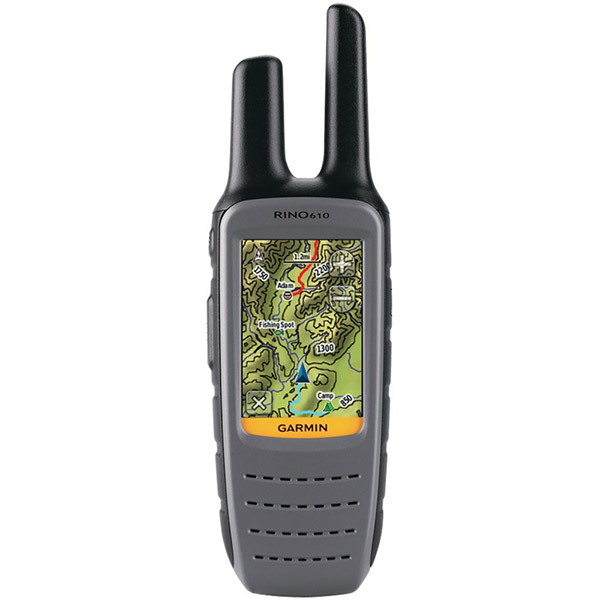
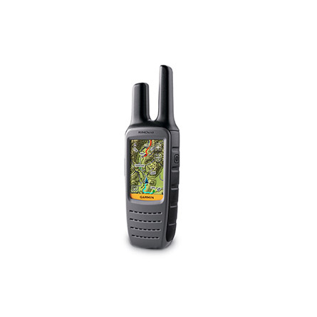
GARMIN Rino 610


AC Charger, Open box


Li-ion Battery Pack


Cup Holder Universal Mount RAM-A-CAN II with 6 in Flex Arm


Lanyard 17 inch


Carabiner clip

Lanyard Carabiner

Ear receiver with push-to-talk microphone

Chirp Wireless geocaching beacon

BirdsEye Satellite Imagery Retail Card

Virb X
Virb Xe
NOH Virb XE
VIRB Camera
VIRB Elite Camera Dark
VIRB XE Cycling Bundle
VIRB XE Auto Racing Bundle
VIRB XE Aviation Bundle
VIRB Elite Camera
BirdsEye Satellite Imagery US and Canada

Suggested Maps and Software:
 | Inland Lakes |
 | BlueChart g2, g3 on micro SD card with adapter |
 | Garmin Street Maps and City Navigation |
 | Garmin Topographic Maps |
 | Garmin Extras |
Contents of the package
- Rino 610
- USB cable
- Belt clip
- Owner's manual
- Quick start guide
Features
When you receive your Rino 610, you get a 1 W FRS GMRS radio on a 2.6-inch glove-friendly touchscreen in vivid color. And it all fits perfectly in the palm of your hand.Know where you are
Your Rino 610 tells you exactly where you are at all times. Thats because its quad helix antenna and high-sensitivity GPS receiver can pinpoint your position no matter your cover or terrain. And, the 3-axis compass and barometric altimeter let you get your bearings even when you arent holding it level.
See everything
You can navigate anywhere you need to go with the built-in worldwide basemap with shaded relief. And, if you need more maps, you can add them from Garmins variety of detailed topographic, marine and road maps The Rino 610 allows you to download TOPO US 24k maps for a long hike. It also supports subscription-based BirdsEye Satellite imagery, which allows you to download and integrate satellite images to your unit. Plus, the Rino 610 works with Custom Maps, the free software that converts paper and electronic maps into downloadable gems.
Let others know where you are
With the Rino 610s Position Reporting feature, you can send your exact location to other Rino users. It shows up right on their map page. Communication with other area FRS/GMRS radios is easy with improved audio performance. And, when you need silence, you can text message other Rino users in your area. The Rino 610 is the perfect way to keep tabs on your family, friends, hunting partner or hiking party.
Specifications
Installed languages: English,
French.
Physical & Performance:
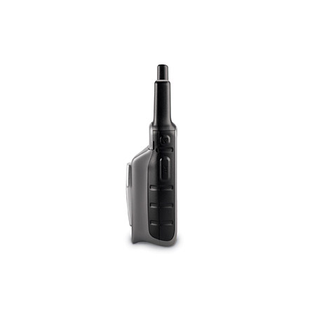
Unit dimensions, WxHxD: 2.4" x 7.5" x 2.2" (6.0 x 19.0 x 5.6 cm)
Display size, WxH: 1.6" x 2.2" (4.1 x 5.6 cm); 2.6" diag (6.6 cm)
Display resolution, WxH: 160 x 240 pixels
Display type: transflective, 65-K color TFT
Weight: 12.2 oz (345 g) with batteries
Battery: 4 AA batteries (not included)
Battery life: 18 hours
Waterproof: yes (IPX7)
High-sensitivity receiver: yes
Interface: high-speed USB and NMEA 0183 compatible
Maps & Memory:
Basemap: yes
Ability to add maps: yes
Built-in memory: 1.7 GB
Accepts data cards: no
Waypoints/favorites/locations: 2000
Routes: 200
Track log: 10,000 points, 200 saved tracks
Features:
Automatic routing (turn by turn routing on roads): yes
Electronic compass: no
Barometric altimeter: no
Hunt/fish calendar: yes
Sun and moon information: yes
Area calculation: yes
Other:
Frequency band: FRS and GMRS
Channels: 22
Squelch codes: 38 (CTCSS); 83 (DCS)
Transmit power: 0.5 watts FRS, 1.0 watt GMRS
Range: Up to 2 miles over FRS; up to 5 miles over GMRS
VOX (voice activation): yes
Location reporting (send and receive GPS positions): yes
Vibration alert: yes
NOAA weather radio: no
External temperature recording: no
Additional: Unit-to-unit transfer and ANT+ compatible: no
Picture viewer: yes
Item number: 010-00928-00
UPC: 753759975784
Package weight: 2.5 lb
Following reviews were written by actual customers.
Every GPS4US customer has a chance to live a feedback after receiving a product.
 by Francisco Javier R, , 11/20/2017
Excelent GPS, and the best service
by Francisco Javier R, , 8/26/2015Excellent
Other Products in the Series:
| GARMIN Rino 110 | Add to comparison |
| GARMIN Rino 120 | Add to comparison |
| GARMIN Rino 130 | Add to comparison |
| GARMIN Rino 520 | |
| GARMIN Rino 520HCx | Add to comparison |
| GARMIN Rino 530 | |
| GARMIN Rino 530HCx | Add to comparison |
| GARMIN Rino 530HCx NOH | |
| GARMIN Rino 610 | Add to comparison |
| GARMIN Rino 650 NOH | |
| GARMIN Rino 650 | Add to comparison |
| GARMIN Rino 650t | Add to comparison |
| GARMIN Rino 650t REFURBISHED NOH | |
| GARMIN Rino 655t NOH | |
| GARMIN Rino 655t | Add to comparison |
 | GARMIN Rino 750 | Add to comparison |
| GARMIN Rino 750 NOH | |
| GARMIN Rino 750, Refurb NOH | Add to comparison |
| GARMIN Rino 755T | Add to comparison |
| GARMIN Rino 755t Referb. NOH |