GARMIN Boundary Waters Inland Lakes SD card


1 reviews - 5.0

This item is brand new
$100.95
Backorder, ships in 3 - 4 weeks
|sw


Contents of the package
Features
Get highly detailed inland lake and topographic maps for the Boundary Waters Canoe Area Wilderness. These maps include freshwater lakes and rivers, high-definition shorelines, underwater depth contours, terrain contours, elevations, summits, portages, camping areas and more.
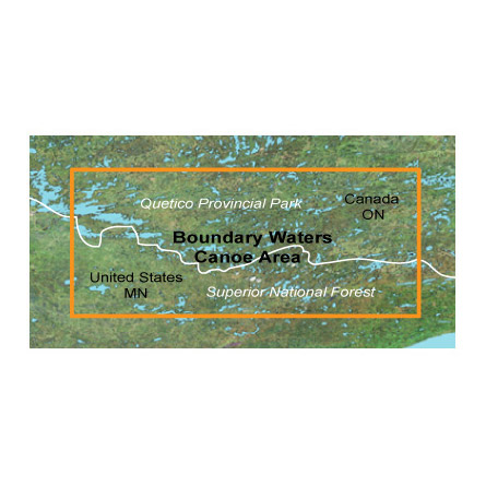
CoverageIncludes lake and topographic map coverage for the Boundary Waters Canoe Area Wilderness, located between Ontario, Canada, and Minnesota, on the Canada-US border; includes extended coverage of Quetico Provincial Park, plus coverage of Superior National Forest.
Provides inland lake detail, including creek channels, streams, fishing locations, boat ramps, marinas and more.
Features detailed topographic maps, comparable to 1:24,000 scale USGS maps and 1:50,000 scale NRC maps.
Includes navigational aids, wrecks, obstructions and hazards as well as searchable points of interest, including geographic place names, campgrounds, entry points, businesses and more.
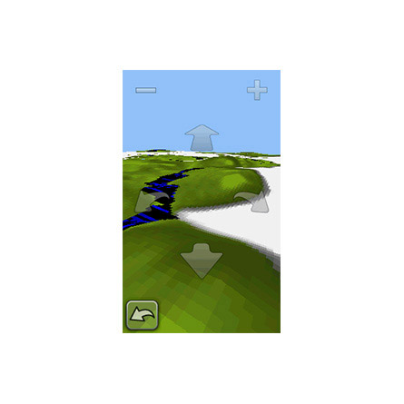
Displays dense contour intervals combined with digital elevation model (DEM) shaded relief on compatible devices to help estimate terrain difficulty.
Provides routable road content for accurate directions to your destination.
Features current USGS quad names or townships, ranges and sections on your compatible device.
Specifications
Item number: 010-C1060-00
UPC: 753759097066
Package weight: 1.00 lb
 | Video by GARMIN |
View latest videos by GPS4US
Visit GPS4US
 Channel.
Following reviews were written by actual customers.
Every GPS4US customer has a chance to live a feedback after receiving a product.
 by J Scott P, , 3/4/2020
This Micro SD card will serve us well in the BWCA.
List of Compatible Units:
Note: Displayed are products sold in gps4us store.
There might be more GPS units compatible with chosen accessory.